/


Contact Form
Utah Chaco

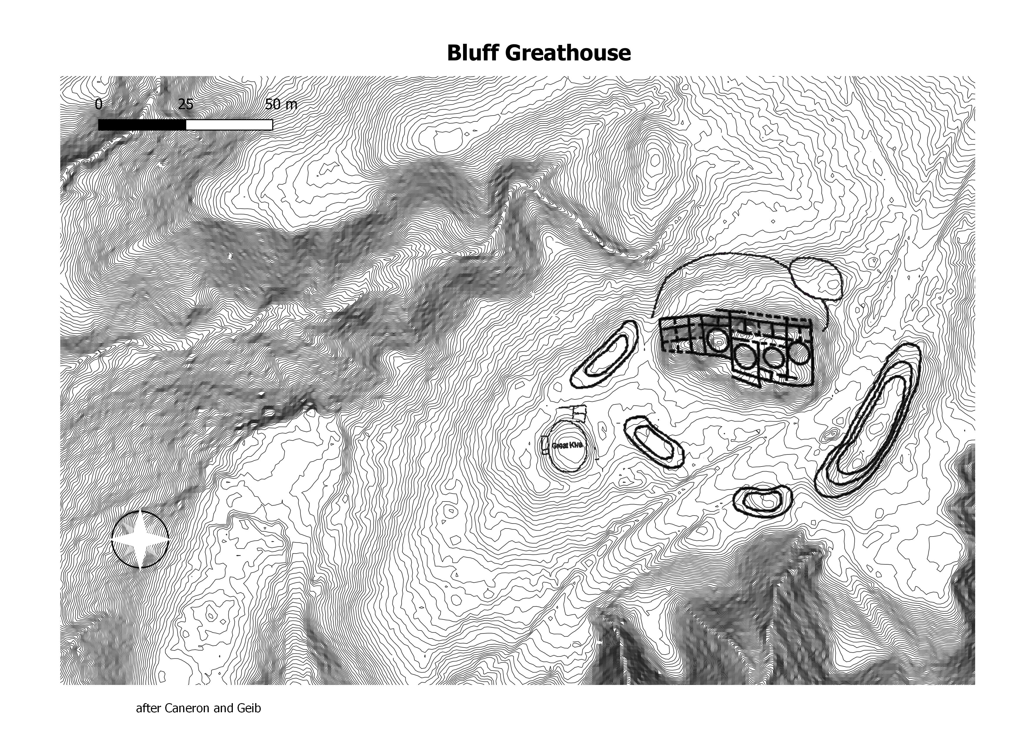
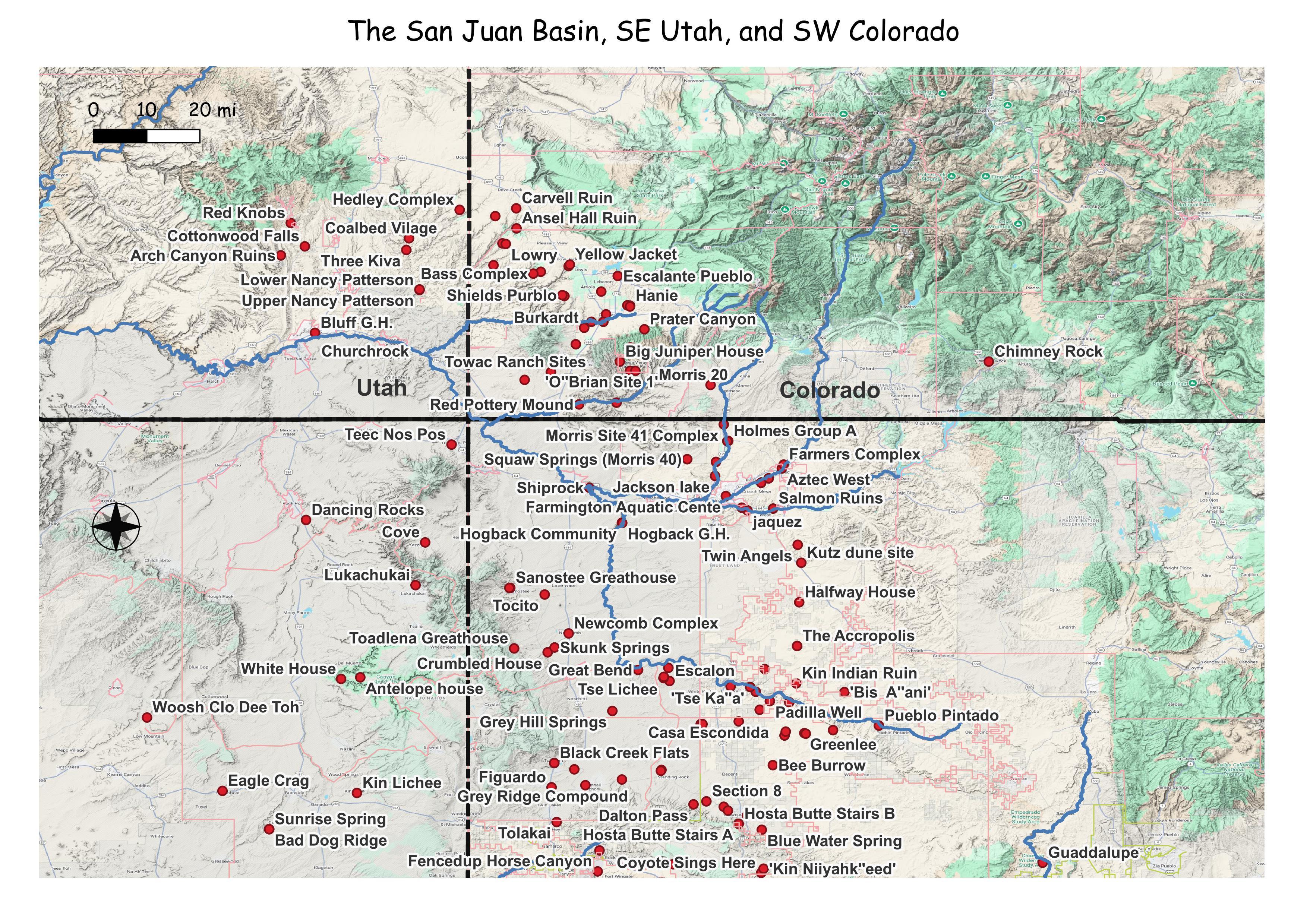
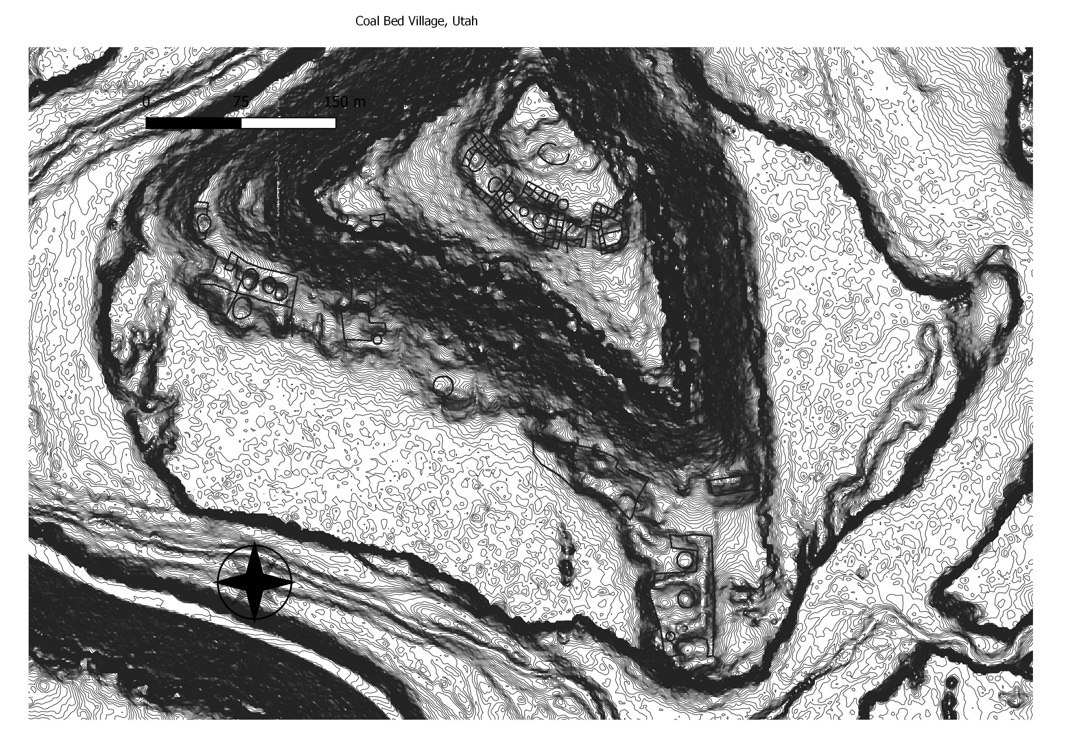
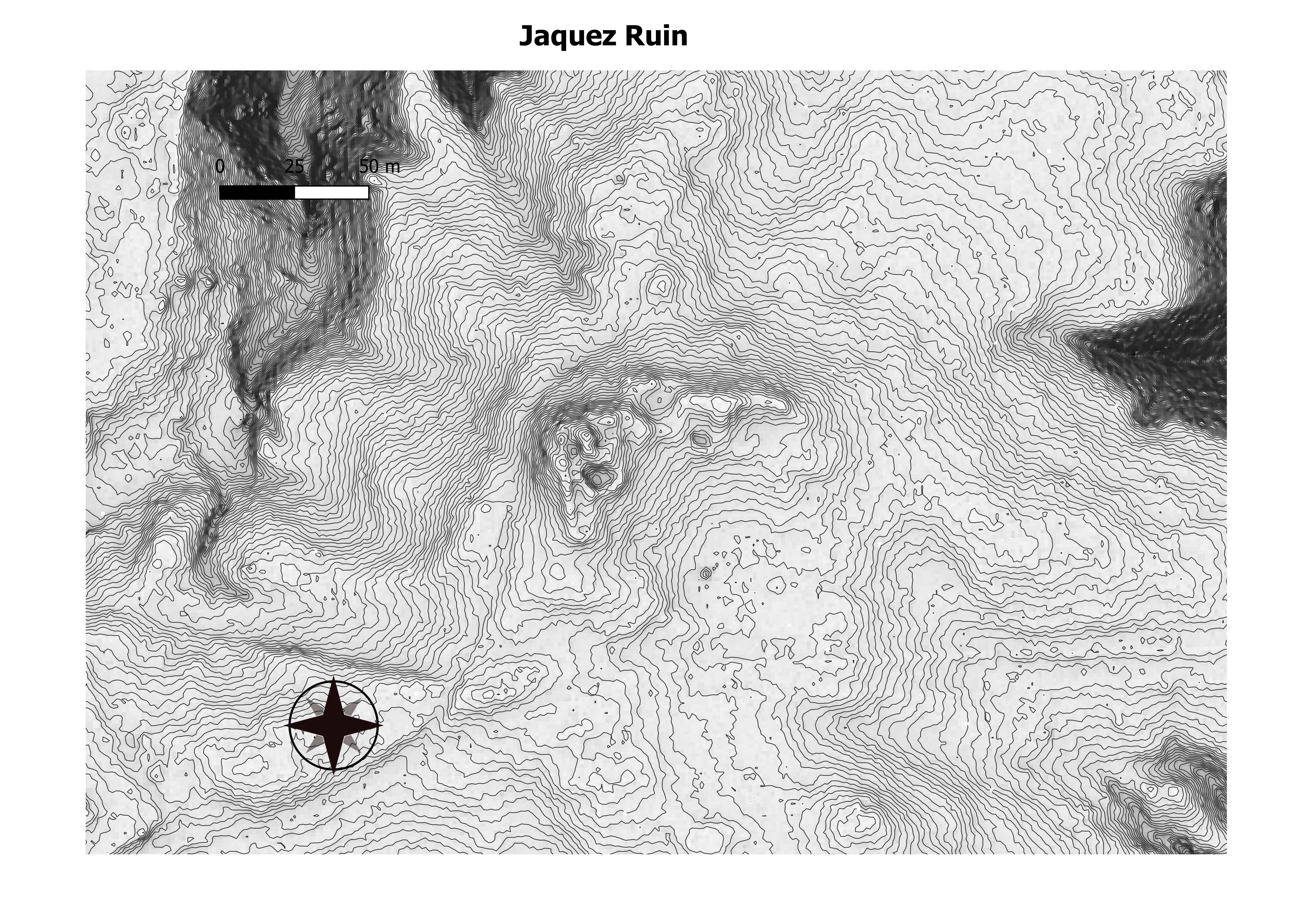
The site lies near the north bank of the San Juan River, approximately 130 miles (210 km) northwest of Chaco Culture National Historical Park. It contained between fifty and sixty rooms, with four kivas and a great kiva nearby. Two ancient road segments were found in the area, and several berms were leveled to create a terrace, which is rare in Chacoan sites. The great house was partially excavated from 1996 to 2004, and archeologists believe the site was constructed, in at least two stages, between 1075 and 1150 CE by Chacoans who interacted with the Puebloan residents of both Mesa Verde and Kayenta, Arizona. Bluff Great House was abandoned c. 1250. (Wikepedia)

The site lies near the north bank of the San Juan River, approximately 130 miles (210 km) northwest of Chaco Culture National Historical Park. It contained between fifty and sixty rooms, with four kivas and a great kiva nearby. Two ancient road segments were found in the area, and several berms were leveled to create a terrace, which is rare in Chacoan sites. The great house was partially excavated from 1996 to 2004, and archeologists believe the site was constructed, in at least two stages, between 1075 and 1150 CE by Chacoans who interacted with the Puebloan residents of both Mesa Verde and Kayenta, Arizona. Bluff Great House was abandoned c. 1250. (BYU)


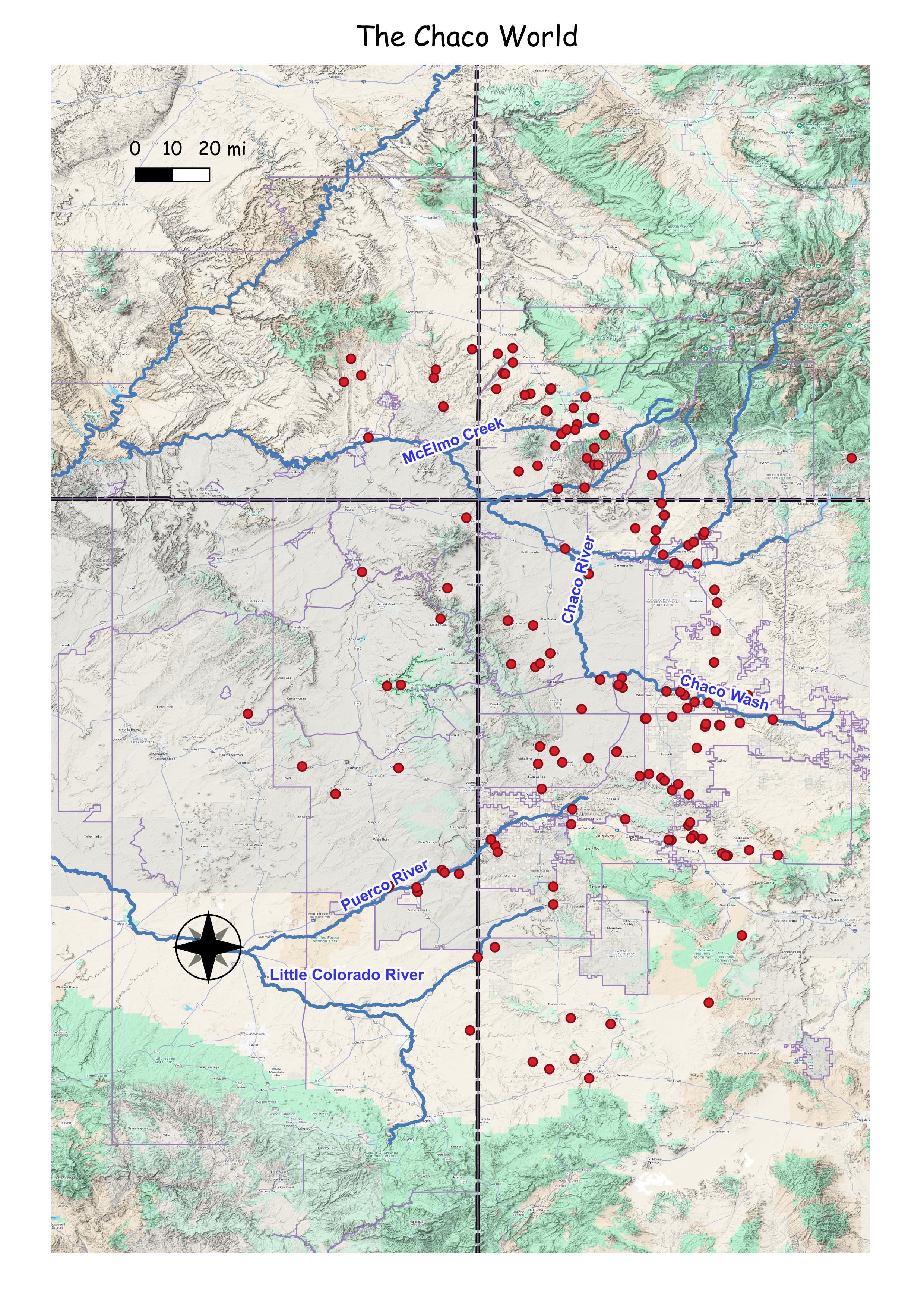
The Chaco World


Dinetah Pueblitos


Situated on the edge of a bench overlooking San Rafael Canyon, this pueblito is one of the largest of the Gobernador Phase and most complex Dinetah pueblitos (Towner 2003).
The site consists of two roomblocks of 12 ground floors with at least four rooms having second stories and eight forked-pole hogans of which one still remains standing. Surrounding these structures was a defensive compound masonry wall of 2 meter height which three doorways and two hatched entry ways once existed. The doorways are not as apparent as once before however the passageways from below the bench are still visible (Powers and Johnson 1987).
Tree-ring Analysis: Some 80 tree-ring samples have been collected over a period of 80 years by various researchers. Wood species are represented by juniper, pinyon, Douglas-fir and Ponderosa pine. In addition, metal ax modifications were observed on a number of samples. Dates obtained from the samples suggest that the central complex of the pueblito was initially constructed in 1746. The covered passageways were likely completed by 1750 and the last episode of construction occurred in 1753. As such, it is likely that the site was occupied for less than 10 years (Towner 2003). (http://www.aztecnm.com/archaeology/index.htm)

I included this, as it is a cluster of pueblitos.

The Citadel Pueblito is a two story, twin tower complex that sits on top of a boulder on the edge of an arroyo that drains into Cuervo (Crow) Canyon. There is a covered walkway between the towers and a courtyard area on the east side of the boulder. Most of the second story has collapsed along with the roofs of the first floor rooms. Loopholes and a sealed doorway are also visible. Loopholes are small observation ports in the walls that are aligned to provide views of access routes or other surrounding sites (Powers and Johnson 1987). The presence of a sealed doorway indicates that the pueblito underwent remodeling or repair.
Ceramic Assemblage: Only Dinetah Gray and Gobernador Polychrome wares have been identified at the site (Towner 1997).
Tree-ring Analysis: A total of 16 samples have been collected from the pueblito. Wood species identified only consisted of juniper. About half of the samples showed evidence of metal ax use. Though numerous tree-ring samples have been taken, results were rather disappointing. At best, the pueblito was likely built sometime after 1688 (Towner 1997). The pueblito has undergone some stabilization (Site Signage). (http://www.aztecnm.com/archaeology/index.html)

Located on the valley floor in a rincon adjacent to Delgadito Canyon, this pueblito consists of a three-room structure built on an isolated boulder with a two room structure at the base of the boulder. Access to the rooms on the boulder were likely from the lower rooms as evident by hand and footholds carved into the boulder above the lower rooms (Powers and Johnson 1987).
Ceramic Assemblage: Only Dinetah Gray ceramics have been documented at the site (Towner 1997).
Tree-ring Analysis: Six tree-ring samples have been collected from the site. Wood species included juniper and pinyon and metal ax use was observed on all the samples. Results from the tree-ring samples suggest that the pueblito was built sometime after 1717 (Towner 1997). (http://www.aztecnm.com/archaeology/index.html)

Located on the valley floor in a rincon adjacent to Delgadito Canyon, this pueblito consists of a three-room structure built on an isolated boulder with a two room structure at the base of the boulder. Access to the rooms on the boulder were likely from the lower rooms as evident by hand and footholds carved into the boulder above the lower rooms (Powers and Johnson 1987).
Ceramic Assemblage: Only Dinetah Gray ceramics have been documented at the site (Towner 1997).
Tree-ring Analysis: Six tree-ring samples have been collected from the site. Wood species included juniper and pinyon and metal ax use was observed on all the samples. Results from the tree-ring samples suggest that the pueblito was built sometime after 1717 (Towner 1997). (http://www.aztecnm.com/archaeology/dinetah/delgadito.html)

The complex consists of an estimated 23 ground floor rooms, 12 second-story rooms, three third-story rooms, two hogans, activity areas, and one burned rock pile. Rock art, forked-pole hogans, sweat lodges and basins used for grinding corn surround the pueblito. The four-story tower (now only three stories) which is central to the site is the most distinctive structure at the site. In addition, several rooms have storage bins, loopholes, looming fits, peg holes, and Spanish-style hooded fireplaces. Supports for weaving looms were also found (Powers and Johnson 1987).
The site was first excavated by Earl Morris in 1915, (Morris also excavated Aztec Ruins). Among other artifacts, he recovered a fragment of a seventeenth century wheel lock rifle from the site.
Ceramic Assemblage: The ceramics consist of Dinetah Gray, Gobernador Polychrome, Zia-Puname, Tewa, Acoma, and Jemez wares (Towner 2003).
Tree-ring Analysis: The comparison of architectural data and the 53 tree-ring samples recovered from different investigations indicate that the pueblito underwent several occupations, growths and abandonment. Two possibly three distinct temporal stages were identified. Initial occupation sometime between 1710 and 1714, the second phase in 1722, and probably a third phase in 1735 or 1736. Complete abandonment likely occurred sometime around 1745 (Towner 2003). The site was stabilized by the BLM in 1975 (BLM Site plaque). (http://www.aztecnm.com/archaeology/dinetah/franciscanyon.html)

The pueblito consists of a two-room single-story structure, remnants of a third masonry structure, and two forked-pole hogans. Room 1 appears to have burned as evidence of burning on the wall and charred roof timbers below the pueblito. The roof of Room 2 remains intact, along with shelves and vertical pole wall (Powers and Johnson 1987).
Ceramic Assemblage: Field observations of ceramics only noted Dinetah Gray. No puebloan ceramics have been documented at the site.
Tree-ring Analysis: Twenty tree-ring samples have been collected from the site. Two samples from a Hogan 2 and 18 from the pueblito. Wood species included juniper and pinyon and all samples showed evidence of metal ax cutting. Dates from the tree-ring samples suggest several possible interpretations. In general, it is likely the pueblito was constructed sometime between 1749 and 1751 with repair or remodeling occurring in 1753. The samples taken from the Hogan 2 was inconclusive and so the hogans may or may not be contemporaneous to the pueblito (Towner 2003). (http://www.aztecnm.com/archaeology/dinetah/gouldpass.html)

Ceramic Assemblage: Ceramics include Dinetah Gray and Gobernador Polychrome (Towner 2003).

Located on a low knoll in the eastern portion of Superior Mesa, this pueblito is not situated defensively like most pueblitos. This pueblito is larger than most and had at least six ground floors with at least three having evidence for second-story floors. In addition, there are two large stone circles which may have functions as hogan foundations (Powers and Johnson 1987).
Ceramic Assemblage: Dinetah Gray and Gobernador Polychrome comprises majority of the ceramics noted on the site. Small amounts of Puname (Zia Pueblo), Tewa (Northern Rio Grande), and Ako (Acoma Pueblo) Polychrome ceramics have been documented.
Tree-ring Analysis: Ten samples were collected from the pueblito. Pinyon seems to dominate the wood species, however this could be simply sample bias. One sample was identified as cottonwood. Analysis of the dates suggests that the pueblito was likely built in one episode in 1723 (Towner 2003). (http://www.aztecnm.com/archaeology/dinetah/hoodedfireplace.html)

Ceramic Assemblage: Ceramics previously identified include Dinetah Gray, Gobernador Polychrome, Payupki (Hopi) Polychrome, and Ashiwi (Zuni Pueblo) Polychrome.
Tree-ring Analysis: Sixteen samples were collected from the pueblito. Pinyon and juniper was used and evidence of metal ax use was found on almost every sample. Date clustering of samples indicate that the pueblito was constructed in 1727 (Towner 2003).
(http://www.aztecnm.com/archaeology/dinetah/hoodedfireplace.html)

The pueblito sits on an unnamed mesa south of Largo Canon between Big Rincon and Palluche Canyons. The pueblito consists of three ground floors built in at least two construction phases. One of the circular structures (Room 1) has evidence of a second story. The second circular room (Room 2) still has some roofing intact. Room 3 is rectangular and postdates at least one of the circular rooms. A fourth masonry structure (Feature 1) was also identified, but it is unknown as to the function of this feature (Powers and Johnson 1987).
Ceramic Assemblage: Ceramics identified included Dinetah Gray, Gobernador Polychrome, Acoma, Zia and Zuni wares (Towner 1997).
Tree-ring Analysis: Twenty-eight tree-ring samples have been collected from the pueblito from two separate investigations. All but one sample show evidence of metal ax use. Tree-ring dates obtained from the pueblito indicate construction episodes around the late 1730s (Rooms 1 and 2) and mid-1740s (Room 3) (Towner 1997). ((http://www.aztecnm.com/archaeology/dinetah/hoodedfireplace.html)

Located in Rafael Canyon, this pueblito is situated on the valley floor of Rafael Canyon. Old Fort Pueblito is visible across the canyon. The site consists of a three-room pueblito. A panel of ceremonial images (petroglyphs and pictographs) is located on a boulder nearby and is likely associated with the site (Towner 2003). Unfortunately, modern vandalism in the form of someone engraving their initials is also present on the rock art.
Ceramic Assemblage: Ceramics include Dinetah Gray and Gobernador Polychrome (Towner 2003).
Tree-ring Analysis: Twelve tree-ring samples have been collected from the pueblito. Juniper was exclusively used in the construction of the pueblito. All but one sample showed evidence of metal ax use. The tree-ring dates indicate that the pueblito was constructed around 1752. This date places Rabbit House contemporaneous with Old Fort (Towner 2003). (http://www.aztecnm.com/archaeology/dinetah/hoodedfireplace.html)

Located on the east bench of Simon Canyon, this pueblito is the most northern of the pueblitos and the only one documented north of the San Juan River. The pueblito consists of a single room on a large 20-foot high boulder. The room is rather well preserved with the greater part of the roof intact. Handholds and footholds were carved into the sandstone high up on the side of the boulder and the inhabitants likely used a notched log as a ladder or rope to reach the structure. Simon Canyon Pueblito was unusual because other pueblitos could not be seen from the site and forked-pole hogans do not appear to have been located nearby (Powers and Johnson 1987).
Ceramic Assemblage: Currently only Dinetah Gray and Gobernador Polychrome ceramics have been documented.
Tree-Ring Analysis: Only seven samples have been collected from the pueblito. It appears that the roof was entirely constructed using juniper wood and metal ax cuts were noted on the ends and branches of the timber. Tree-ring dates indicate that the structure was likely constructed in 1754 (Towner 2003). The site was stabilized by the BLM in 1975 (BLM site plaque). (http://www.aztecnm.com/archaeology/dinetah/hoodedfireplace.html)
Chaco New Mexico
(+) expands (-) collapses
Chaco Sites
List of Sites
tsin klietsin
twin angels
una vida
walsh maps merged
walsh maps of pueblo bonito
wijiji
19sj2282
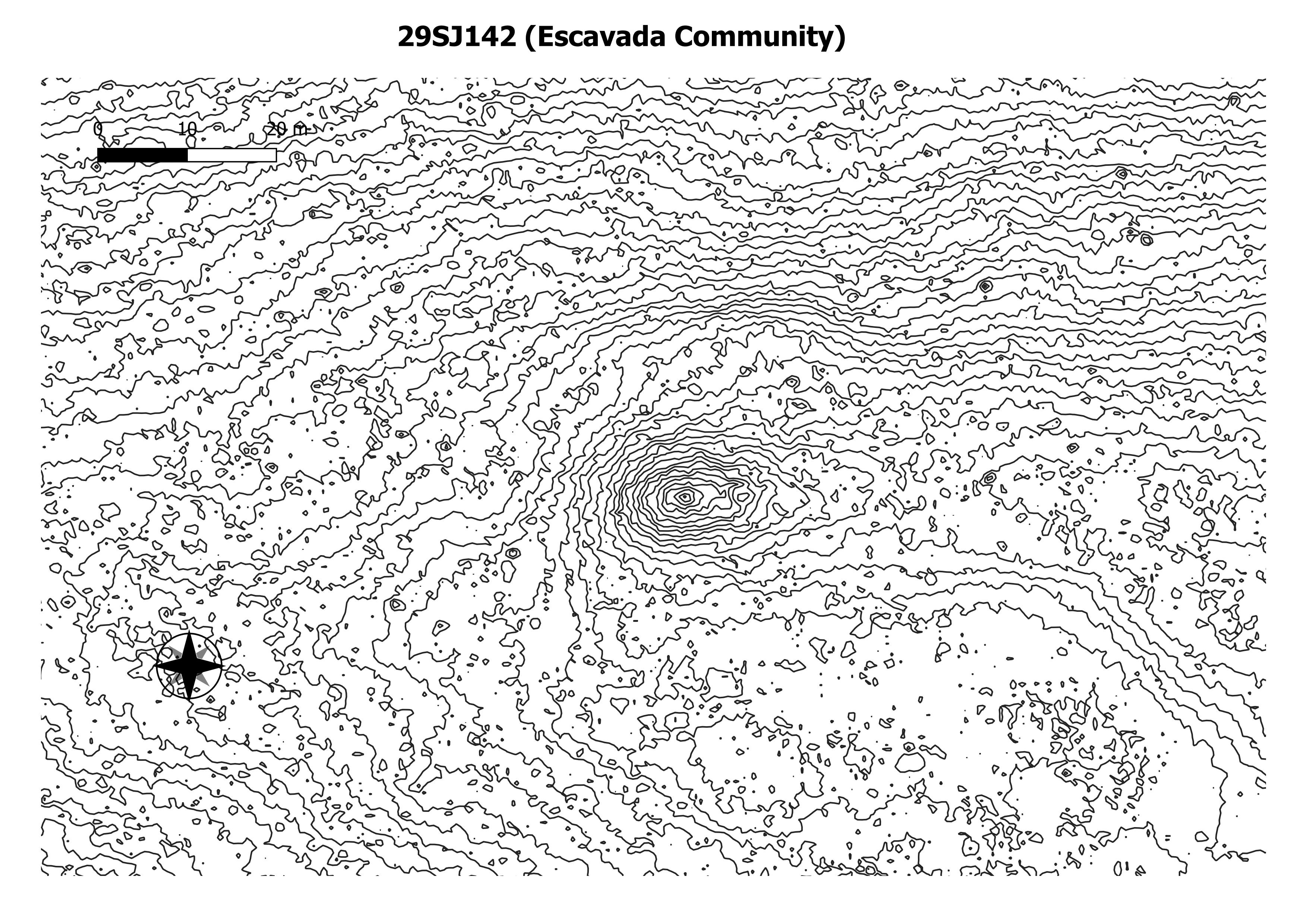
29SJ142
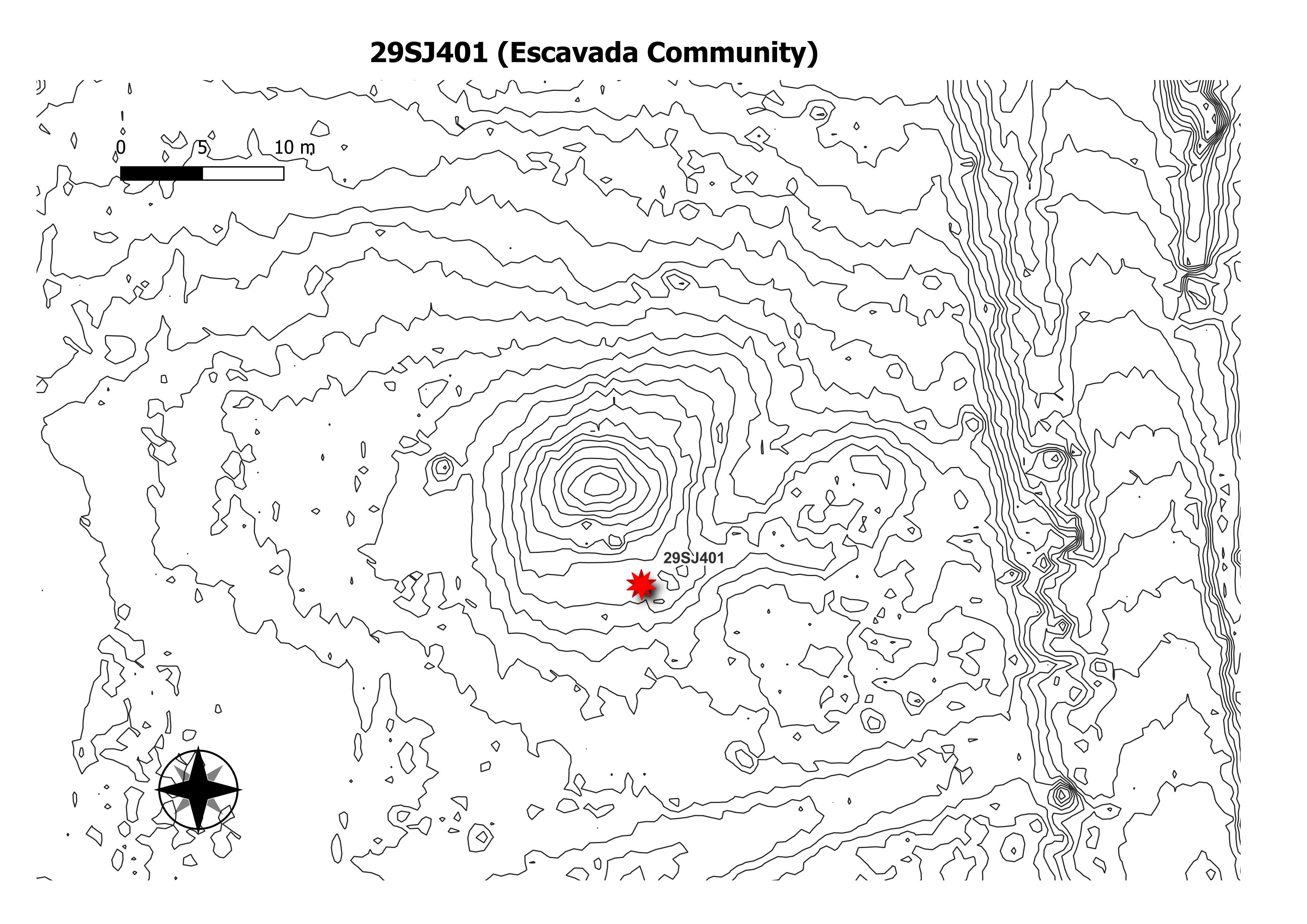
29SJ401
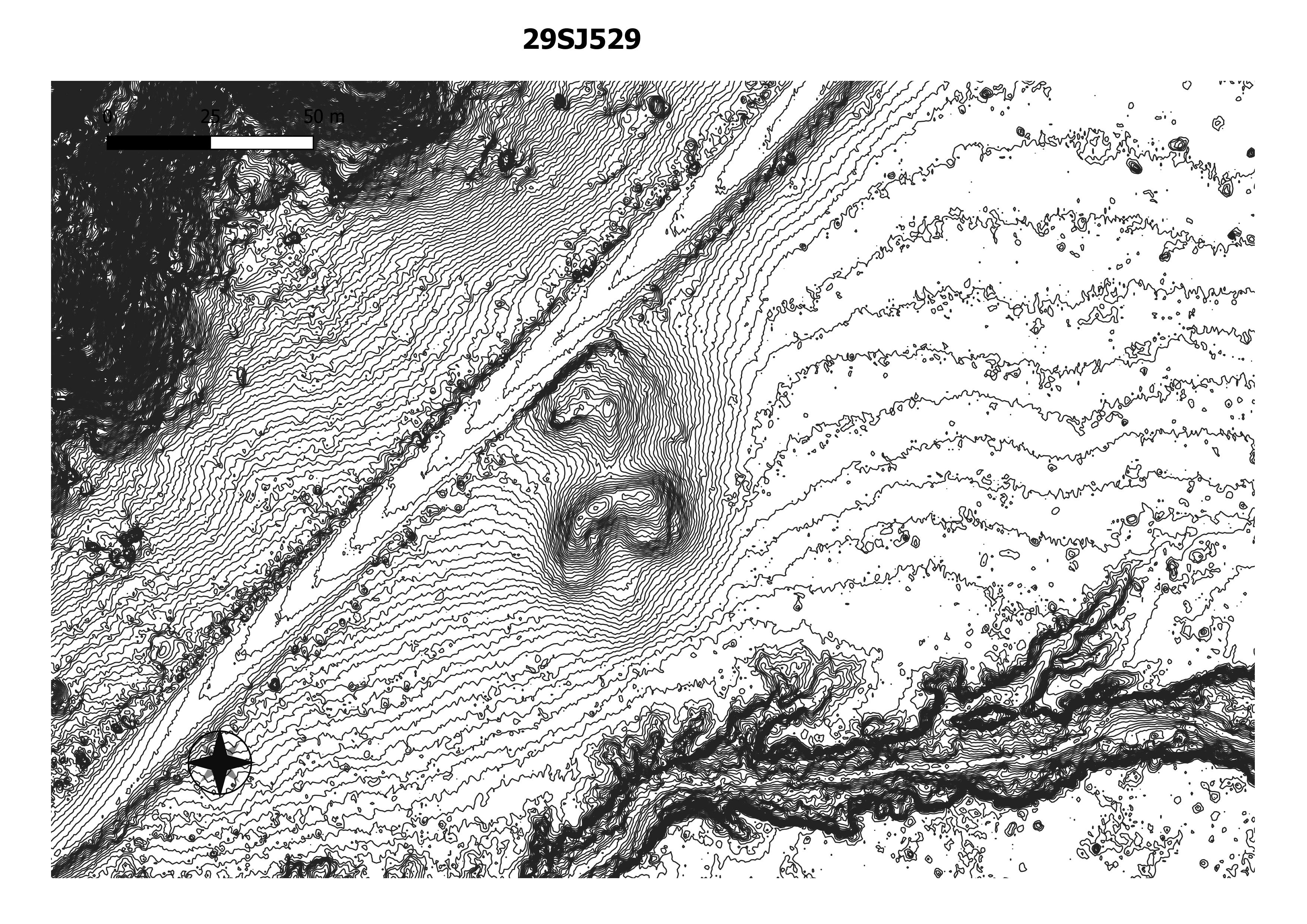
29SJ529
29SJ2261
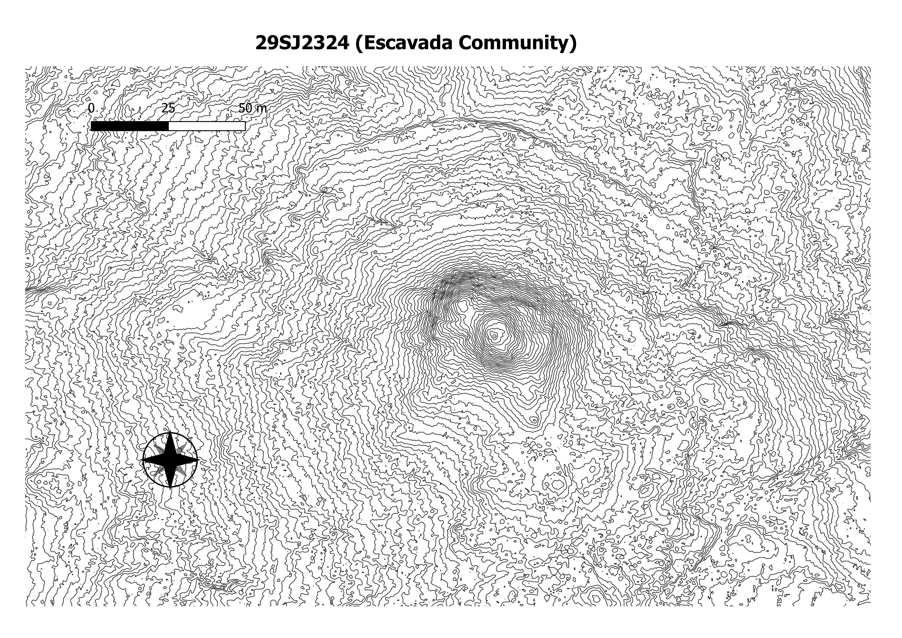
29SJ2324
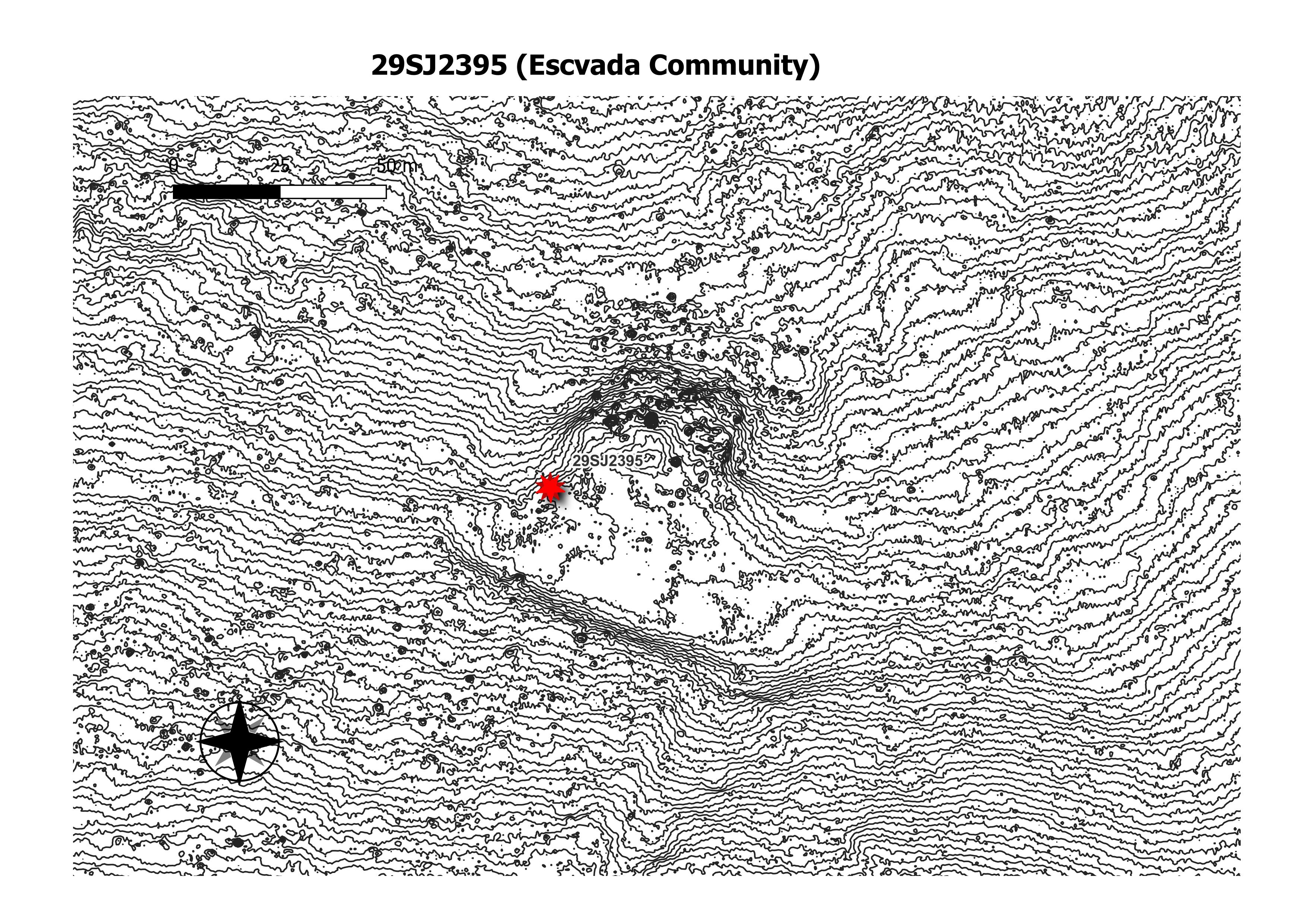
29SJ2395
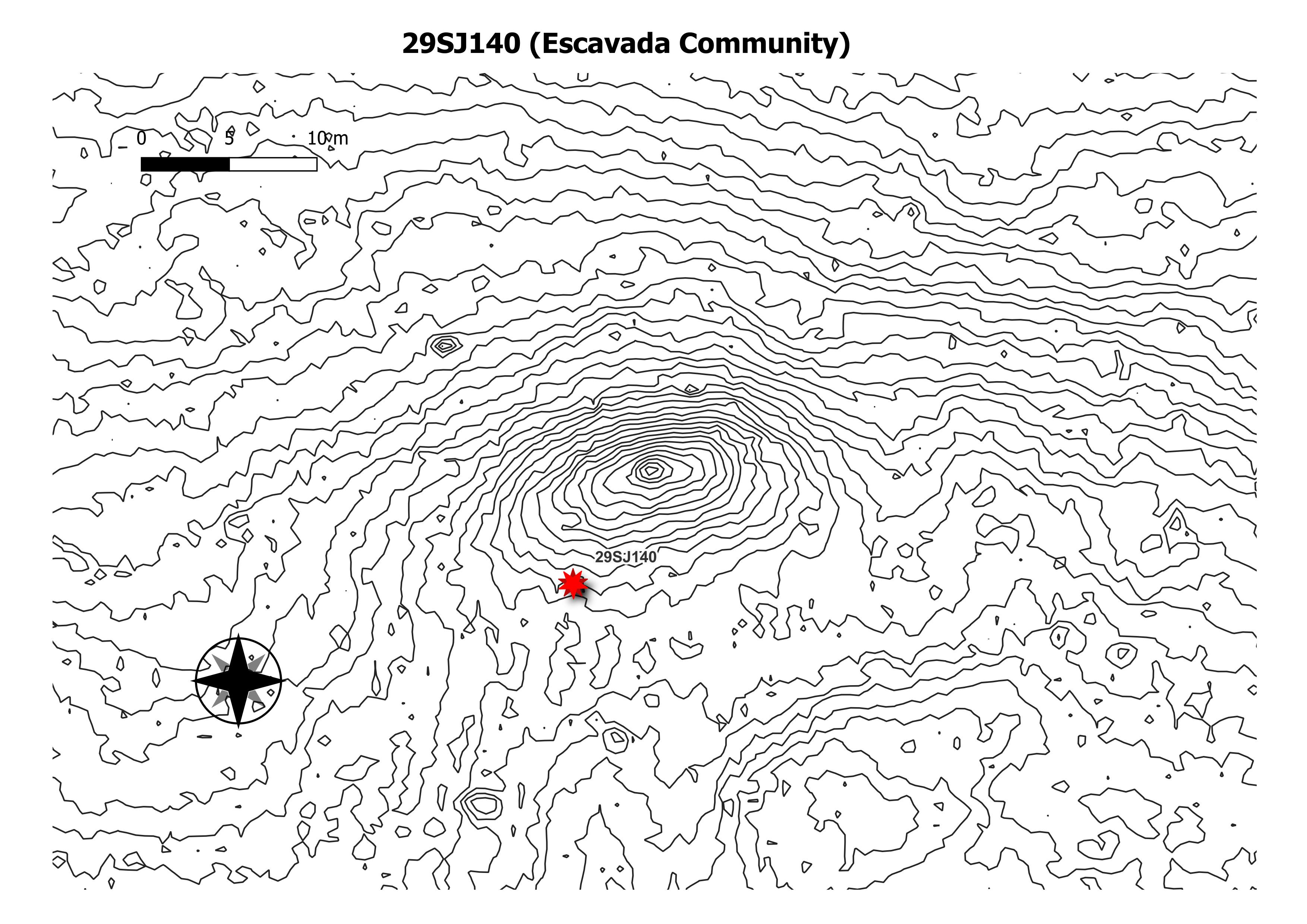
59SJ140
accropolis
alto
andrews
aztec community
aztec east
aztec west
holmes
bc 50
bc51
bc53
bc57
bc58
bc59
BEE BURROW
bis sani
blancett
blancett
candelaria ruin
casa abajo
casa chiquito
casa de valle
casa rinconada community
casa rinconada
casamera
cero pomo
cero prieta – Copy
cero prieta
chaco core
chetro ketl
community
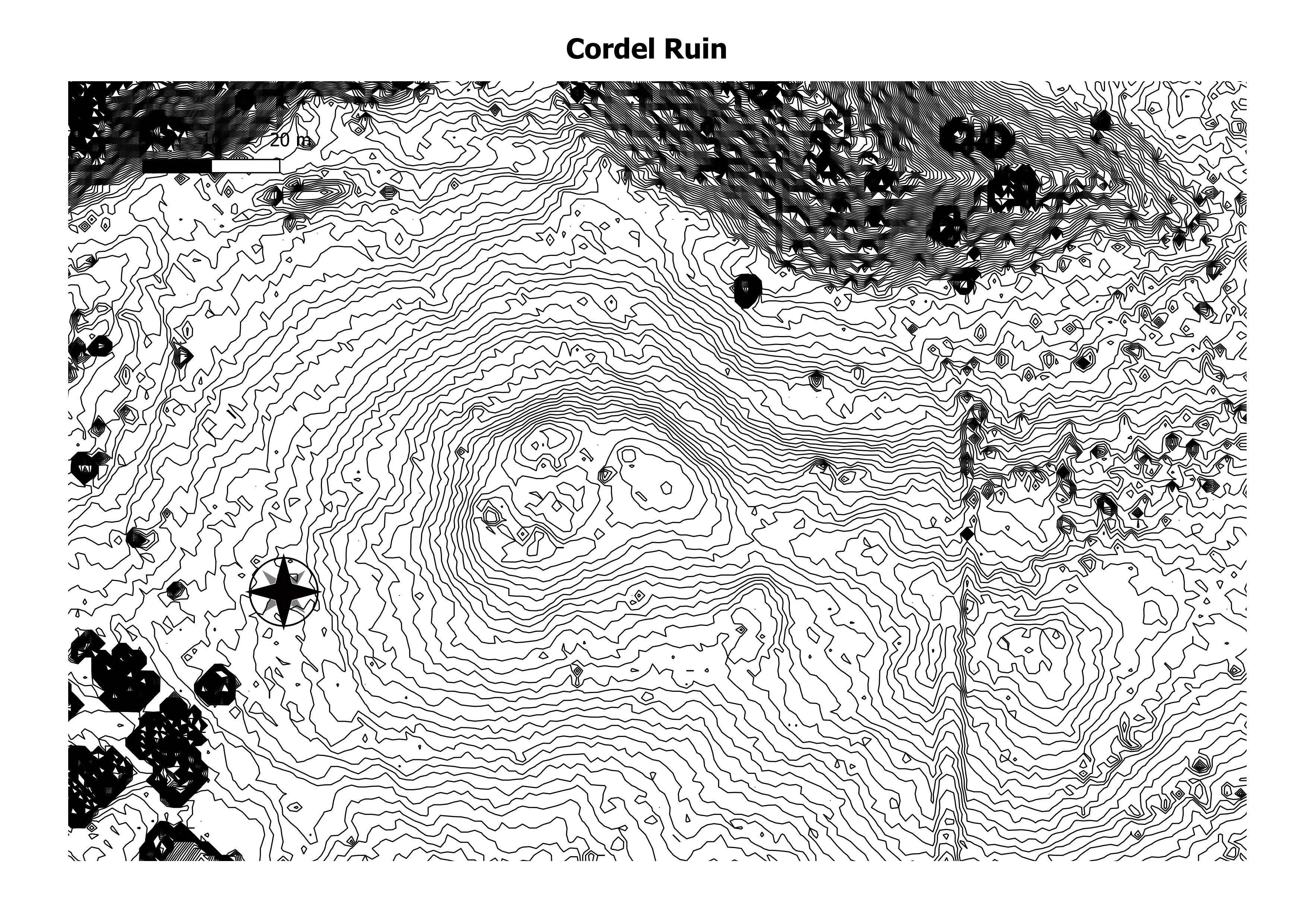
cordel
cottonwood falls
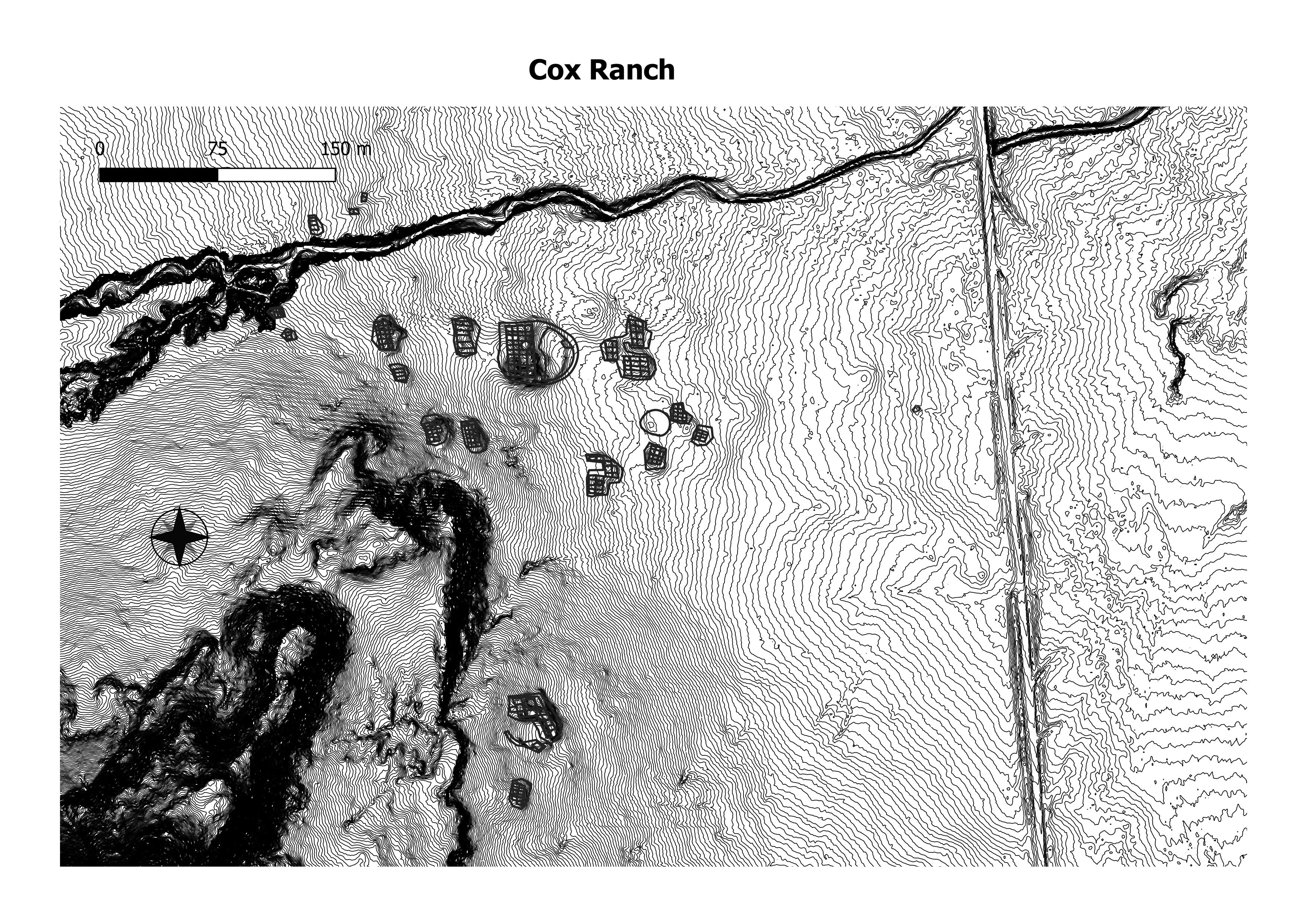
cox ranch
coyote sings here
crumbled house
dalton pass
dittert site
dune ruin
eal morris
east ruin
el faro
el rito
escavada community
fajada butte
farmers
flora vista
greenlee
habs abajo
halfway house
haystack great kiva
haytstack
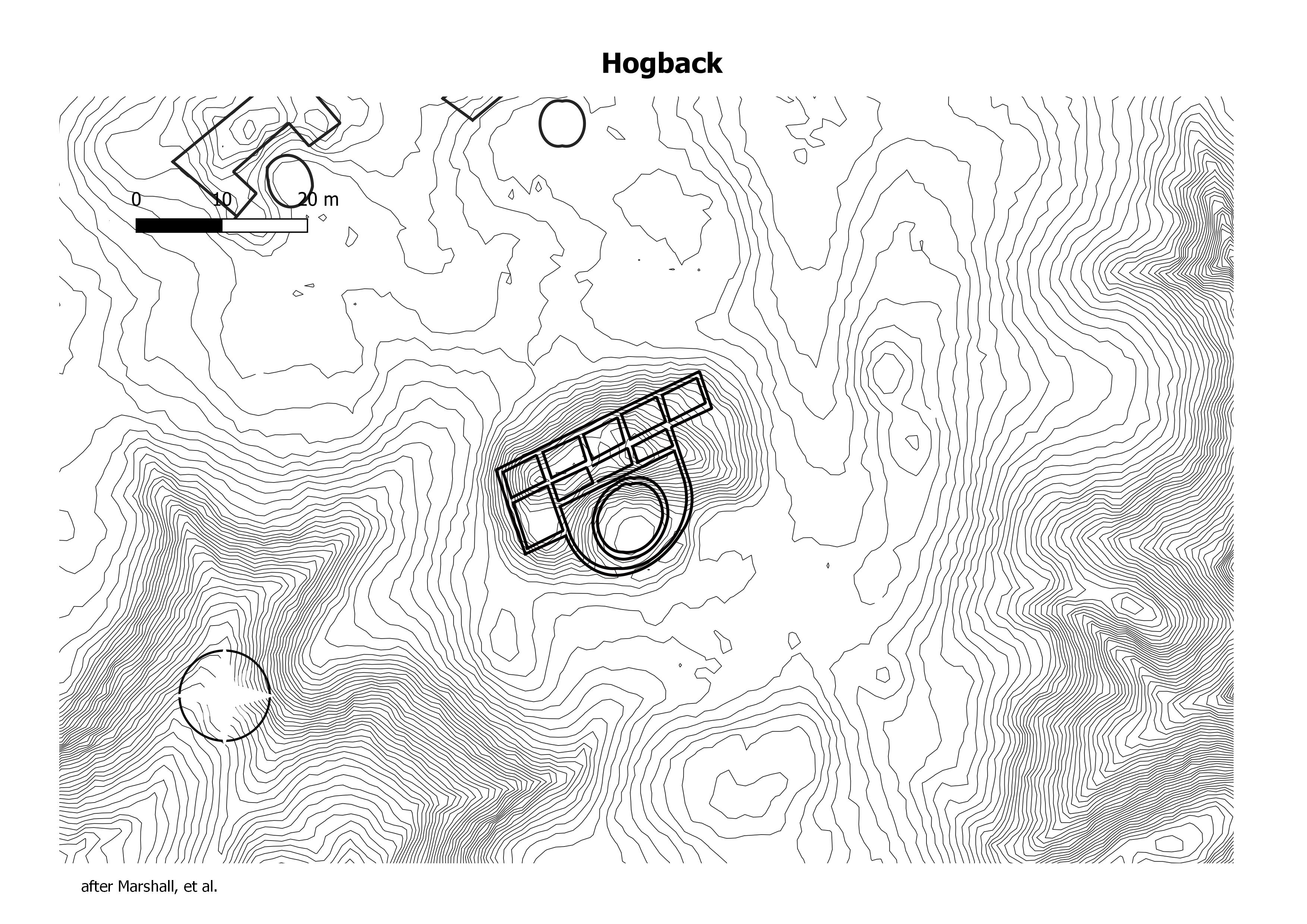
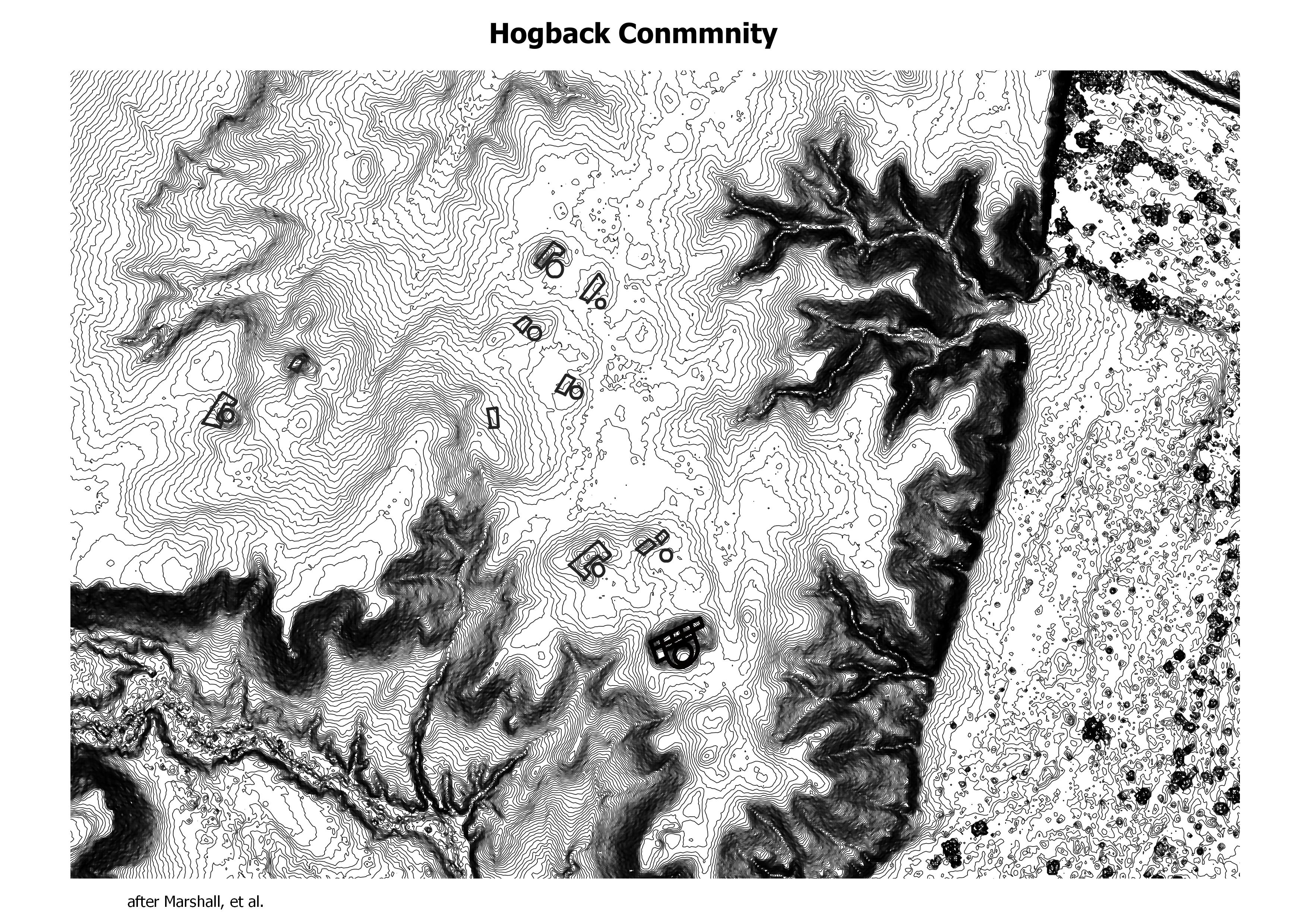
hogback
hogbback community
hubbard tri-wall
hungo pavi
jaquez
kin cheops bW
kin indian ruin
kin kishin
kin kletso
KIN KLETZHIN
kin nahasbas
kin niiyahk’eed
kin nizhoni
kin something
kin ya’a
los rayos great kiva
lower greenlee
lower nizhoni
morris 20
morris 41 greathouse
morris 41 north
morris 41 south
Morris site 39
muddy water
new alto bw
outliers
penasco blanco
pierre’s complex
pueblo del arroyo
pueblo pintado
puerco pueblo
quatros payasos
rabbit ruib
red knos
red willow
salmon ruins
salmon
salmon2
san mateo
section 8
fenced up horse canyon community
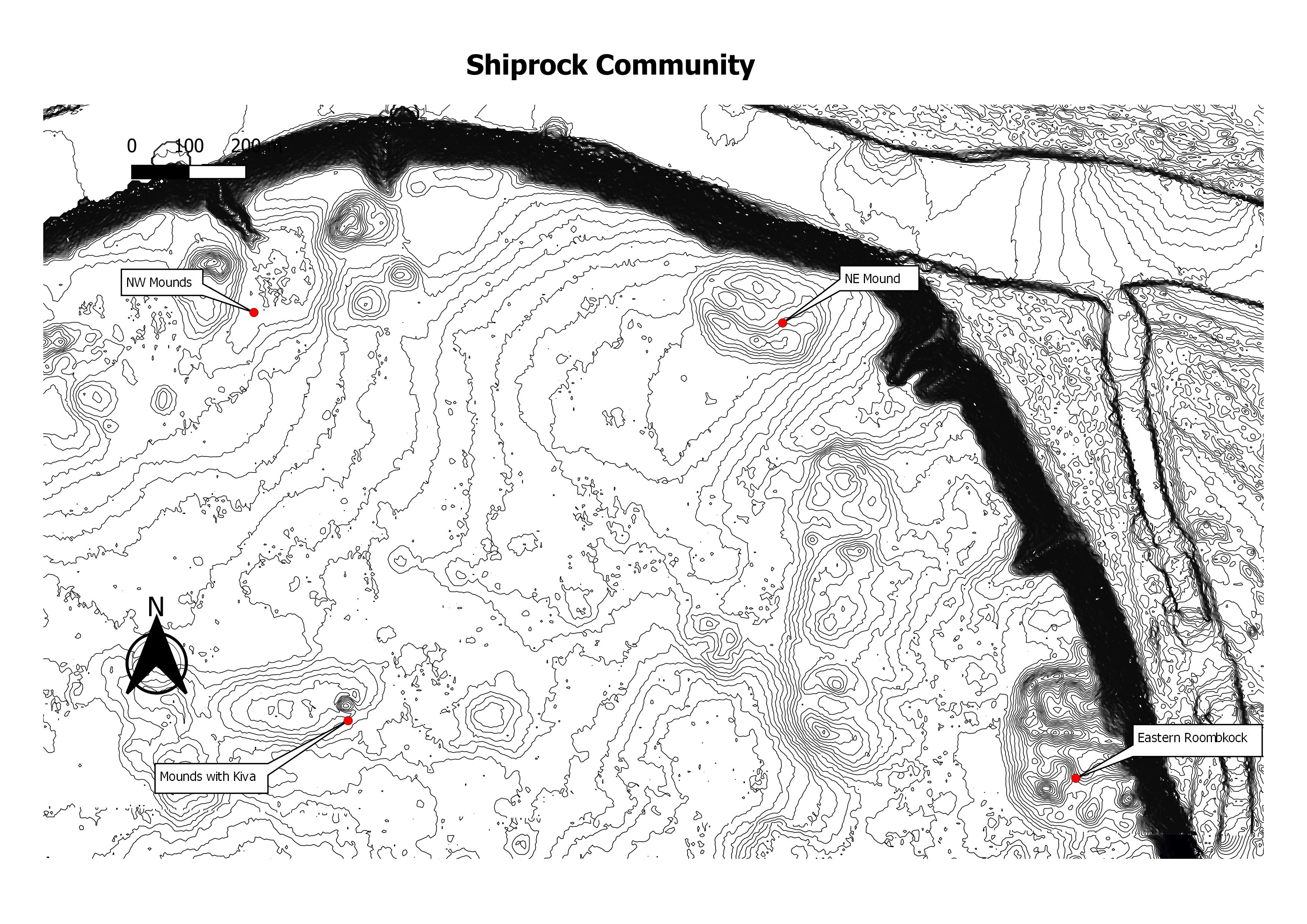
Shiprock Community
Landscape of Shiprock Community
skunk springs
squaw springs
standingrock
the accropolis
three kiva pueblo2
tolokai
tse bee kintsoh
No data found.
No data found.
No data found.

No data found.
No data found.
No data found.
No data found.

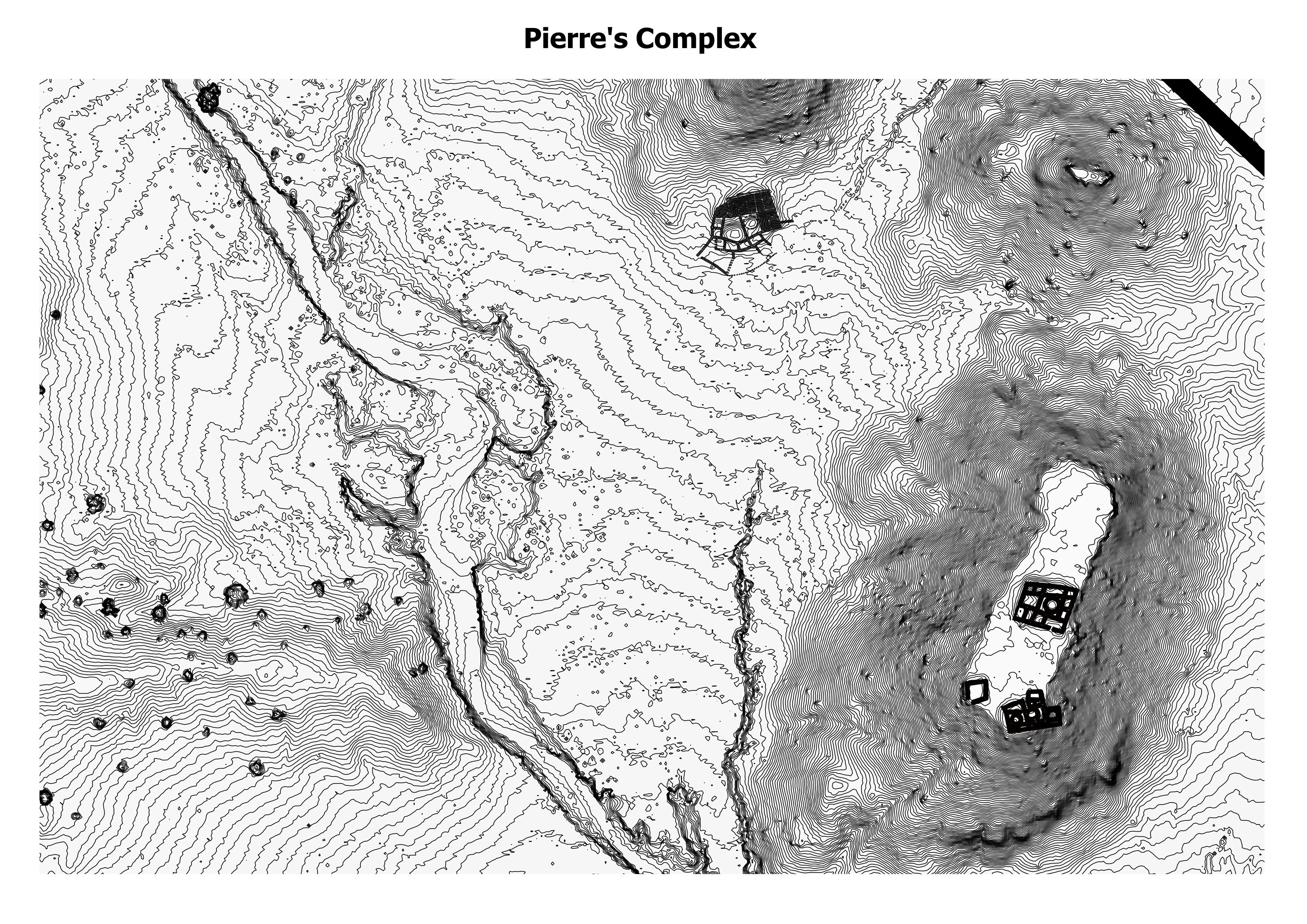
Pierre’s Ruins include three great houses and at least eighteen small sites on and around a group of badland cones and buttes 20 kilometers north of central Chaco Canyon. The sandstone-capped buttes in the vicinity of Pierre’s Ruins are the most prominent landscape features between Chaco Canyon to the south and Huerfano Mesa to the north. (University of Idaho)
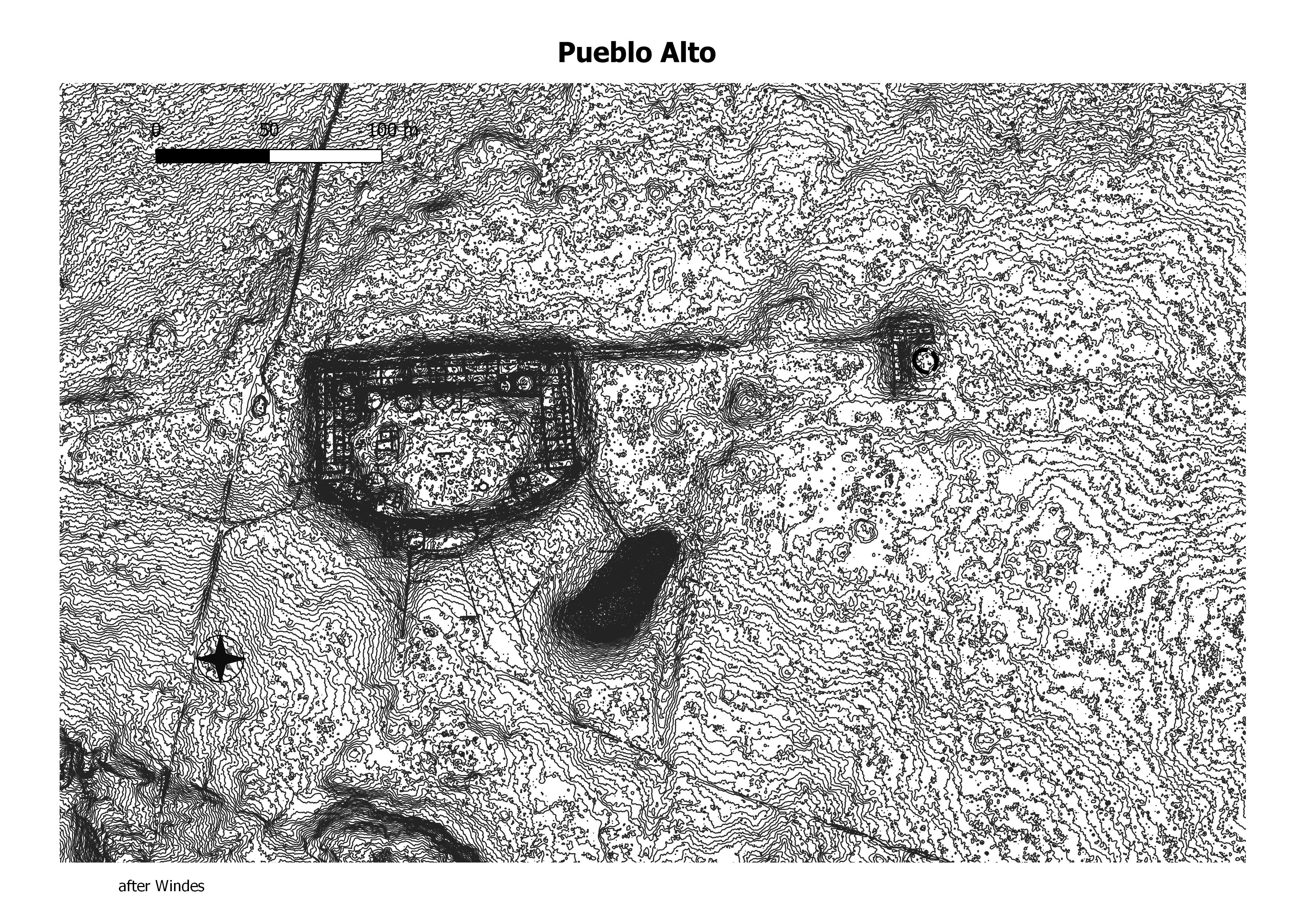
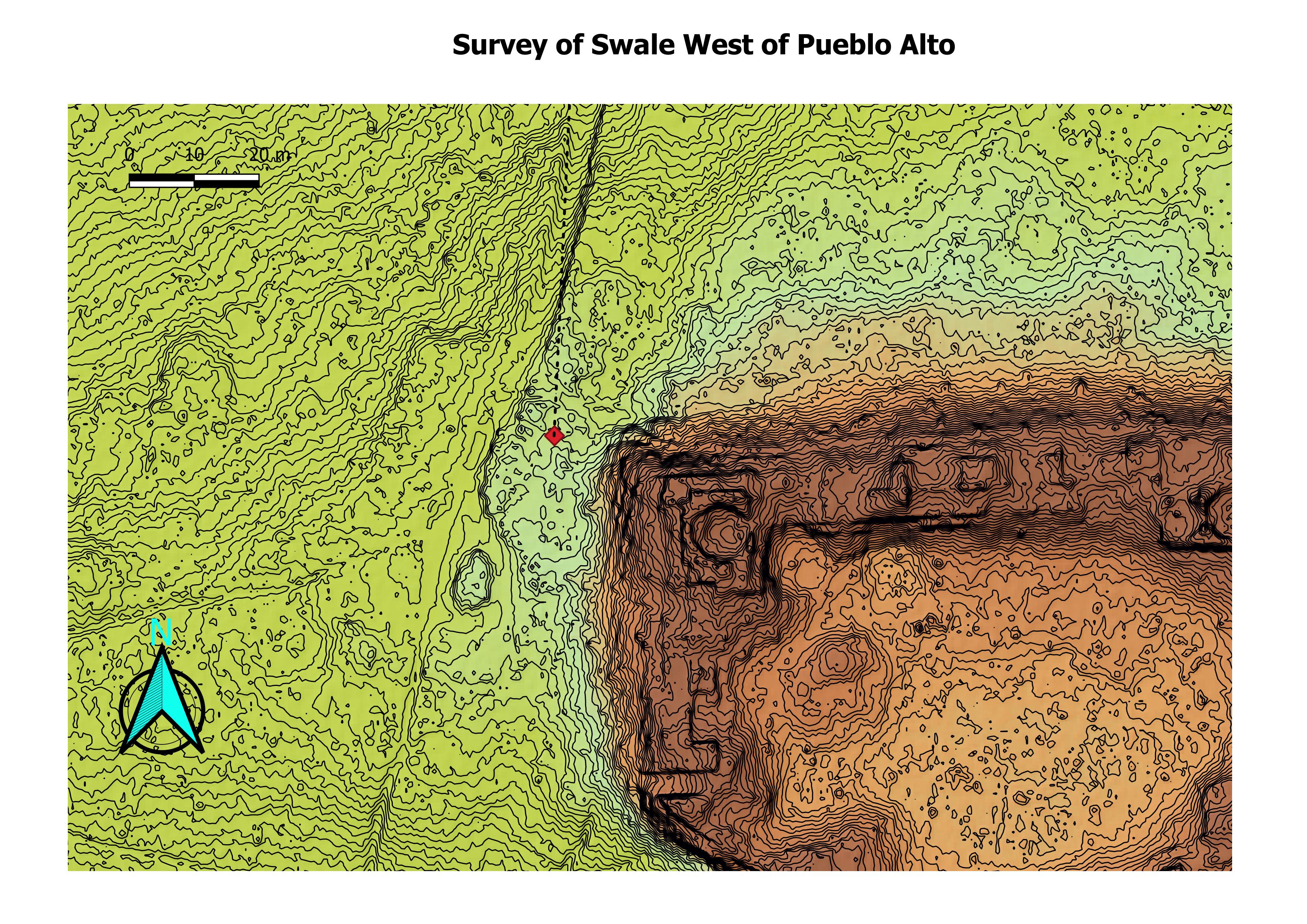
Pueblo Alto contains about 130 masonry rooms and 18 kivas; the roomblocks appear to have been single-story throughout. Unlike most other great houses of the same time, Pueblo Alto does not appear to have a great kiva. (Chaco Research Archive)
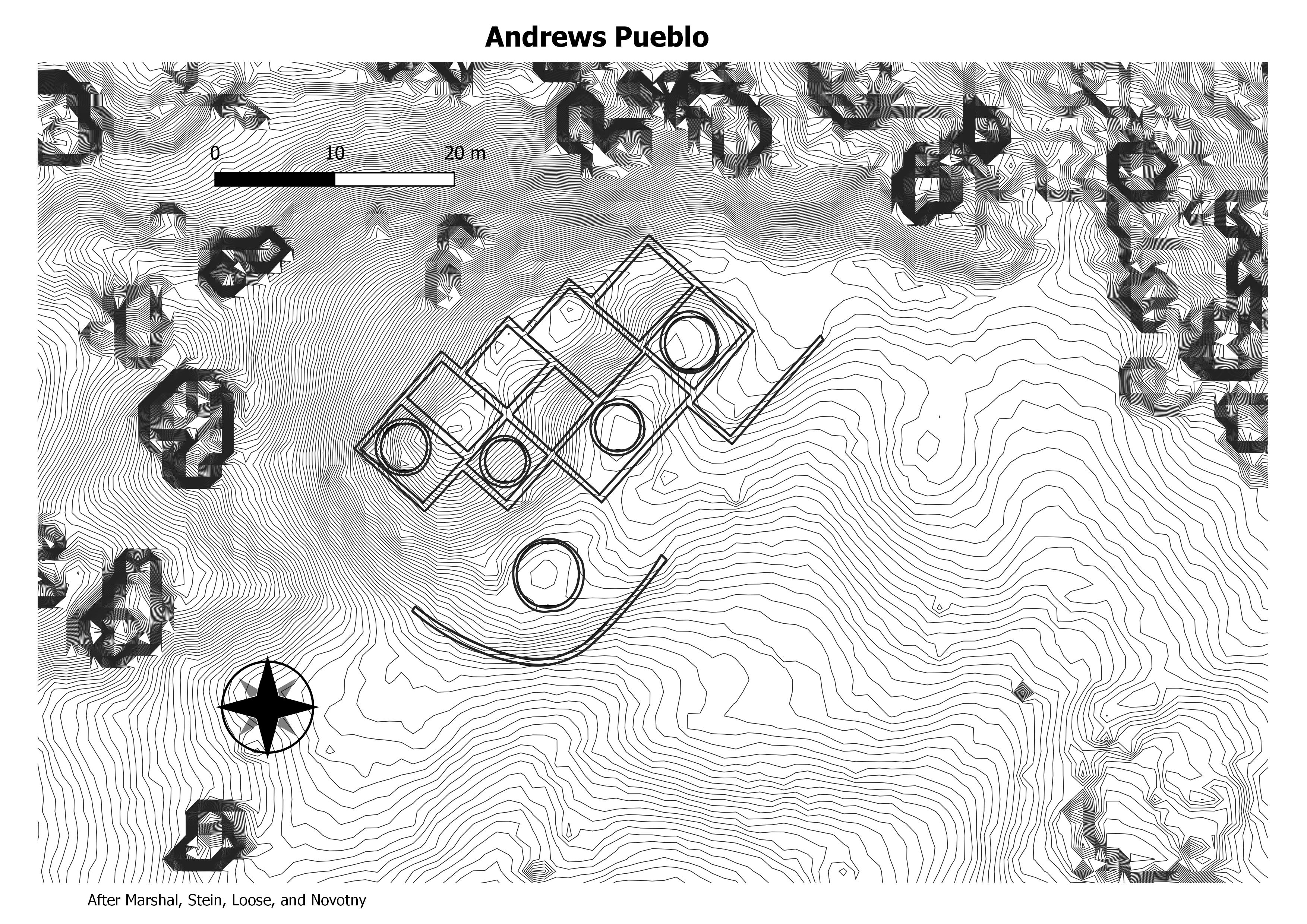
Located a few kilometers to the southeast of Casamero lies the small community of Andrews. The Andrews great house is a 22-room, two-story structure that contains two blocked-in kivas, three small kivas in a plaza, and a nearby great kiva. (Chaco Research Archive)
One of the complex’s larger features is a 500-room multi-story stone compound known as the “Big House”, whose occupation period has been estimated to be 1200-1325 AD. “Atsee Nitsa”, a small site, has 150 rooms, and is believed to have been occupied between 1150 and 1250. (Wikepedia)
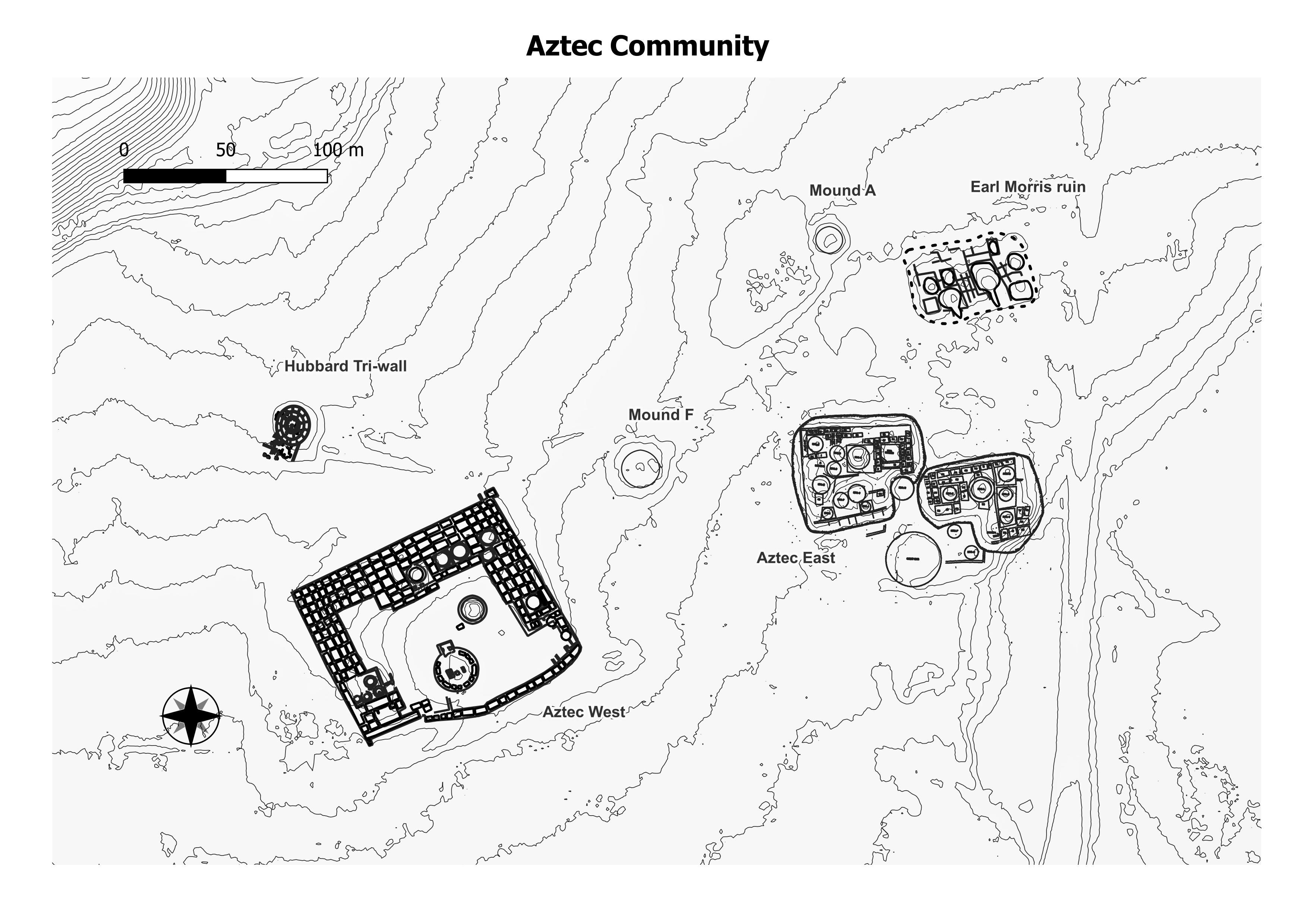
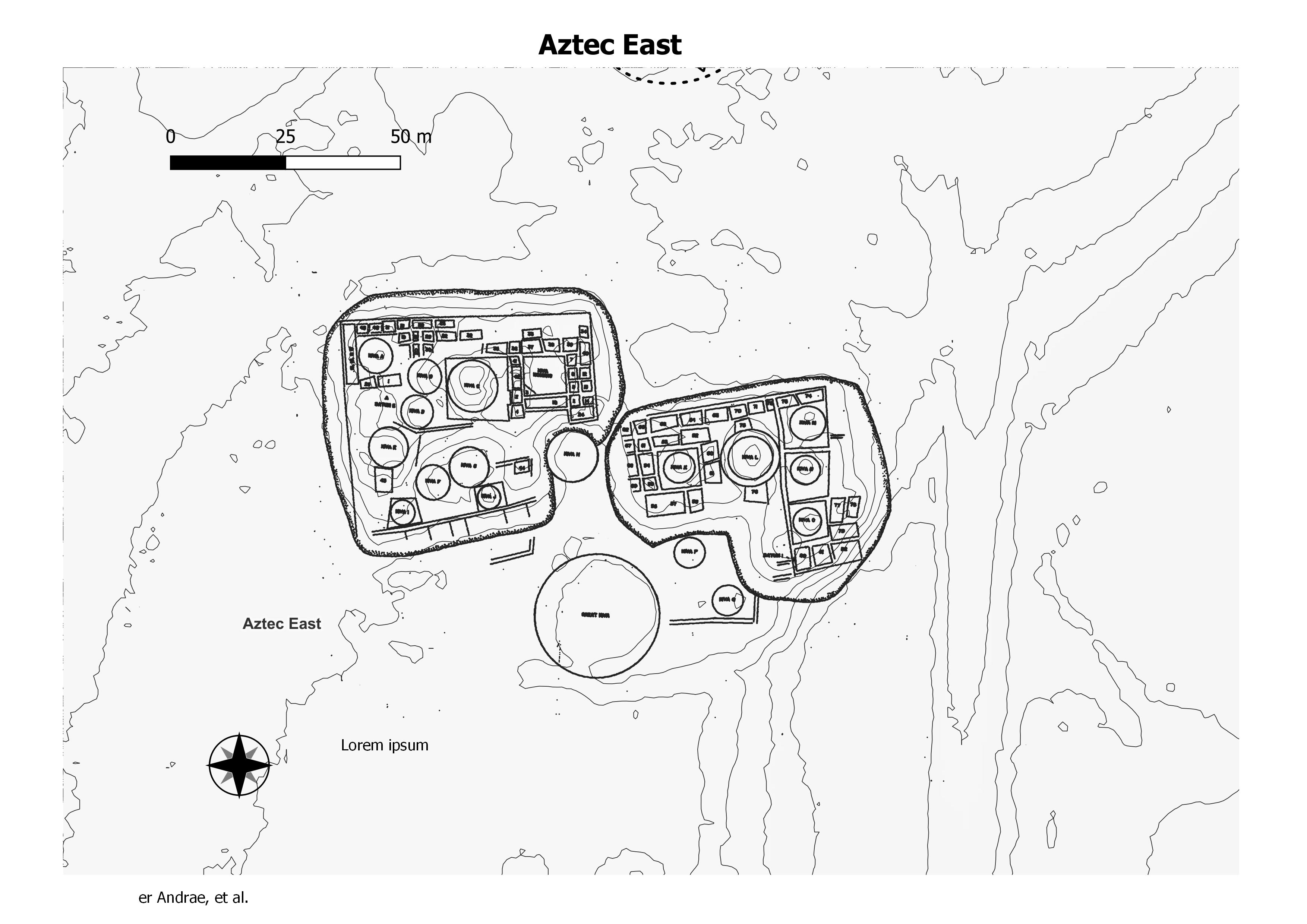
Aztec East is one of several prominent structures composing a tight aggregation of 12 sites known collectively as Aztec Ruins, which are preserved today in a 27-acre (10.93 hectare) plot known as Aztec Ruins National Monument. (Chaco Research Archive)
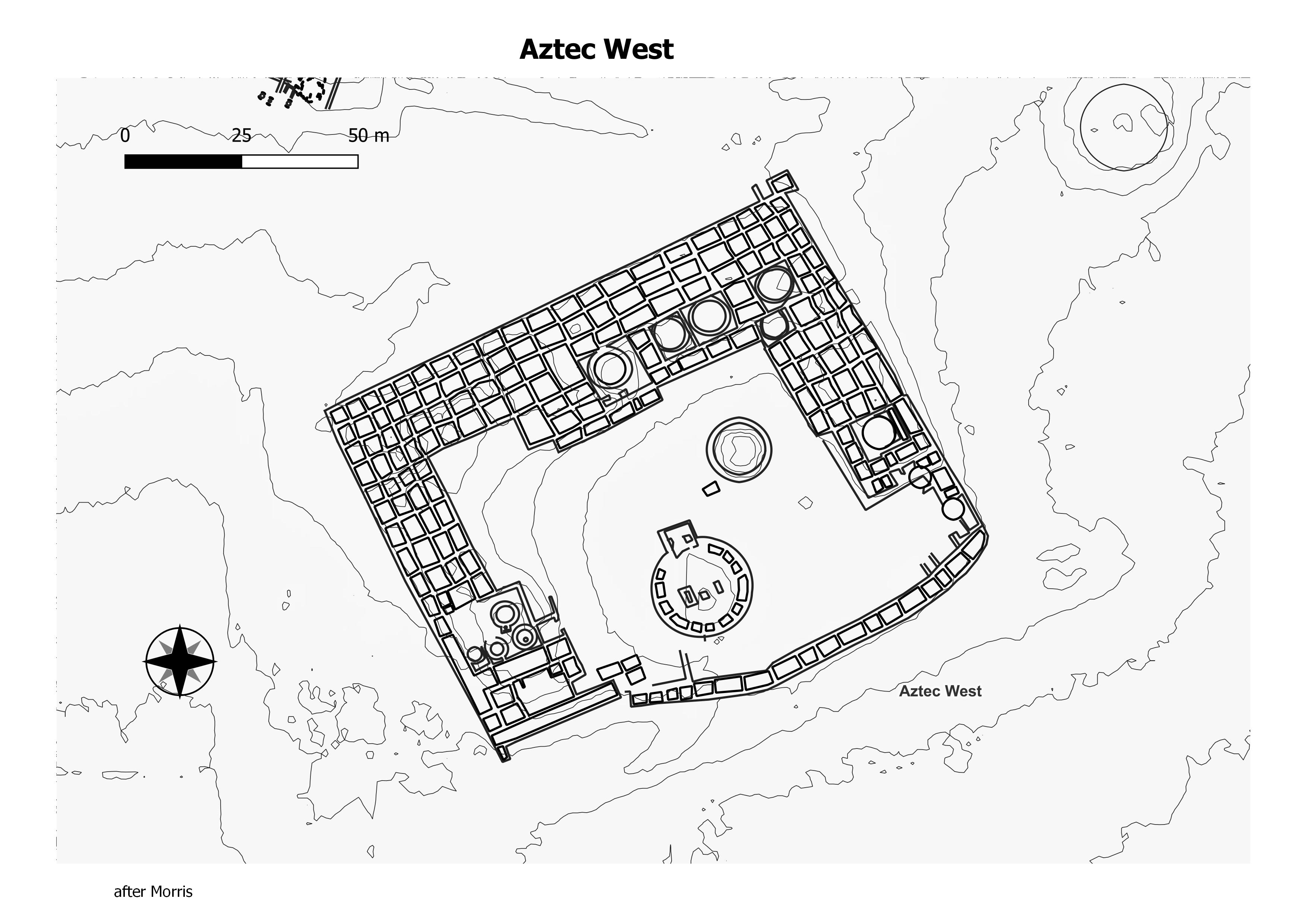
The Aztec West Ruin is a D-shaped structure with a low-curving wall that connects the southward-extending wings and encloses a large plaza. An estimated 405 rooms and 28 kivas (including both early Chacoan style and late occupation kivas) are present in addition to a centrally located great kiva. (Chaco Research Archive)
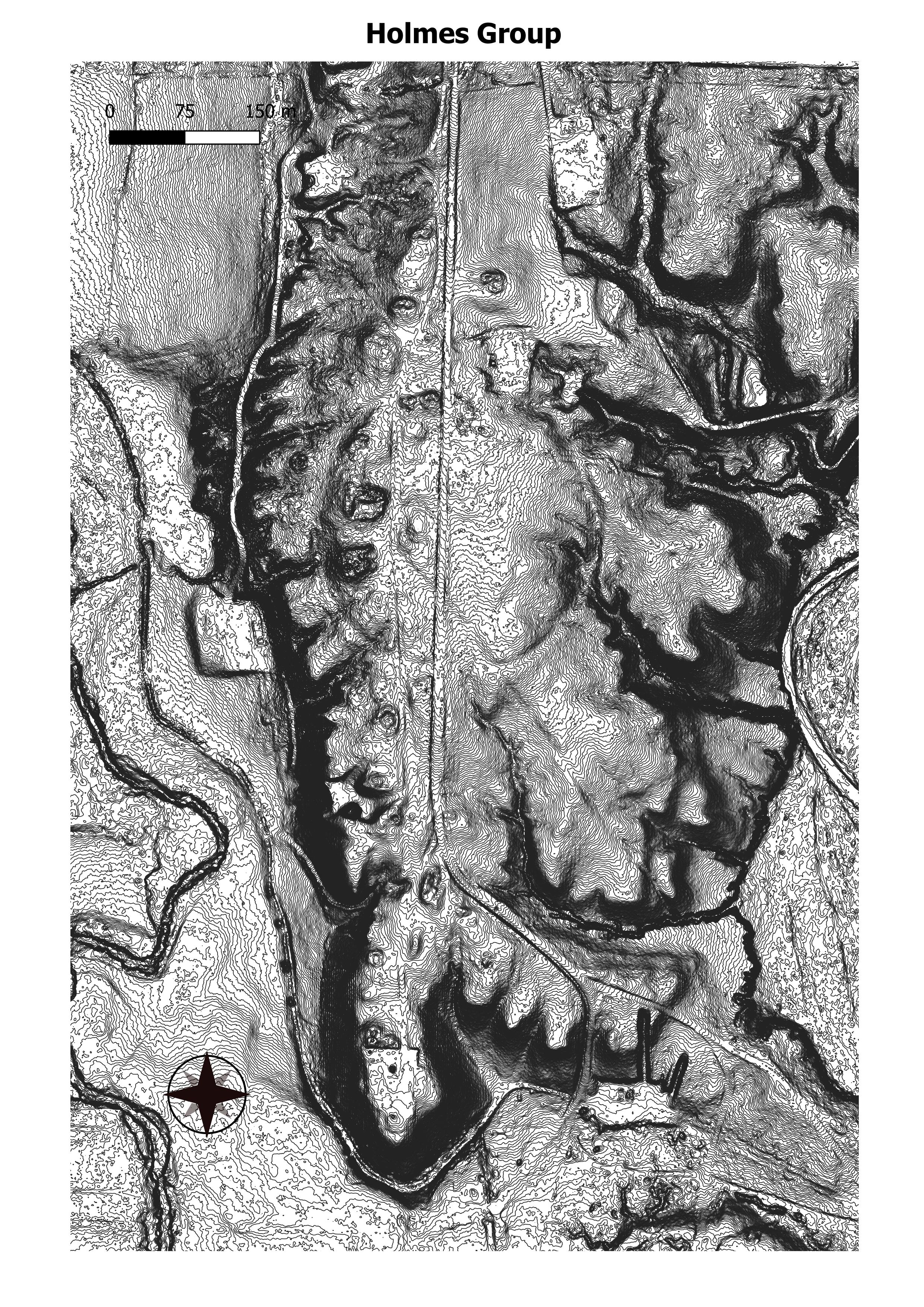
The majority of features relating to the Pueblo II-Pueblo III occupation of the Holmes Group complex are located toward the western portion of the site. These include two two-story roomblocks (F35.0, F36.0) and two great kivas (F34.1, F40.0), located within approximately 240 m of each other in the central portion of the group. (Chaco Research Archive)
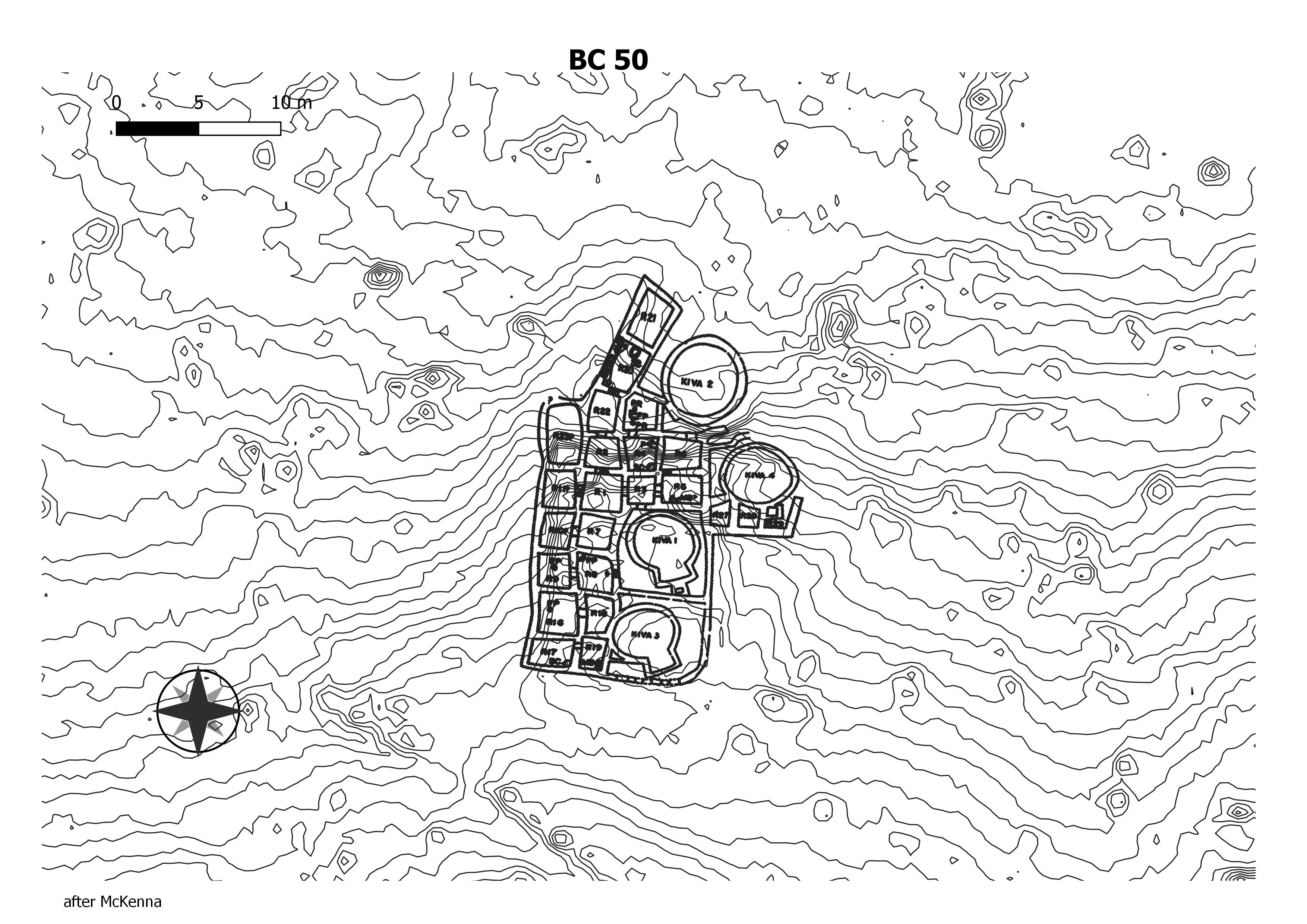
A small residential structure located just east of Casa Rinconada and a ½ mile south of Pueblo Bonito. This rectangular building, also known as “Tseh So,” had twenty-six ground-floor masonry rooms with four kivas along the east side. The excavators also identified substructure and superstructure components of the building indicating multi-story architecture. (Chaco Research Archive)
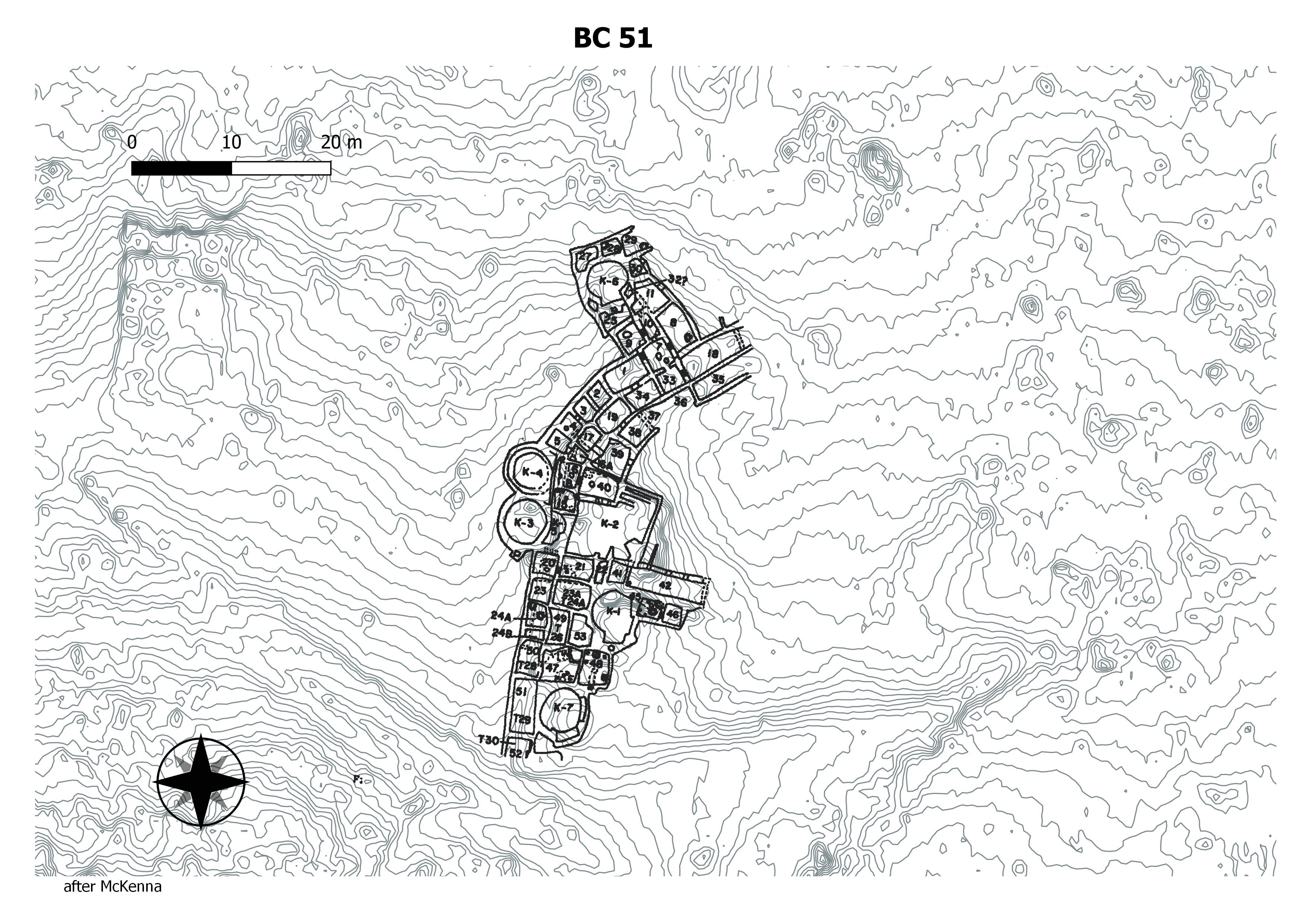
This site, along with Bc 50, became “type sites” for Chacoan small house residences. With about 45 ground-floor rooms and seven kivas, Bc 51 is very large for this building type. The three tree-ring dates for the site, all from Room 7, are from trees harvested in A.D. 967 and A.D. 1043. (Chaco Research Archive)

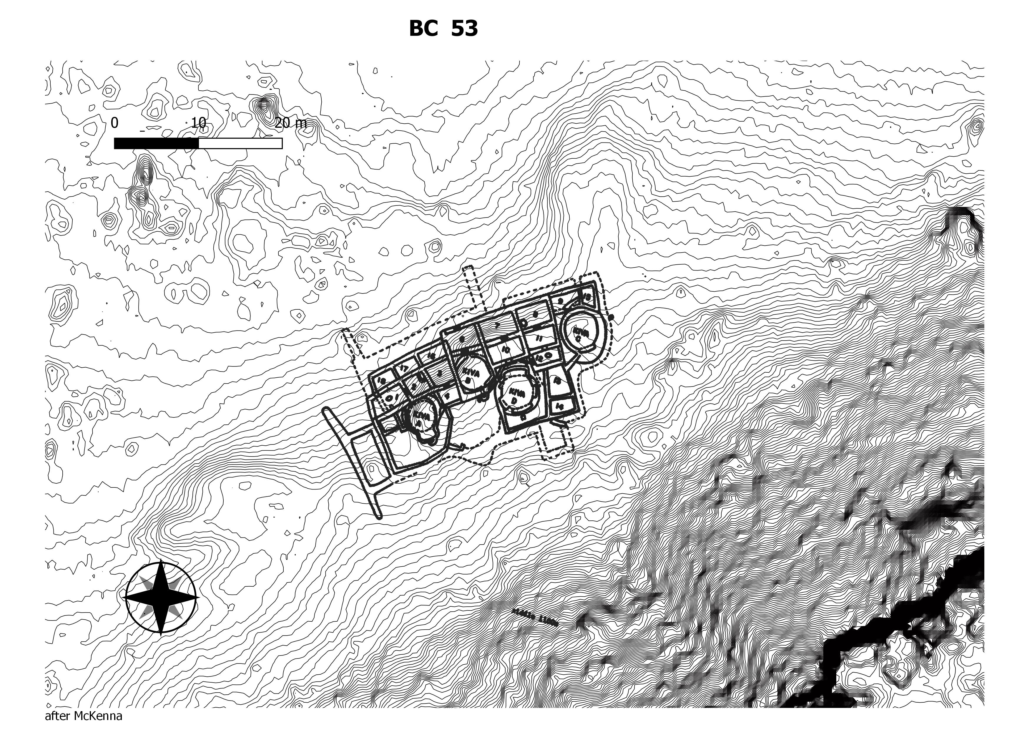
Bc 53 is a small house settlement located on the south side of the canyon, opposite Pueblo Bonito. Bc 53 lies 0.2 miles (0.33 km.) east of Casa Rinconada and about 450 feet (137 m.) east-northeast of Bc 51, on the eastern edge of the cluster of small house sites in the Casa Rinconada rincon. (Chaco Research Archive)
A small house site on the south side of the canyon along a natural hillside. Bc 57 is adjacent to Bc 58 and approximately 400 feet (122 m.) northeast of Casa Rinconada. The site was excavated by the University of New Mexico and School of American Research field school under the direction of Paul Reiter and includes approximately nine masonry rooms, three enclosed kivas, one exterior kiva, and one pithouse. Ceramic assemblages from the site’s refuse-filled rooms suggest that activity at and around the site likely spanned the 9th, 10th, and 11th centuries, but was not continuous throughout that period. (Chaco Research Archive)

A small-house site located on the south side of the canyon between Bc 57 and Casa Rinconada, approximately 290 feet (85 m.) northeast of the latter and along the same natural hillside. Bc 58 was excavated during the 1947 season of the University of New Mexico and School of American Research field school under the direction of Paul Reiter and includes roughly 14 masonry rooms and three kivas (two of which are subsurface). Rather than the simple rectangular footprint of Bc 57, the roomblock of Bc 58 is amorphous, suggesting rooms may have gradually been added as necessary. (Chaco Research Archive)
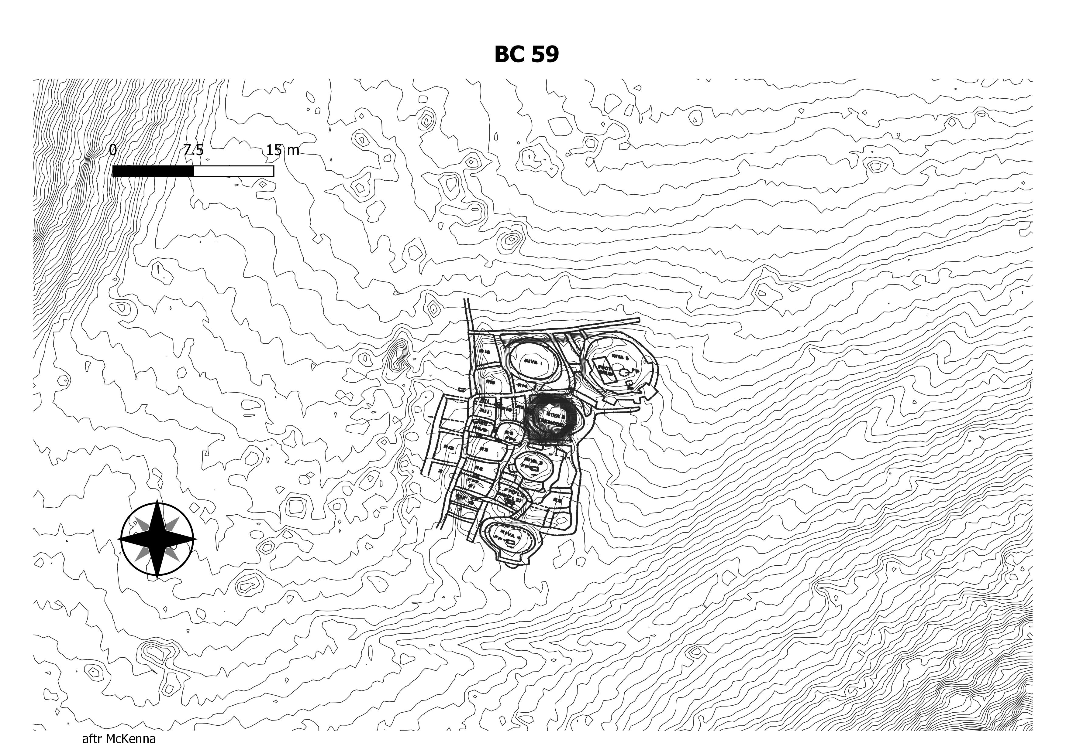
A small house site located about 325 feet (100 m.) southeast of Casa Rinconada and along the Casa Rinconada trail, Bc 59 was excavated in 1947 as part of the University of New Mexico/School of American Research field school. The site includes approximately 30 masonry rooms and five kivas. (Chaco Research Archive)
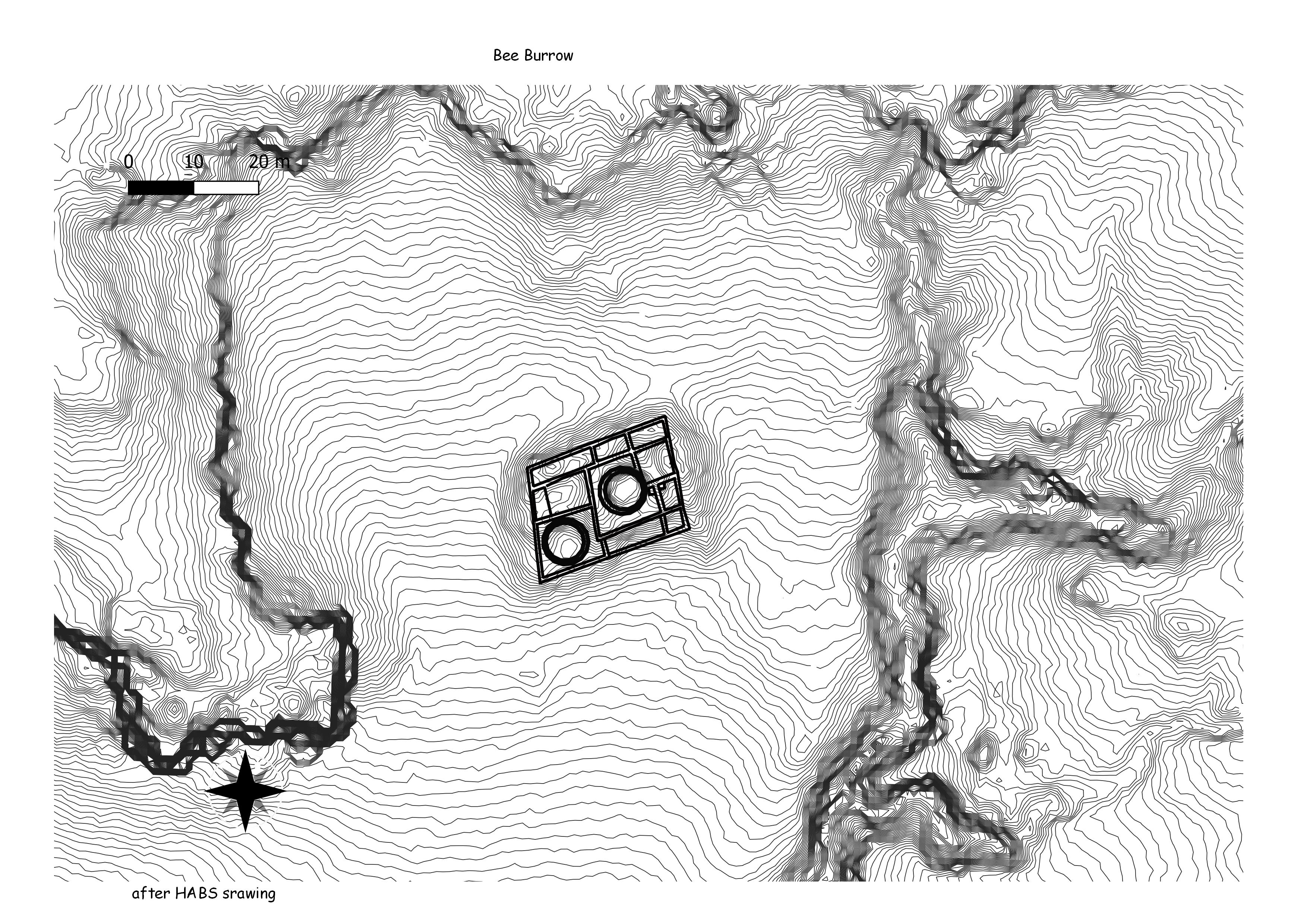
The Bee Burrow ruin is a rectangular structure with at least eleven rooms and two kivas. The long axis of the building is oriented approximately 20 degrees north of east, and therefore the front of the structure faces 20 degrees east of south. The outside dimensions of the structure are approximately 25 m E-W x 18 m N-S. The outside wall varies in thickness from 60 to 70 cm, and the interior walls range from 50 to 60 cm in thickness. (Chaco Research Archive)
One of the complex’s larger features is a 500-room multi-story stone compound known as the “Big House”, whose occupation period has been estimated to be 1200-1325 AD. (Wikepedia)
This is a prehistoric “community” which included two great houses, eight smaller “village” pueblos, 8 fieldhouse sites, two special-use sites, and seven scatters of occupational debris. Though a small number of these sites were occupied between Basketmaker III and and late Pueblo II, the majority of them were occupied only during early Pueblo III times (1050-1150 A.D.) The entire community was abandoned at the end of the time period. (Chaco Research Archive)
Structures such as the Old Indian
Racetrack, Kello Blancett, Flora Vista,
Salmon, and the structures of the Aztcc
complex may be architectural elements of
a regional center constructed on the scale
of Chaco. (Chaco Research Archive)
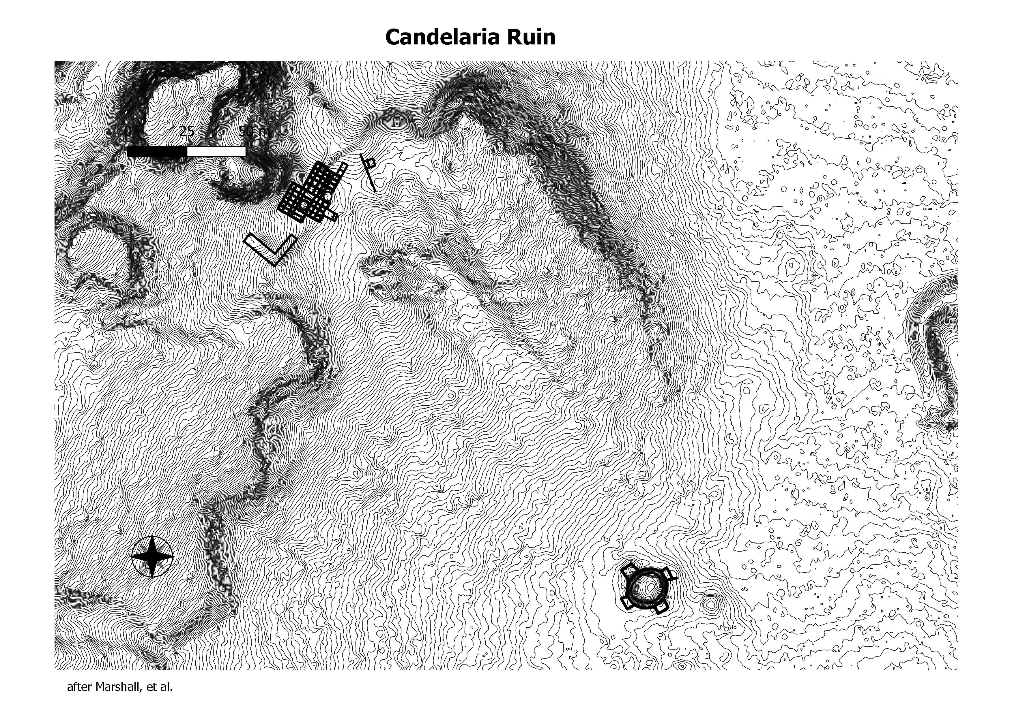
Candelaria Pueblo, also known as Las Ventanas, is a Chacoan-style site located within the El Malpais National Monument. The site consists of a two-story great house with approximately 75-90 rooms. Built circa 1050-1100 A.D., (Wikepedia)
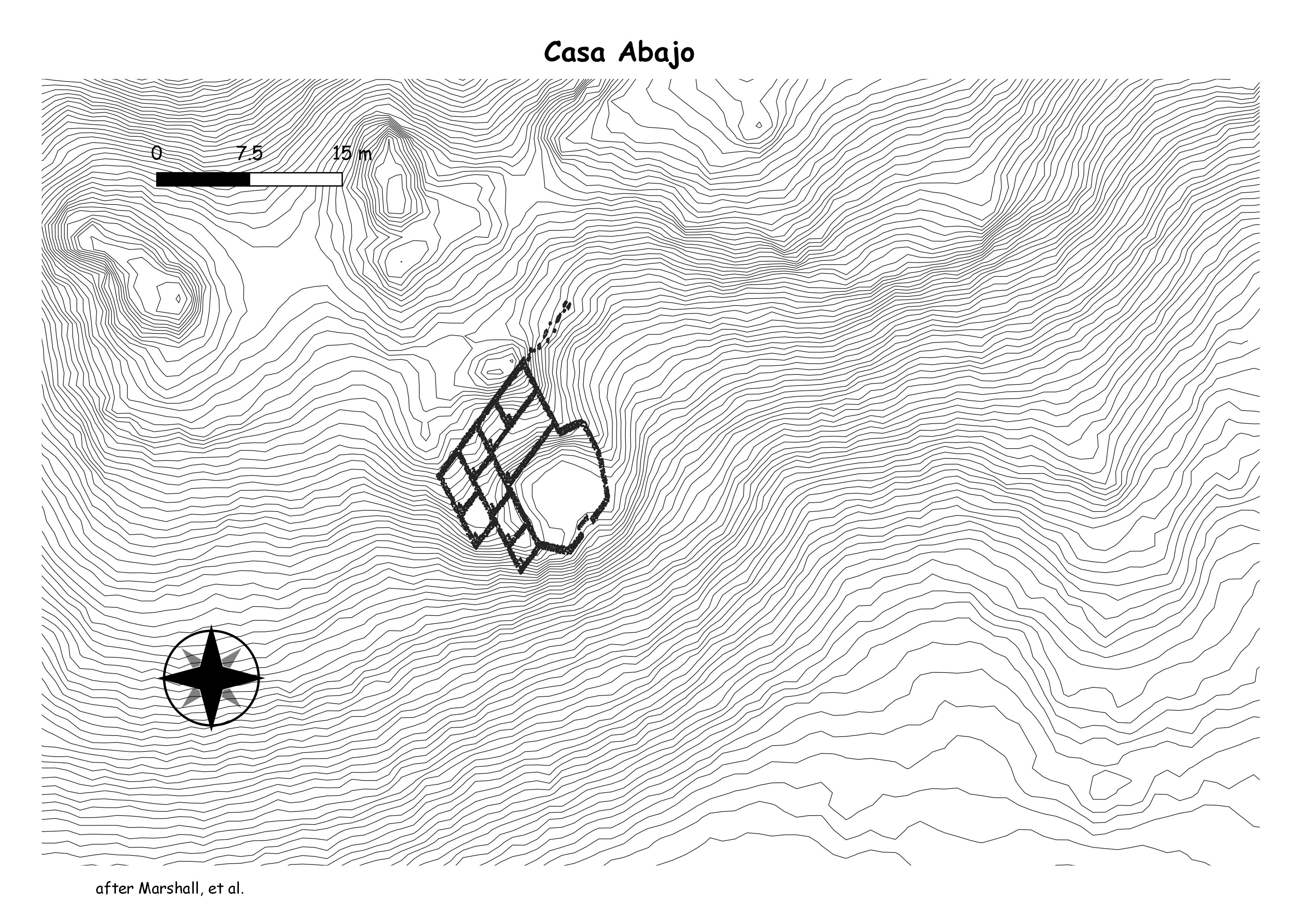
Also known as Indian Creek and LA 17083. Originally documented by Marshall et al. (1979), it was reexamined by Windes (2007). Casa Abajo is a relatively large “L”-shaped pueblo which contains nine rooms and has an enclosed plaza. The quantity of masonry rubble give the house a massive appearance. (Chaco Research Archive)
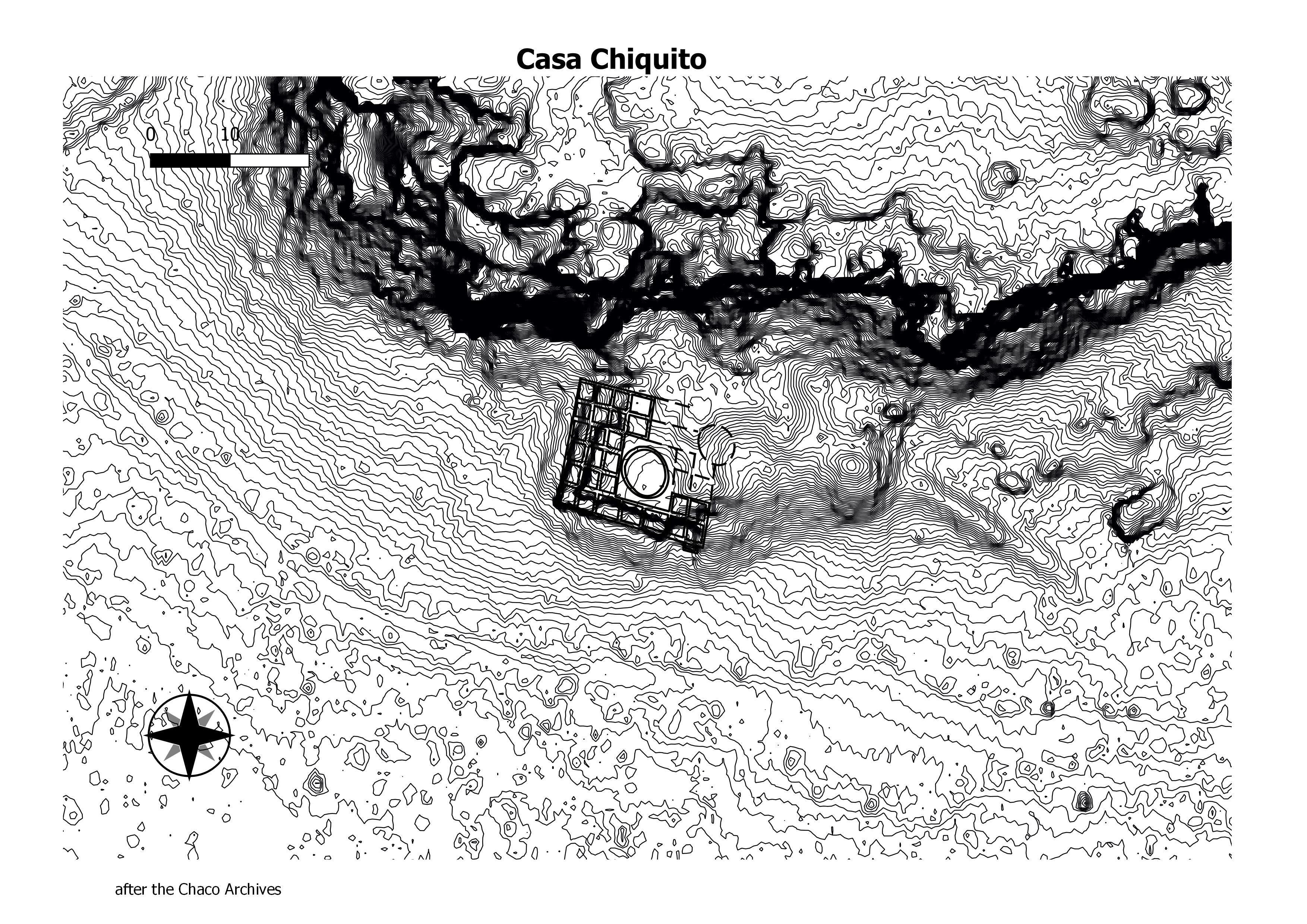
Casa Chiquita lies at the mouth of Cly’s Canyon approximately 1 mile (1.6 km.) northwest of Pueblo Bonito, just north of the Peñasco Blanco trail. The great house has never been formally excavated, The site forms a compact, square roomblock with approximately 34 ground-floor rooms surrounding a central, elevated kiva. Casa Chiquita was originally two or three stories tall. (Chaco Research Archive)
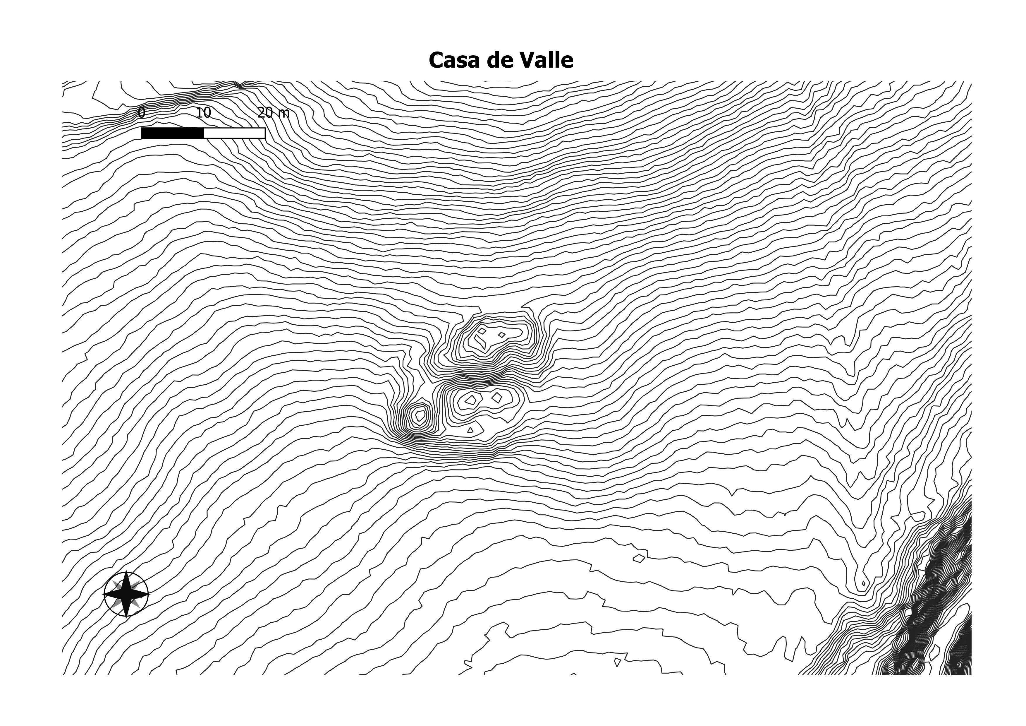
It may not be a great house, but it is a big bump that may have 50 rooms. (Chaco Research Archive)
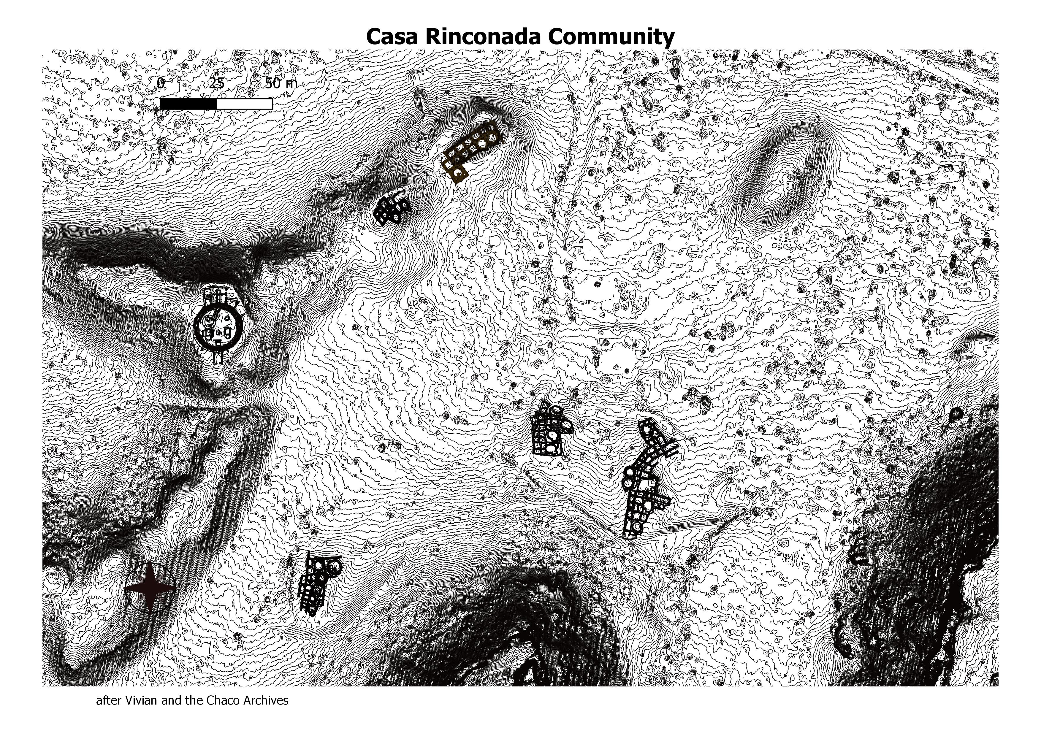
Casa Rinconada is an isolated great kiva located on top of a ridge on the southern side of the canyon directly across from Pueblo Bonito. It is located within a cluster of small house sites. Two of the closest are Bc 58, 290 feet (85 m.) to the northeast, and Bc 50, 290 feet (85 m.) to the east. (Chaco Research Archive)
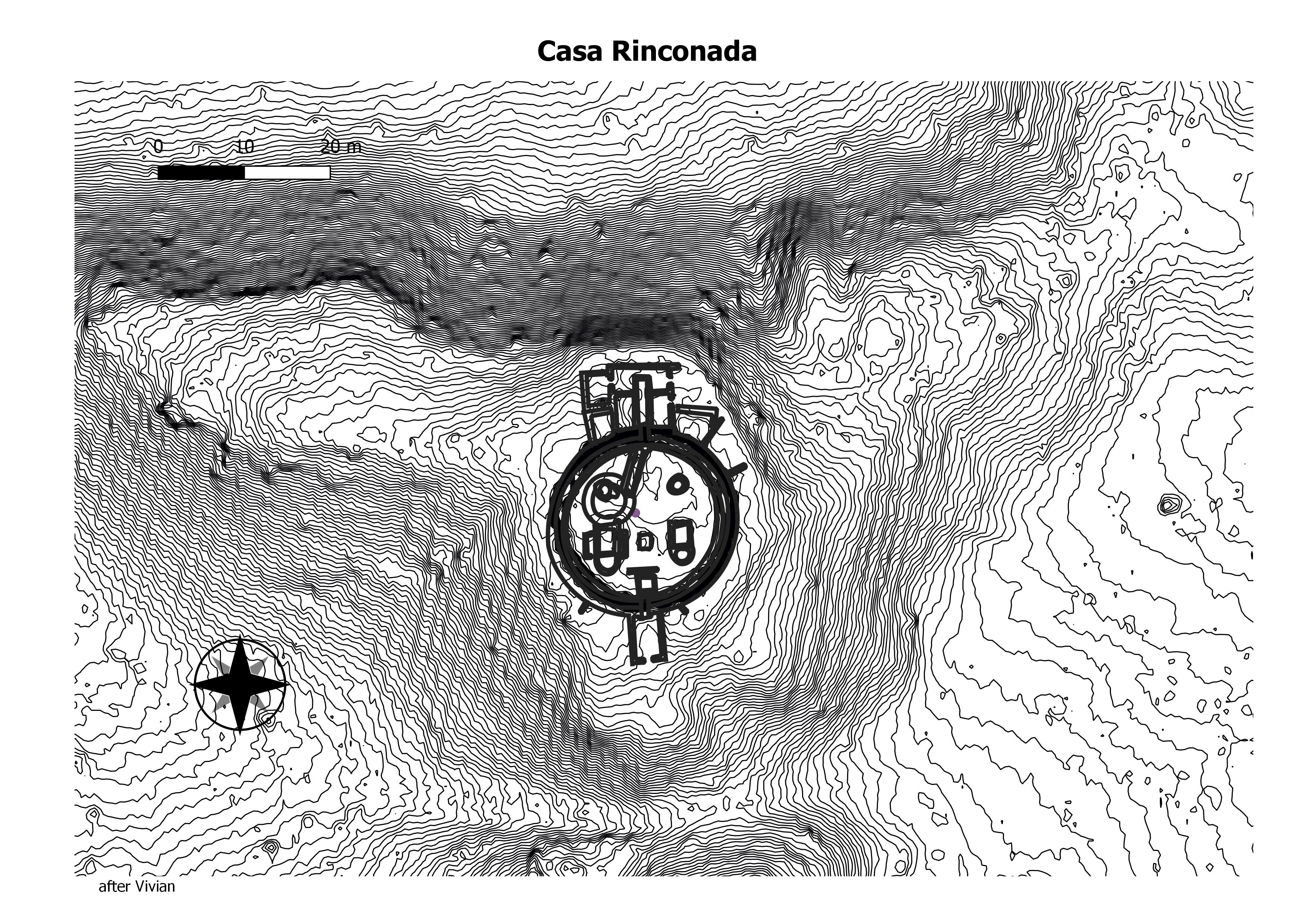
Casa Rinconada has an average interior diameter of 63 feet (19.2 m.). It contains all features generally associated with great kivas including a firebox, an inner bench, four large seating pits that served as roof supports, two masonry vaults/foot drums, and 34 niches encircling the great kiva. (Chaco Research Archive)
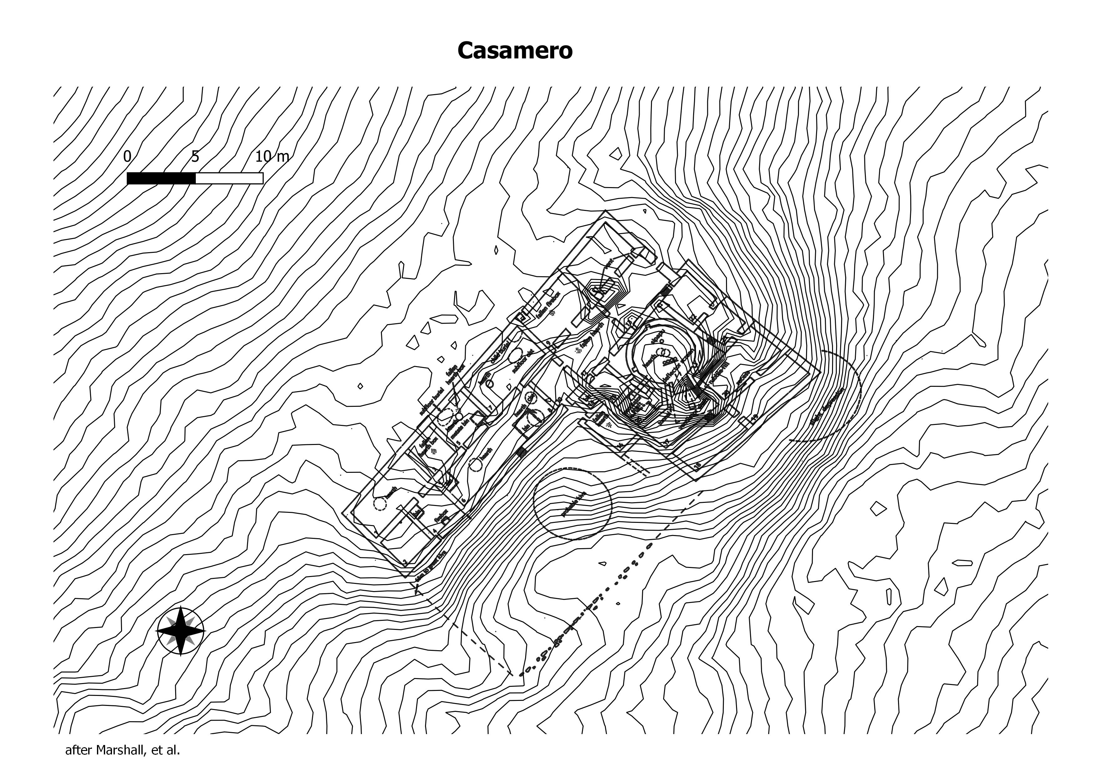
Most of the research in Casamero has focused on the great house after which the community is named. This structure, consisting of 21 ground-floor and six second-story rooms, includes a plaza area in front as well as a blocked-in kiva. A road appears to approach the great house from the southeast. Mean ceramic dates from this (Chaco Research Archive)
This appears to be a great house of approximately 40 rooms with 3 blocked-in kivas, 2 plaza kivas, and 2 nearby great kivas. Possibly 2 prehistoric roads approach the great kivas and great house. (Chaco Research Archive)
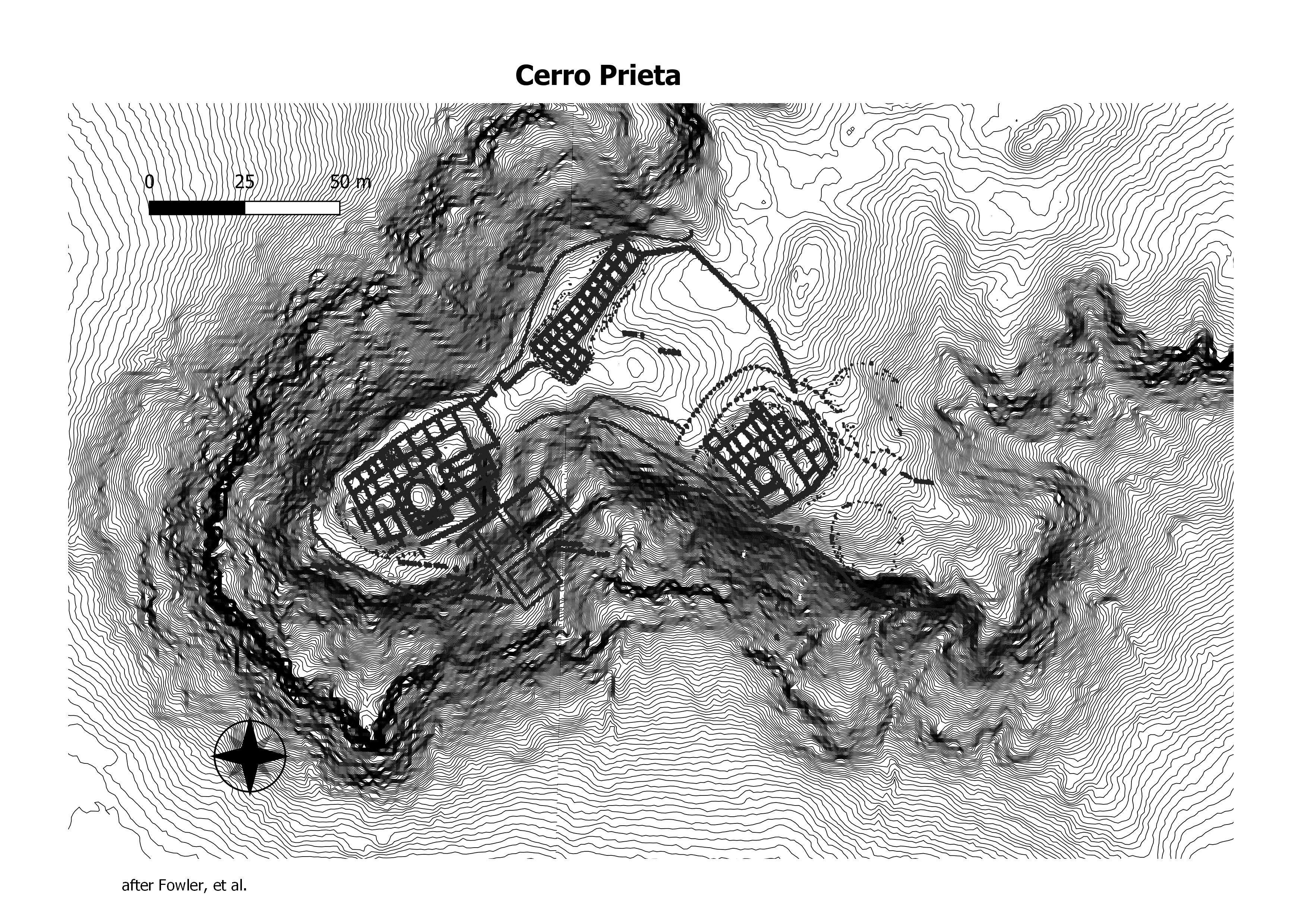
Also known as LA 48056. Cerro Prieto was mapped in part by John Stein and Dabney Ford as Site 472. Cerro Prieto is an extensive complex of at least 17 roomblocks, only 10 of which have been documented in any detail. The central core of the complex is on the ridge top and consists of Units 1 to 3. (Chaco Research Archive)
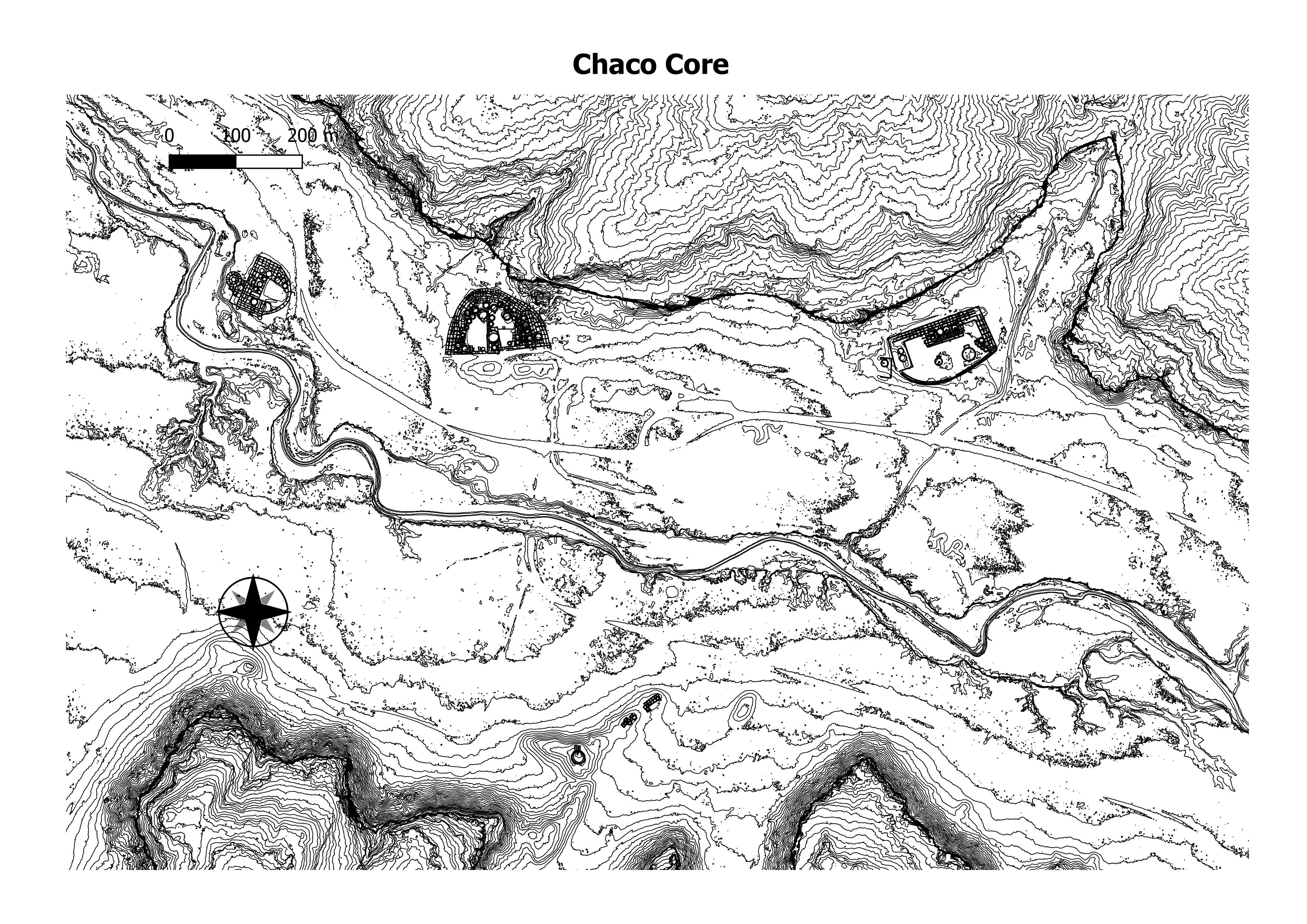
The core comsists of Pueblo Bonito, Chetro Ketl, Pueblo del Arroyo, and thr Casa Riconada Community.
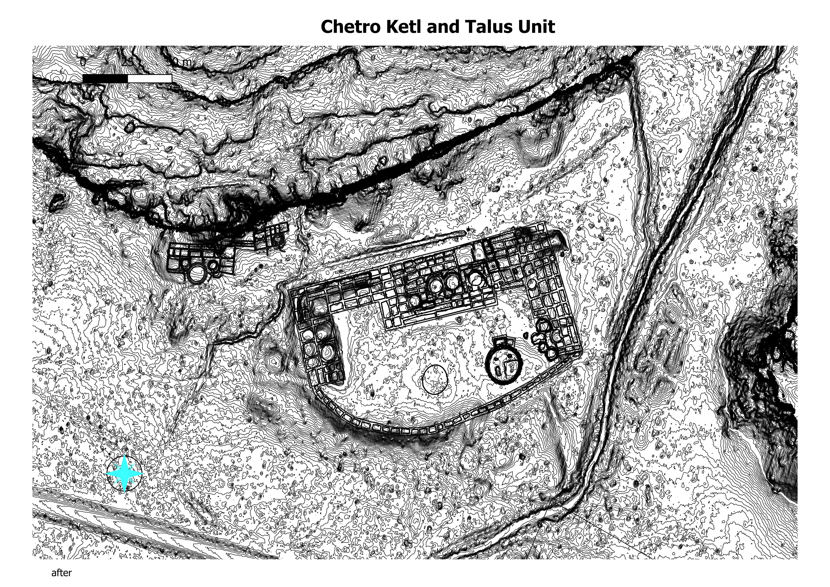
Chetro Ketl is the second largest great house in the canyon in number of rooms (approximately 400 ground and upper-story) and the largest in surface area (more than 5.7 acres or 2.3 hectares). The great house may have risen to four stories along areas of the north side. Talus Unit is a small structure composed of an east and west building located against the cliff behind the back wall of Chetro Ketl. (Chaco Research Archive)
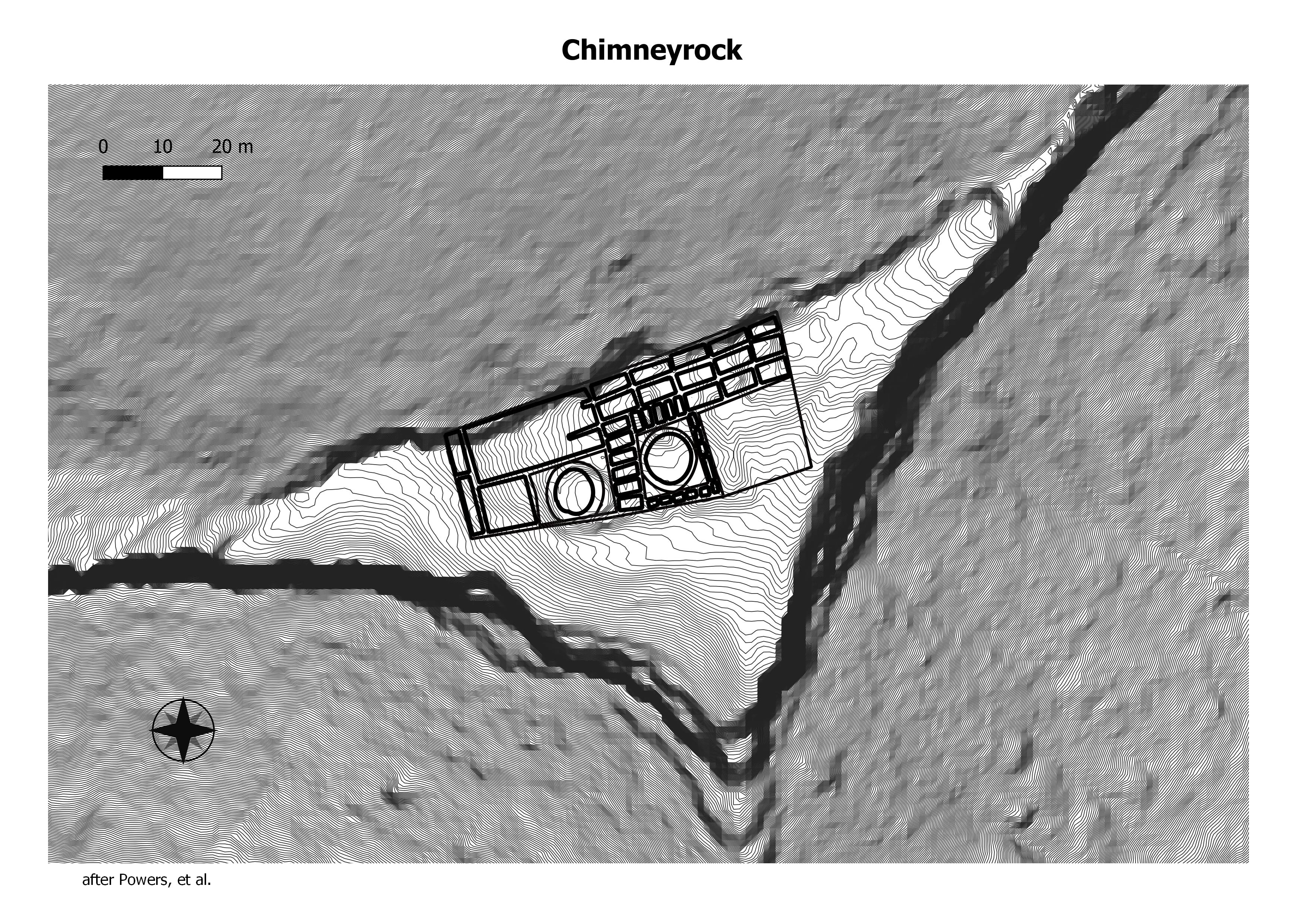
The great house at Chimney Rock (5AA83) is an L-shaped structure with a floor area of 2,535 m2, containing 2 kivas, 35 ground-floor rooms, and perhaps 20 more rooms on the second floor. (Chaco Research Archive)
42SA 920 is a huge Pueblo III architectural complex with substantial PI and PII components. Could include a great house structure, in the room block complex at SE part of site. The best information is from Marilyn Swift’s 1984 National Register Nomination Form. (Chaco Research Archive)
No data found/
No data found.
This community is also known as Mogollon Pueblo due the obvious influence from the south; the site form states “it would appear that this site is a Reserve Mogollon settlement which is receiving considerable influence from the Cibola Anasazi populace.” The community consists of two clusters: 13 buildings and a possible great kiva depression in a northern cluster and two buildings in the southern cluster. The northern cluster includes one great house. (Chaco Research Archive)
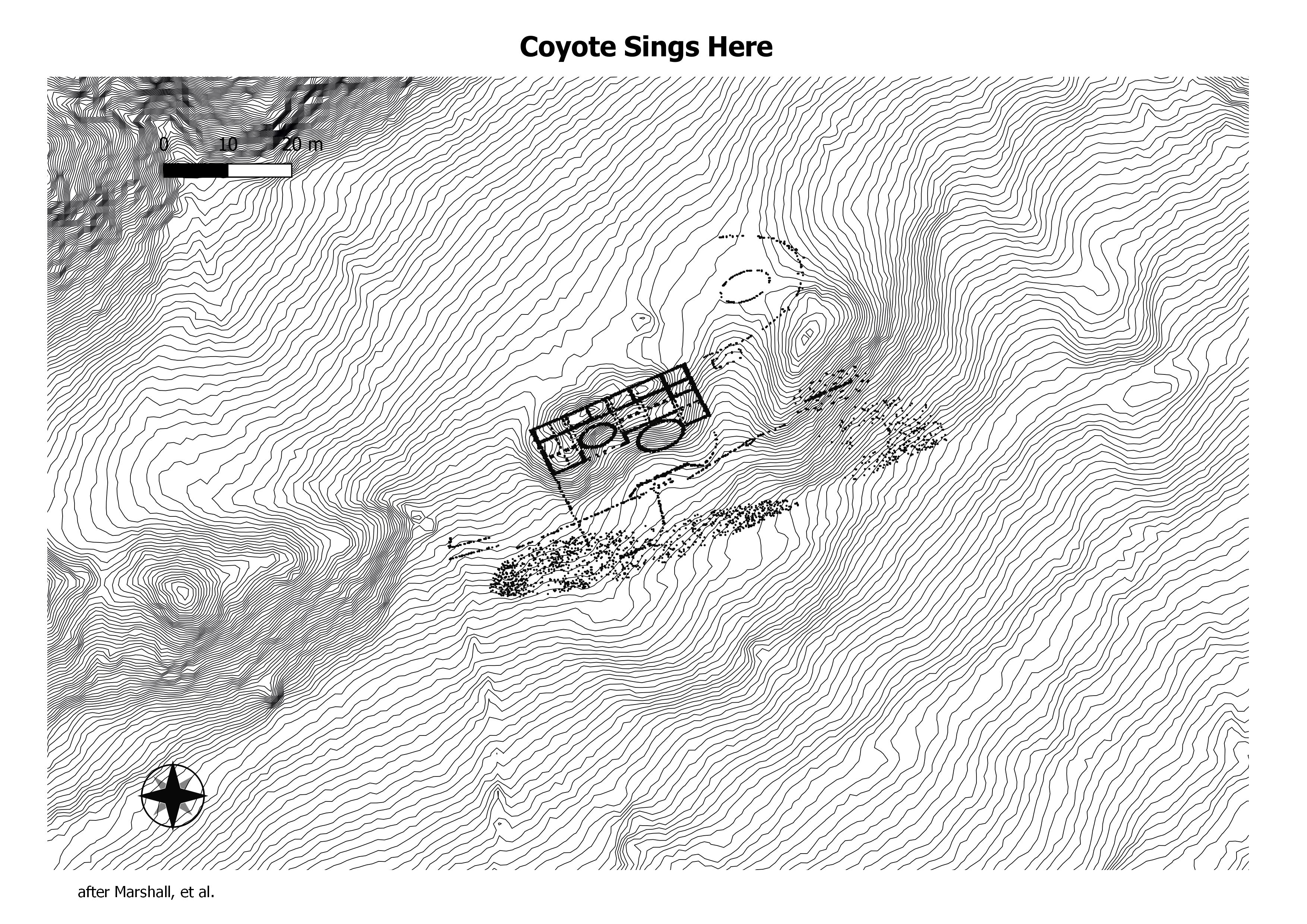
This two-story structure includes 20 rooms and two kivas in a 550 m2 area (Wilcox estimates a total interior floor area of 500 m2). An unusual number of low exterior walls also surround the great house, suggesting the presence of at least one enclosed plaza. Mean ceramic dating suggests that use of the structure spanned from A.D. 990–1081. (Chaco Research Archive)
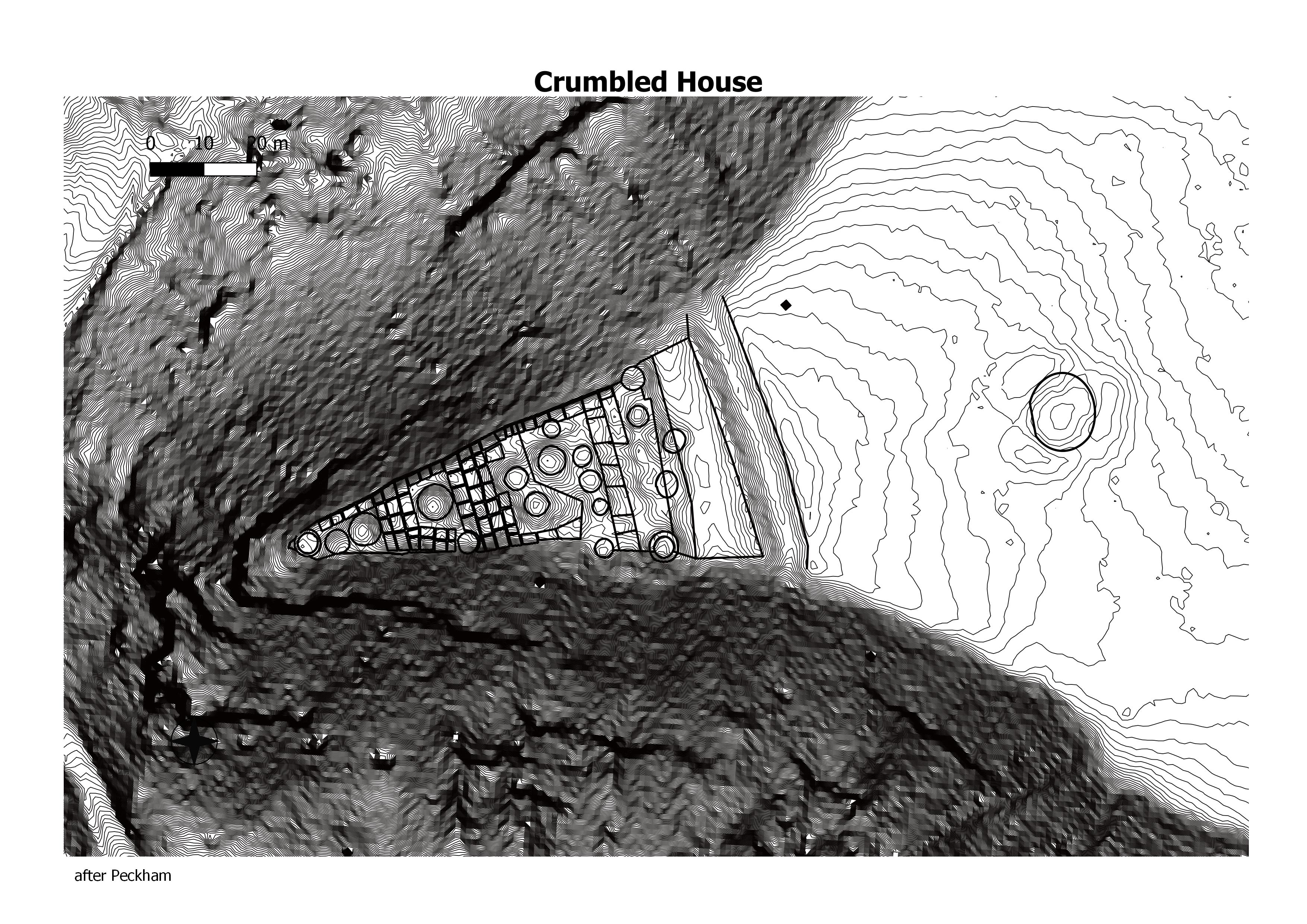
Crumbled House is a ruined great house of the Ancestral Puebloans, just east of the Chuska Mountains, in New Mexico. Based on ceramic dating, the buildings were built and occupied between 1100 and 1250 AD.[1] Crumbled House is a Chaco Protection Site, or special management area.[2] (Wikepedia)
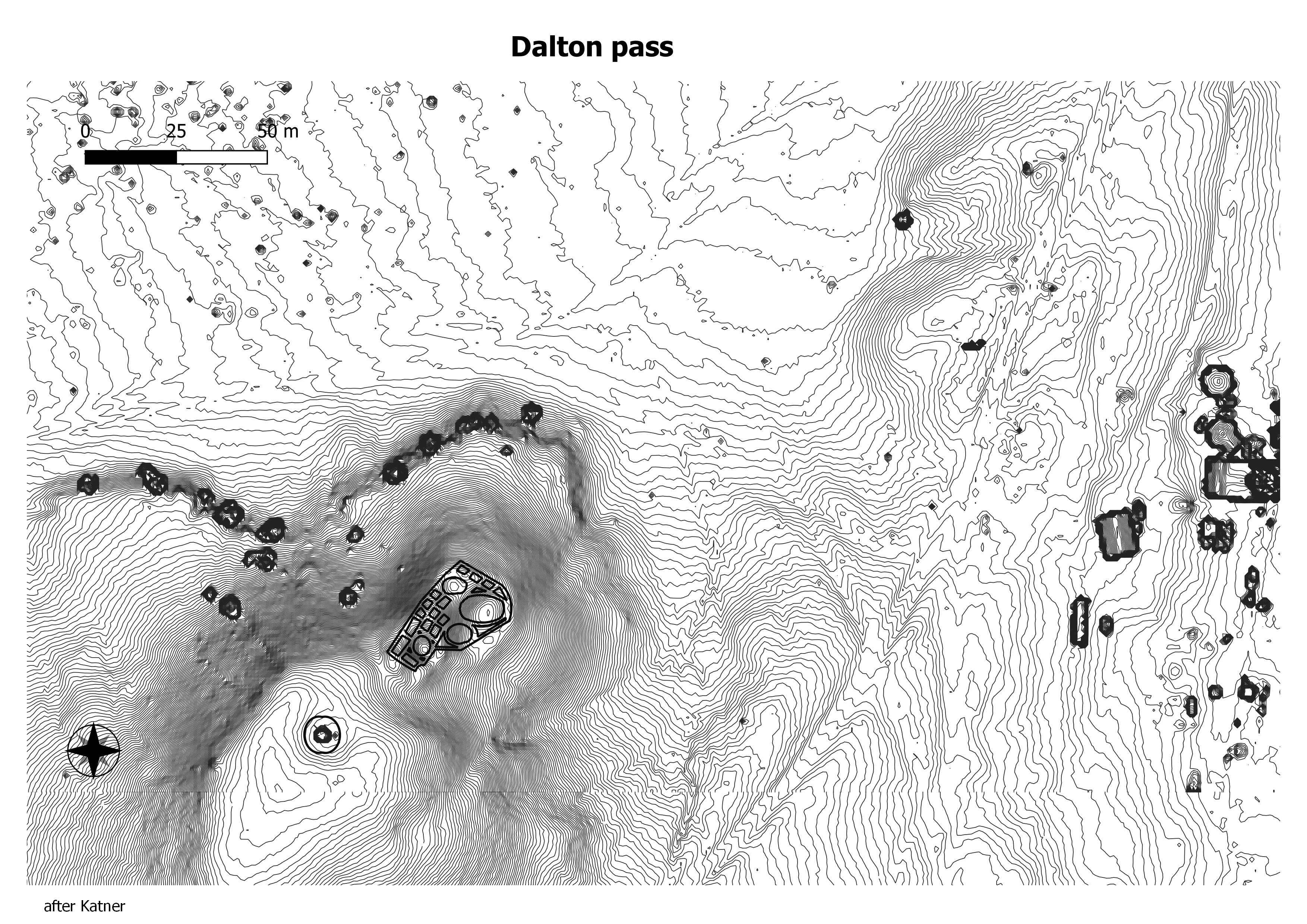
The great house, about which little is known (Powers et al. 1983:205–207), is a two-story structure featuring approximately 20 rooms, four small kivas, two of which are in an enclosed plaza. The larger kiva in the plaza of the Great House may be a Great Kiva too, but it is only 9m. A second great kiva is reported to be about 20 m southwest of the great house. Based on maps of the site, and considering the second story, the interior space of the great house measures 675m2 (Kantner 1999), although Wilcox suggests that its 825m2. Mean ceramic dates for the structure suggest an occupation range from A.D. 880-1132. (Chaco Research Archive)
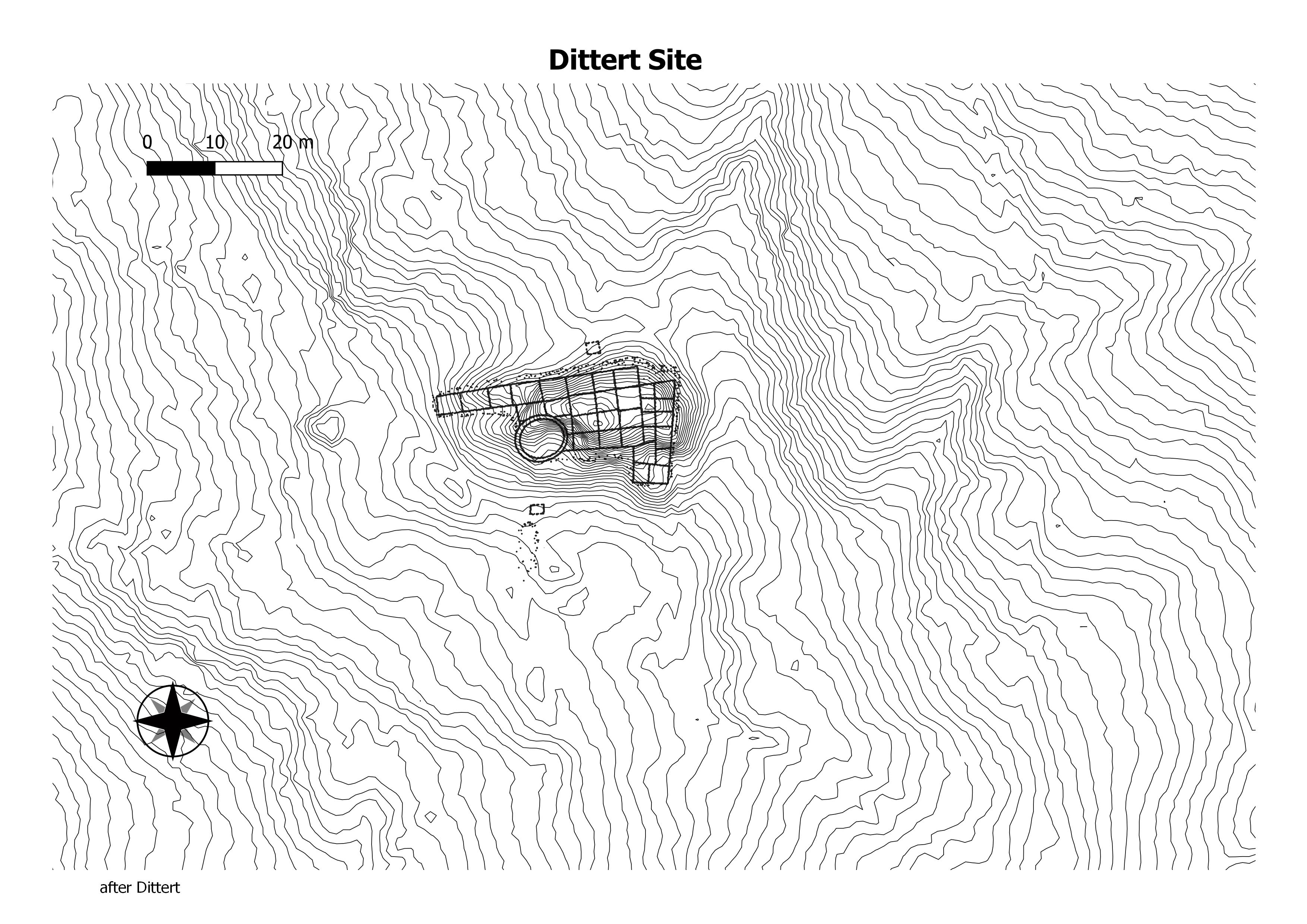
The site consists of an L-shaped masonry building, containing about 30 ground-floor rooms, 8 of which were excavated by Dittert. There may be two stories of construction along the north side. Near the southwest corner is a circular kiva about 6 meters in diameter, which was also excavated by Dittert. The kiva appears to have been partially housed in the roomblock. (Chaco Research Archive)
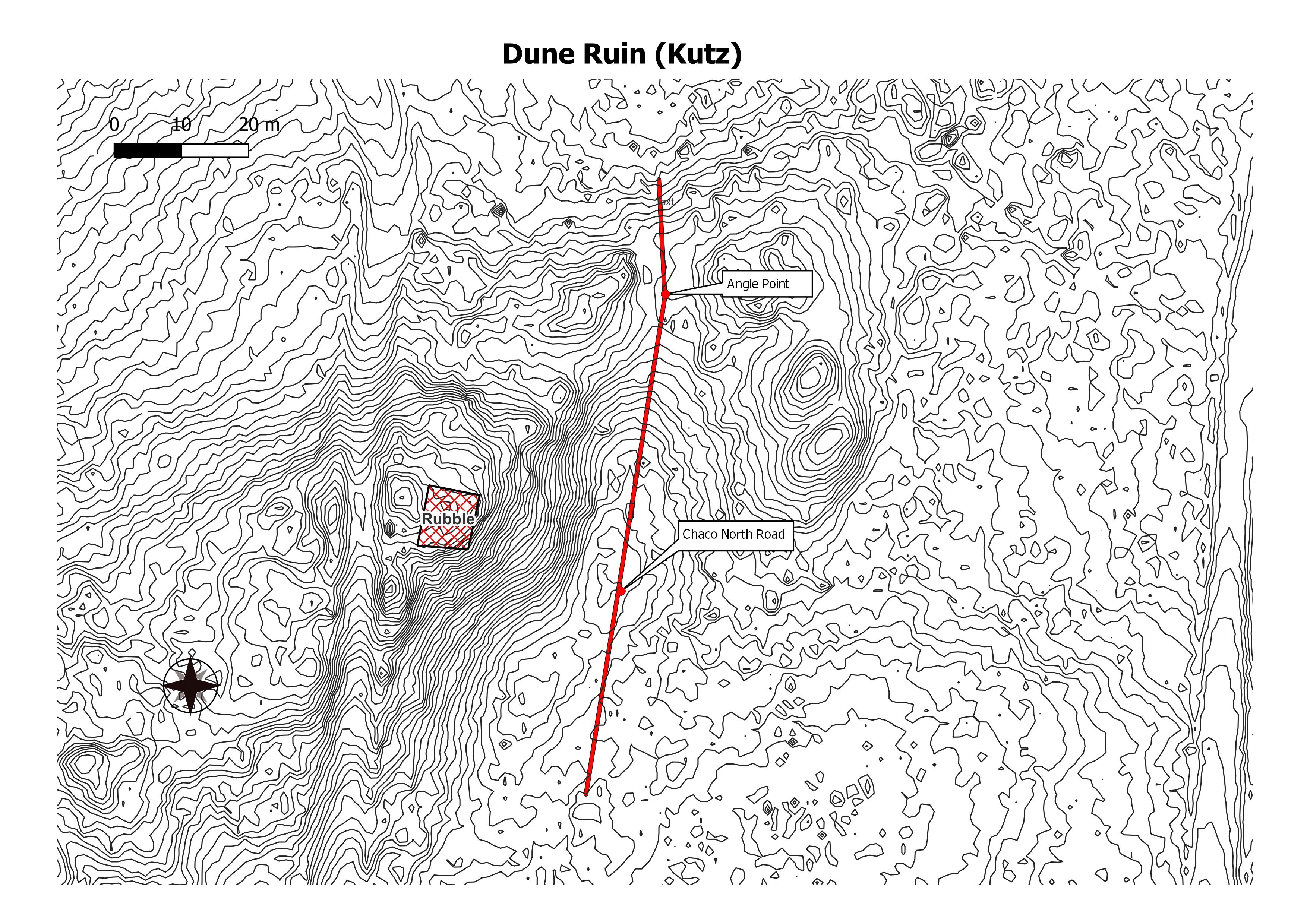
Probably the north terminus of the Chaco North road.
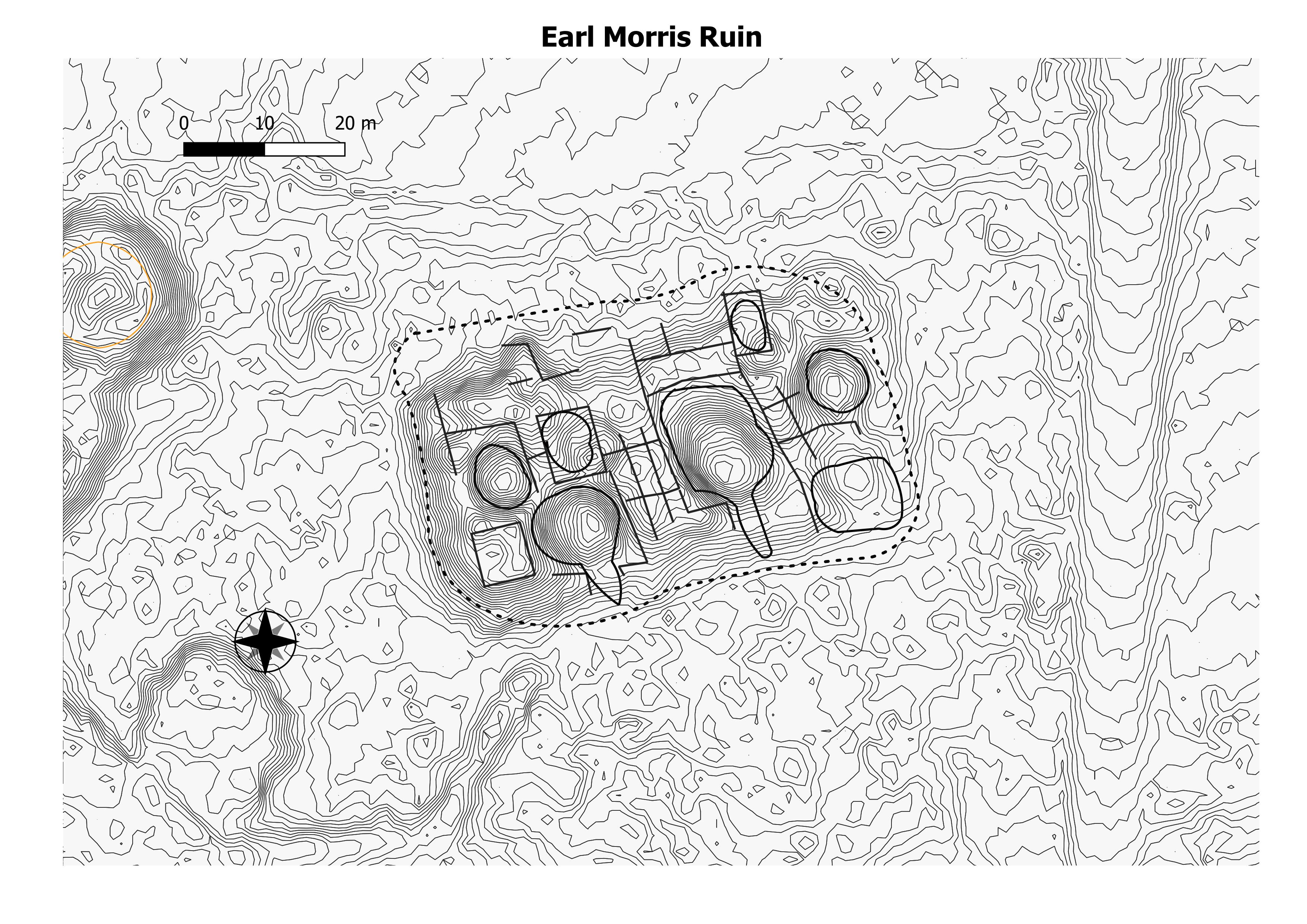
The Earl Morris Ruin is a rectangular roomblock located 65 to 70 m north of the East Roomblock of Aztec East. It is roughly 64-by-34 m in size and stands 2.8 m above the modern ground surface. Seven kiva depressions corresponding to Stein and McKenna’s 1989 map (Kivas A-G) were identified during the AERLMP project. (The NPS)
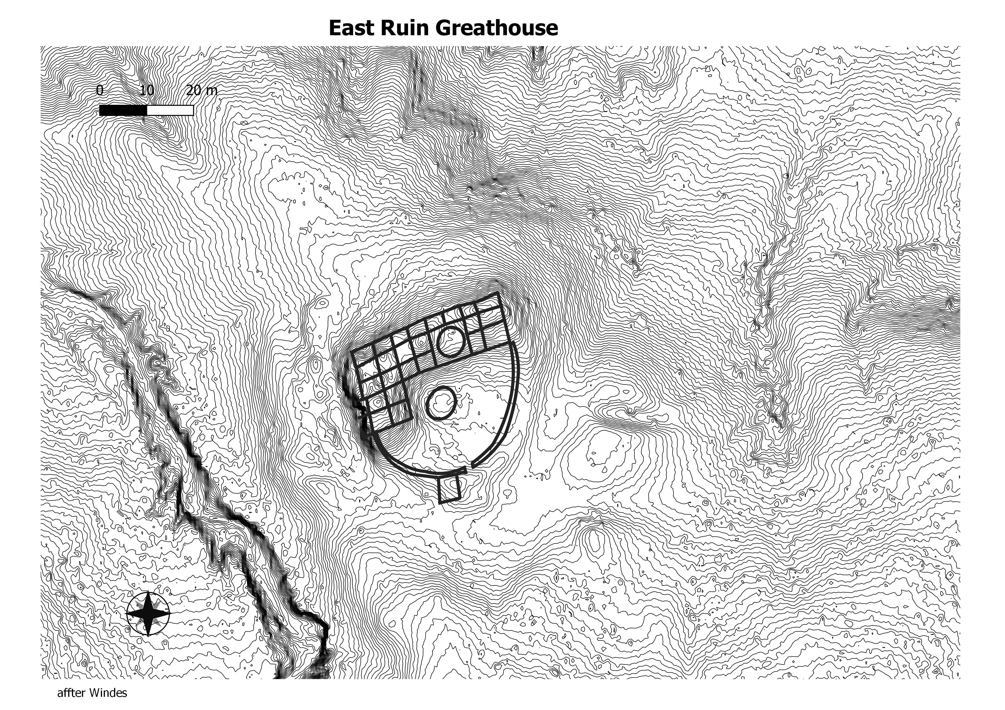
East Community is an Ancestral Puebloan great house community and archeological site located 12 miles (19 km) east of Pueblo Bonito, at the eastern end of Chaco Culture National Historical Park, New Mexico, United States. Archeological evidence uncovered during the 1980s suggests the site was occupied by both Chacoans and Mesa Verdeans. Eighty-two structures have been identified in the area, including a great house that contains twenty-five rooms and several small house sites. At least one kiva has been uncovered there, but no great kivas. (Wikepedia)
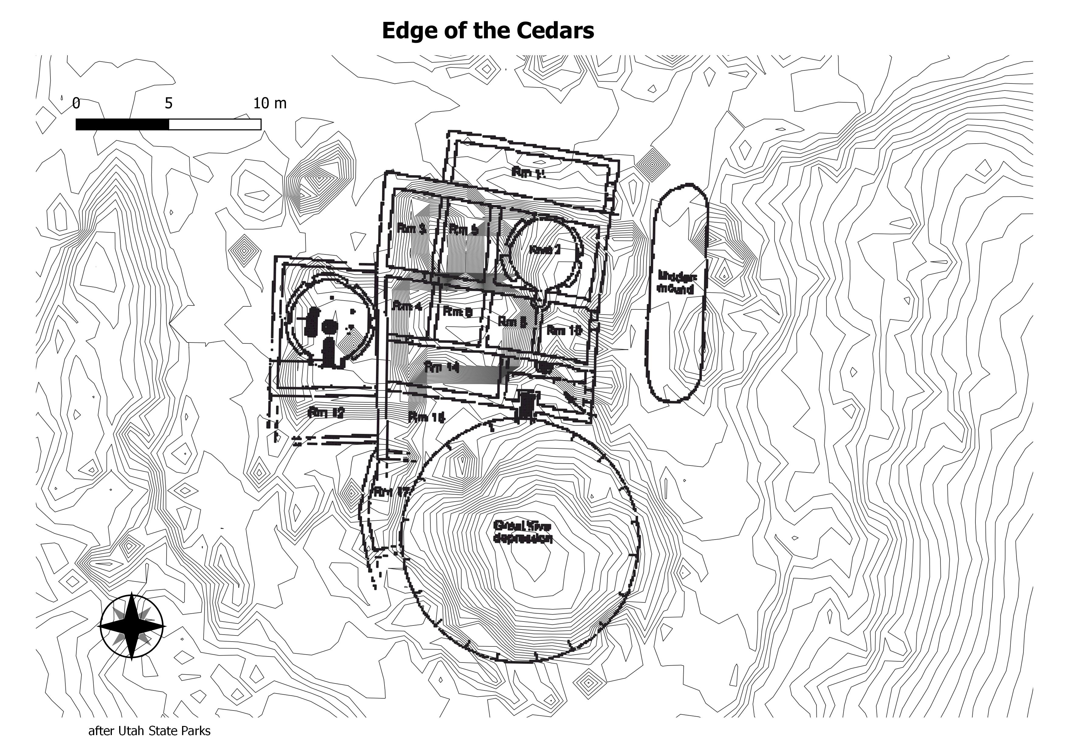
Several small roomblocks flank either side of the great house. Much of the surrounding community area is coverd by the town of Blanding and adjacent cultivated fields. No block survey has been done. (Chaco Research Archive)
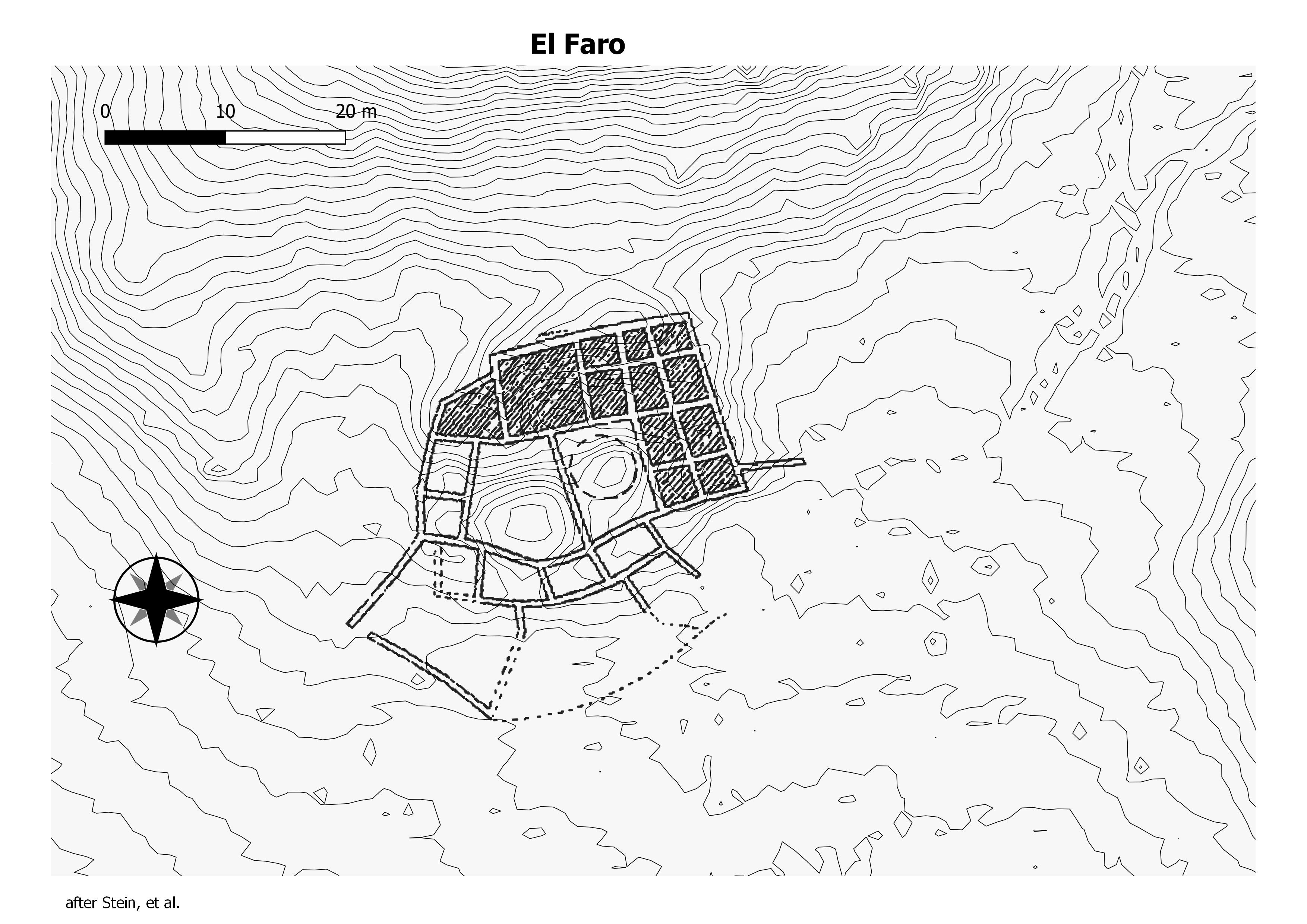
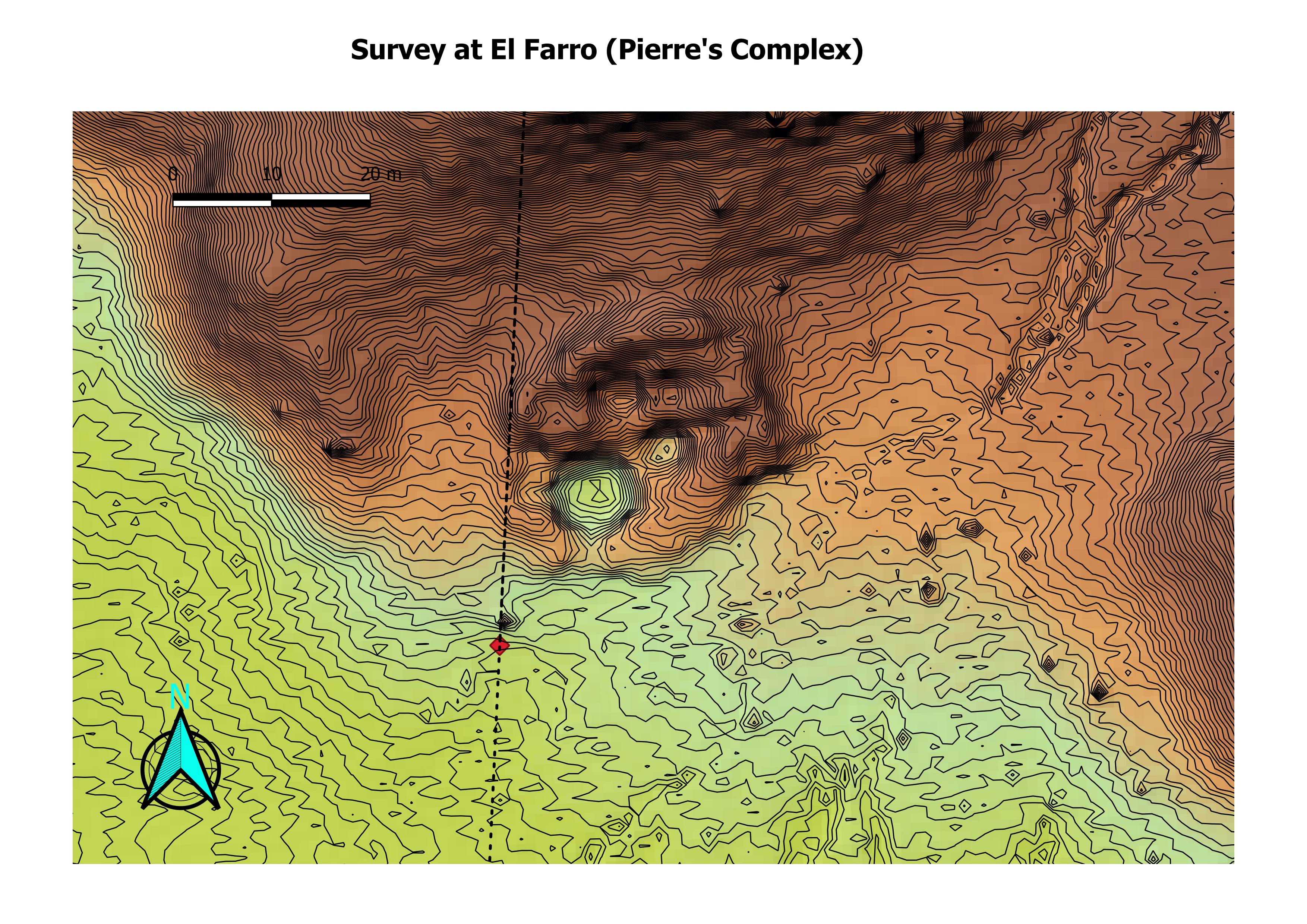
The El Faro great house is irregular in form; it has small, rectangular rooms on the east, two kivas in the center, and four large rooms wrapping around the north and west sides of the kivas. The eastern portion of the El Faro great house may have been two stories, but the rest was probably one-story. Tree-ring dates from El Faro indicate that it was built in the early 1100s A. D. (Powers et al. 1983). (The University of Idaho)
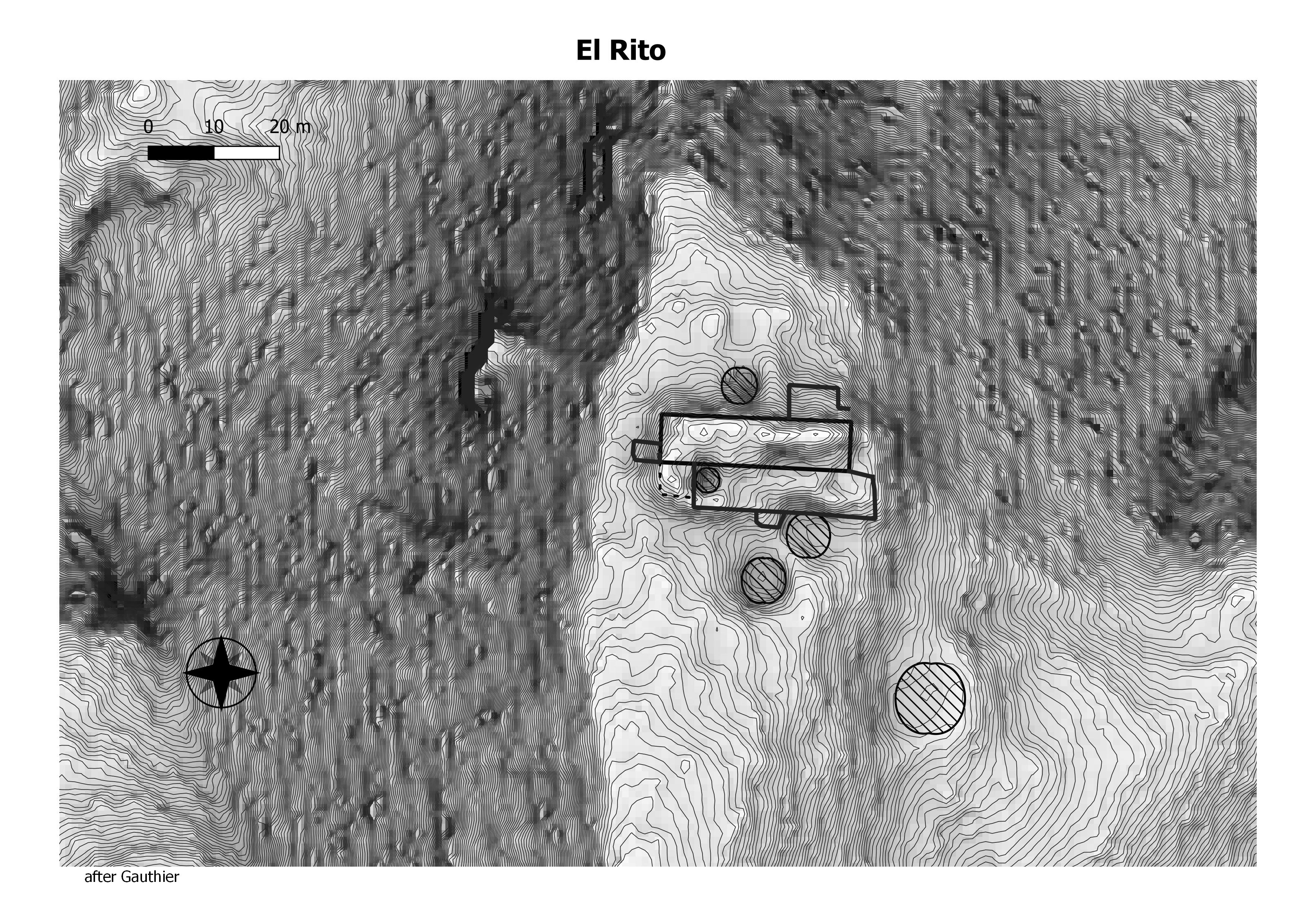
The El Rito great house is a rectangular mound, two-and possibly three-stories high in portions. It has an estimated 55 rooms, four kivas, and an associated great kiva (Allan and Gauthier 1976). Two of the kivas and the great kiva are located in an open plaza area to the south of the ruin, while two others are present within the roomblock. This great house community is located on the hill slopes and flats around El Rito Creek, southwest of San Mateo and northwest of the summit of Mt. Taylor. (Chaco Research Archive)
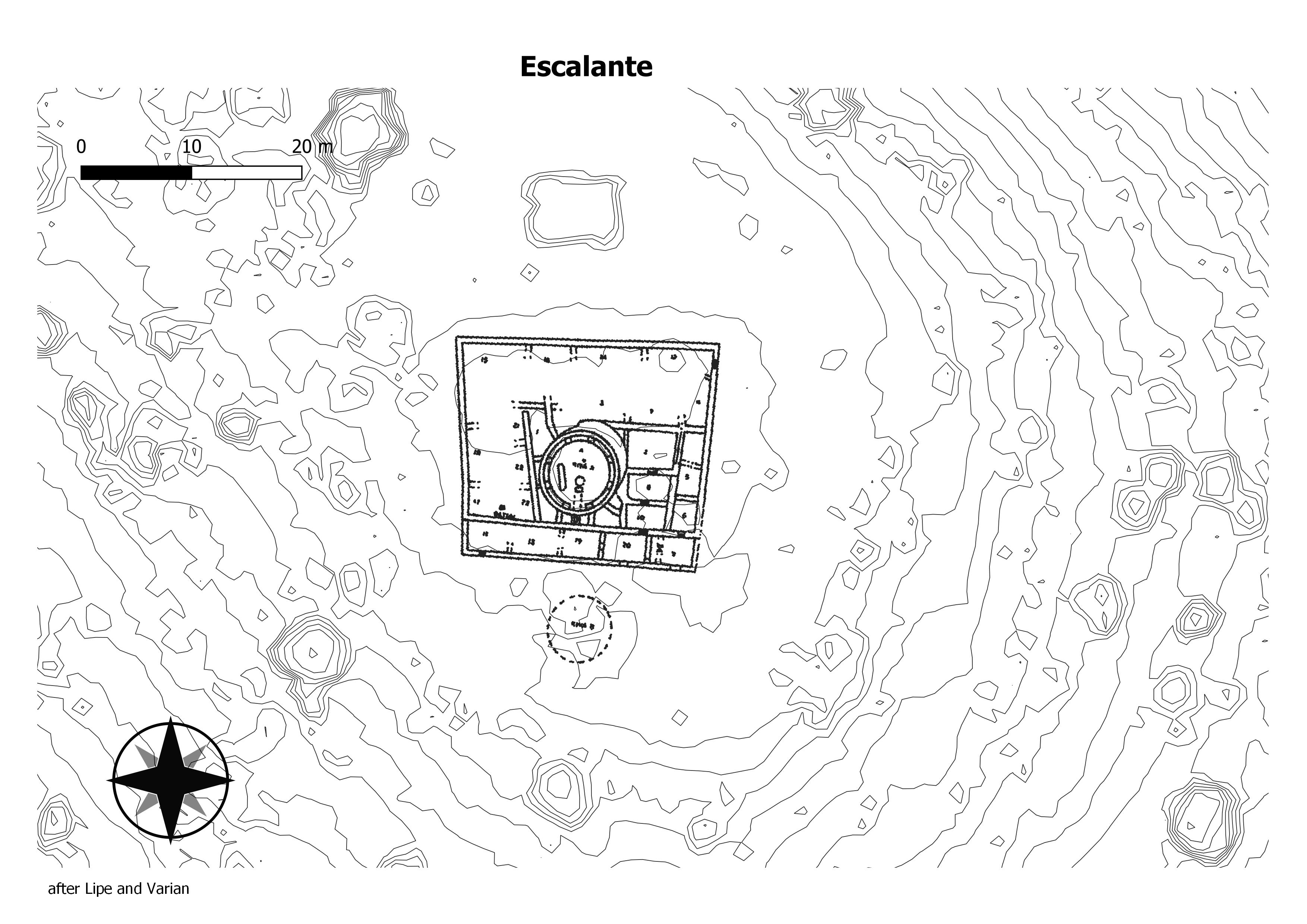
The Escalante Chacoan structure is located on a low gravel hill that directly overlooks the south rim of the Dolores River Canyon west of the Dolores and northeast of Lebanon, Colorado. Escalante is a roughly squared one-story house of approximately 25 ground-floor rooms and one intramural kiva. The mound rises 2.5–3 m, and the total floor area is estimated at 455 m2. (Chaco Research Archive)
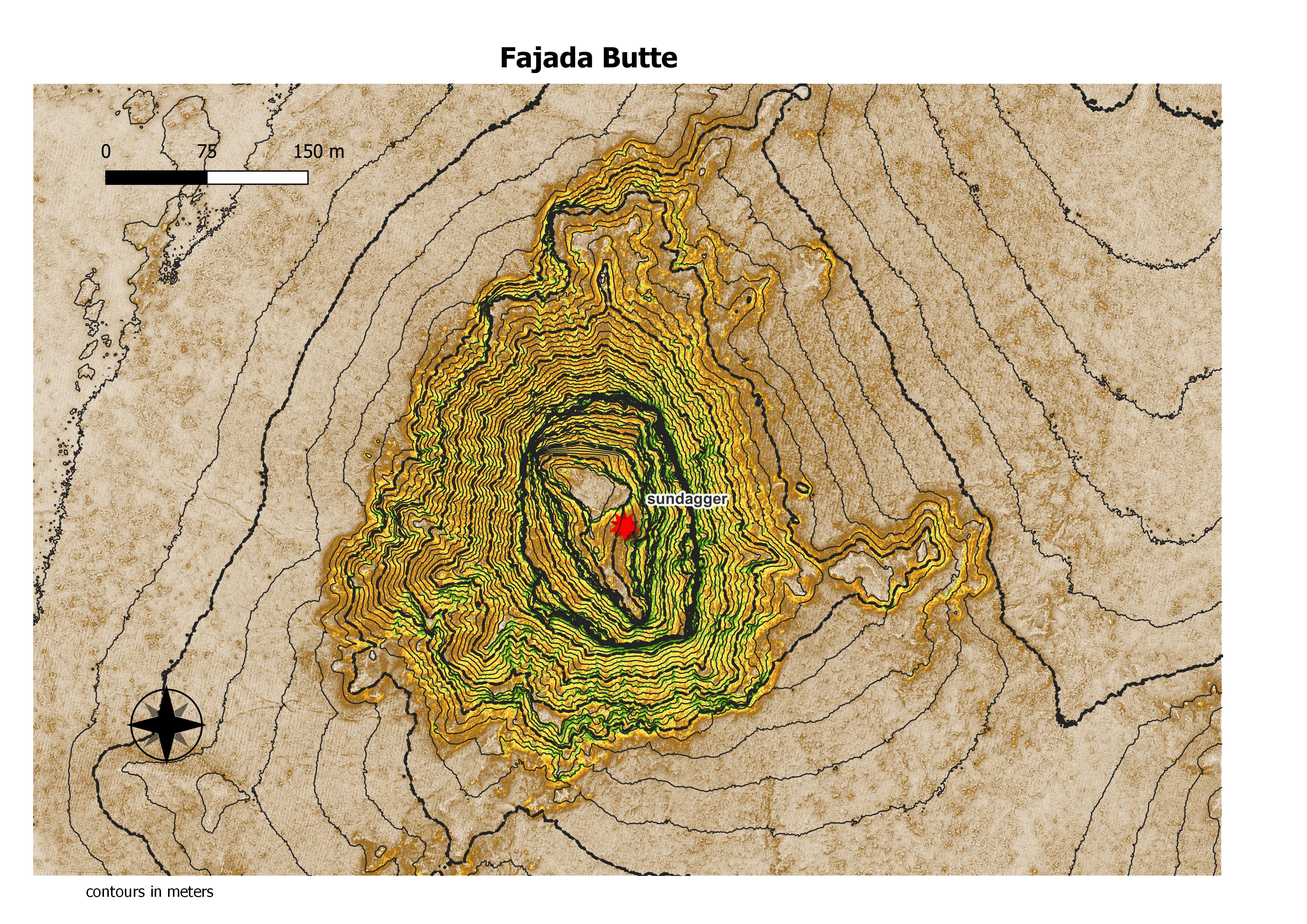
Fajada Butte (Banded Butte) rises 135 meters above the canyon floor. Although there is no water source on the butte, there are ruins of small cliff dwellings in the higher regions of the butte. Analysis of fragments of pottery found on Fajada show that these structures were used between the 10th to 13th centuries.[3] The remains of a 95-meter-high, 230-meter-long ramp are evident on the southwestern face of the butte (Ford 1993, p. 478). The magnitude of this building project, without an apparent utilitarian purpose, indicates that Fajada Butte may have had considerable ceremonial importance for the Chacoan people. (Wikepedia)
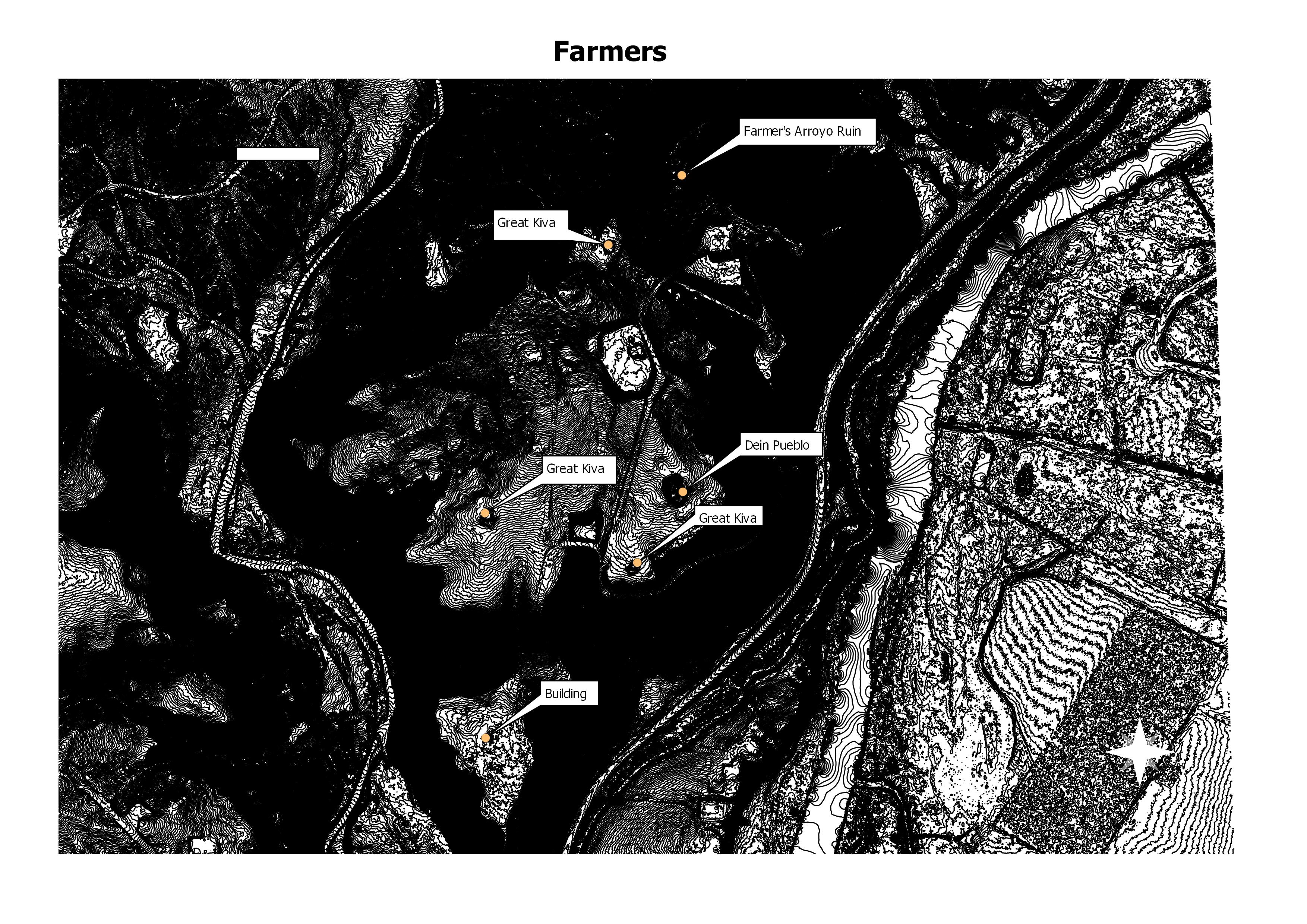
Approximately 1.6 km northeast of the Aztec complex and just above tle confluence of the Rio de Los Animas and Farmer Arroyo, the river swings into the northern gravel bench. Here the ascent to the upper surface of the terra: is very precipitous. Located atop the bench are three massive buildings of Bonito style construction, segments of apparent roadways, a great kiva, an isolated large kiva, and three other possible great kivas. (The NPS)
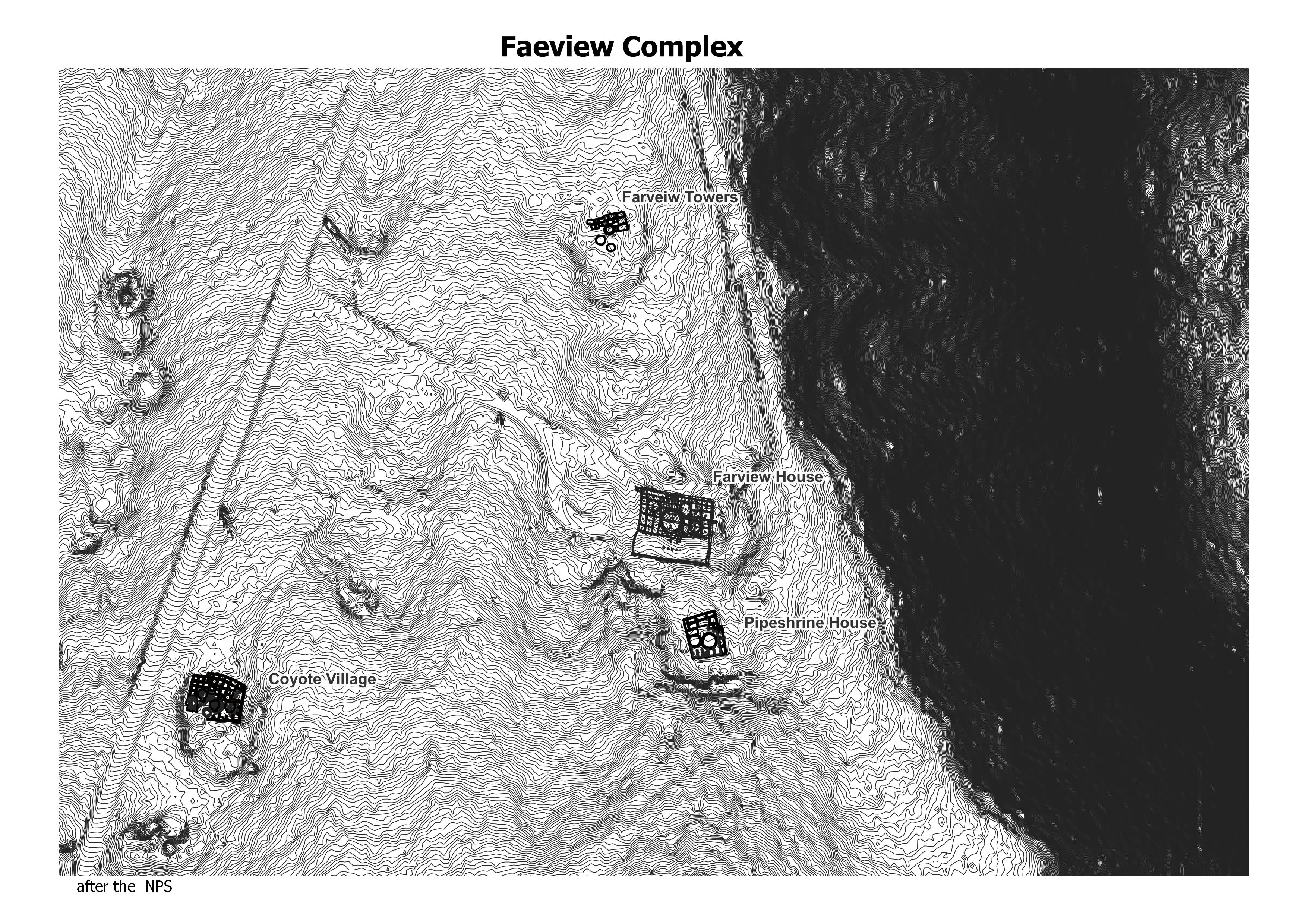
Far View was one of the most densely populated parts of the mesa from A.D. 900 to about A.D. 1300. Nearly 50 villages have been identified within a half square mile area, and were home to hundreds of people. (The NPS)
No data found.
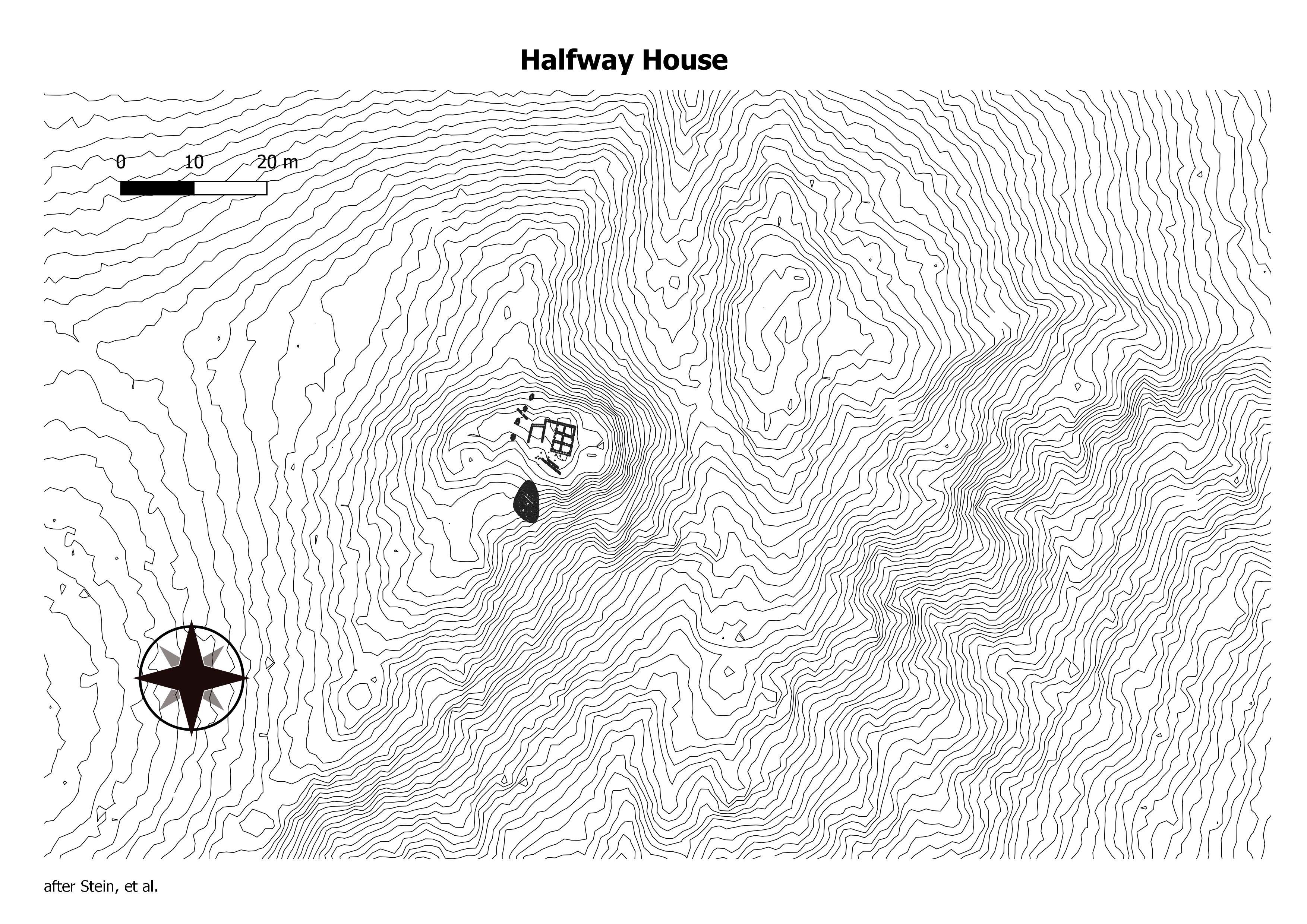
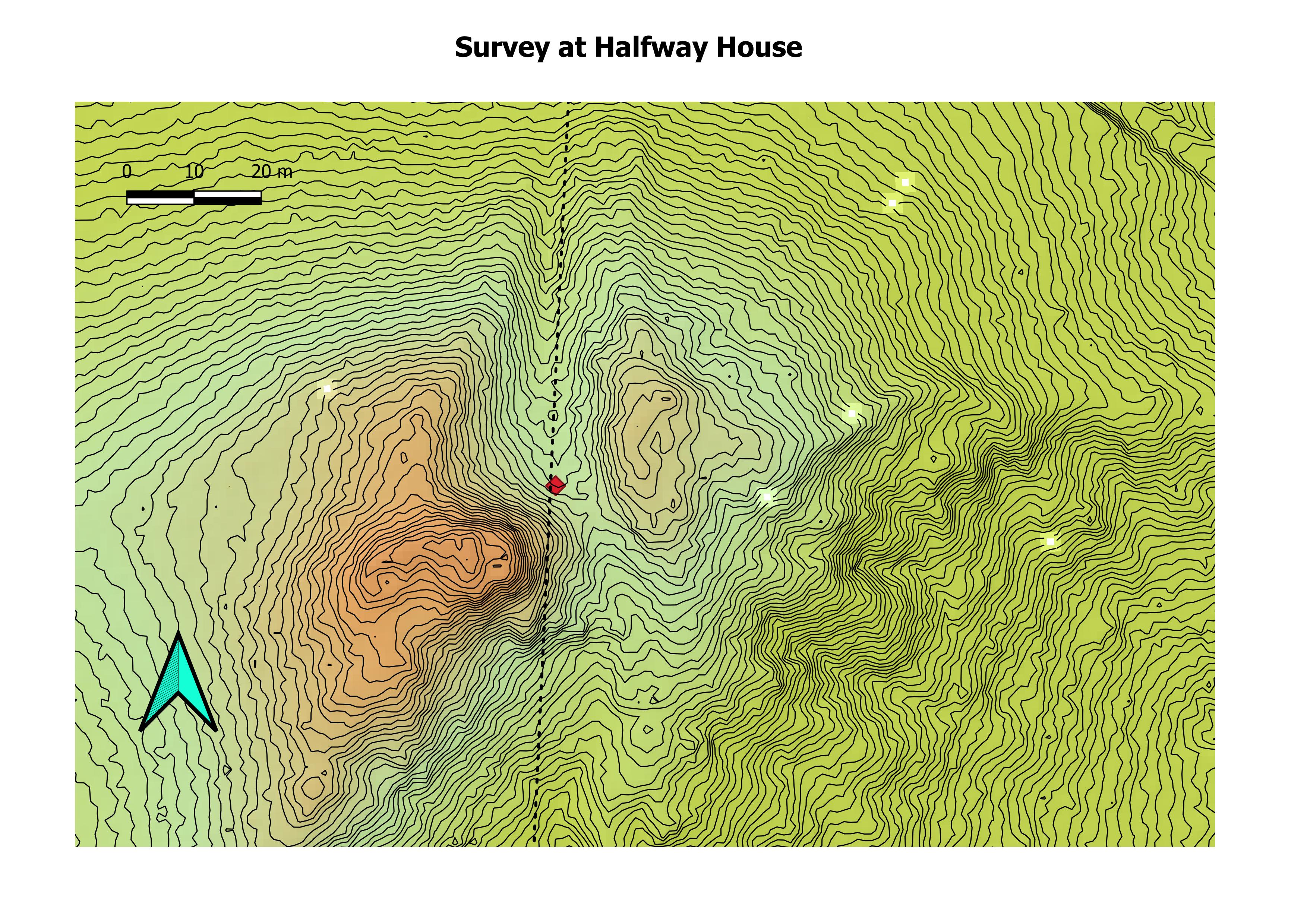
Halfway House, also known as LA 15191, lies on a slight knoll on the western slope of an unnamed tributary drainage of Gallegos Wash. The site is south-southwest of Huerfano Trading Post and southeast of Carson Trading Post, New Mexico Halfway House is a barely visible rectangular house mound, one story in height, with an estimated 12 rooms. Because aeolian deposits enshroud the mound, its height is difficult to estimate, but a height of about 2 m is probable. (Chaco Research Archive)
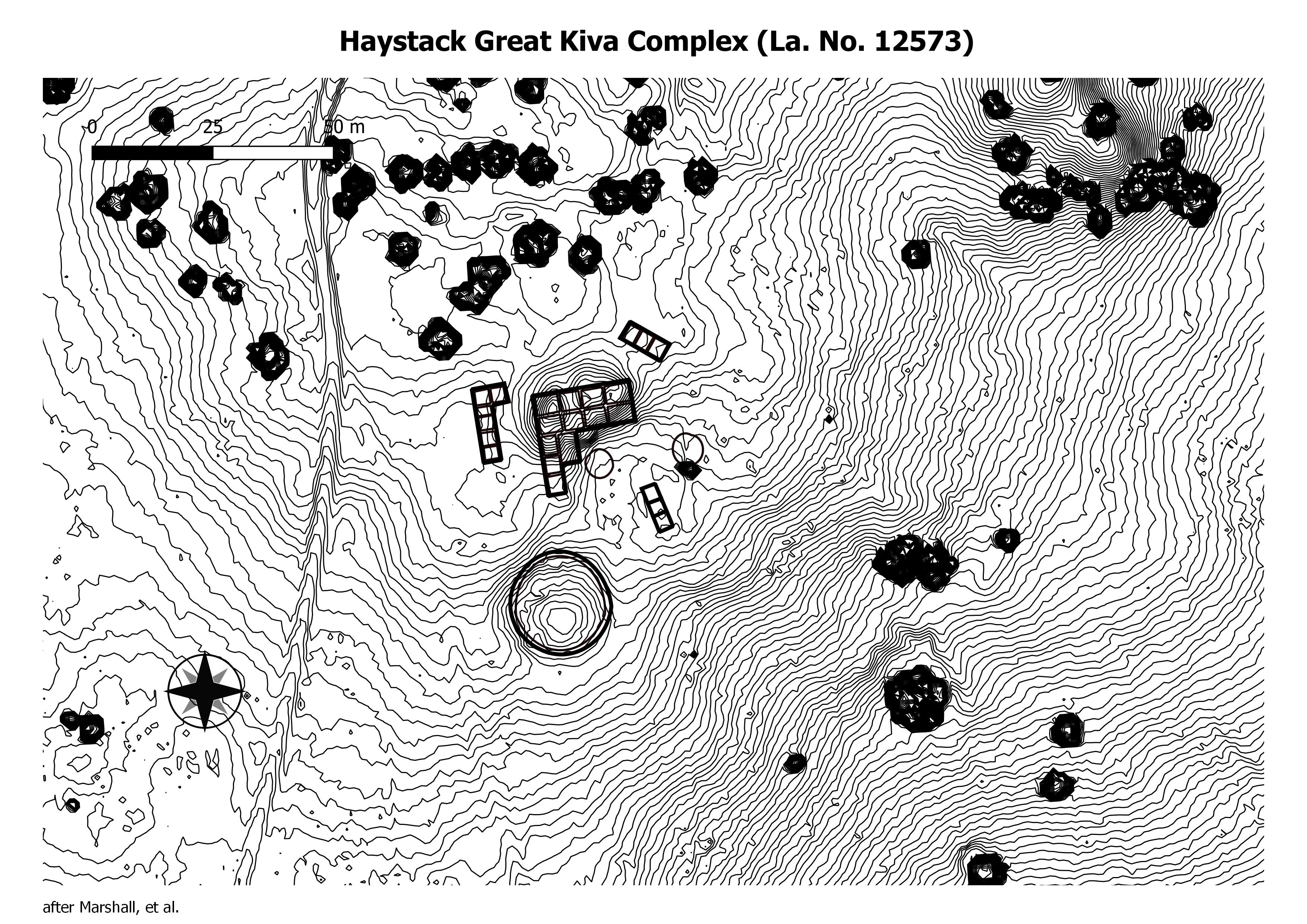
Haystack is located in the Red Mesa Valley. Three great houses and five great kivas are found scattered throughout this community. (Chaco Research Archive)
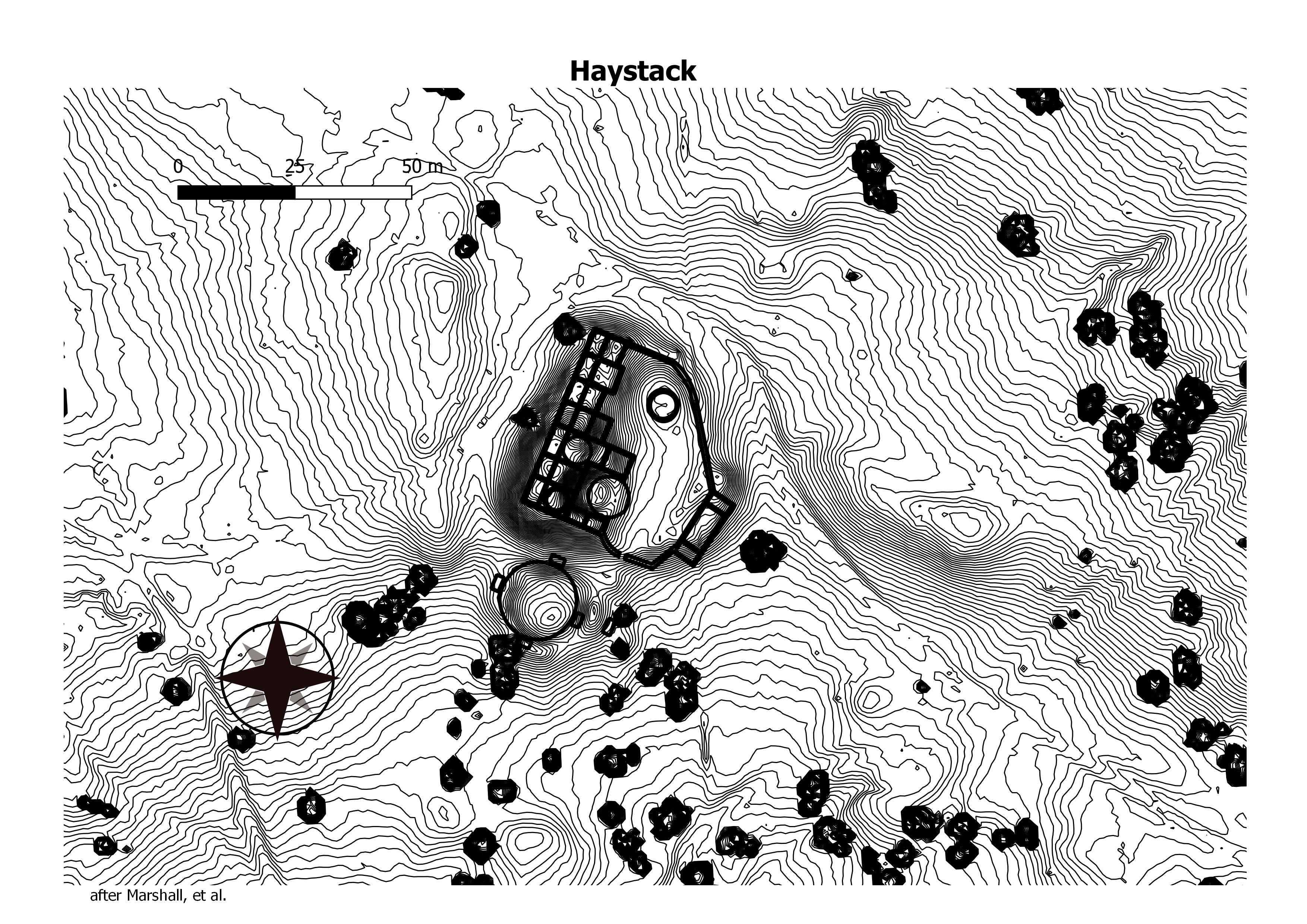
Haystack is located in the Red Mesa Valley. Three great houses and five great kivas are found scattered throughout this community. (Chaco Research Archive)
Also known as LA 11594 Component A. This site, located along the Chaco River a mere 11 km south of the San Juan River, consists of an “L”-shaped masonry house with a semicircular enclosed plaza area containing a kiva and three associated midden areas. (Chaco Research Archive)
Numerous other unit house complexes occur nearby, comprising the nuclear community of which this site is the center. There is an extensive view reaching to the Chuska and La Plata mountains. (Chaco Research Archive)
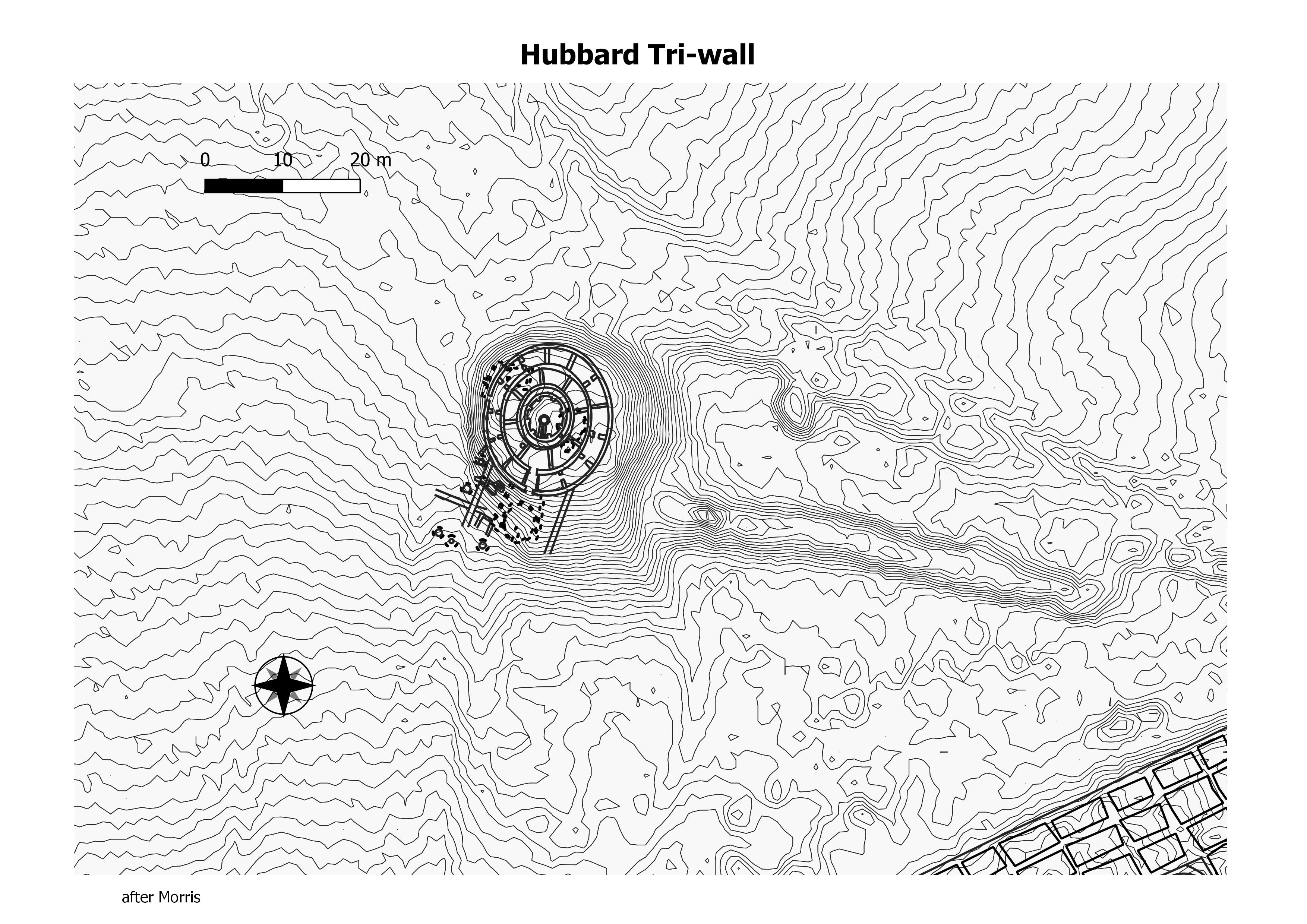
Hubbard Tri-Wall Site One of a few tri-wall structures in the Southwest, it was built of three concentric walls divided into 22 rooms encircling a kiva. This complex stood atop two earlier structures; one was adobe. Construction may date from the early 1100s. (The NPS)
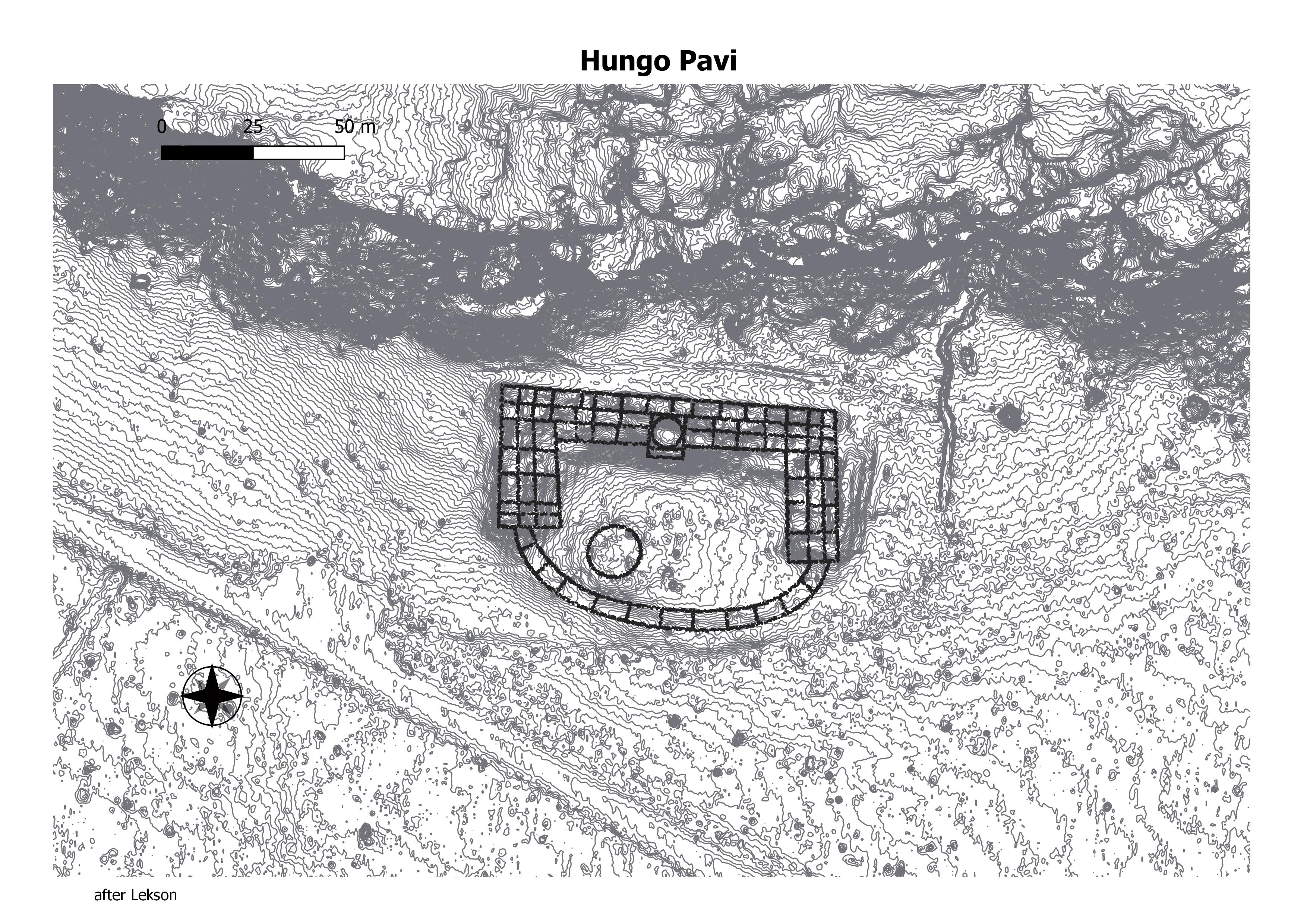
Hungo Pavi is an unexcavated great house located about 1.8 miles (2.9 km.) southeast of Pueblo Bonito at the mouth of Mockingbird Canyon. he site contains approximately 140 rooms. The north roomblock includes three rows of rooms and stood at least three-stories tall along the rear wall, dropping to a single story along the plaza. (Chaco Research Archive)
No data found. Site is at the mouth of Gallgos Wash.

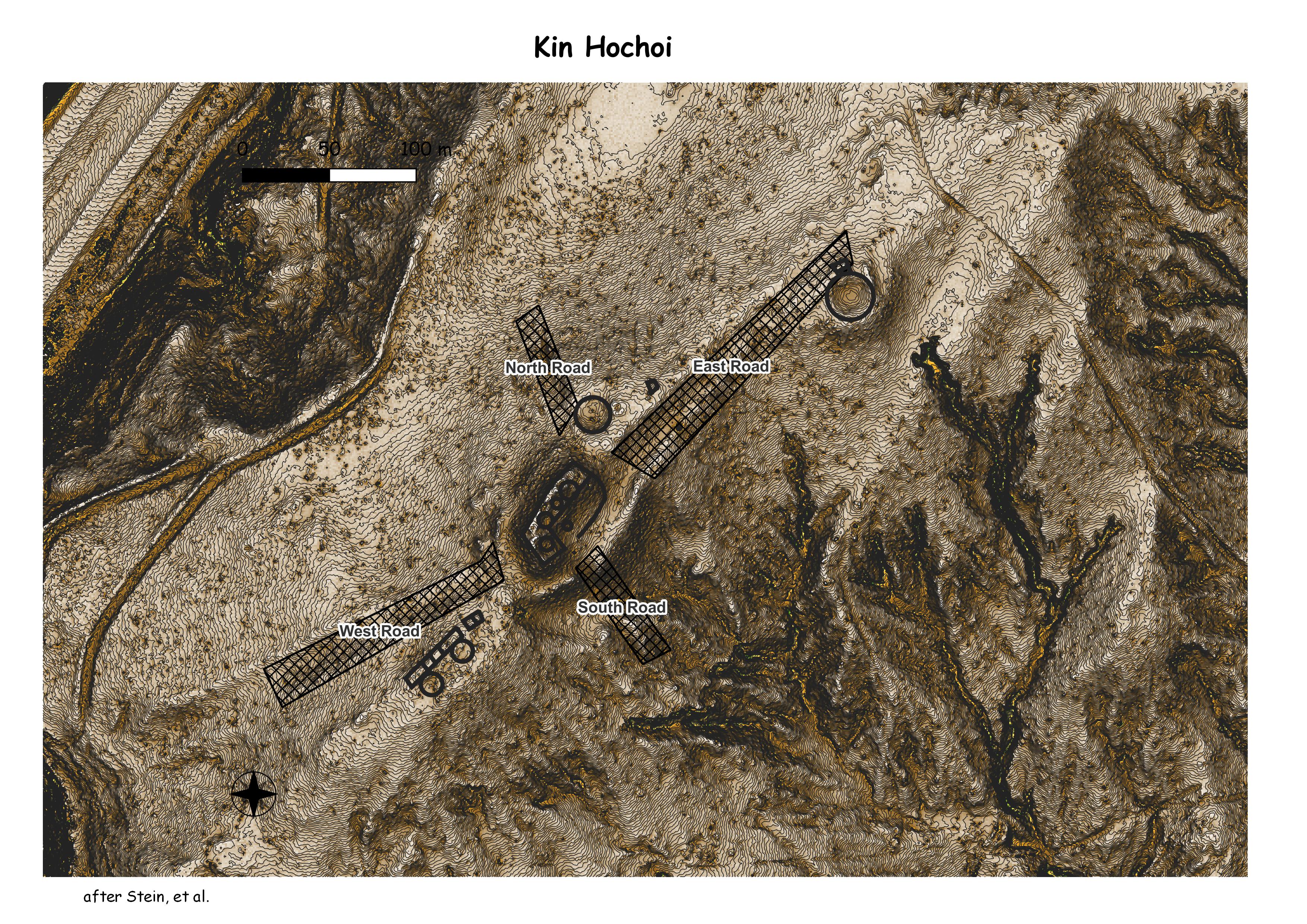
Kin Hocho’i is in Manuelito Canyon, New Mexico, approximately 130 kilometers southwest of Chaco Canyon. Kin Hocho’i is on the elevated south edge of Lupton Gap and has an expansive view overlooking the gap.
The L-shaped great house defines a plaza on the east side that is enclosed by a curved wall. Surrounding the great house is a sunken avenue 15 meters wide. Around the avenue is an aureola, an encircling earth dike. The aureola is perforated by gateways through which roads enter Kin Hocho’i. At least four kivas are within the roomblock; to the north is an early great kiva and to the northeast is a Chaco era great kiva. (University of Idaho)
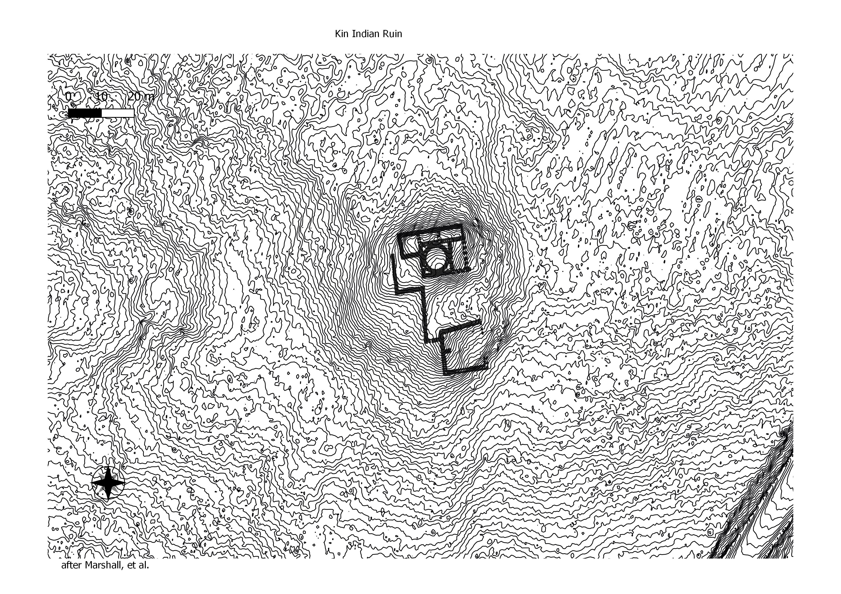
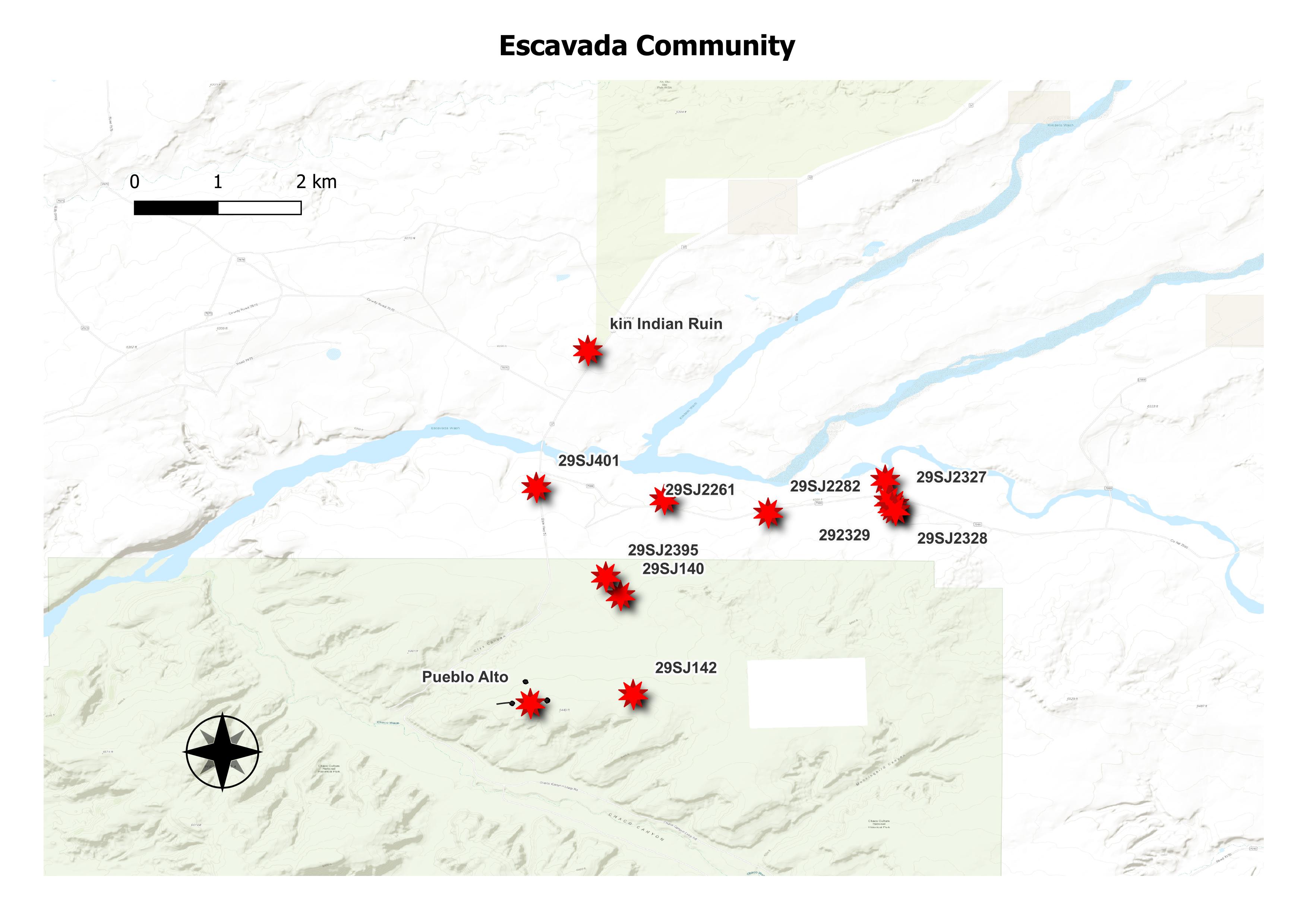
Kin Indian Ruin represents the first Bonito Style outpost to be encountered north of Chaco Canyon. Just as Pueblo Alto rests on the crest of the southern margin of the Escavada Valley so Kin Indian Ruin rests on the crest of the northern margin. A distance of 5km separates the two ruins. (Chaco Research Archive)
Tsin Kletsin is a small great house located on South Mesa two miles (3.2 km.) south of Pueblo Bonito. The site consisted of approximately 80 rooms and three kivas (two of which were elevated). (Chaco Research Archive)
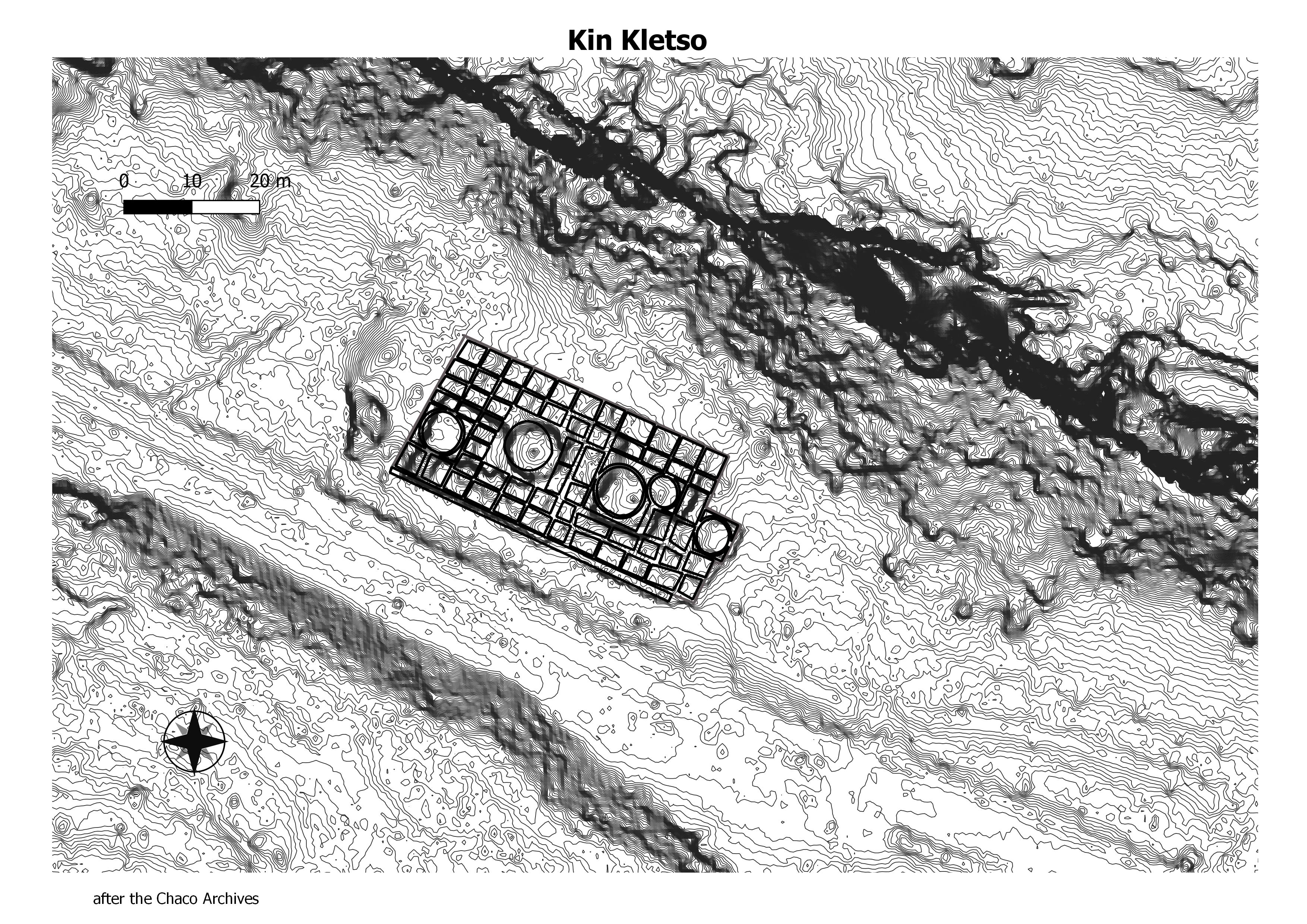
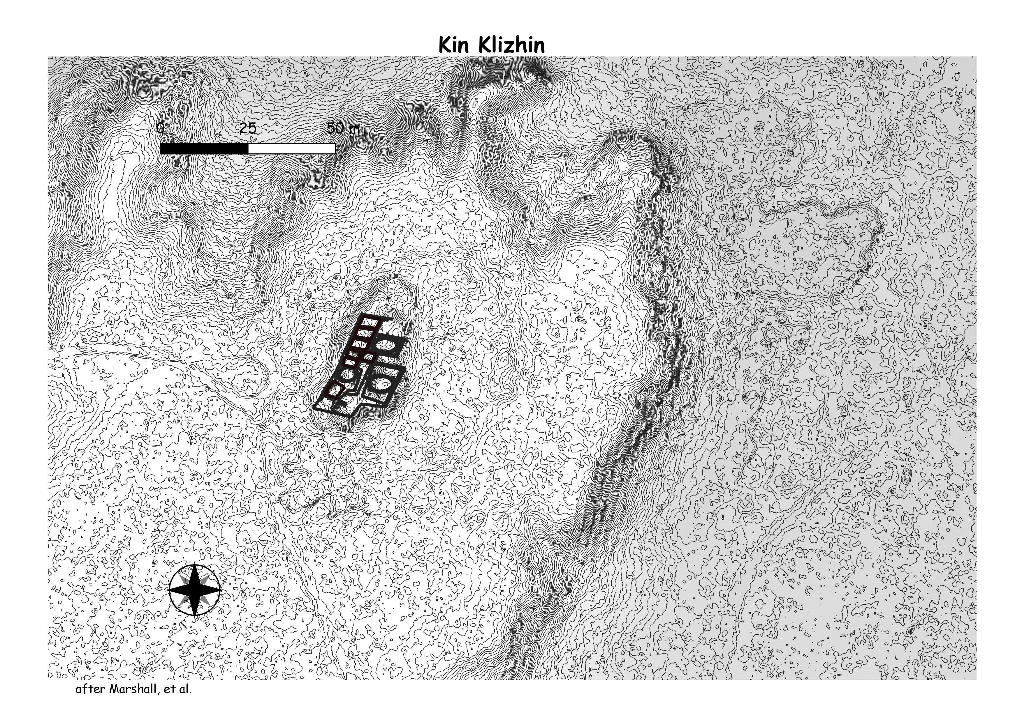
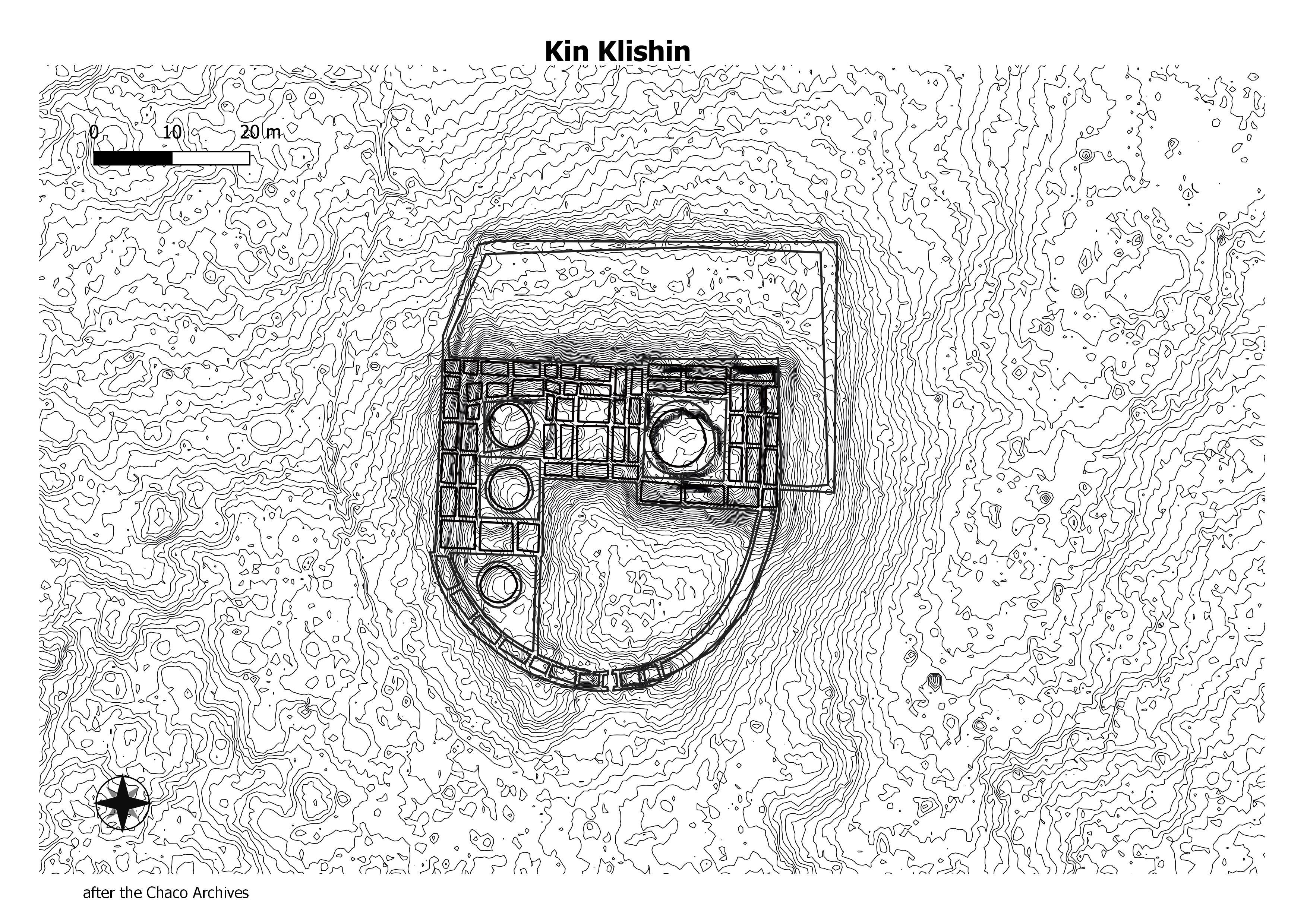
Kin Klizhin is a small, unexcavated, great house located roughly 10 miles (16.1 km.) southwest of Pueblo Bonito. Tree rings date the construction of this site to the late A.D. 1080s. The structure includes 16 rooms, two kivas, a tower kiva, and an enclosed plaza. It has not been excavated. Due to its high visibility, the three-story tower kiva may have been a signaling station within a broader regional communication system. The structure can be seen from Tsin Kletsin, a great house just south of Chaco Canyon and a Chacoan road that leaves Chaco Canyon through South Gap. (Chaco Research Archive)
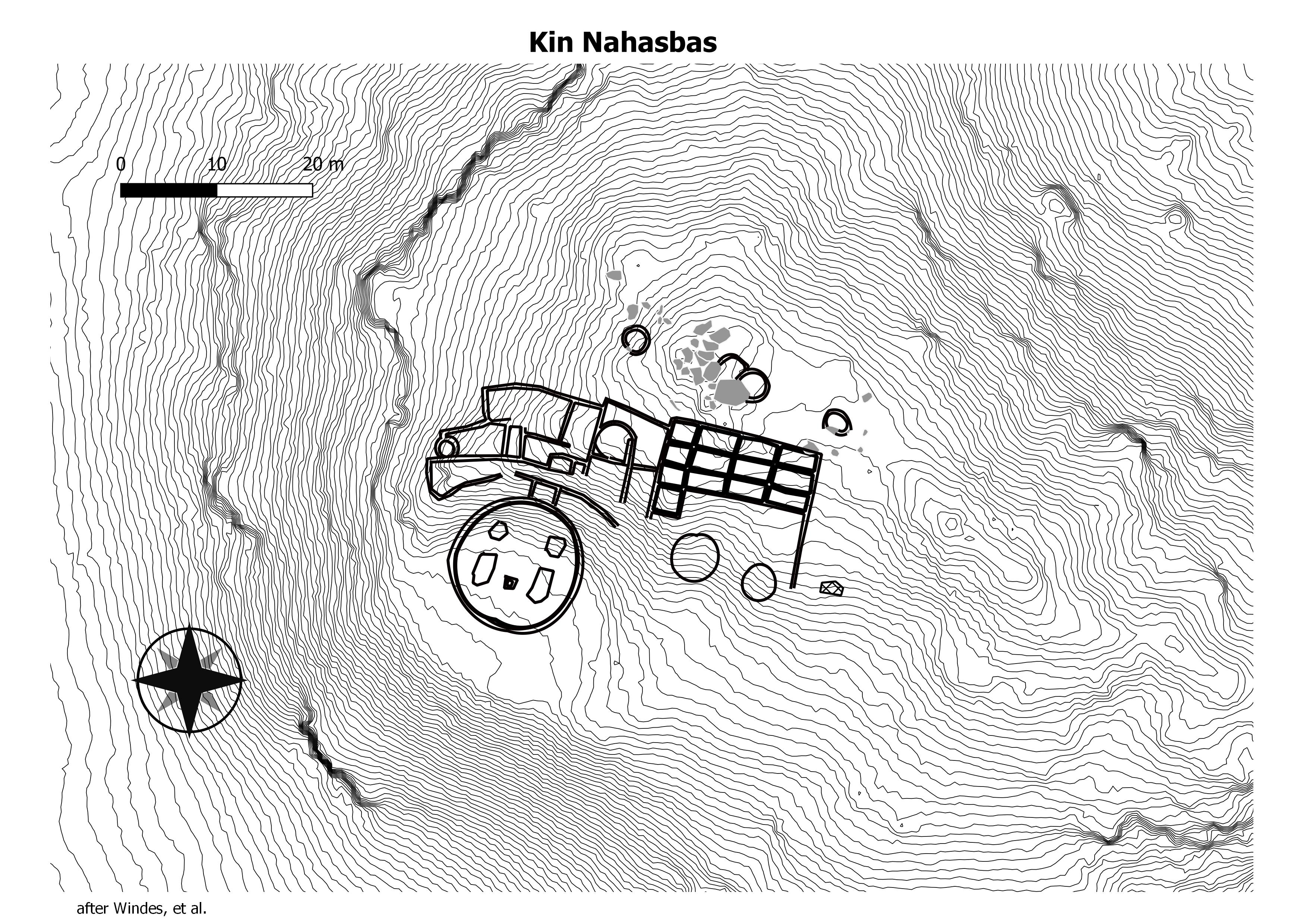
A great kiva and associated roomblock located about 550 feet (168 m.) north-northwest of the Una Vida great house and about three miles (4.8 km) southeast of Pueblo Bonito. Like Casa Rinconada, the great kiva is elevated above the canyon floor on a sandstone ridge. (Chaco Research Archive)
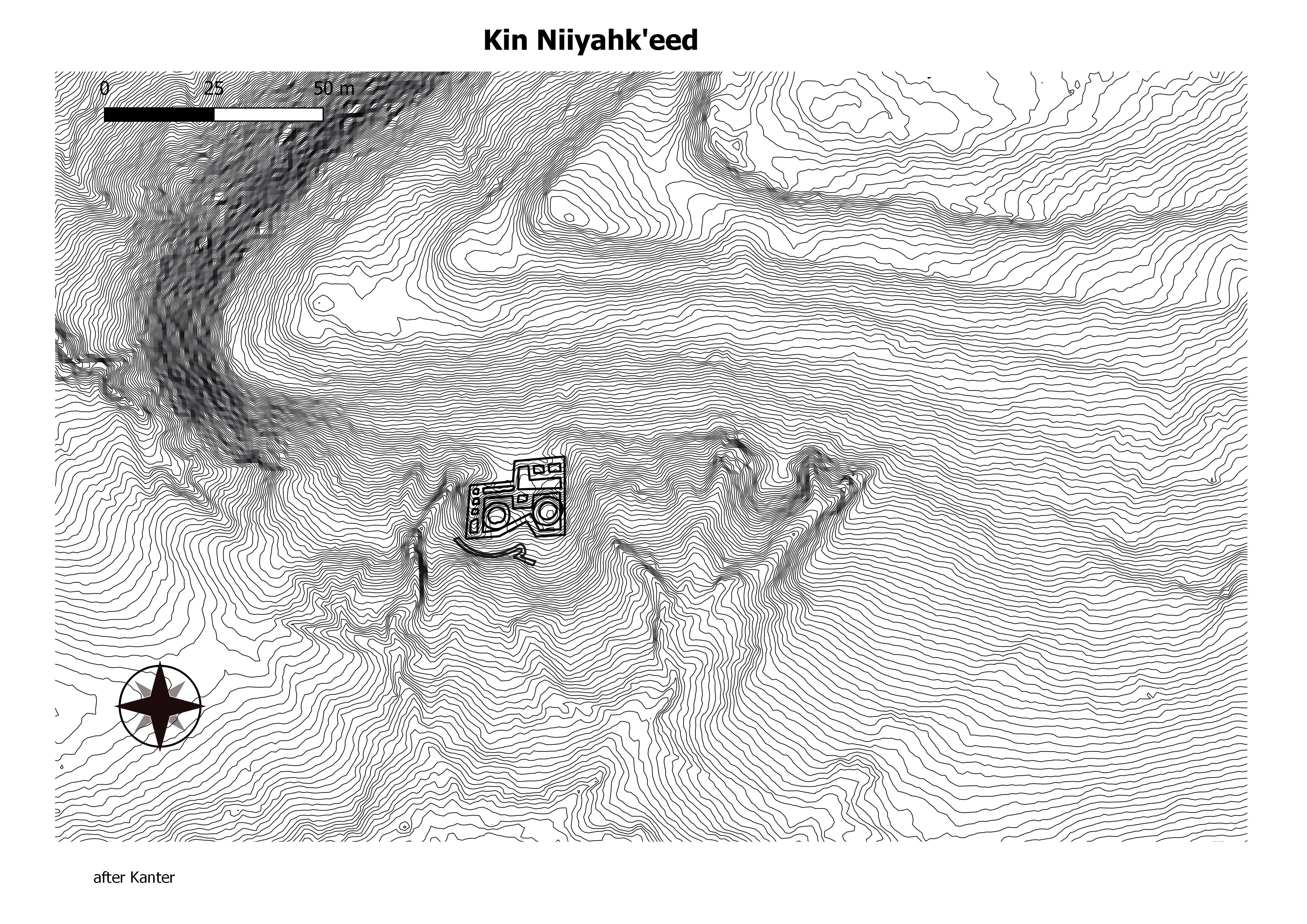
Kin Niiyahk’eed has 9 rooms and two kivas in a one-story, 300 m2 area. A short road segment and associated steps ascend a small mesa to provide access to Kin Niiyahk’eed. No great kivas have reportedly been identified in this community. (Chaco Research Archive)
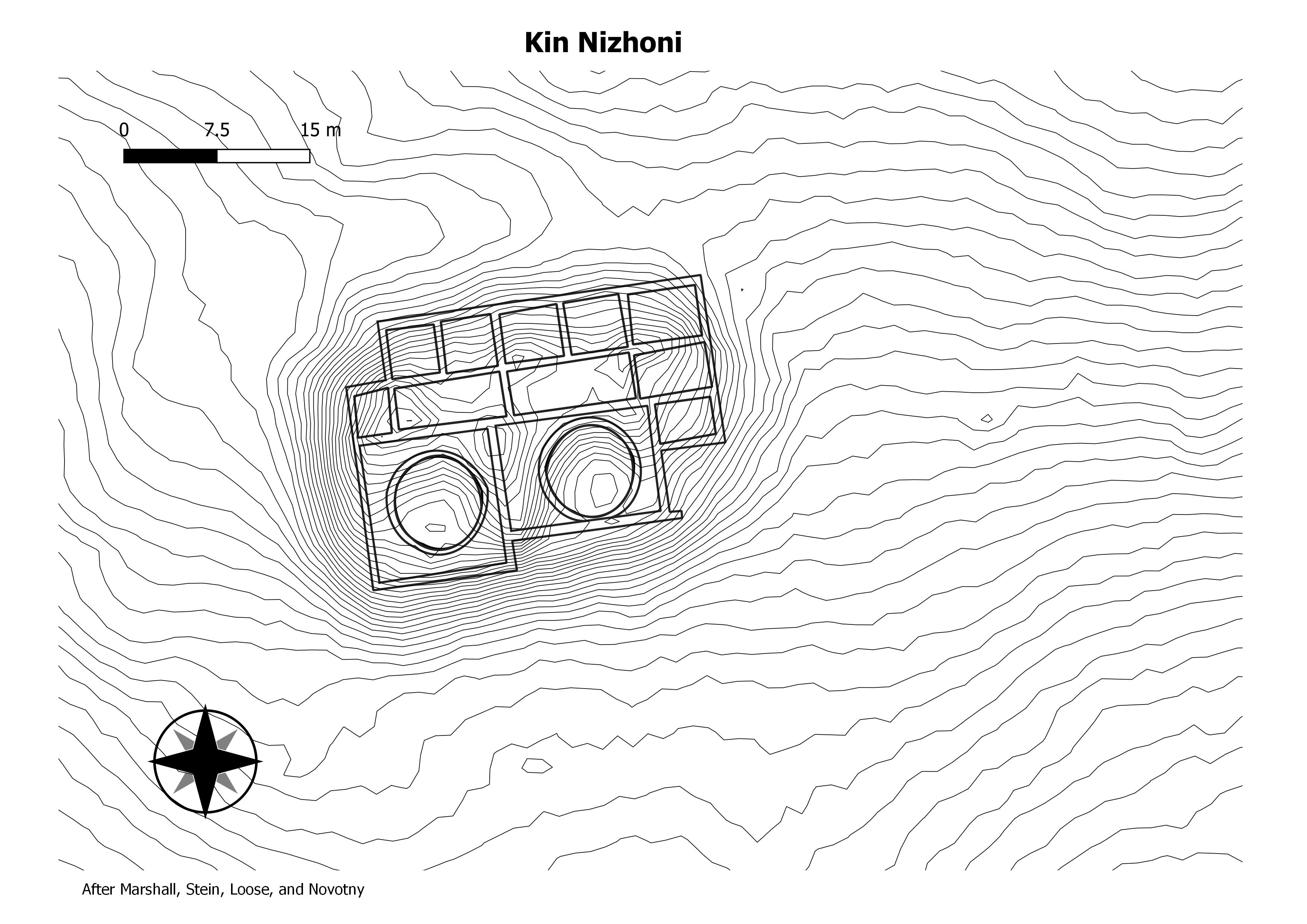
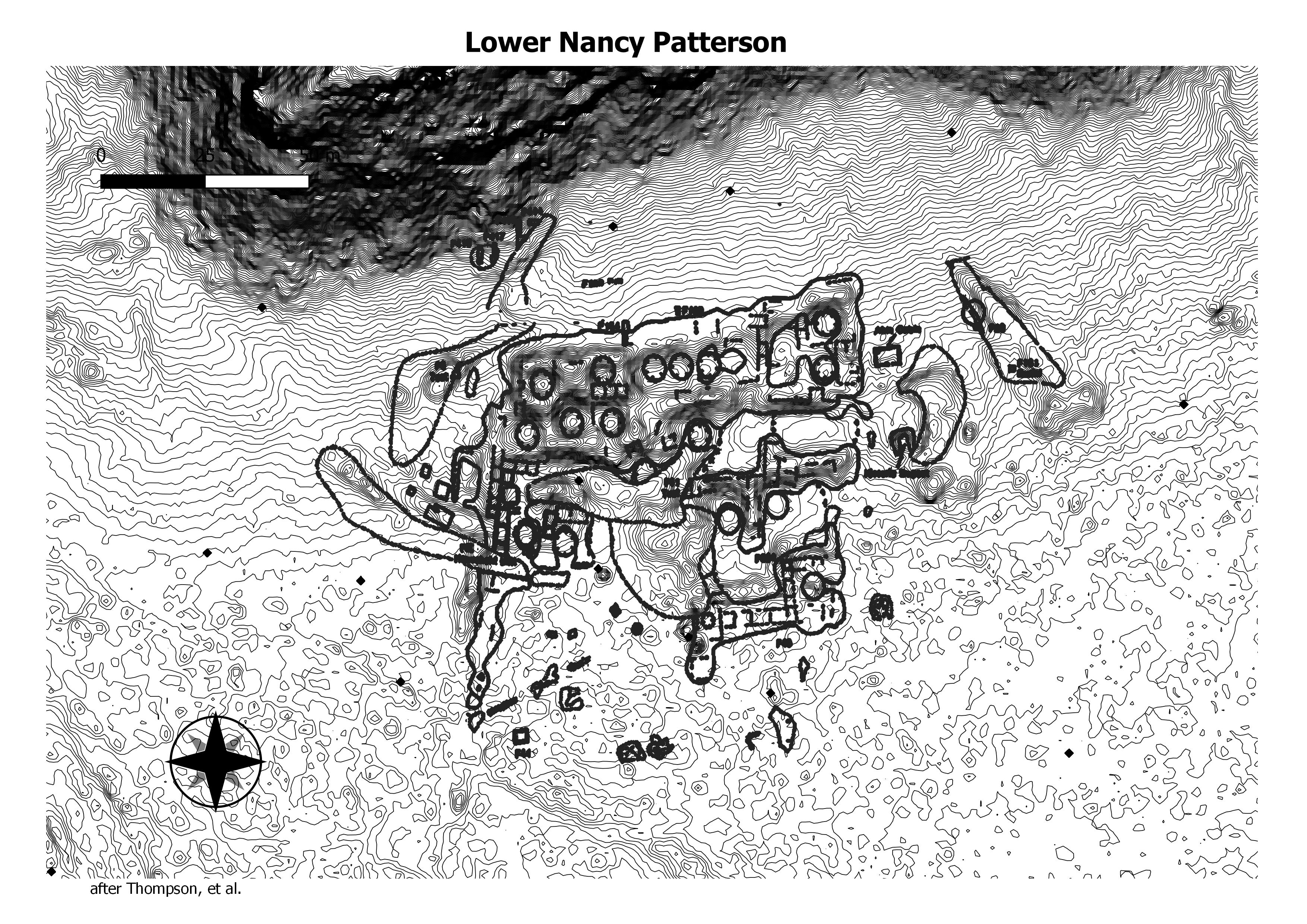
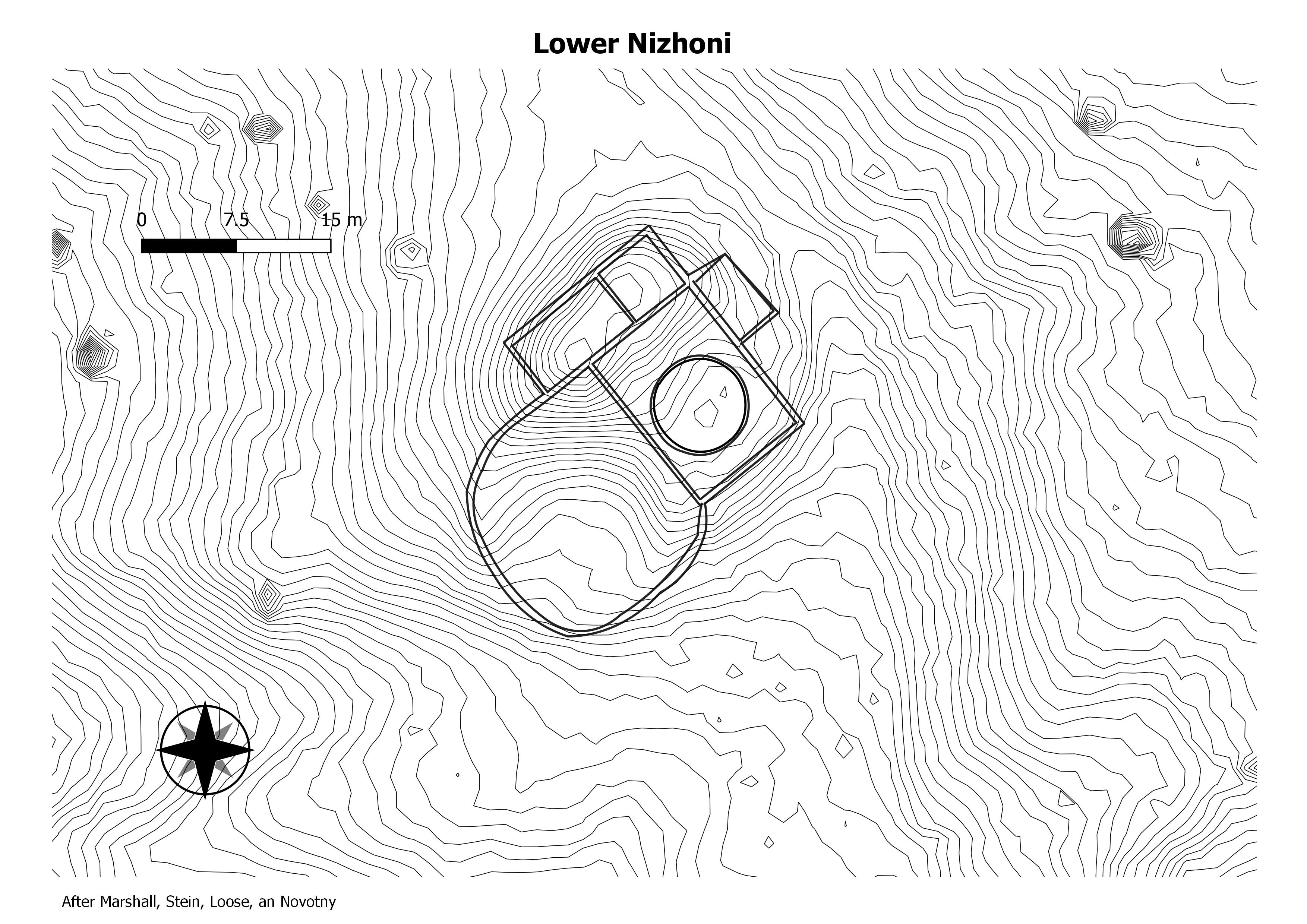
The Kin Nizhoni house is the most massive architectural edifice in the Nizhoni community complex. The house is a double-terraced structure, in part multistory, and contains an estimated 14 rooms and 2 kivas. The structure occupies a position on high ground and is the terminus of the Nizhoni “roadway.” These characteristics serve to distinguish the structure within the Nizhoni complex and suggest a public affinity and function. (Chaco Research Archive)

Between the residence area and campground.
29SJ529–on east side of road between Visitors Center and Campground “Warnock ‘s ..Little Site..; 20 + rooms, 1-2 kivas, 1 tower; Pl – late PIII.” (“Small Site Architecture of Chaco Canyon”)
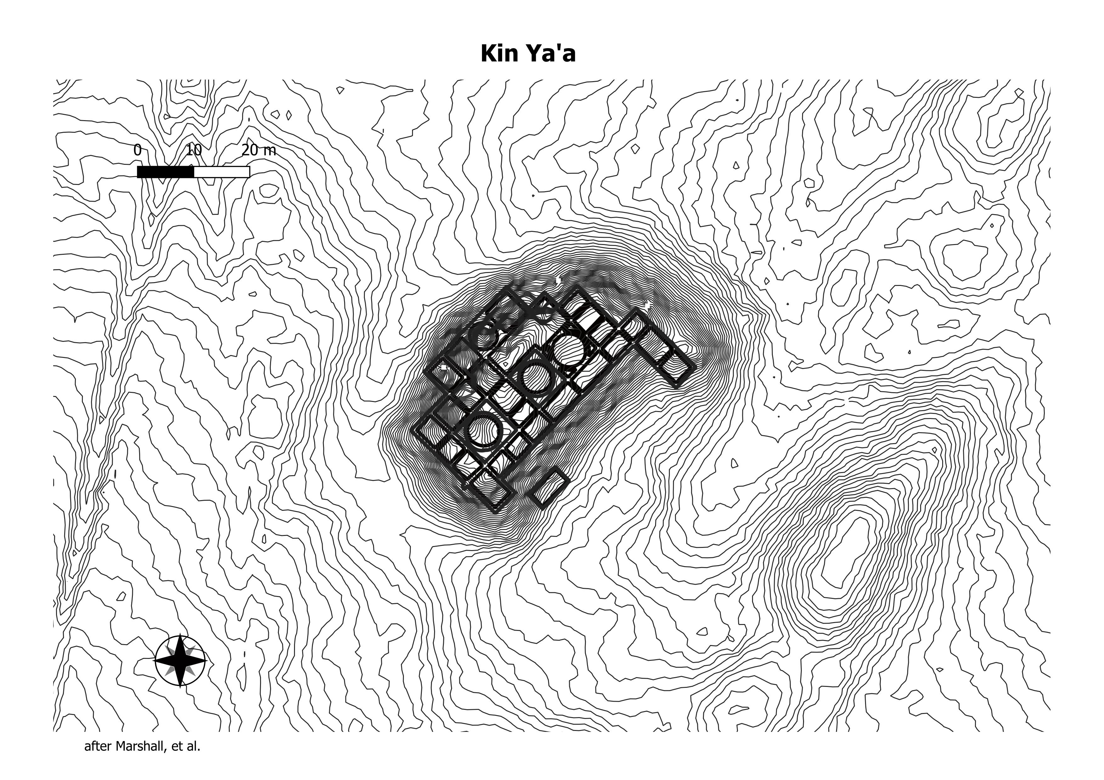
The great house at Kin Ya’a contains 44 rooms and four kivas in four stories, including the tower kiva, from which a burial of an adult male was recovered (Akins 1986:160). With a floor area of 1782m2, this structure is the largest in the study area. A total of 18 tree-ring dates were recovered from the tower and a nearby room; the results indicate an early date of A.D. 1087, a late date of A.D. 1106, and date clusters of A.D. 1087–1088 and A.D. 1106 (Marshall et al. 1979:201–206). However, mean ceramic dating indicates that the structure as a whole was occupied between A.D. 1018-1111. The great kiva is situated 200 m northwest of the great house. (Chaco Research Archive)
No data found.
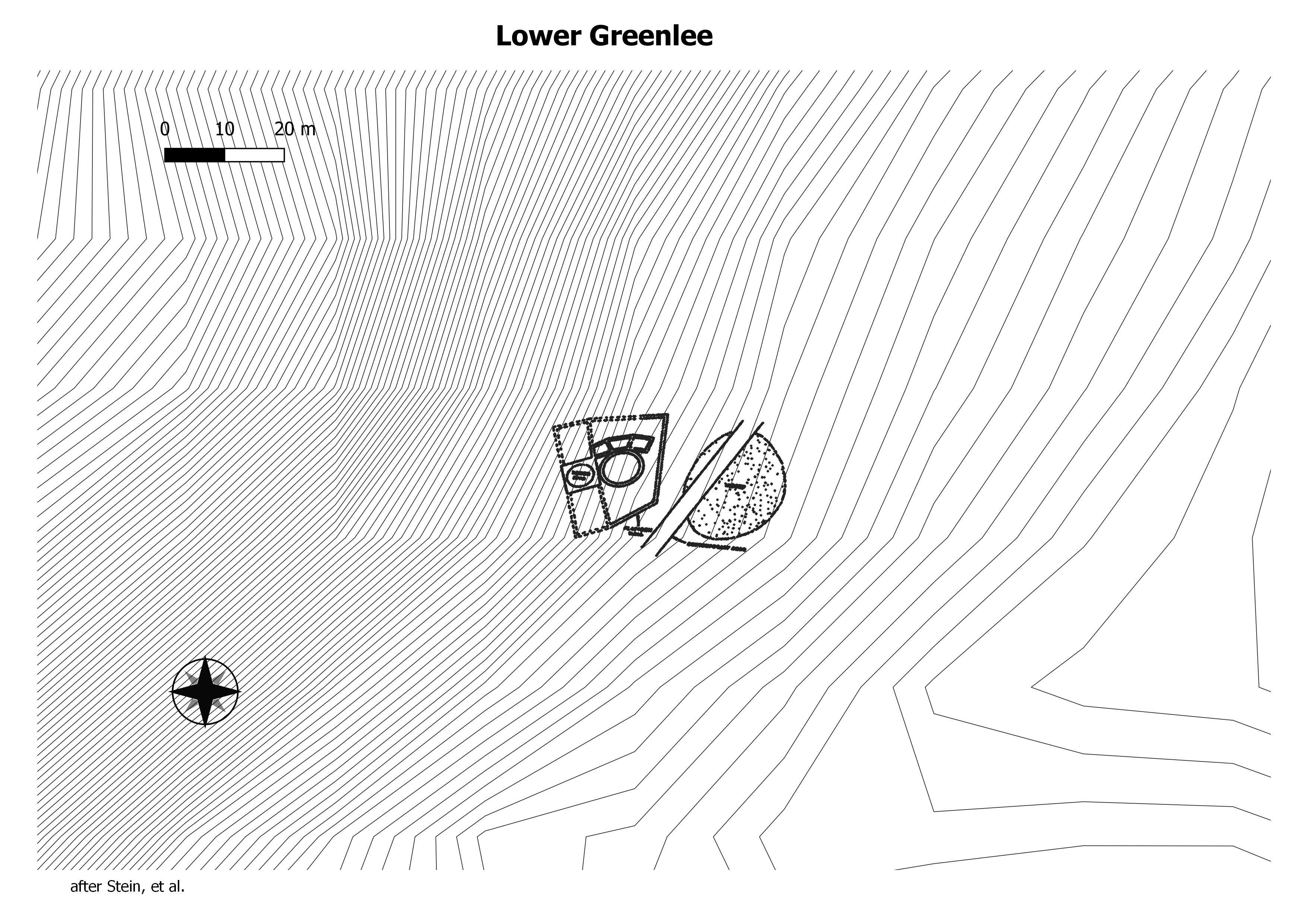
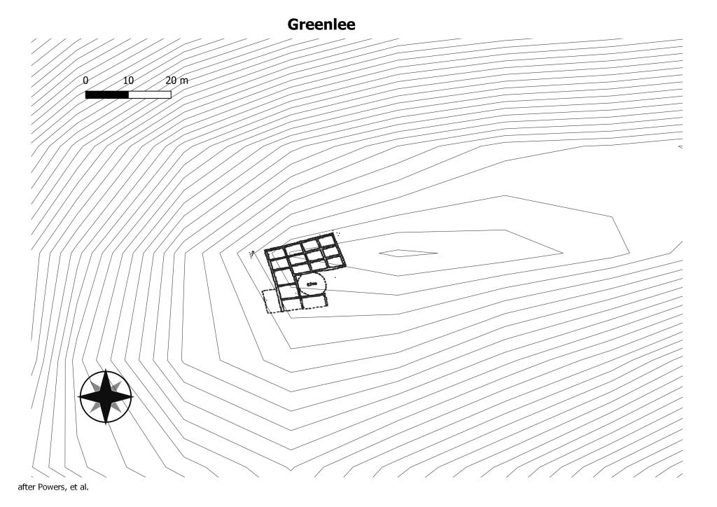
Also known as LA 35419. The apparent construction of this structure upon a platform is not a common aspect of Bonito Style architecture. Presence of the platform-tower kiva combination makes Lower Greenlee a very significant location. (Chaco Research Archive)
This pueblo is a staggered “L” shaped house containing 3 rooms and an enclosed kiva with a plaza area on the south. Mound elevations of 1.0 to 2.0 m suggest that the entire house was a single story in elevation, but of massive construction. Interior rooms sizes are estimated to be; Room 1, 4 m x 8 m, Room 2, 4 m x 4 m, and Room 3, 3.5 m x 5.5 m. The kiva is 6.0 m in diameter and appears within a rectangular enclosure 9 m x 12 m. The kiva is situated toward the east side of the enclosure, and an additional room may exist to the west (Chaco Research Archive).
This Chacoan structure and surrounding sites, also known as LA 37601, are located near the confluence of Barker Arroyo and the La Plata River, north-northwest of Farmington and south-southwest of La Plata, New Mexico. (Chaco Research Archive).
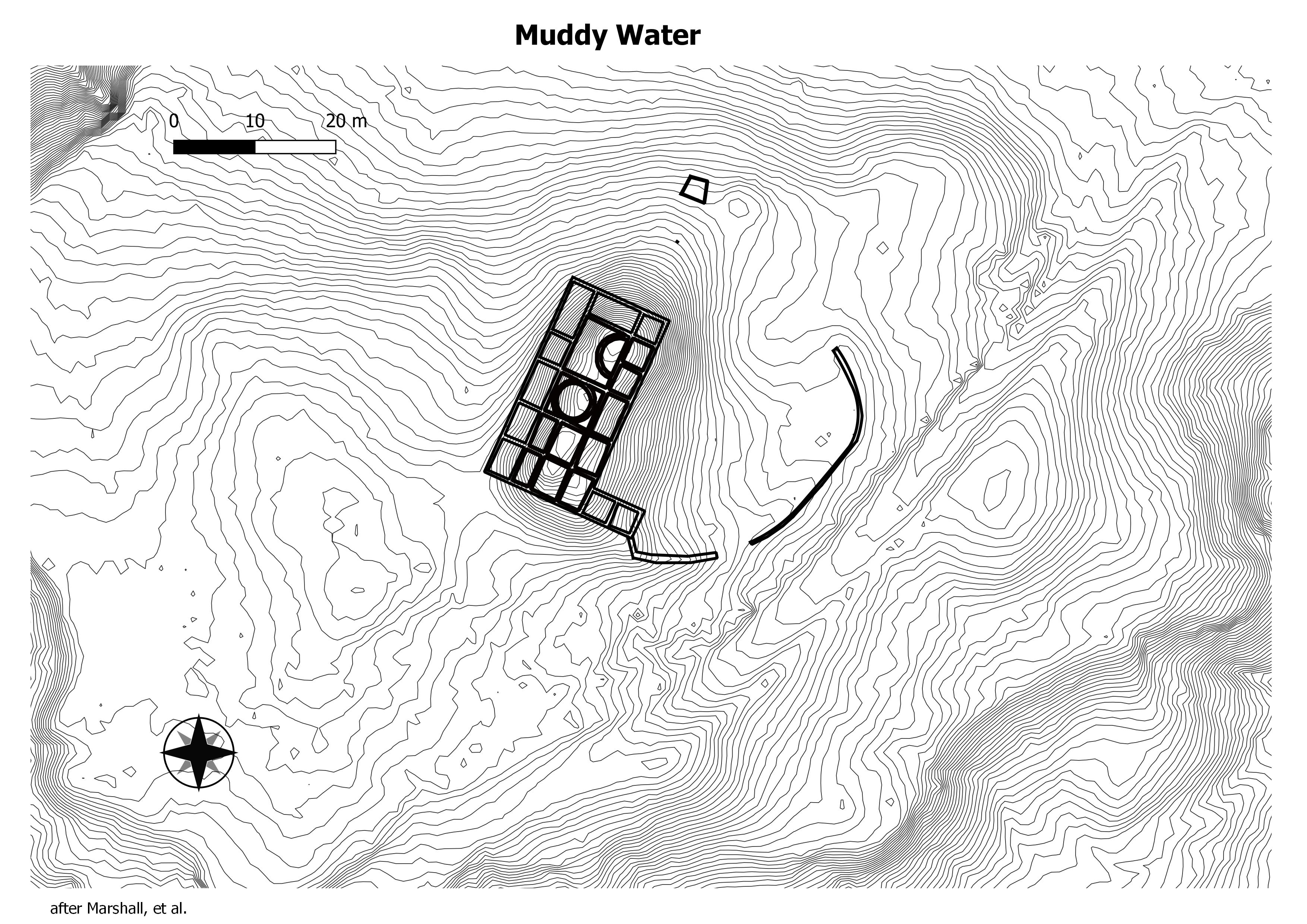
There are three Bonito Phase pueblos and a single great kiva
within the Muddy Water nuclear community area which are
DRAINAGE Indian Creek, to the Chaco Wash, to the recognized as examples of public architecture. The largest pueblo and associated great kiva, LA No. 10959, appear to have served the community throughout the P-ll period. (Chaco Research Archive).
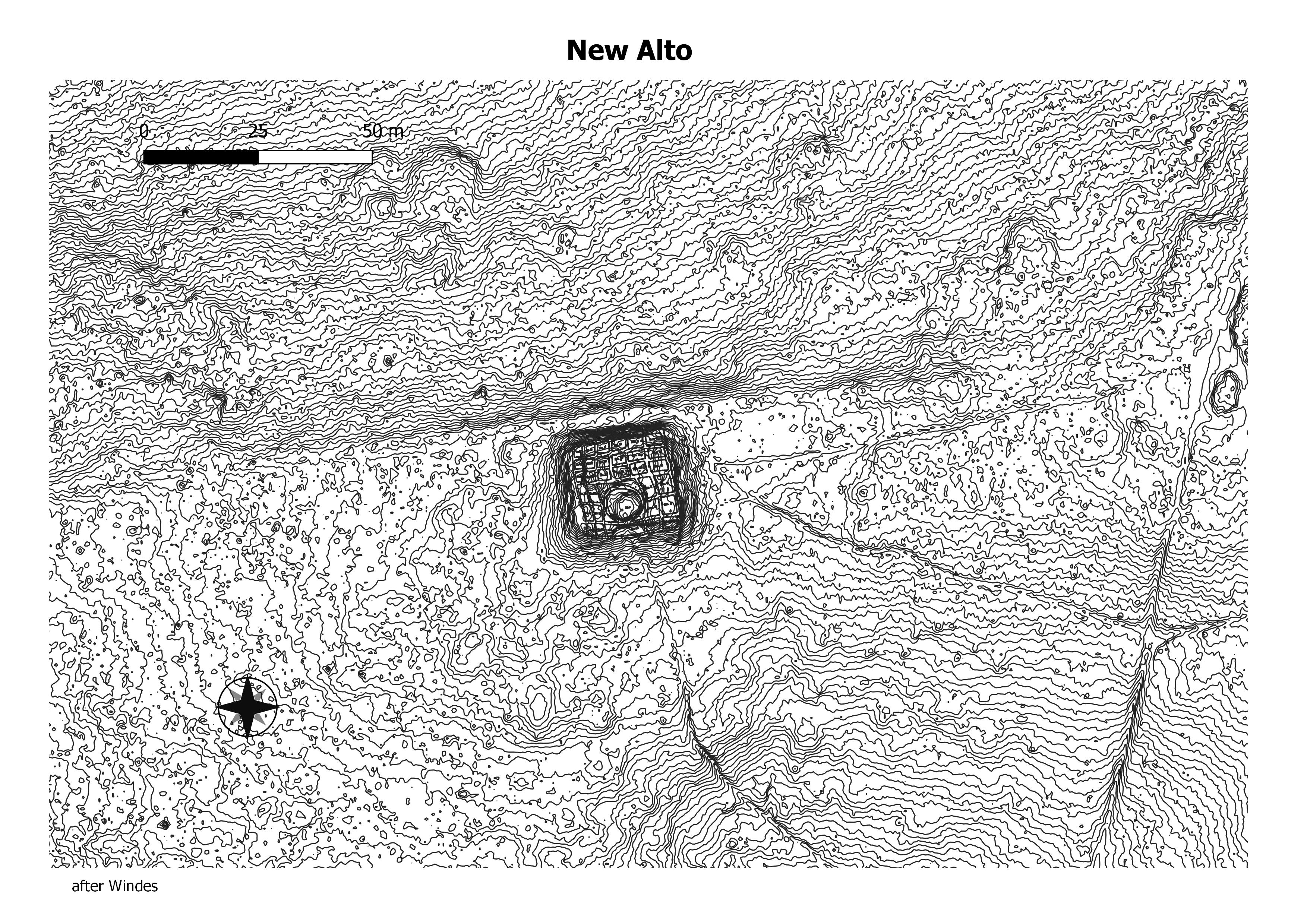
New Alto is connected to nearby and larger Pueblo Alto by a low masonry wall. New Alto is a small McElmo-style great house similar to Casa Chiquita and Kin Sabe. In Chaco Canyon, McElmo-phase structures (A.D. 1110-1140) are defined by a square ground plan with an enclosed kiva, multi-story architecture, a new style of pecked stone facings. (Chaco Research Archive).

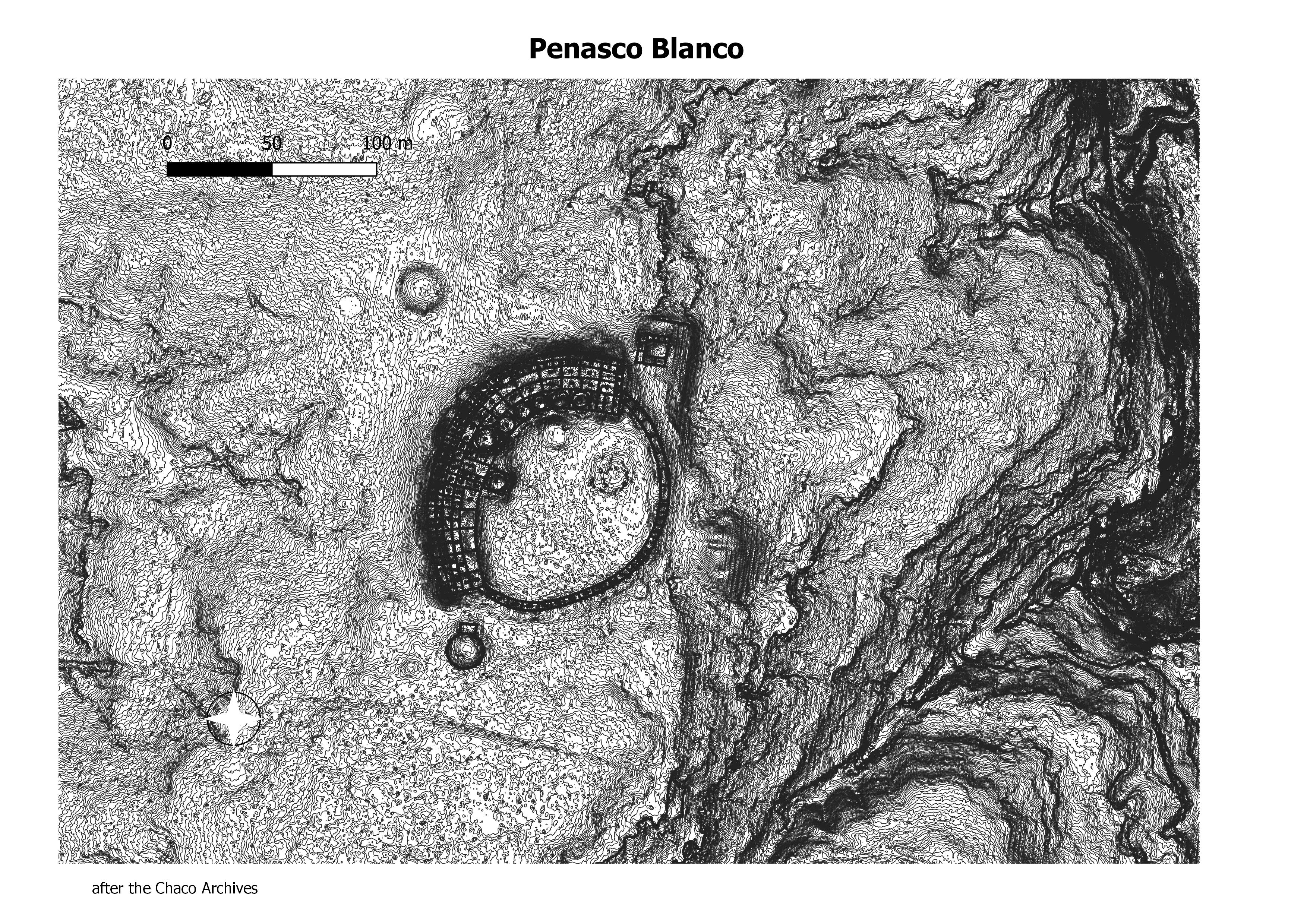
The westernmost great house in Chaco Canyon, Peñasco Blanco sits about 2.7 miles (4.4 km.) northwest of Pueblo Bonito on the northwest tip of West Mesa where it overlooks the confluence of the Chaco and Escavada washes. Peñasco Blanco is the third largest great house in Chaco Canyon and, along with Tsin Kletsin, is one of the only two canyon great houses located on the south side of Chaco Canyon. The oval ground plan is unlike any other great house and contrasts with the classic D-shape of many other canyon great houses. (Chaco Research Archive).
Although all of the sites are situated on mesa-point or butte tops with good visibility, five of the sites consist of a single room or enclosure, indicated by a low, four-sided alignment of rubble. Most of the rooms are small, in the range of 2 x 2 m, although P-19 is 2 x 5 m. The amount of rubble present at each is minor, and it seems likely that the walls were not more than waist high or were supplemented by jacal construction. If the structures were roofed, the ceilings must have been supported by upright posts. (Chaco Research Archive).
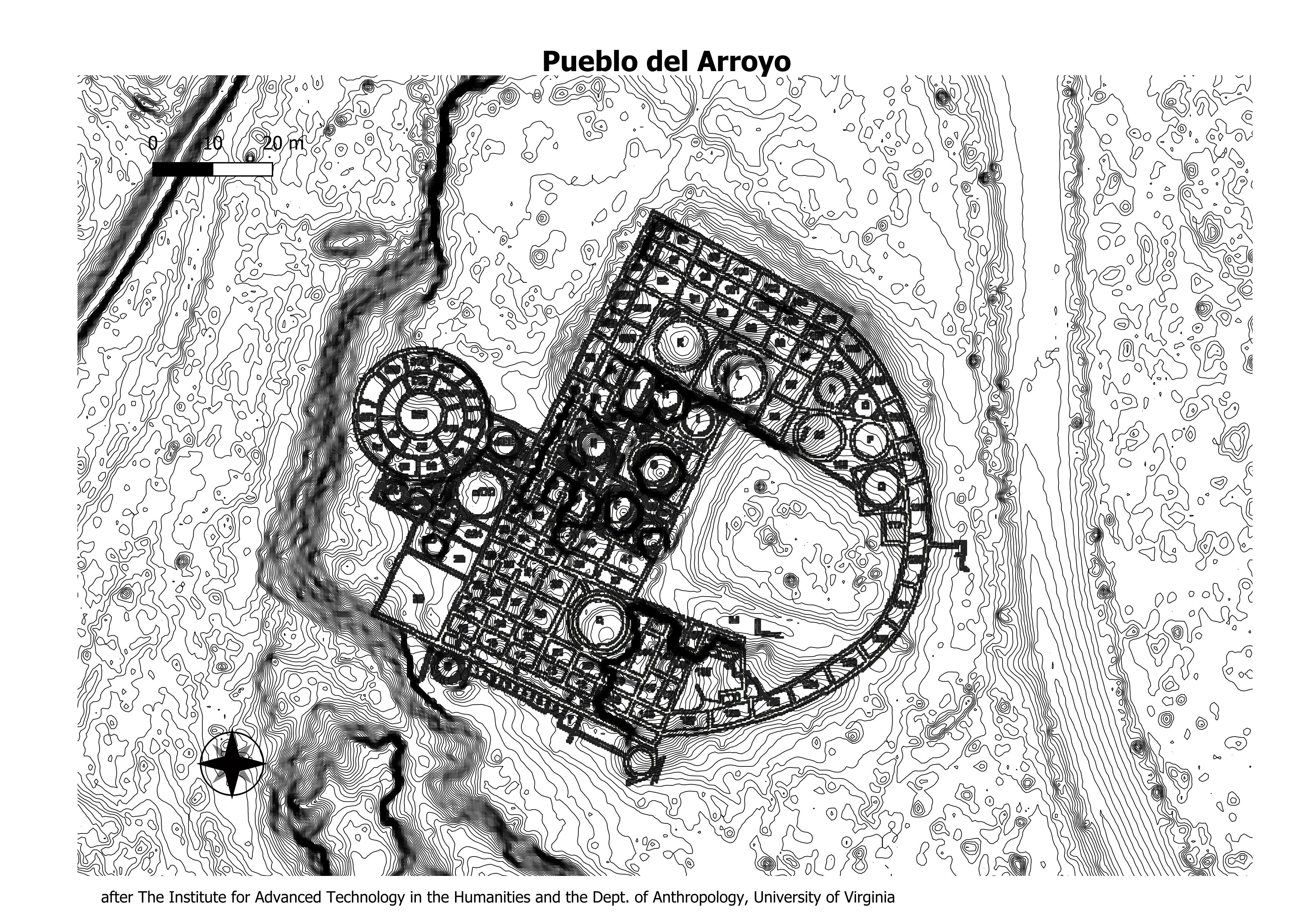
Pueblo del Arroyo, whose name means “town by the arroyo” in Spanish, is a classic D-shaped great house located next to Chaco Wash about 900 feet (275 m.) west of Pueblo Bonito. It differs from other great houses in the canyon because it was not built near the northern cliff face and is oriented to the east rather than to the south. (Chaco Research Archive).
(+) expands (-) collaps
Hopi

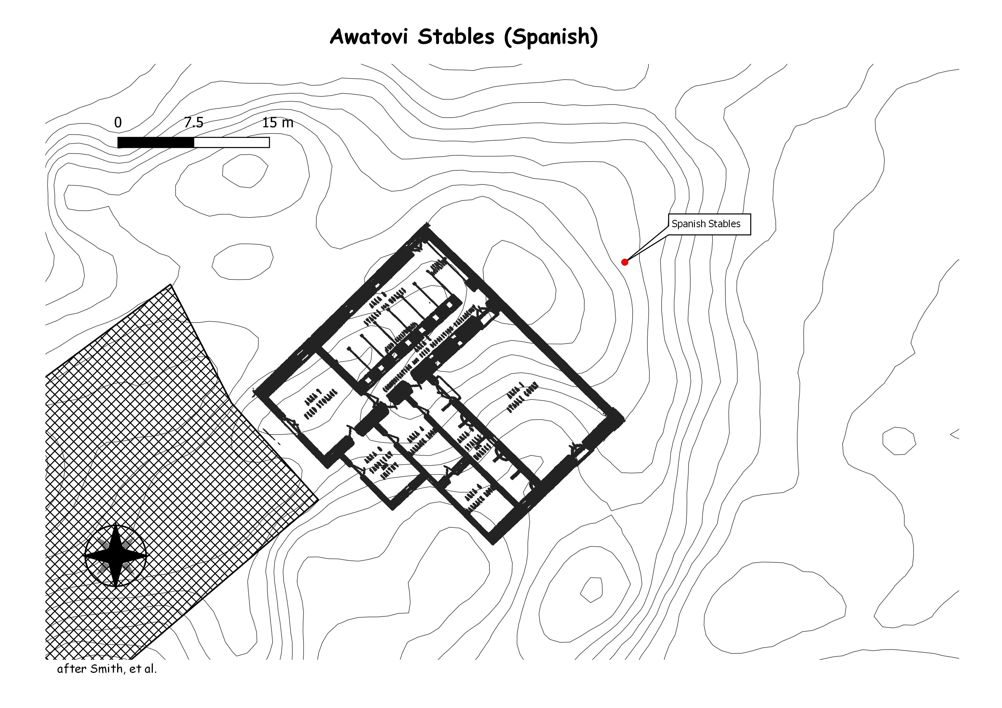
The Awatovi Ruins, spelled Awat’ovi in recent literature, are an archaeological site on the Hopi Reservation in northeastern Arizona, United States. The site contains the ruins of a pueblo estimated to be 500 years old, as well as those of a 17th-century Spanish mission. It was visited in the 16th century by members of Francisco Vázquez de Coronado‘s exploratory expedition. (Wikipedia)


More than 300 archaeological sites are identified within park boundaries, including multiple pit houses and four major pueblos that date back to the 14th century. Two of the historic pueblo sites are open to visitors. Homolovi I and Homolovi II are the largest sites in the park and once housed thousands of people.

Homol’ovi II is a fourteenth-century, ancestral Hopi pueblo with over 700 rooms. Although known by archaeologists since 1896, no systematic excavations were conducted at the pueblo until 1984. he significant findings reported here are that the excavated deposits date between A.D. 1340 and 1400; that nearly all the decorated ceramics during this period were imported from villages on the Hopi Mesas; that cotton was a principal crop which probably formed the basis of Homol’ovi II’s participation in regional exchange; that chipped stone was a totally expedient technology in contrast to ground stone which was becoming more diverse; and that the katsina cult was probably present or developing at Homol’ovi II. (kelly Alan hays-Gilpen)


(+) expands (-) collapses
Pajarito Plataeu Sites
tuyoni
yashipi
16
17
18
big kiva
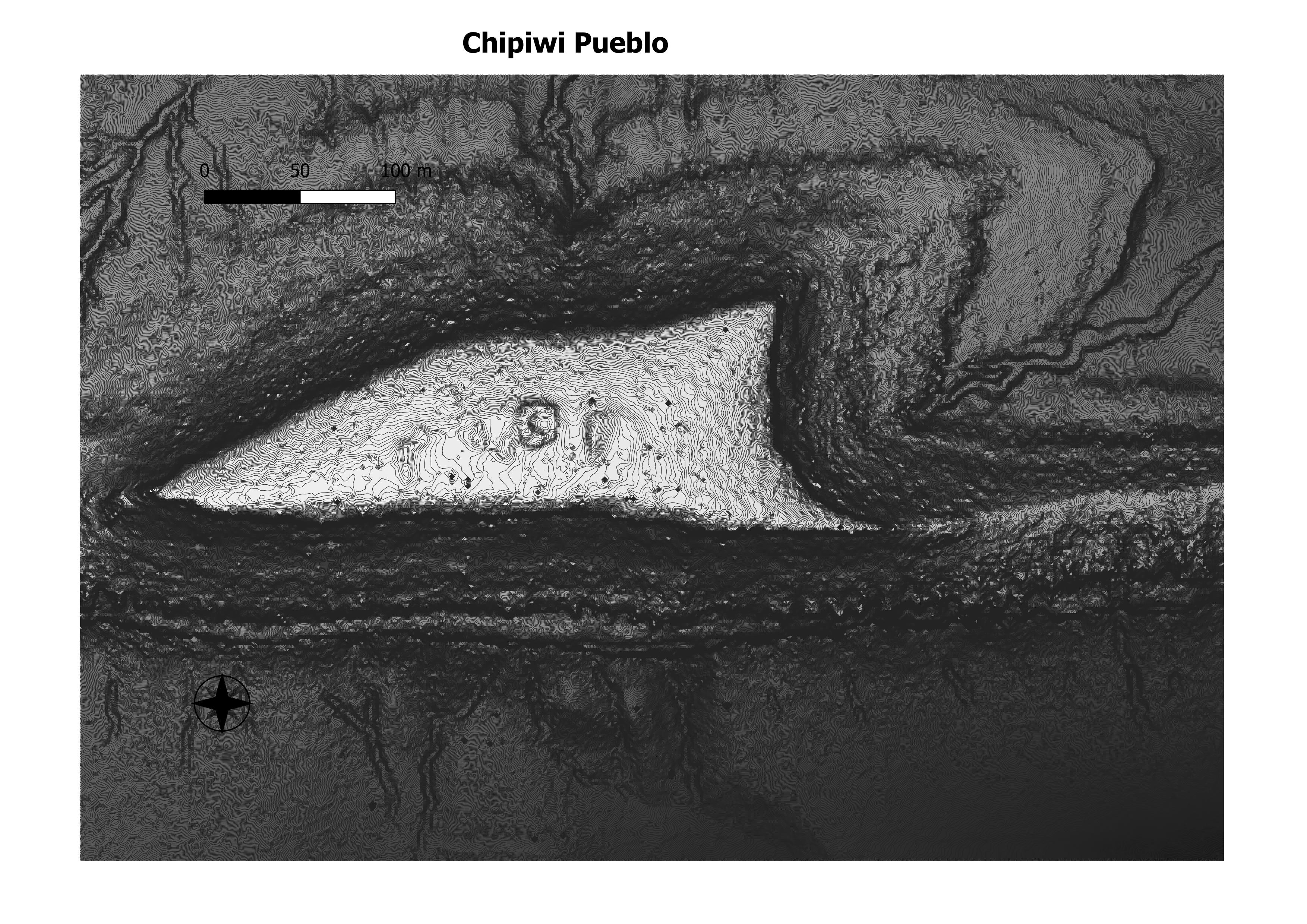
chipiwi
chupadero
dutchess castle
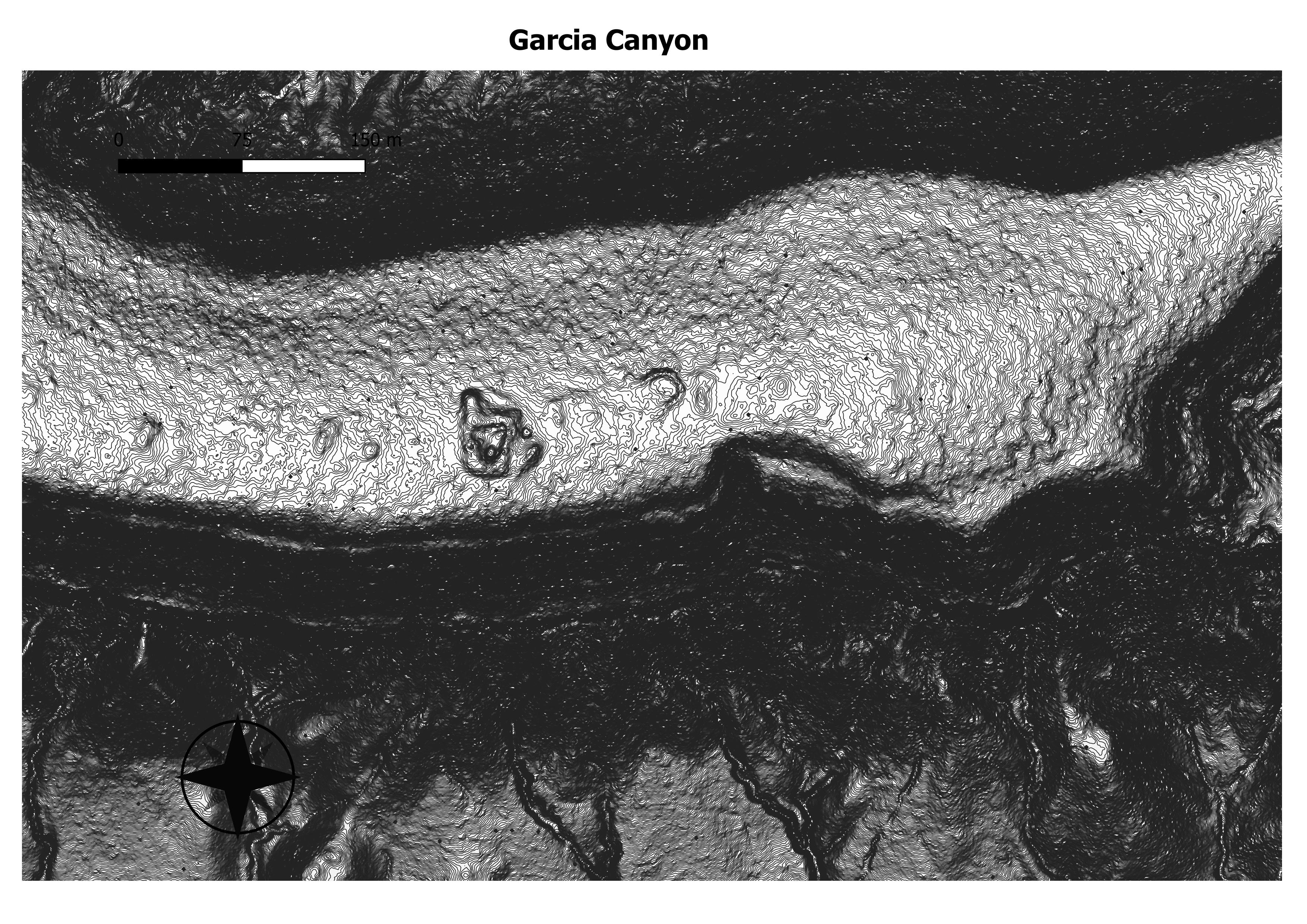
garcia canyon
guaje pueblo
kotyiti
kotyity
kuapa
littlle otowi
navawi
otowi
parege
puye
sandia
shufinne pueblo
stone lions
tsankawi
tshirege
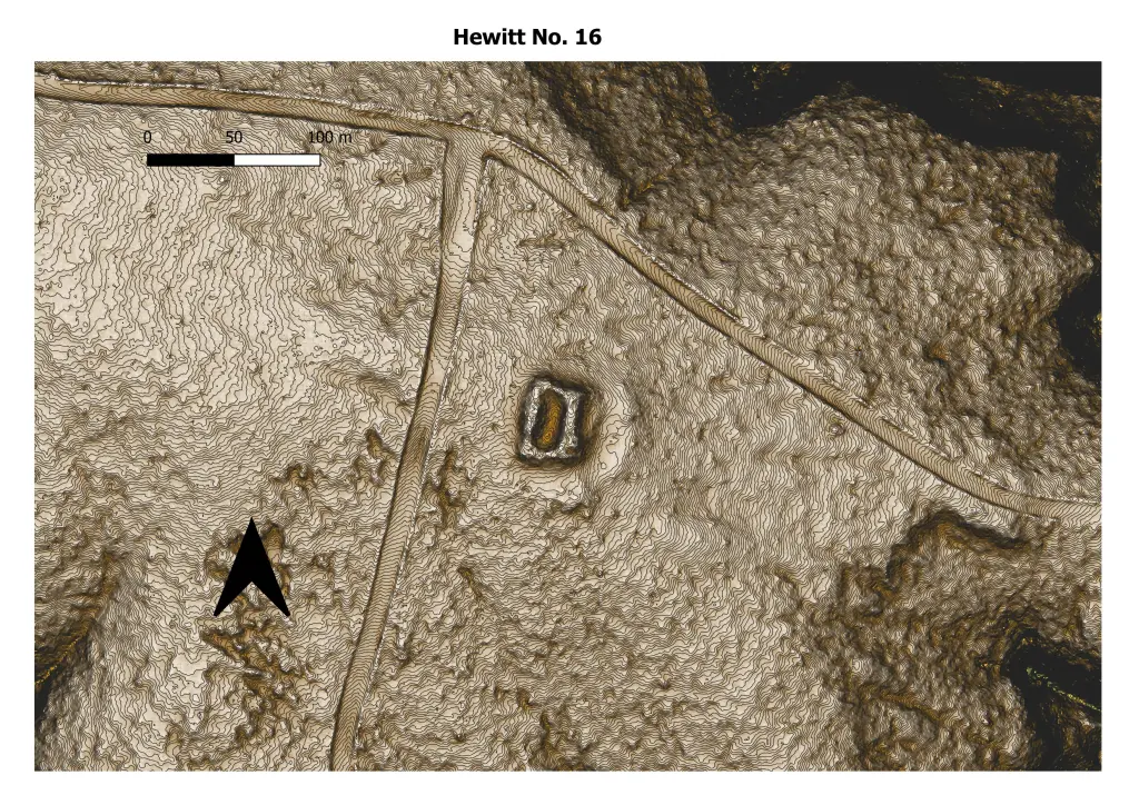
This is a small ruin consisting of a single quadrangle situated
about three miles west of Tshirege, just south of the abandoned Buckman
sawmill road.
(ANTIQUITIES OF THE JEMEZ PLATEAU,
NEW MEXICO, 1906)
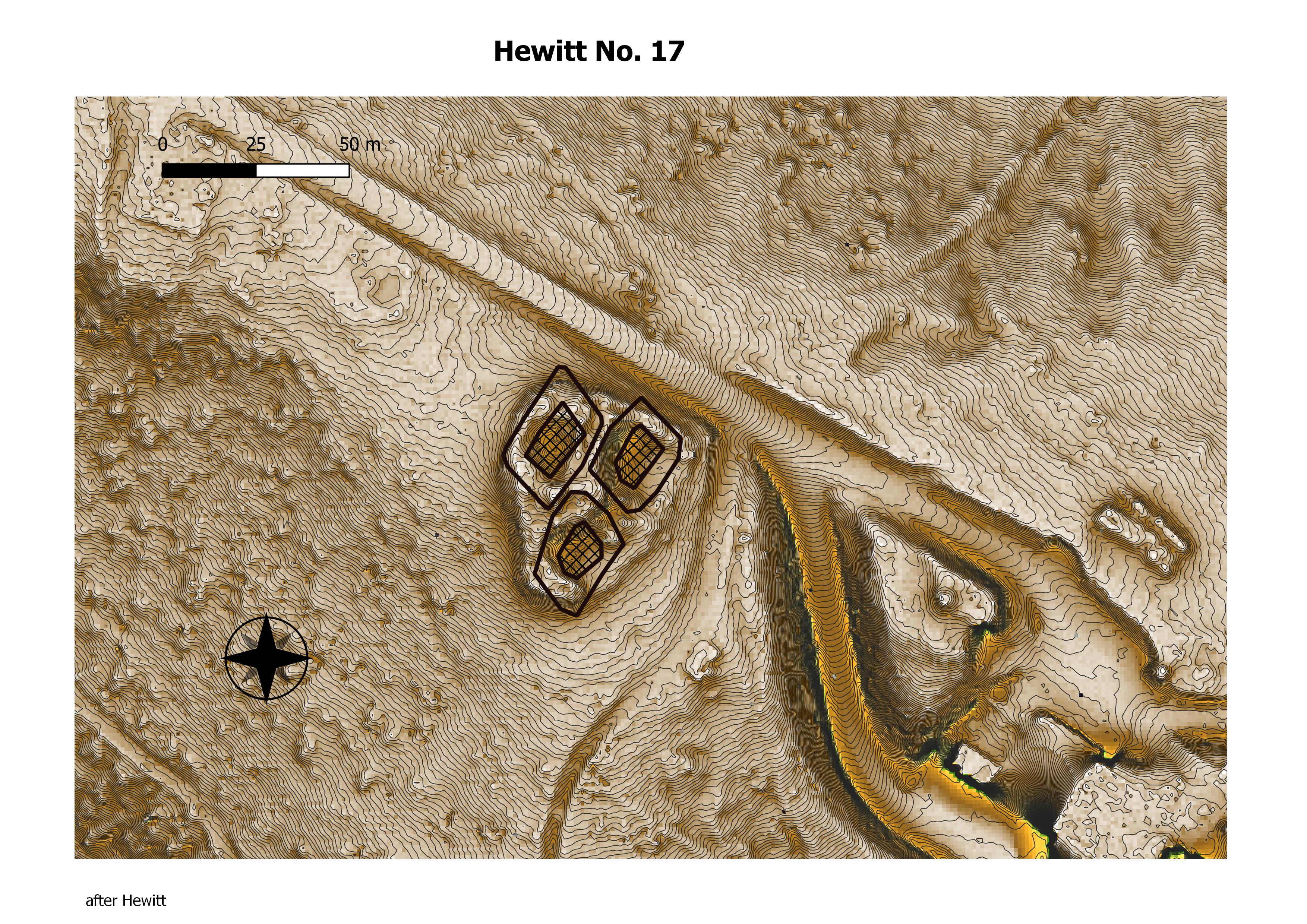
In the midst of a beautiful open park, about three miles southeast of the abandoned sawmill,
is an important ruin (fig. 12) consisting of three compact connected
rectangles.
No walls are visible above the debris, but on
clearing away the loose stone, well-preserved plastered walls eight
feet in height are disclosed. (ANTIQUITIES OF THE JEMEZ PLATEAU,
NEW MEXICO, 1906)
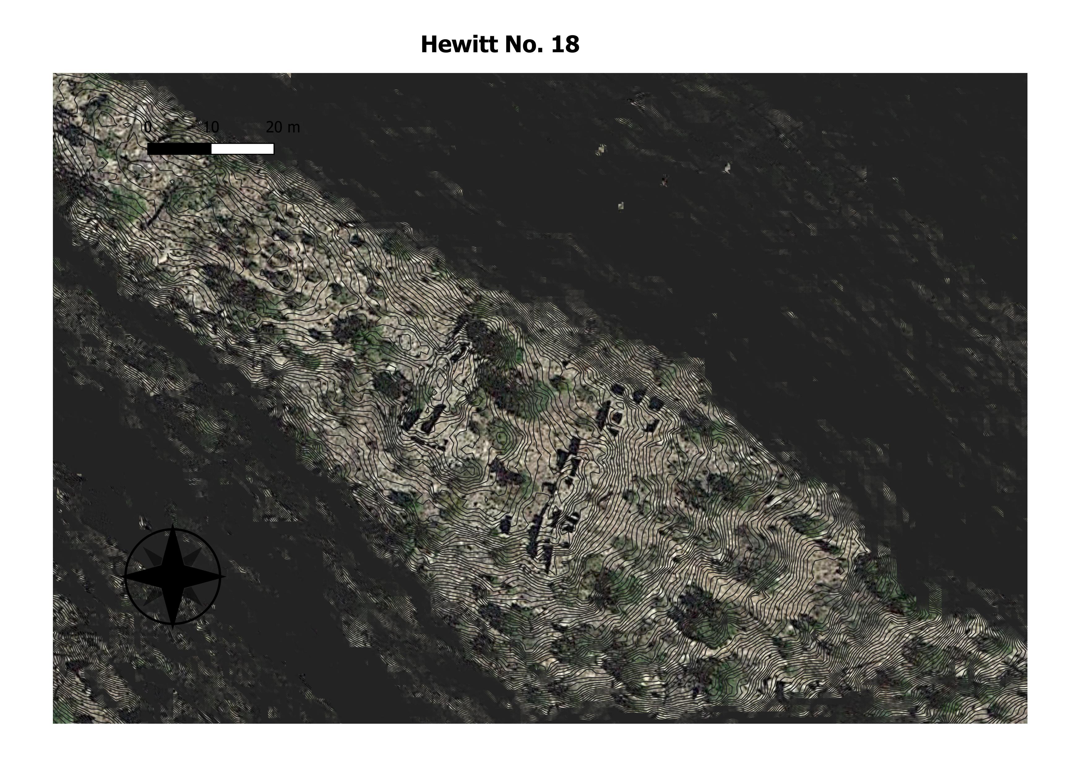
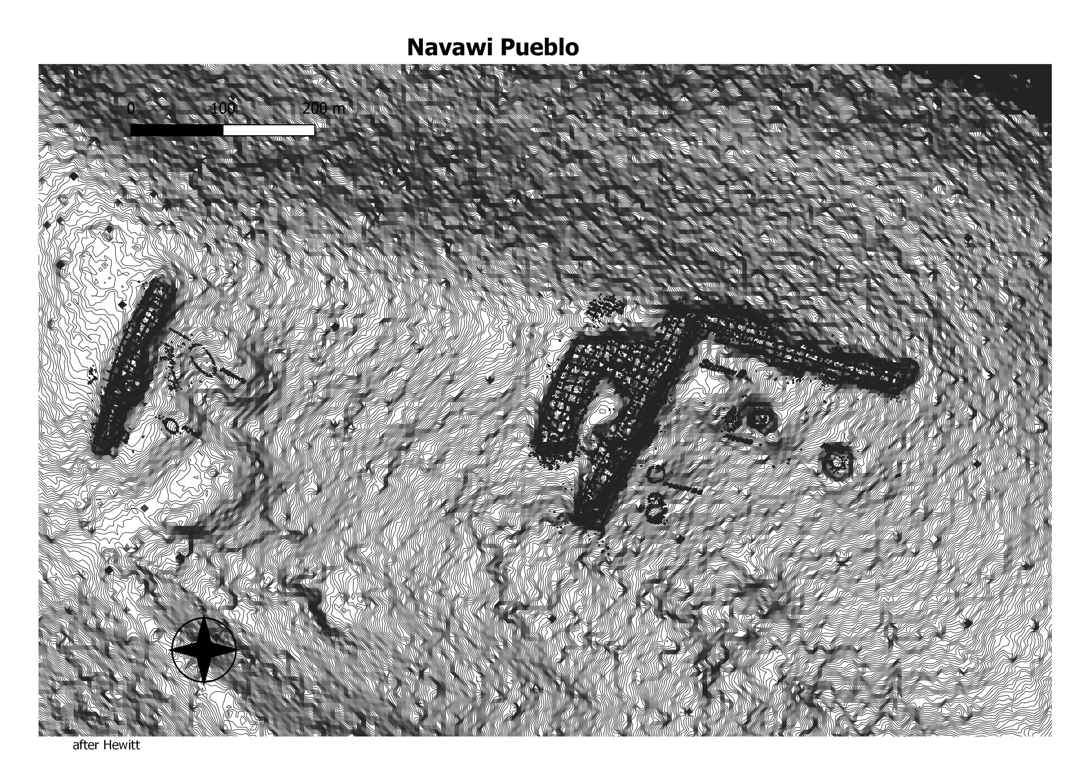
Less than a mile west of no. 17 on a high point at the confluence
of two very deep gorges is the best-preserved ruin in this
region (pi. ix, a). The walls stand in places eight feet above the
debris. Great pine trees are growing within the rooms. There is
every evidence that these mesas have been forested since the abandonment
of the pueblos (pi. vm, a, b; pi. ix, a). This ruin is almost
inaccessible, except from the west. It is not less than 800 feet above
the waters of the Rito del Bravo, which it overlooks. The ground
plan (fig. 13) is very irregular. (ANTIQUITIES OF THE JEMEZ PLATEAU,
NEW MEXICO, 1906)

Down The canyon from the community house, there are a small unexcavated ruin and a great kiva on the valley floor. The large kiva was excavated in 1908, and reexcavated and repaired in 1937. (ANTIQUITIES OF THE JEMEZ PLATEAU,
NEW MEXICO, 1906)
This is a small pueblo of imperfect quadrangular
form situated on a low mesa about two miles west and a little south of
Puye. (ANTIQUITIES OF THE JEMEZ PLATEAU,
NEW MEXICO, 1906)
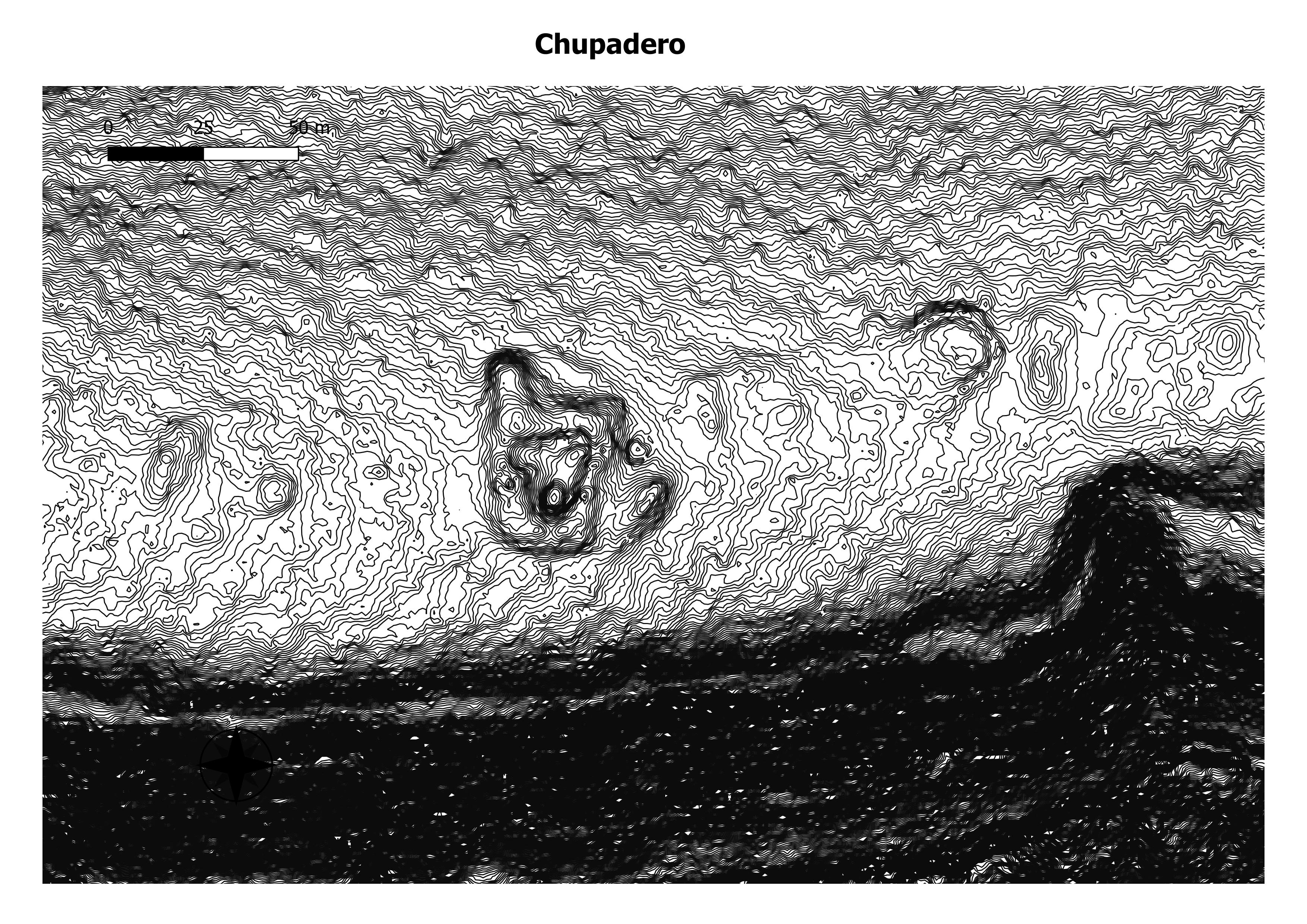
This does not refer to any single site, but to a number of cliff villages grouped within and about the Chupadero canyon. Here is a great network of deep gorges affording exceptional facilities for
retreat from enemies. There is no pueblo ruin of any considerable magnitude in this section and the cliff-dwellings, numbering many hundreds, are of a quite temporary character. (ANTIQUITIES OF THE JEMEZ PLATEAU,
NEW MEXICO, 1906)
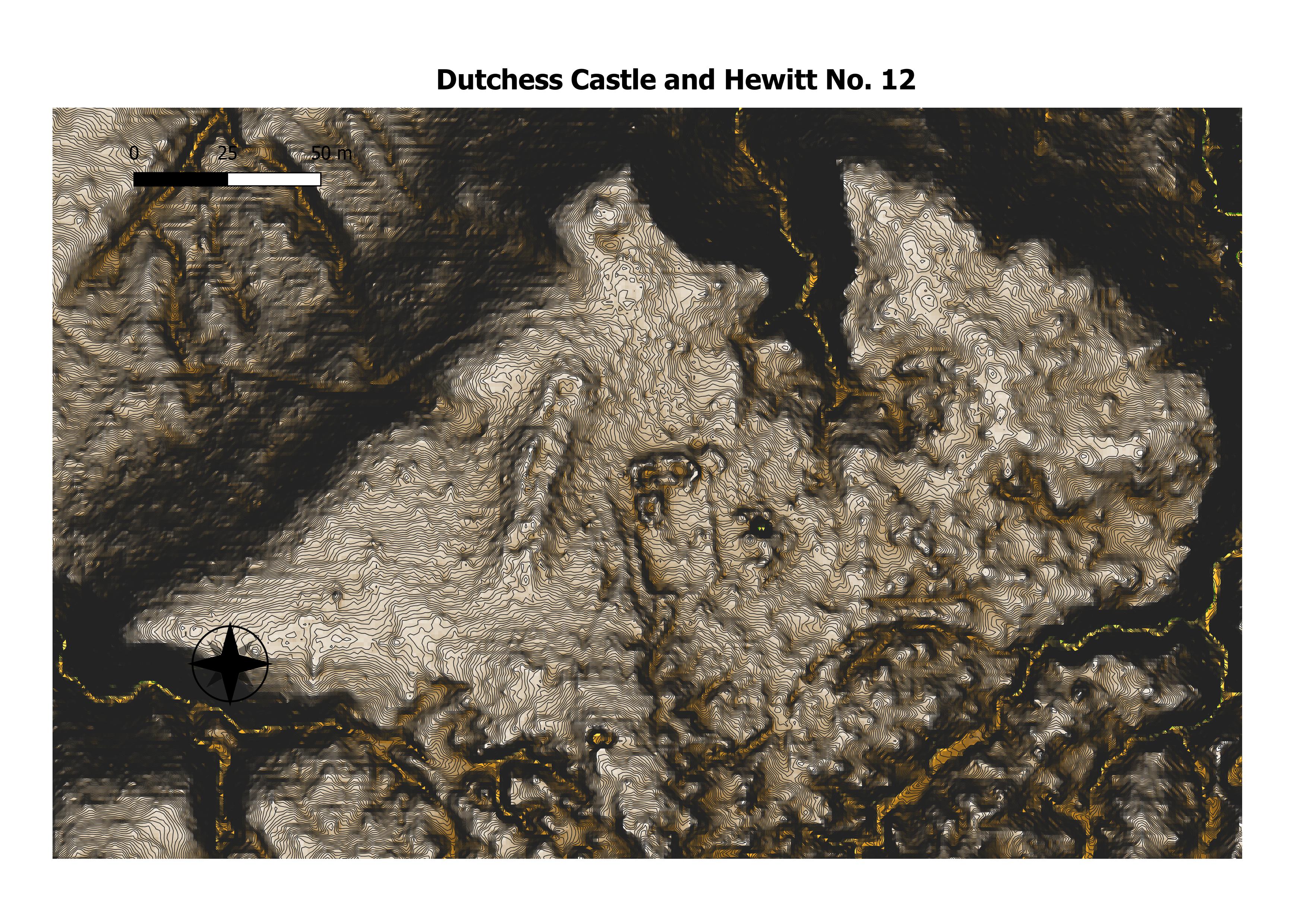
In 1914, Vera von Blumenthal and Rose Dougan, two women interested in the revival of Pueblo pottery, applied for homestead applications. Though the homestead applications were denied the women were able to lease the land from the Forest Service. Around 1916, Vera von Blumenthal and Rose Dougan established a home and pottery studio at the Duchess Castle site, called The Fort at that time. (Los Alamos Historical Society)
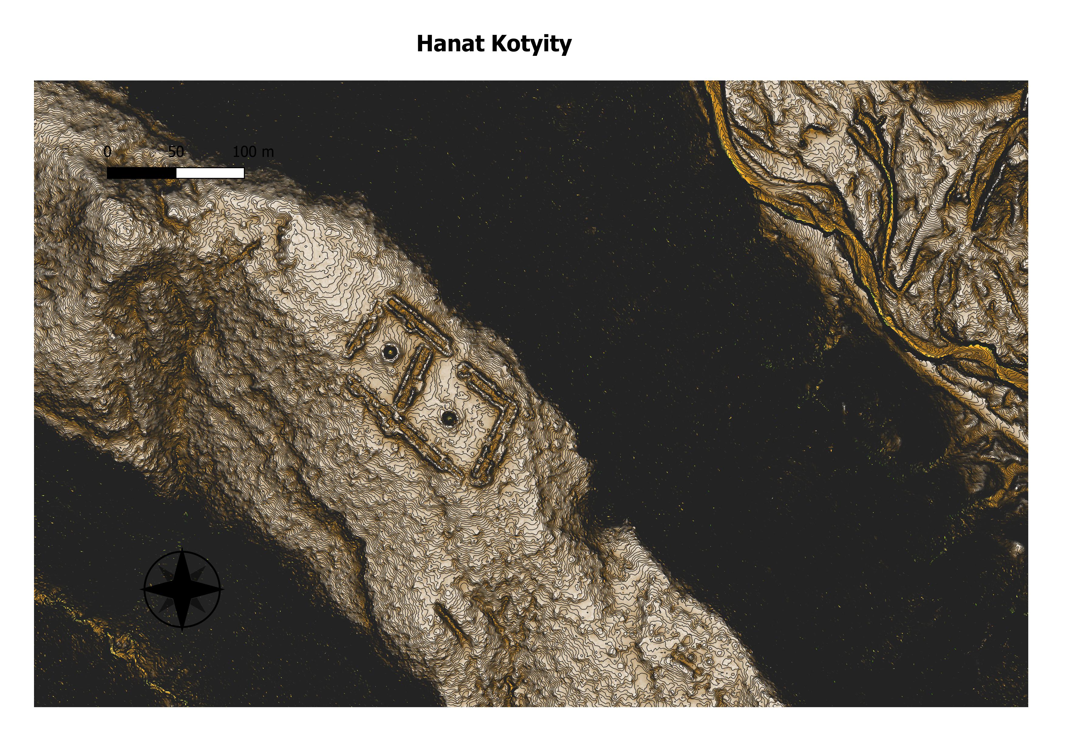
After the Revolt, their ancestors built a mesa-top village now known as Hanat Kotyiti, or “Old Cochiti.” Preucel believes the structure of the village shows they moved there not just for defensive purposes, but to help reimagine their way of life. The experiment at Hanat Kotyiti came to a violent end. It was the first of the mesa-top villages to be seized by Vargas in 1694. After taking the village, Vargas set fire to stored corn, which destroyed the pueblo. (Eric A, Powell)
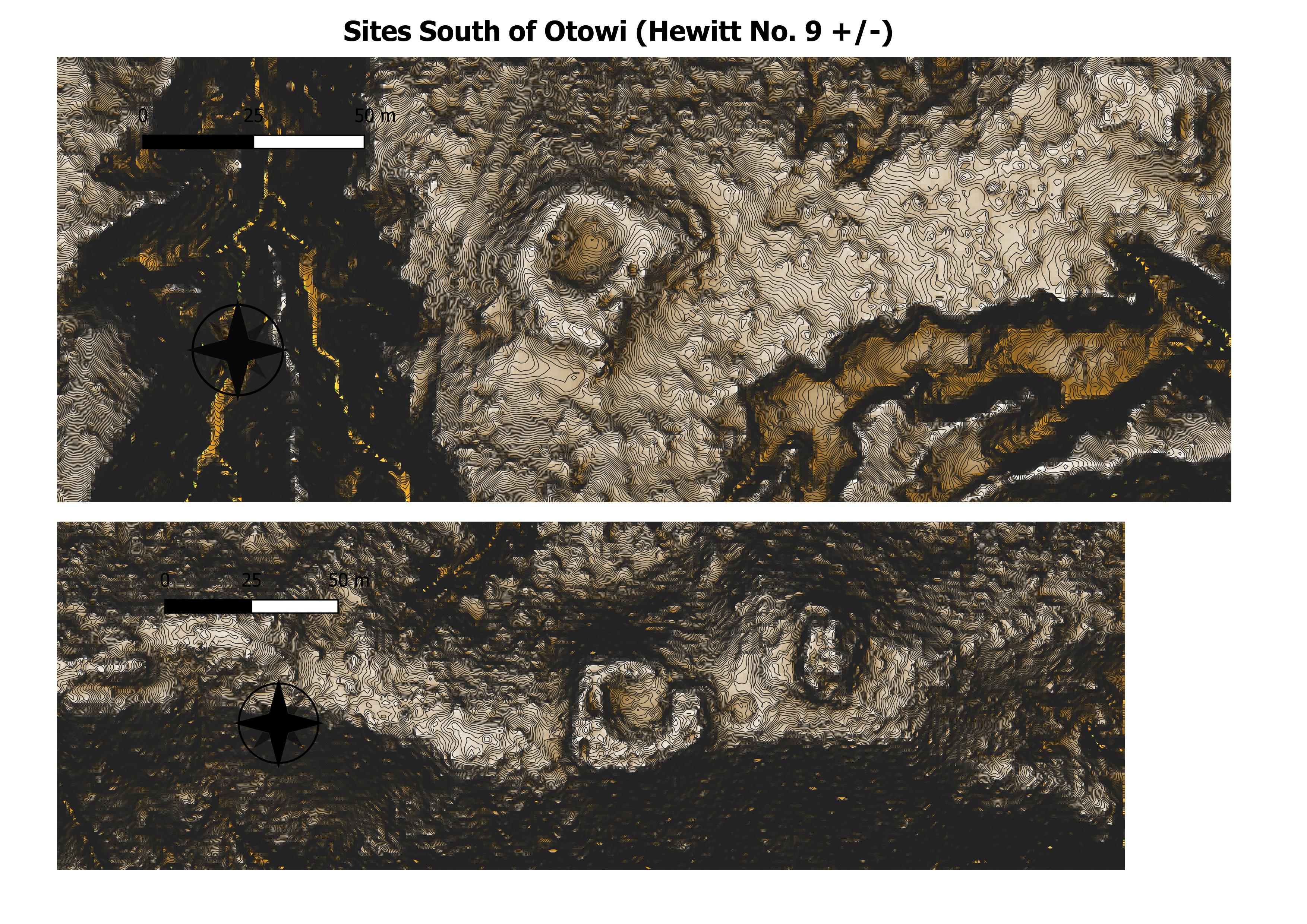
This is a small pueblo ruin in Otowi canyon just across the
arroyo about 300 juirds south of Otowi pueblo. It is situated on top
of a narrow ridge which runs parallel with the one on which the large
ruin stands.
Seven other small pueblo ruins or clan
houses are scattered along the same ridge to the west within a distance
of one mile, all apparenth- belonging to this settlement. (ANTIQUITIES OF THE JEMEZ PLATEAU, NEW MEXICO, 1906)
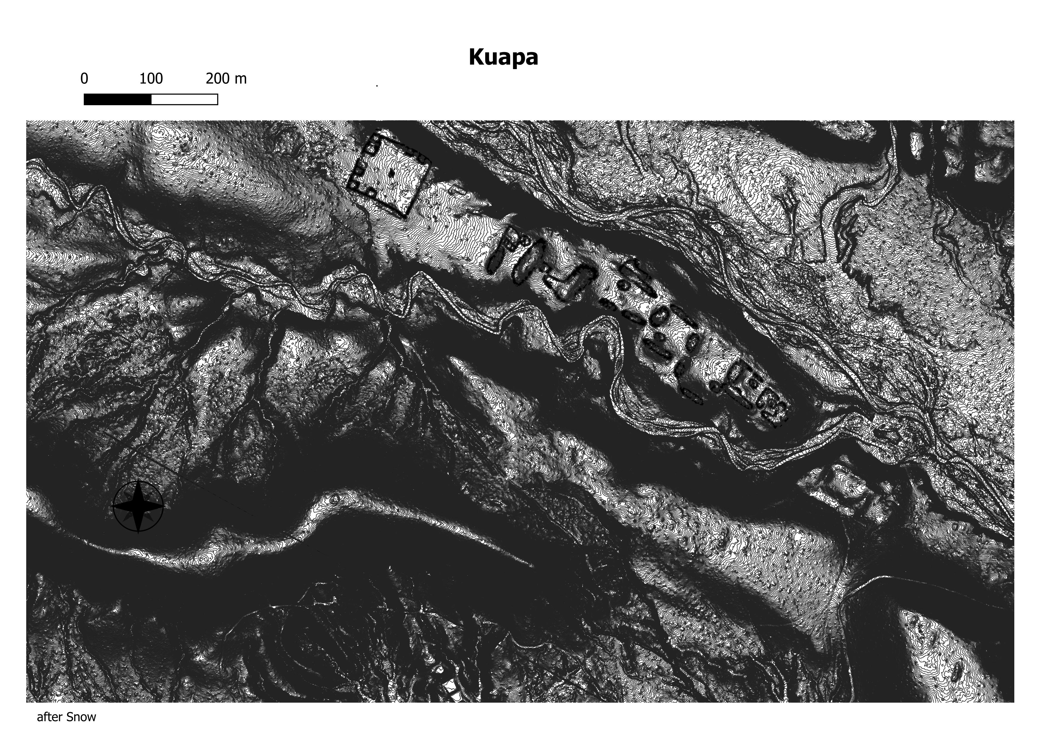
Kuapa A ruined pueblo in the Cañada de Cochiti 12 m N w of Cochiti pueblo N Mex by whose inhabitants it was formerly occupied and to whom are at tributed the execution of the panther statues on the neighboring Potrero de los Idolos It was the third place of settlement of the Cochiti after their abandonment of the Potrero de las Vacas and from which they moved to their present (Bulliten- Smthsonian Institution . Bureau of American Ethnology)
…at the confluence of two very deep gorges is the best-preserved ruin in this
region (pi. ix, a). The walls stand in places eight feet above the
debris. (ANTIQUITIES OF THE JEMEZ PLATEAU,
NEW MEXICO, 1906)
Chaco North Road Alignment
In 2008 and 2009, John Stein and myself made an attempt to document the North Road out of Chaco Canyon. At the time Scott Andrae was a Licensed Professional Surveyor. John Stein was a contributor to the 1983 BLM Roads Project. We identified swales and obtained accurate Latitude and Longitude as close to the center of the swale as we could estimate. What we found is that if you connect the observations with straight lines you can identify a number of alignments North of Chaco Canyon. The one we would like to discuss in this paper is the most formalized alignment, and goes from Chaco Canyon to Aztec ruins. We refer to these as alignments rather than roads because the term “road” carries with it all kinds of baggage and connotations. What became clear is that these were not transportation corridors. Ground evidence was very ephemeral, and there appears to be little or no maintenance. What they were for remains a mystery, but they appear to be the result of a one time event. Another thing that became apparent, is that there is no such thing as an isolated artifact north of the canyon. Even a lone sherd, when observed with GPS fell on one of the alignments.
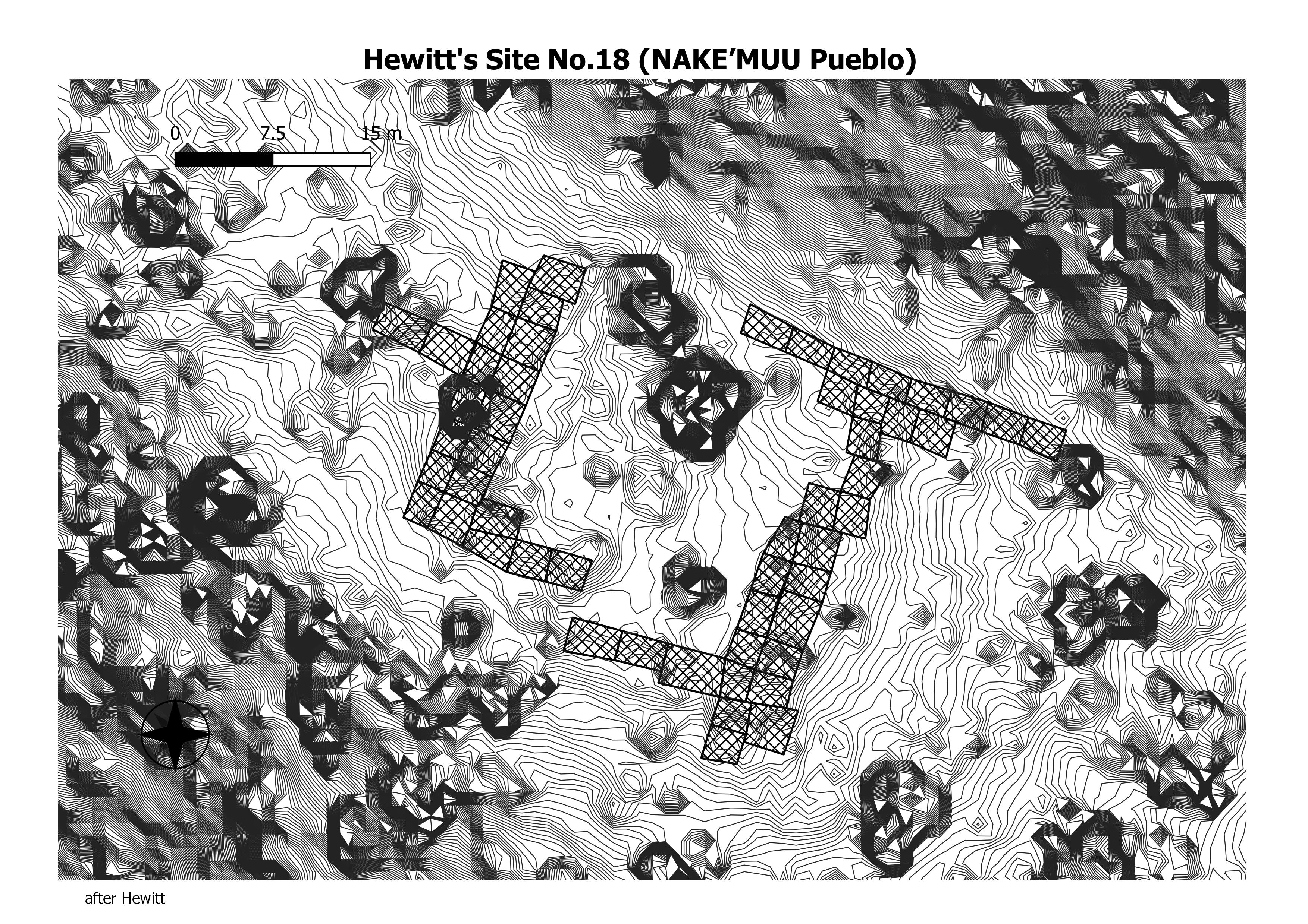
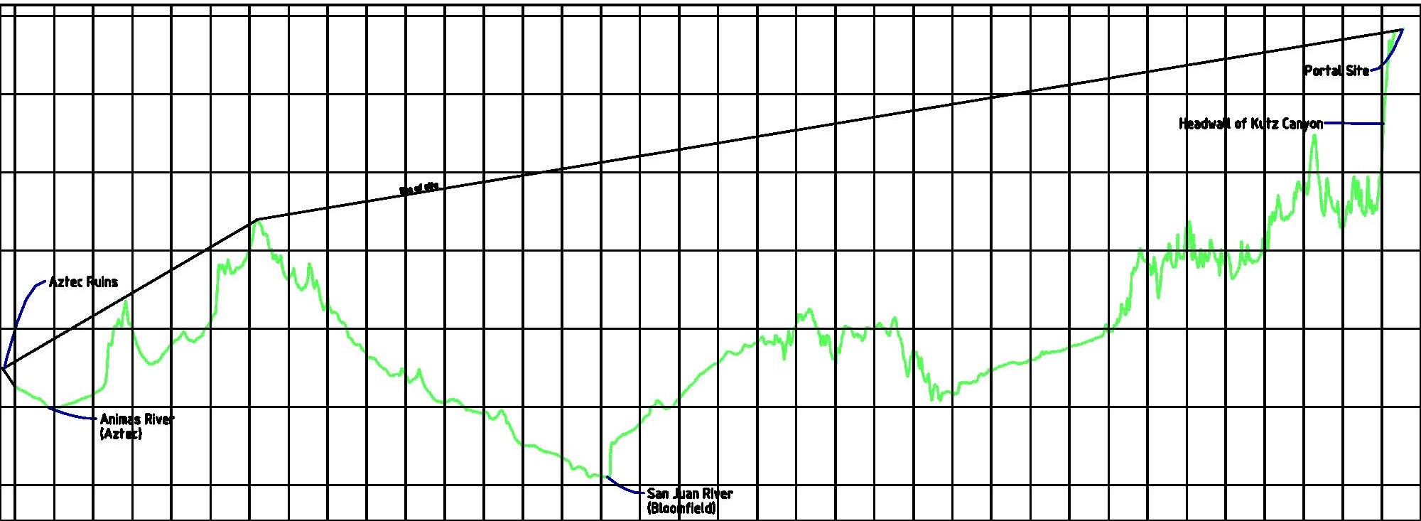
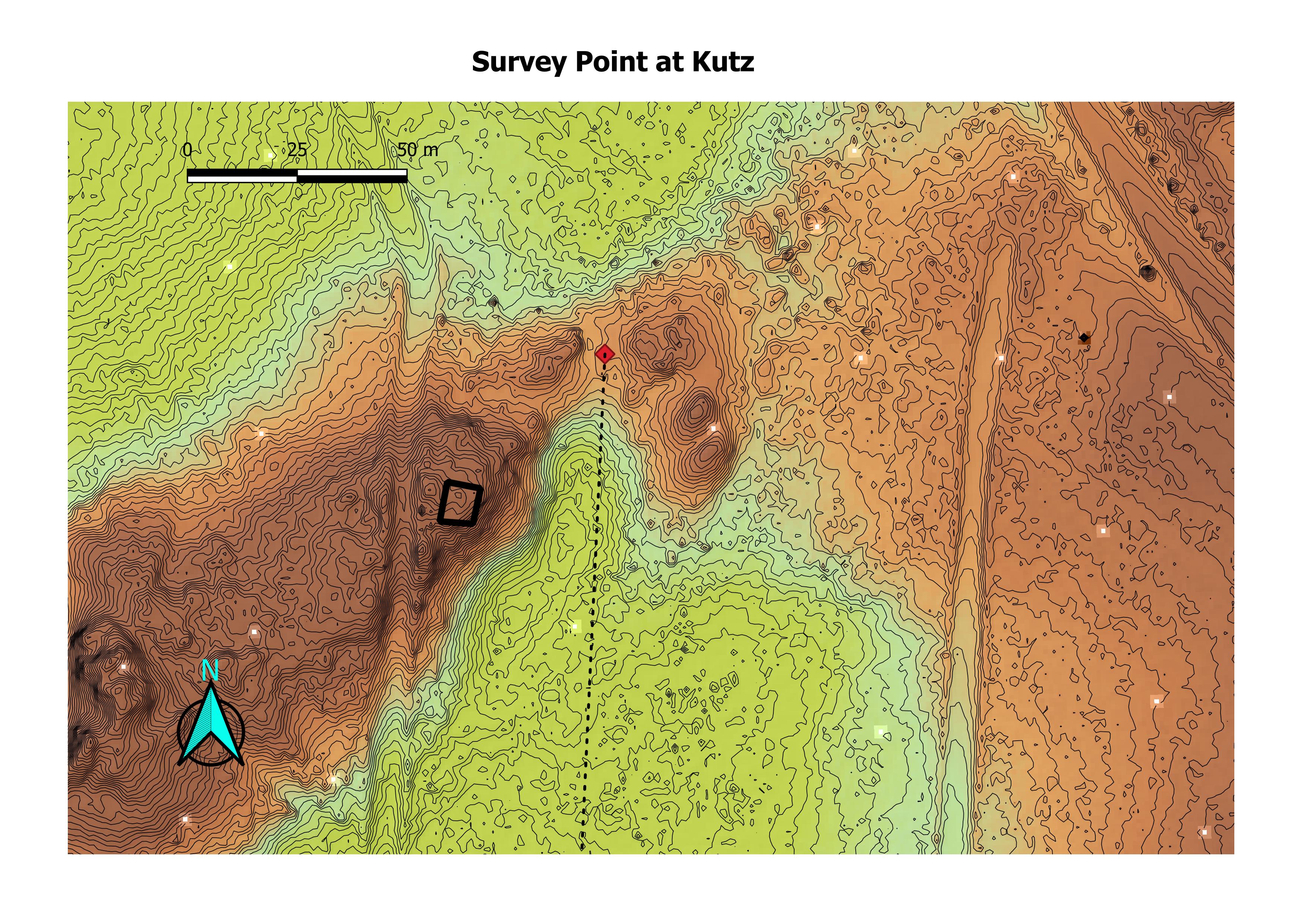
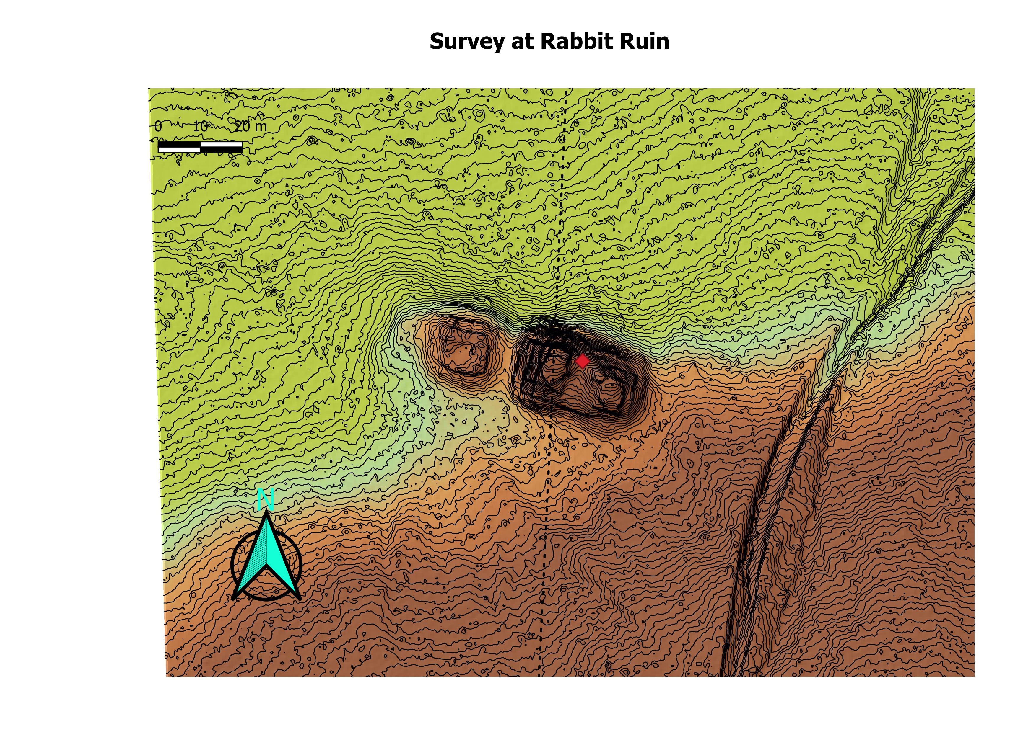
Whether the alignments lead to the canyon, or lead away from the canyon cannot be ascertained. But for this paper we will describe it as starting in the canyon. Beginning at BC-57, some 100 meters east of Casa Rinconada the formalized building alignment goes slightly north east to a swale near the northwest corner of Pueblo Alto. It continues in a straight line to Rabbit Ruin. Rabbit Ruin has an “alley way” through it that may have been the entrance or exit to the canyon. The alignment continues in a straight line to El Faro. From here it goes straight to the swale at Halfway House. On it’s way to Halfway House it runs through a swale on the Carson Divide. From here it goes straight to a ruin and a swale just south of the rom of Kutz Canyon. We call this the Dune Ruin. Here there is an angle point. Through this angle point, the alignment goes slightly northwest to Angel Peak Ruin. From here it goes straight to the great kiva at Aztec West.
In the original work we didn’t get gps coordinates on the at the Carson Divide, and it was identified through LIDAR analysis. The same goes for BC-27.
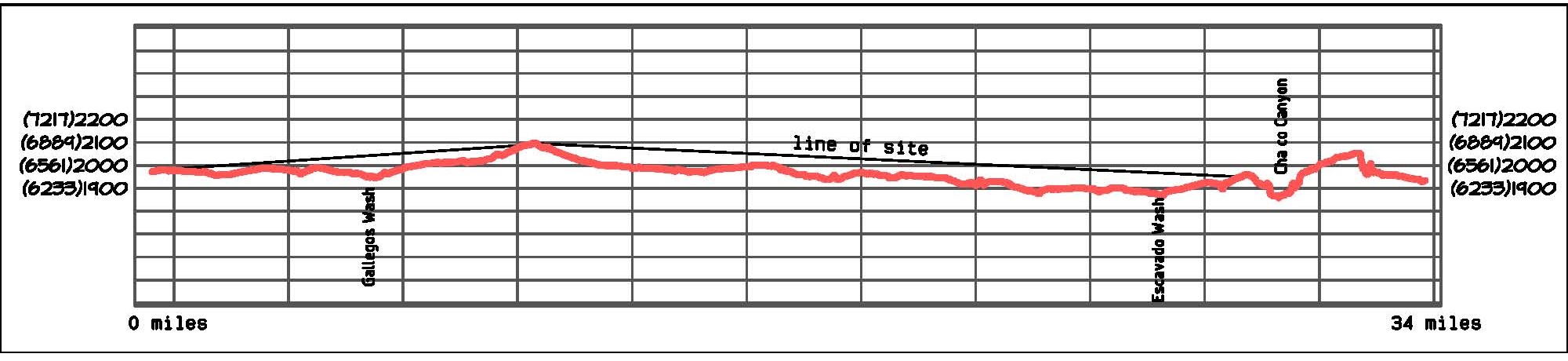
How could they create such straight lines? In surveying there is an exercise called “wiggling in”, some call it “bucking in”. If you can see both ends of a line, you can set a point on the line by moving back and forth until you are finally centered between both points. Between Chaco Canyon and the Kutz ruin there is a spot where you can both ends of the line. This is the ridge known as the Carson Divide. Between the Kutz ruin and Aztec West there is a ridge between the towns of Bloomfield and Aztec where one can see both ends of that line. From these places one could keep breaking down the lines into smaller and smaller segments.
Dating of the alignment can be loosely done by looking at the construction dates of the buildings associated with it. Twin Angels, Dune Ruin, Halfway House, and Rabbit Ruin all seem to be the most closely related. The dates associated with the buildings cluster around 1100. This places the date of the alignment fairly late in Chaco history.
In connecting the observed positions of swales found in the field, it became apparent that here were numerous alignments in the general corridor of the alignment described. This assumes they were straight lines, if they weren’t, all bets are off. The corridor is hour glass shaped, with the alignments converging and diverging around the Pierre’s Complex and being about a mile wide at both ends. This would explain the so called “parallel alignments” found on the bench north of the Pierre’s Complex. The alignment from the Dune Ruin to Chaco Canyon is roughly 33 miles in length, so a slight convergence would appear to be parallel lines when studied up close.
Because of the extensive disturbance at the North end, no conclusions can be made of it there. At the South end where the alignments enter the canyon all of the alignments hit significant points. Several go to Pueblo Bonito, several go down the ramps near Chetro Ketl, and some hit small sites at the base of the cliffs on the north side of the canyon.
Based on this evidence, we think these alignments were the result of a one time event and were not maintained. What this event was or he purpose of the alignments was remains a mystery. Construction and maintaining the alignment would be a huge cost of labor and time. What was not the purpose seems obvious. Transportation of goods can be eliminated. Without beasts of burden or the wheel, all that could be transported was what a man could carry. And if so, he would probably require others to provide water and food. The end result would be very little transported at a great expense of labor. Straight lines appear on modern maps, and they represent any number of things, so assigning a purpose to a found straight line would be very difficult.
Surveyed alignment.
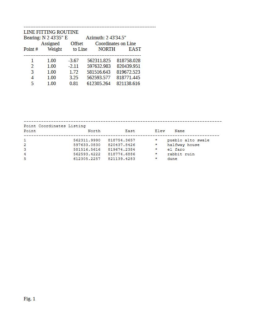
Measurements are in meters.
Galisteo Basin
(+) to expand (-) to collapse
Galisteo Basin Sites
arroyo hondo
galisteo pueblo
paa-ko
pecos
pueblo blanco
pueblo colorado
pueblo largo
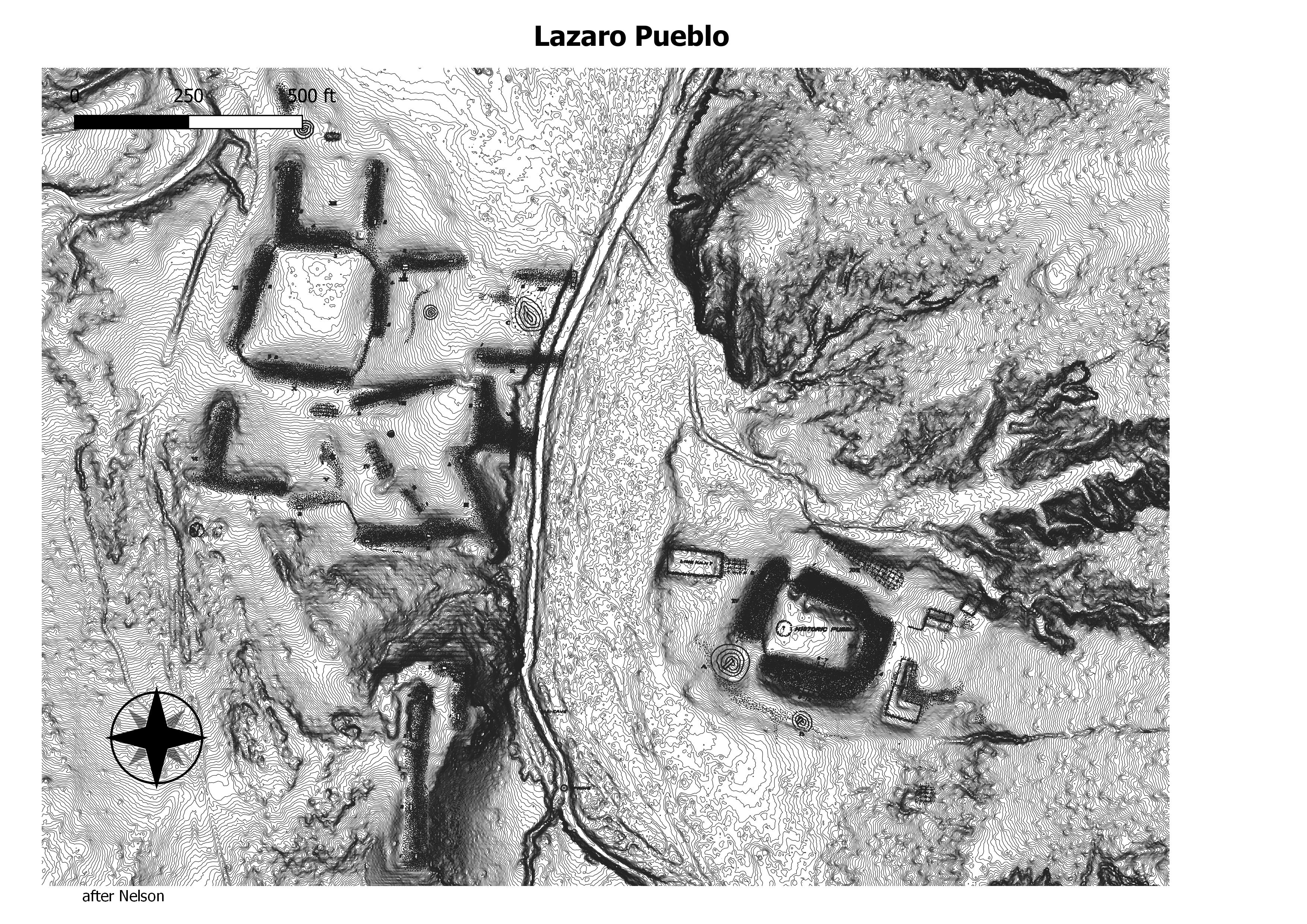
pueblo lazaro
pueblo she
san cristobal
san marcos pueblo
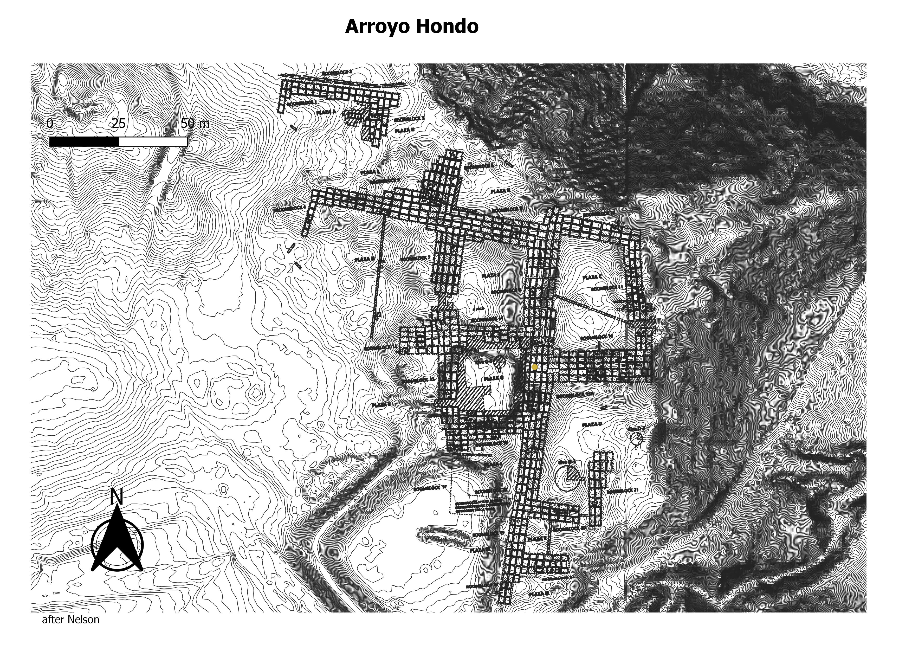
About 1300 C.E., a small pueblo, located just south of present day Santa Fe, New Mexico, rapidly transformed from a one hundred room hamlet to a one thousand-room pueblo boomtown. (GBASPA Working Group)
Pueblo Galisteo has a large footprint—there was little topography to constrain its size. Nelson estimated a total of 1,580 rooms in 26 separate roomblocks, six of which appear to be remnants of the historic period. As mapped by Nelson, the earlier roomblocks are oriented north-south, while the later blocks are on a southeast-northwest axis. For being nearly all adobe, the mounds are quite tall, some on the east nearly 2.5 m high. (GBASPA Working Group)
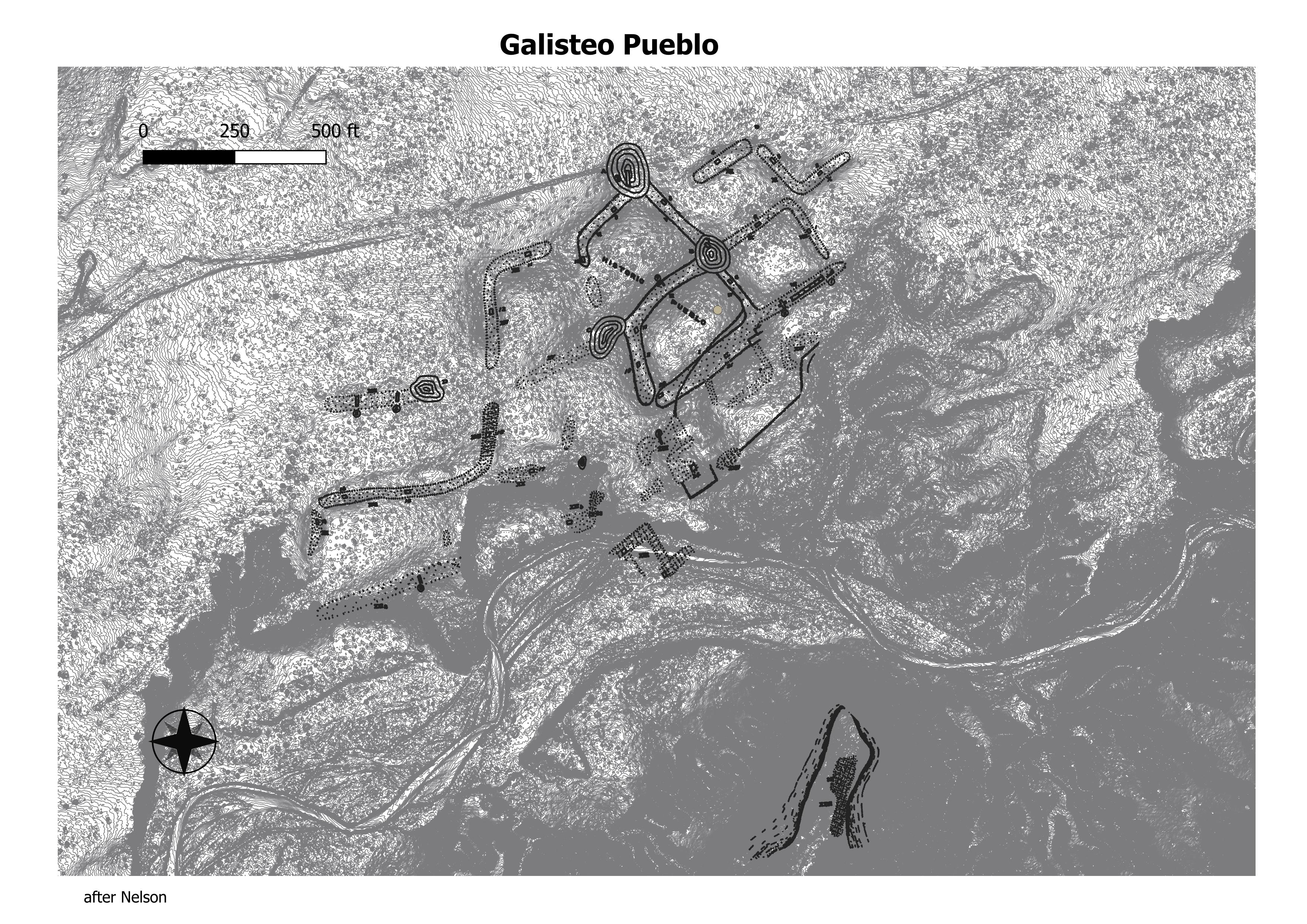
Paa-ko Pueblo, a large Classic Ancestral pueblo and a historic-period pueblo located at the eastern base of the Sandia Mountains, approximately 1 mile north of the town of San Antonio (Bernalillo County). The site is believed to have been occupied from the beginning of the AD 1200s and with a hiatus in the occupation in the AD 1400s. It was finally abandoned during the latter half of the AD 1600s. (GBASPA Working Group)
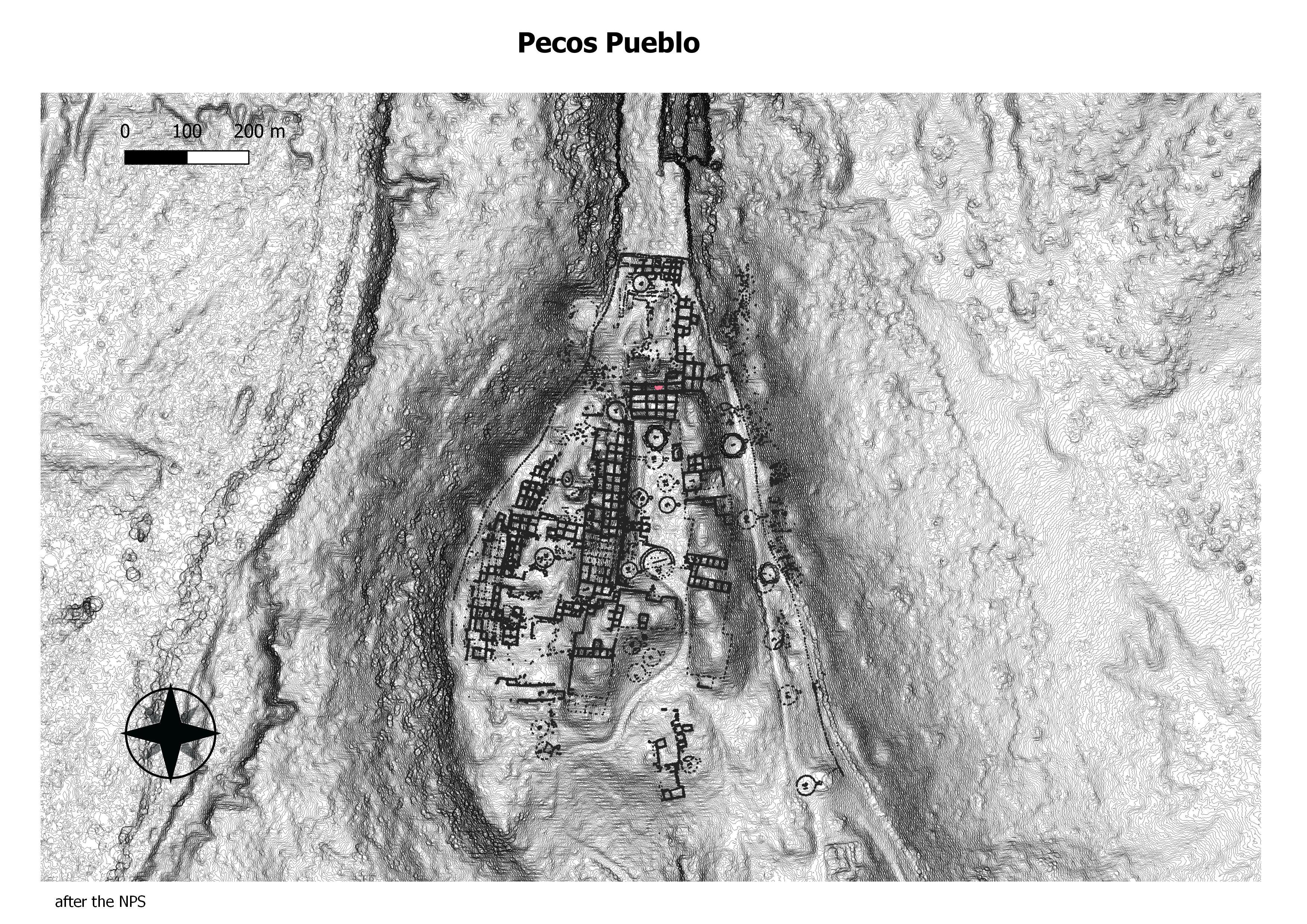
Pecos Pueblo known in the Towa language as P`ǽ kilâ which translates to “the place above the water” is a very special place for the Pecos descendants currently living at Jemez Pueblo. During the time of the great migration by Ancestral Puebloans the P`ǽ kish were a part of the Hemish (Jemez people) and traveled the northern and northwestern mountain ranges, broad valleys and mesa country in the southwestern part of the United States. The P`ǽ kish branched away from the Jemez and took a southeastern migration route stopping in Tǫ́ǫk’ô P’ǽ̨æ̨wâamu (Corn Cob River Valley) or the Pecos River Valley, where they built villages. It wasn’t until the mid-15th century when all the P`ǽ kish villages consolidated into one big village on a narrow ridge above Wǽ̨hæ̨ P’ǽ̨æ̨wâamu (Squash River Valley) or Gloretta Creek. The P`ǽ kish lived in this village on this narrow ridge as a great and powerful nation before the Spaniards came. (Pueblo of Jemez)
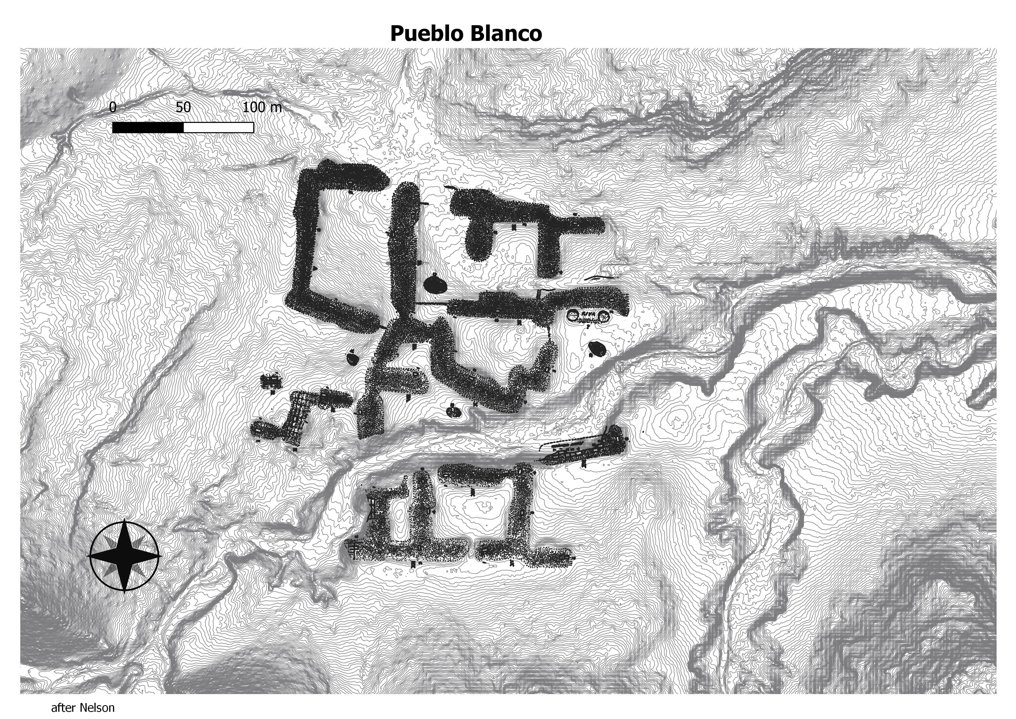
Pueblo Blanco is a large Pueblo IV–period Ancestral Pueblo village on the west side of the Galisteo Basin near Cerro Pelón. Nelson estimated that the ruins retain at least 1,450 ground-floor rooms. (GBASPA Working Group)
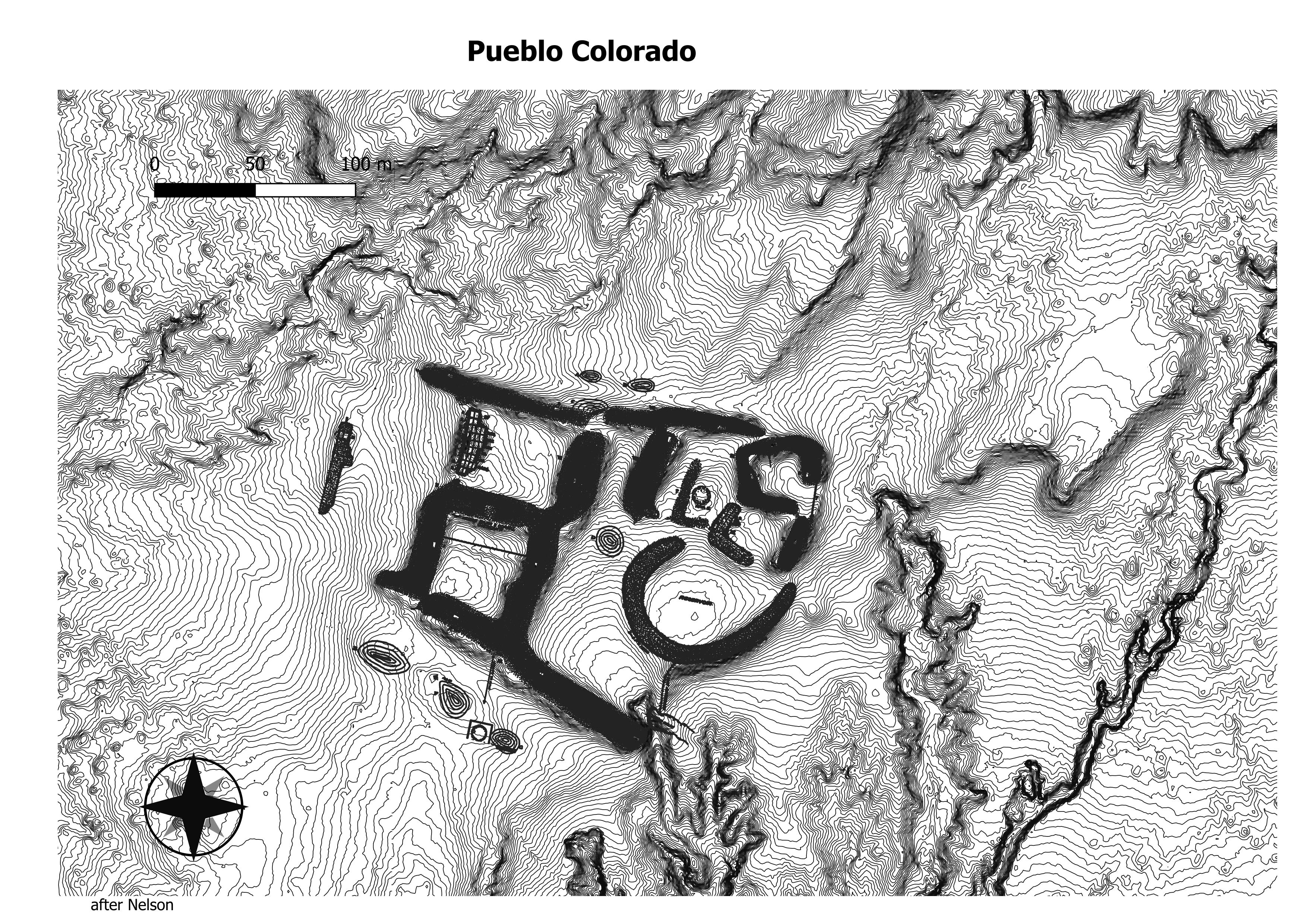
It is adjacent to the Arroyo de la Jara which often has water in it, and by a side canyon where springs are present at the base of the sandstone cliffs. Tano descendants resident at the Keres pueblo of Santo Domingo Pueblo claim the ruins of the Galisteo Basin as ancestral villages and refer to LA 62 as Tze-man Tuo, or “place where the eagle’s claw is inside.” The name Pueblo Colorado was coined by N. C. Nelson (1914), referring to the red sandstone cliffs and building stone found there. (GBASPA Working Group)
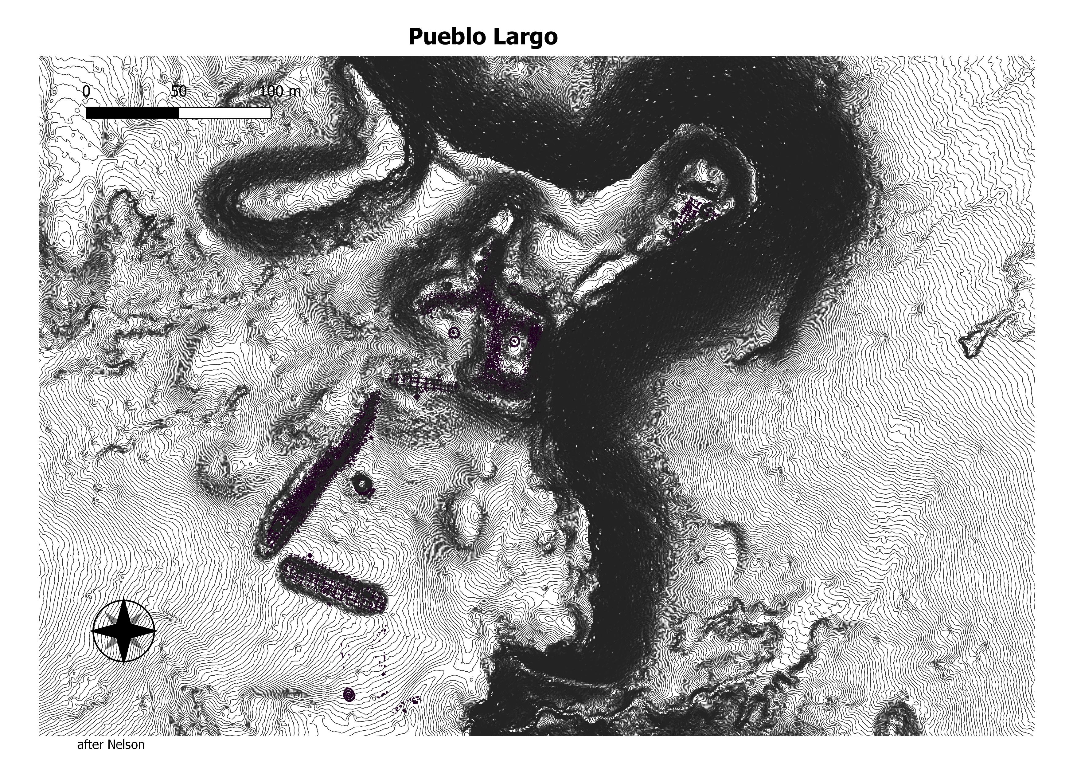
As part of the San Cristóbal Ranch, Pueblo Largo is entirely privately owned. It is listed as Number 110 on the State Register of Historic Places.
Pueblo Largo (Long Village) is the southeastern most and smallest of the eight large Galisteo Basin pueblos occupied during the Classic Period (A.D. 1325-1600) of the Northern/Central Rio Grande cultural sequence. Largo contained 489 shaped sandstone ground-floor rooms and half as many second story rooms, for a total of 734, as estimated by Nels Nelson in 1912. (Maxwell Museum)
Located in the basin of the Galisteo River south of Santa Fe, it was home to a clan of the Tanoan peoples at the time of Spanish colonial contact in the 16th century. It was abandoned in the aftermath of the Spanish reconquest of the area after the 1680 Pueblo Revolt, its people believed to have eventually settled at First Mesa among the Hopi.[3] The site was declared a National Historic Landmark in 1964. (Wikepedia)
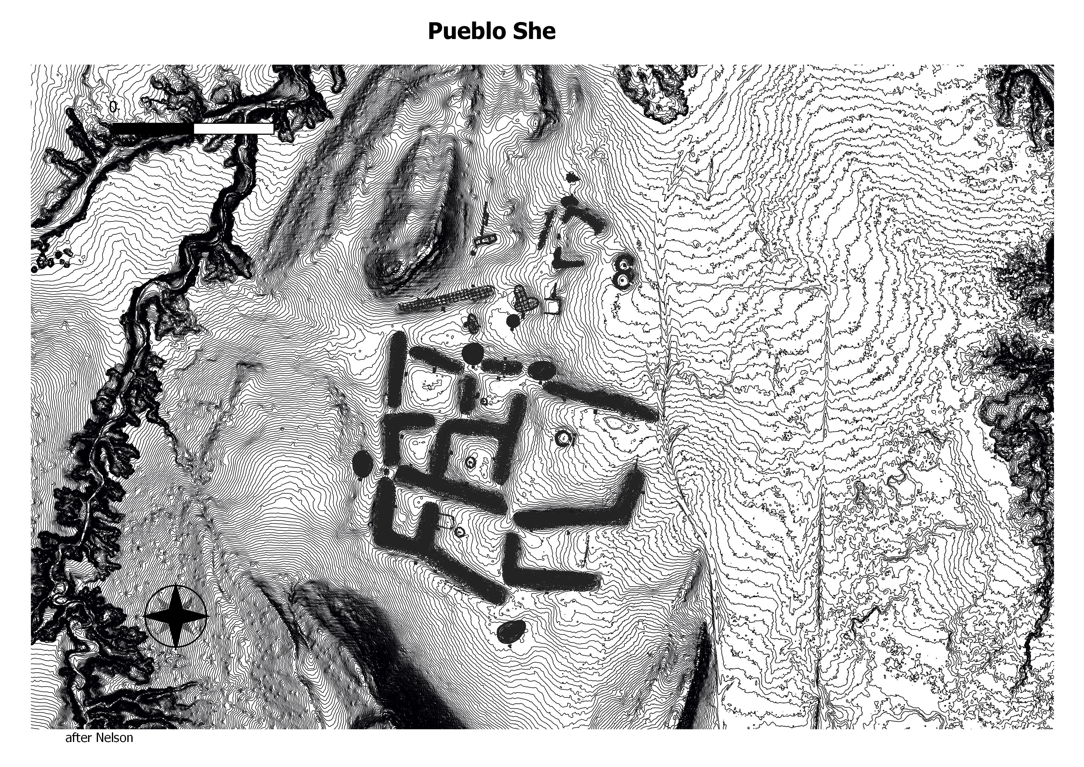
Pueblo Shé is one of the largest Galisteo pueblos.
It is located adjacent to the Arroyo de la Jara, downstream from Pueblo Colorado. The principal occupation is the large Classic-period (AD 1375–1500) village of Pueblo Shé proper. Nelson (1914) reports 5 areas of mounded refuse, 14 roomblocks, and estimated 1,543 ground floor rooms. (GBASPA Working Group)
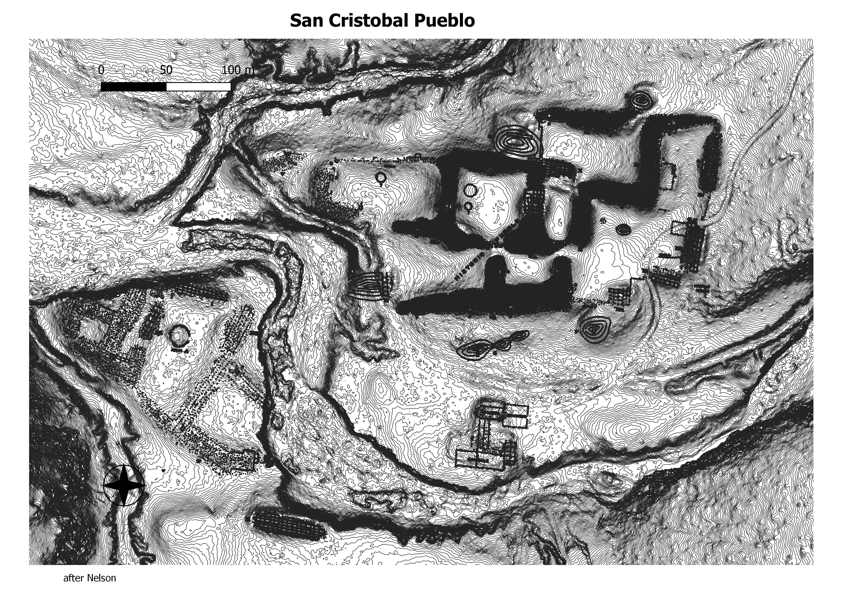
It differs from many of the pueblos in the Galisteo Basin in its greater use of stone as a building material. It is also noteworthy for its prolific rock art in the adjacent boulder field and cliffs and for the Spanish convento with church wall standing 4 m high. It is on the banks of the Arroyo San Cristóbal, a permanent water source. Nelson identified seventeen roomblocks and estimated 1,645 rooms. (GBASPA Working Group)
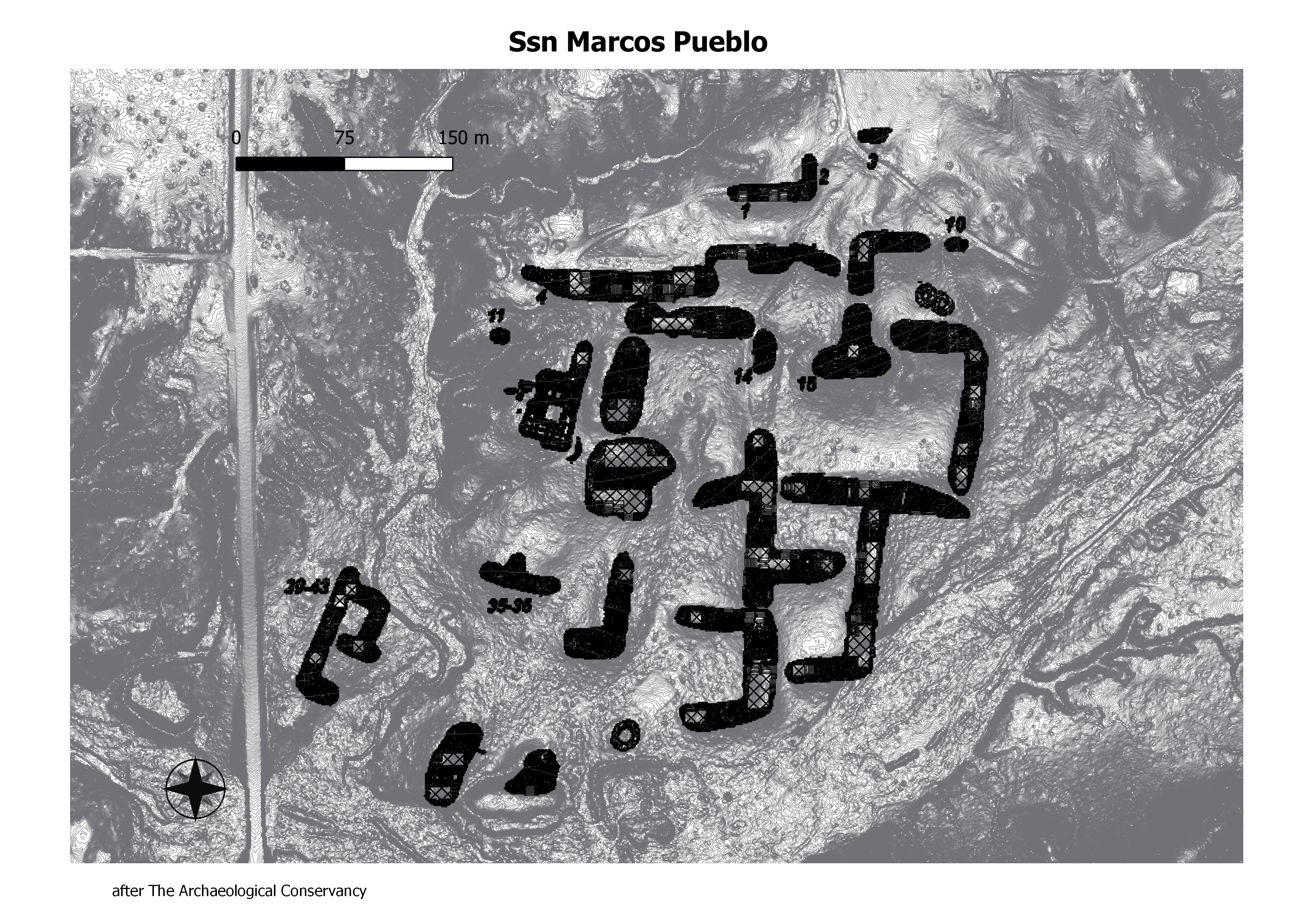
Pueblo San Marcos was one of the largest prehistoric adobe settlements in North America, consisting of an estimated 2,000 adobe rooms in 22 roomblocks, some thought to be two and three stories high, enclosing ten to twelve plazas; nine estimated midden areas; ten estimated kiva depressions; the remains of an early seventeenth-century Spanish Colonial mission complex; a possible cemetery; agricultural features southeast and west of the site’s main architectural features; at least two Spanish Colonial–period metallurgical smelting features; and a sherd and lithic artifact scatter that extends from the central architectural portion of the site in all directions. (GBASPA Working Group)
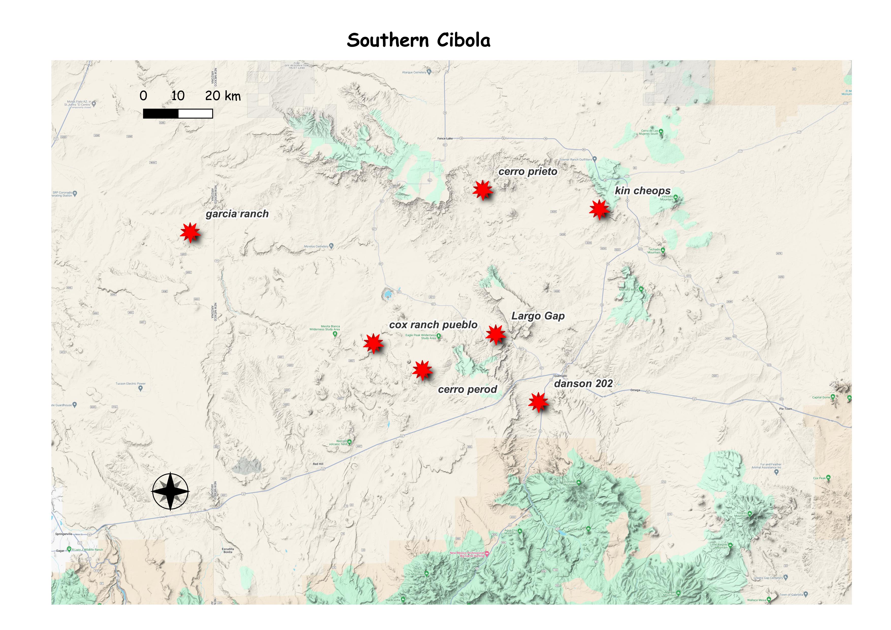
Southern Cibola
(+) to expand (-) to collapse
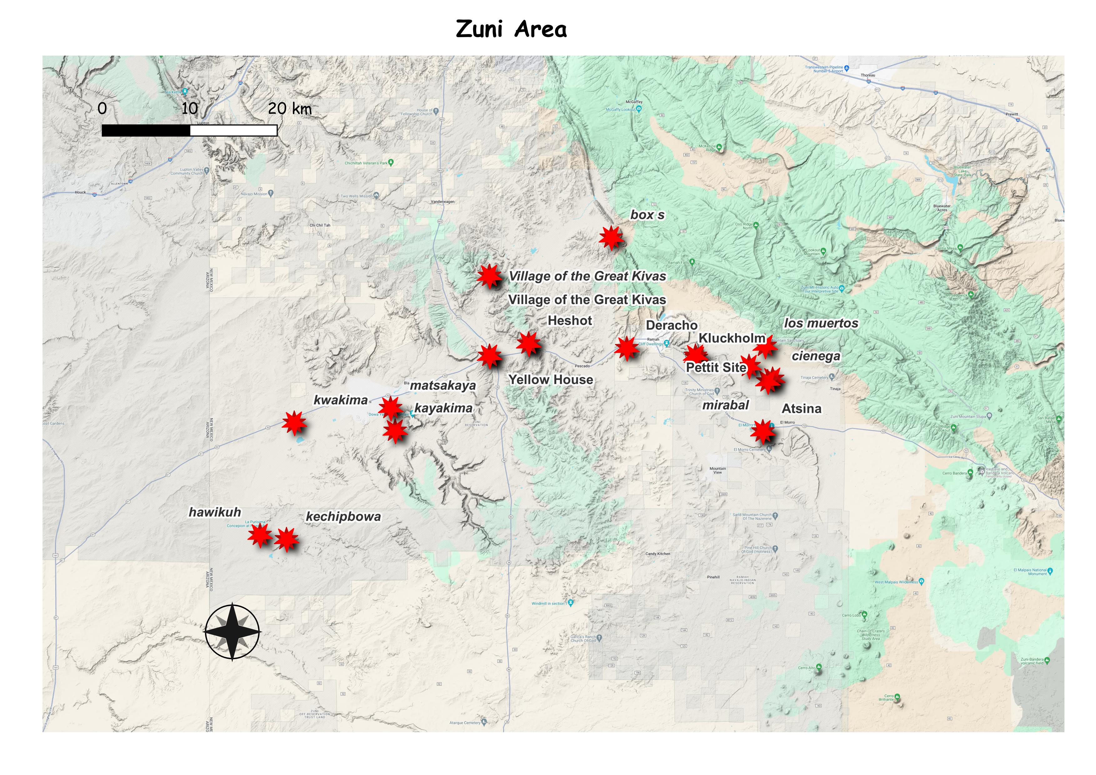
Zuni Area
matsaki
pescado west
petit site
southern cibola
spier 61
upper pescado
village of the great kivas
wimmayawa
wimmaywa
yellow house
zuni area
zuni church
arhcheotekopa
astina
box s
cienaga and mirabal
day site
deracho
jack’s lake
kawikuh
kechipbowa
kluckholm
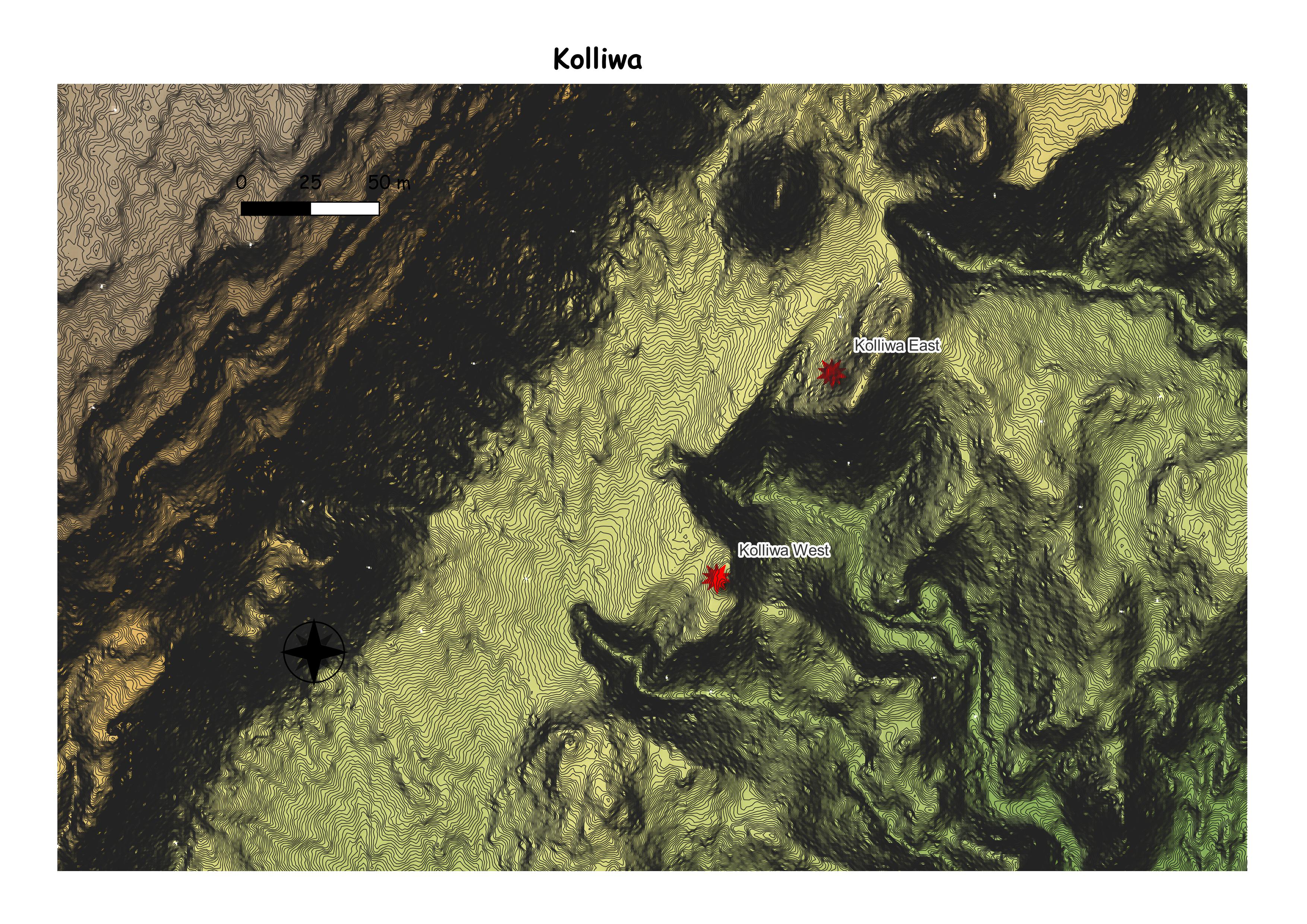
kolliwa
kyakima
los muertes
lower pescsdo
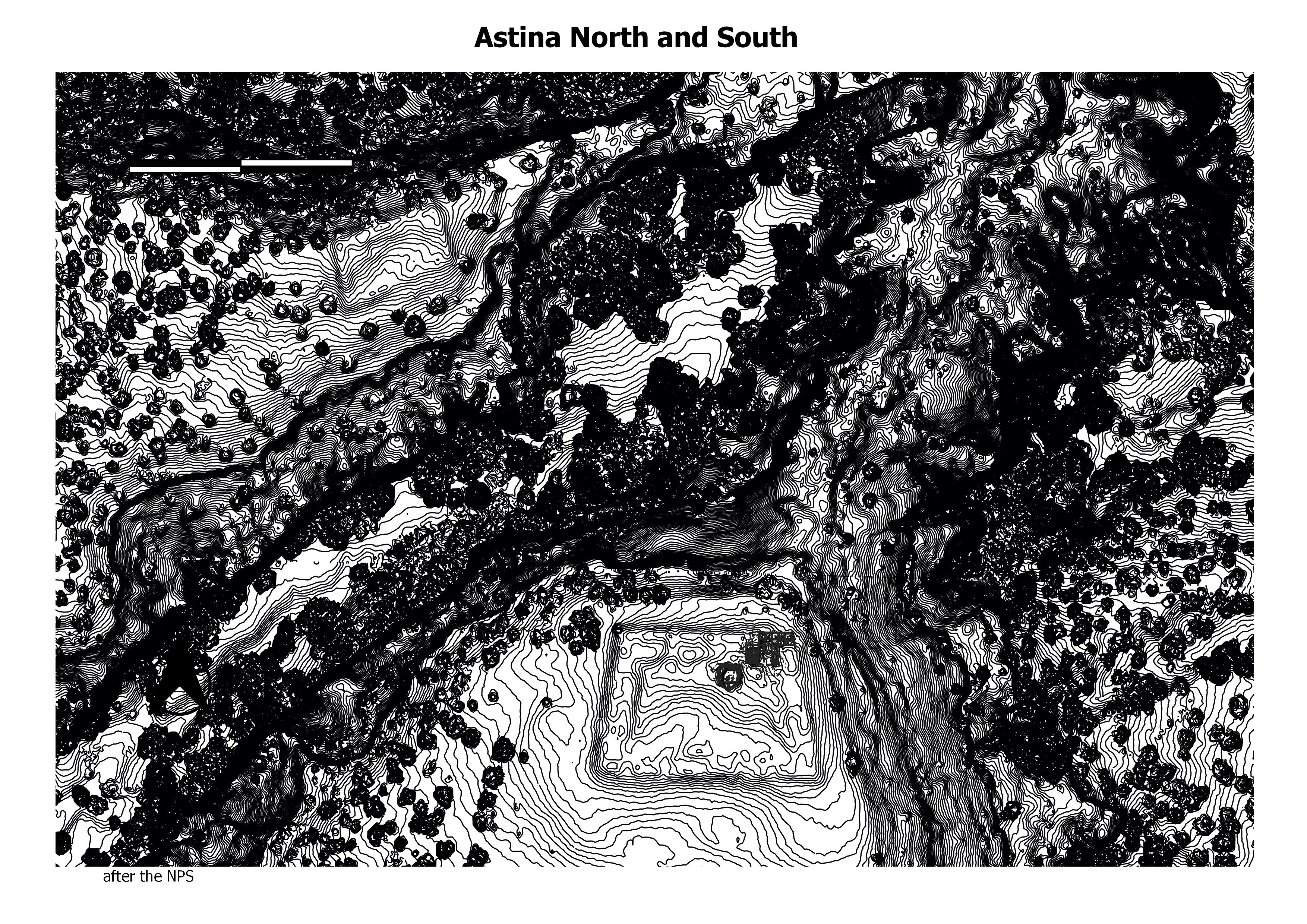
Atsinna Pueblo, the largest of the pueblos in El Morro, dates from about 1275 CE. The community here thrived, as there were reliable resources of food and water found in the valley. The pueblo measures about 200’ by 300’ and would have housed between 500 and 600 people at its peak. Approximately 355 interconnected rooms surround an open courtyard. (The NPS)
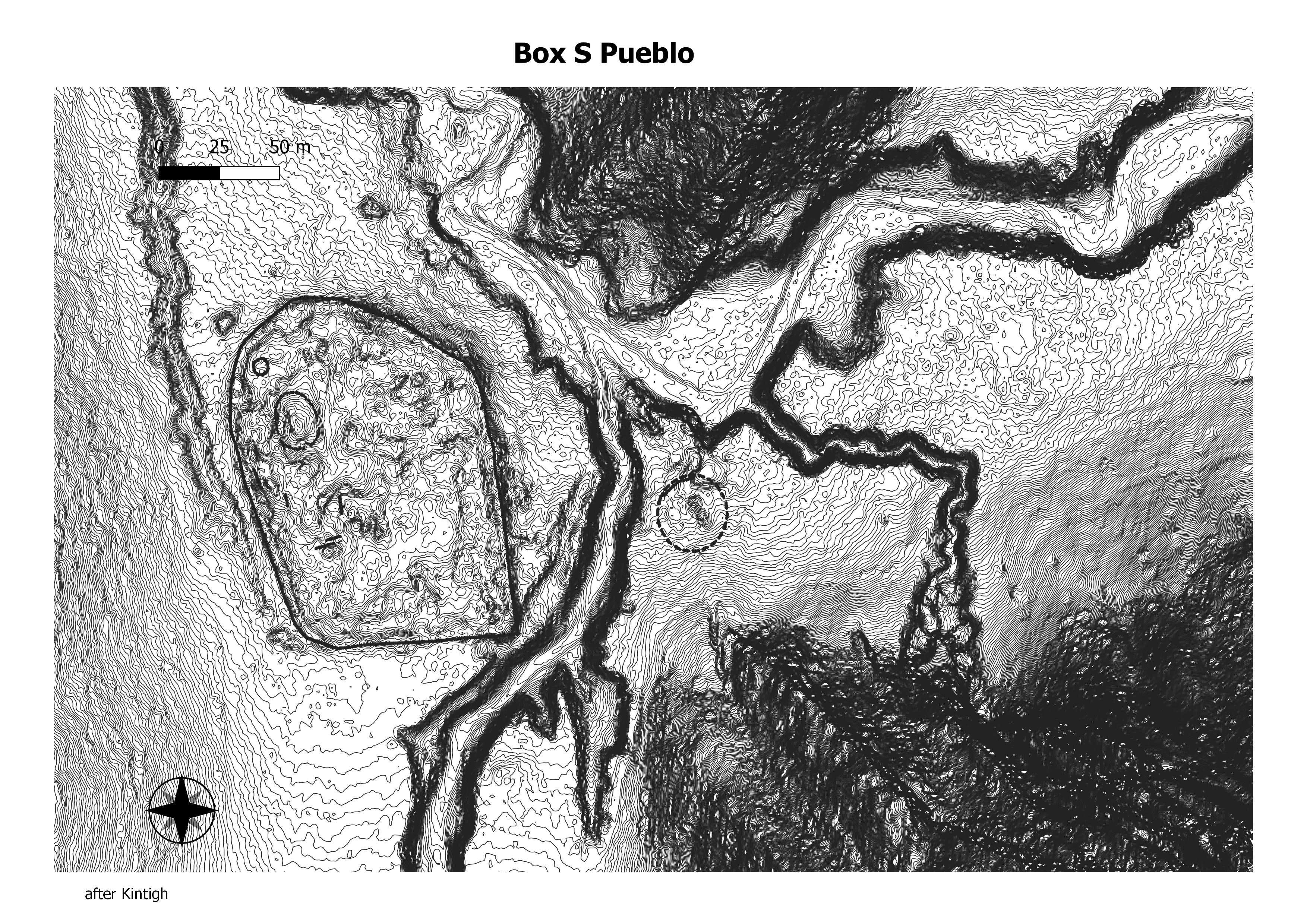
Box S Pueblo (LA5538), in the northern portion of the Zuni reservation , is roughly rectangular and apparently contained more than 1,000 two-story rooms. The site’s perimeter was apparently formed by a row of rooms that were two stories high in most places. On the eastern side of the pueblo there was a double wall, as well as an architectural addition outside the exterior wall. An unroofed, oversized great kiva some 28 m in diameter was located across the arroyo and about 70 m east of the main room block. Based on surface ceramics (no treering dates are available), the pueblo’s large size, and the presence of the oversized great kiva, Box S probably dates from about A.D. 1225 to 1290 . (Deborah L. Huntley)
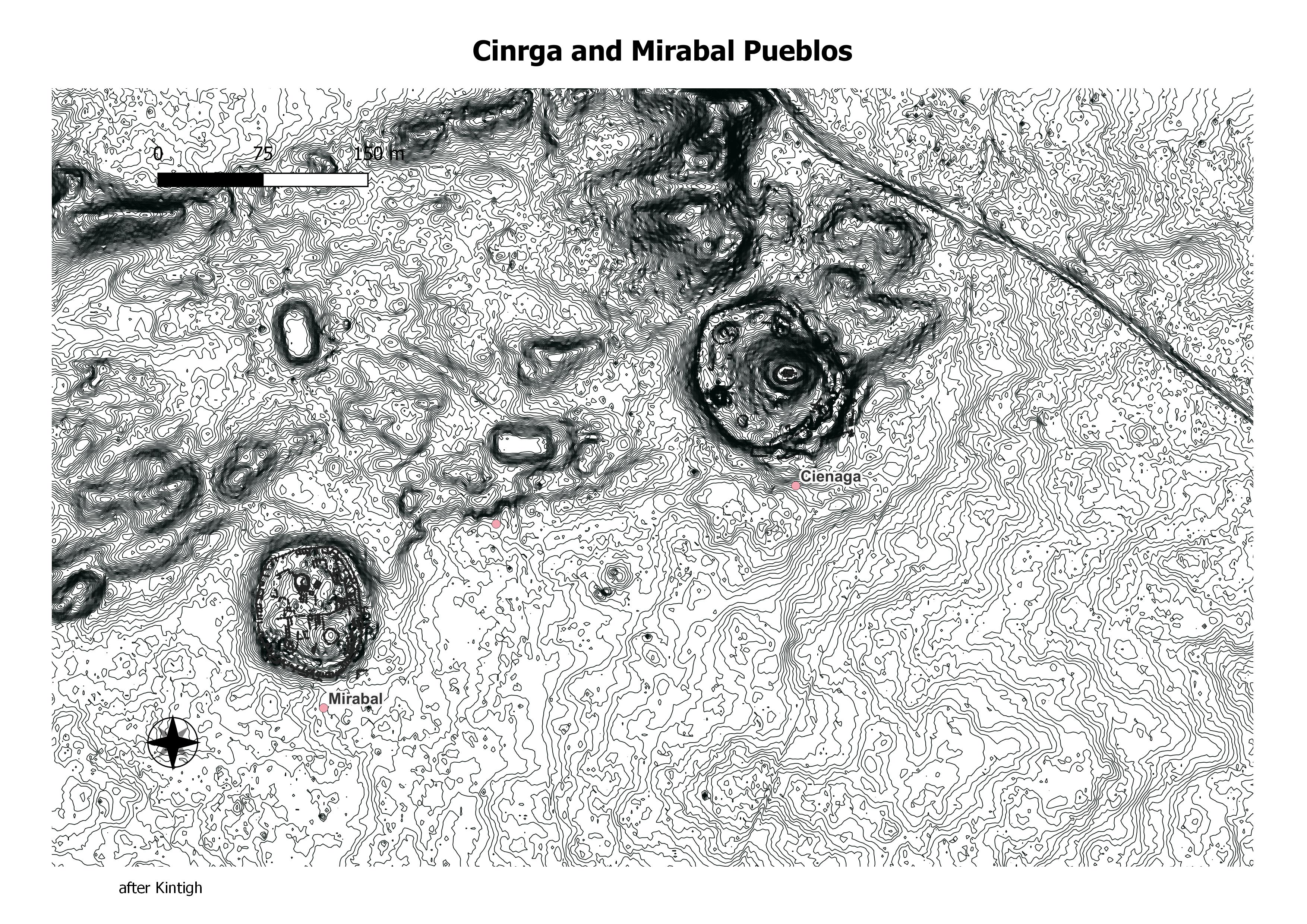
Cienega Pueblo (LA425; CS 140) is located in the center of the El Morro Valley . The pueblo is oval , probably contained about 500 rooms (Kintigh 1985a: 48), and appears to have been constructed in the A.D. 1280s and later expanded. The pueblo of Mirabal (LA426; CS 141) is located about 300 m southwest of Cienega in the El Morro Valley . (Deborah L. Huntley)
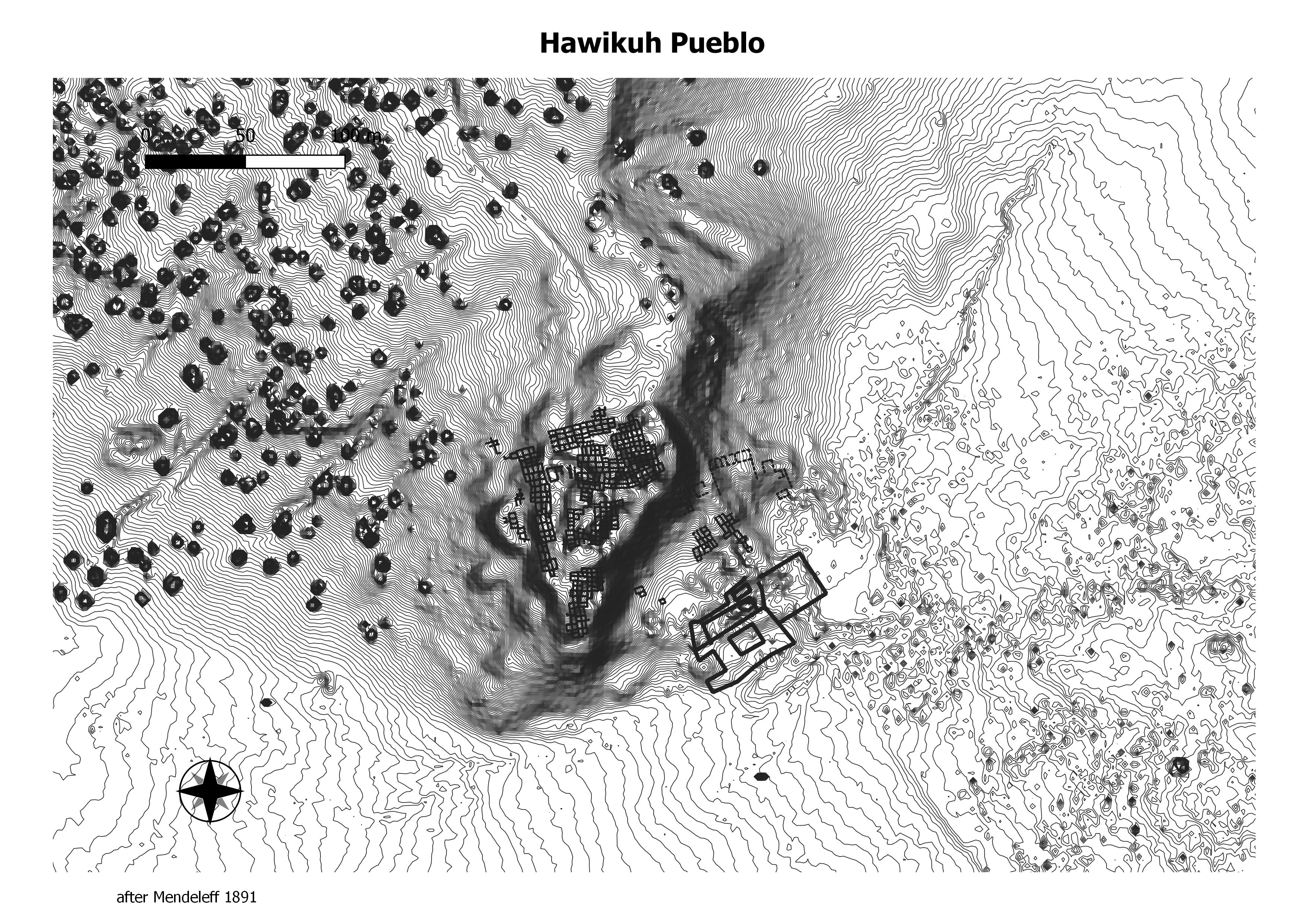
Hawikuh (also spelled Hawikku, meaning “gum leaves” in Zuni), was one of the largest of the Zuni pueblos at the time of the Spanish entrada. It was founded around 1400 AD. It was the first pueblo to be visited and conquered by Spanish explorers. The Spanish chroniclers referred to it as Cevola, Tzibola, or Cibola. (Wikeprdia)
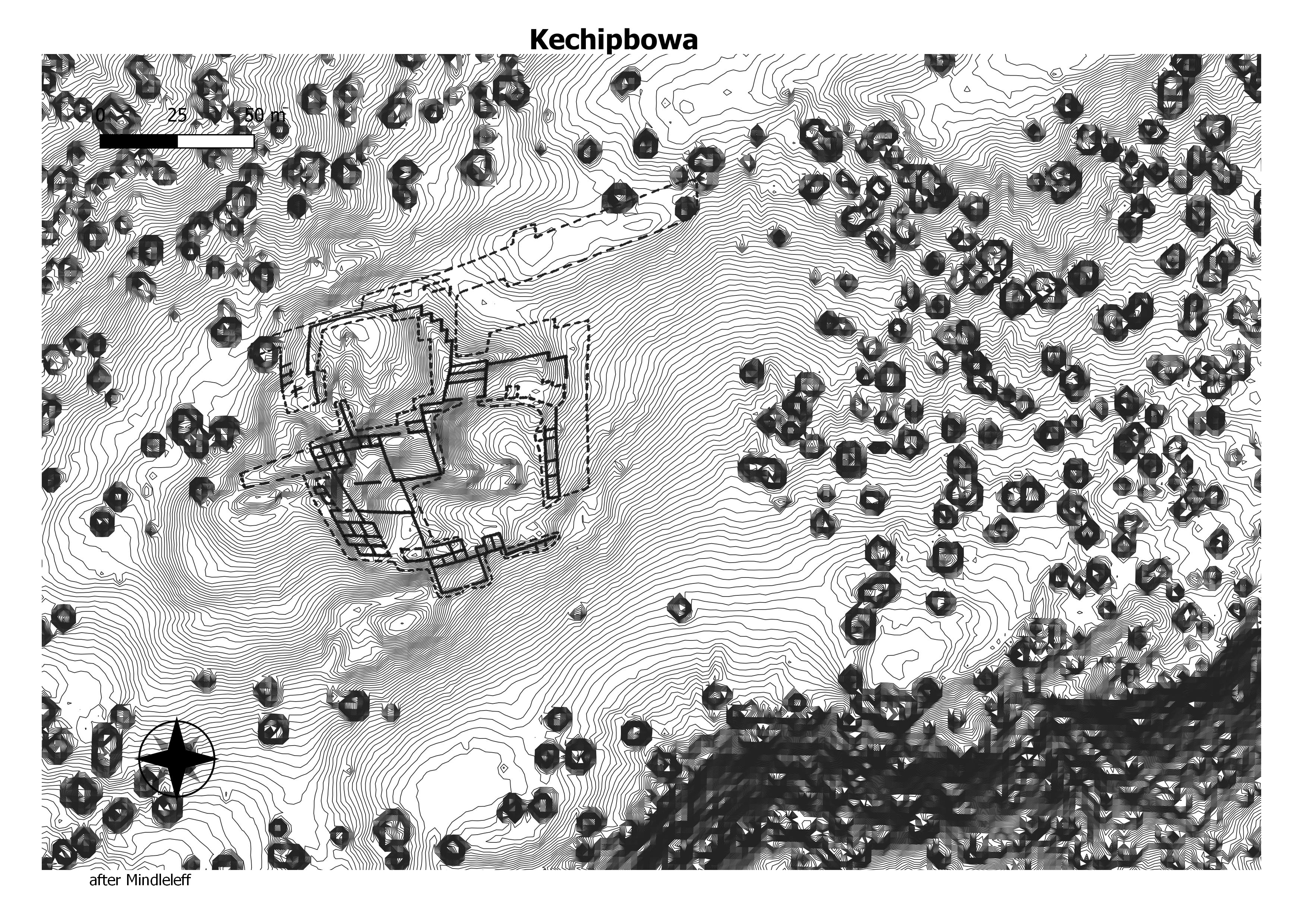
Kechipbowa is located about 3 miles (4.8 km) east of Hawikuh. It is a multifaceted site, including structures associated with occupation during the 15th and 16th centuries, but also with remains that are likely older, and the remains of another 17th-century Spanish mission church. (Wikeprdia)
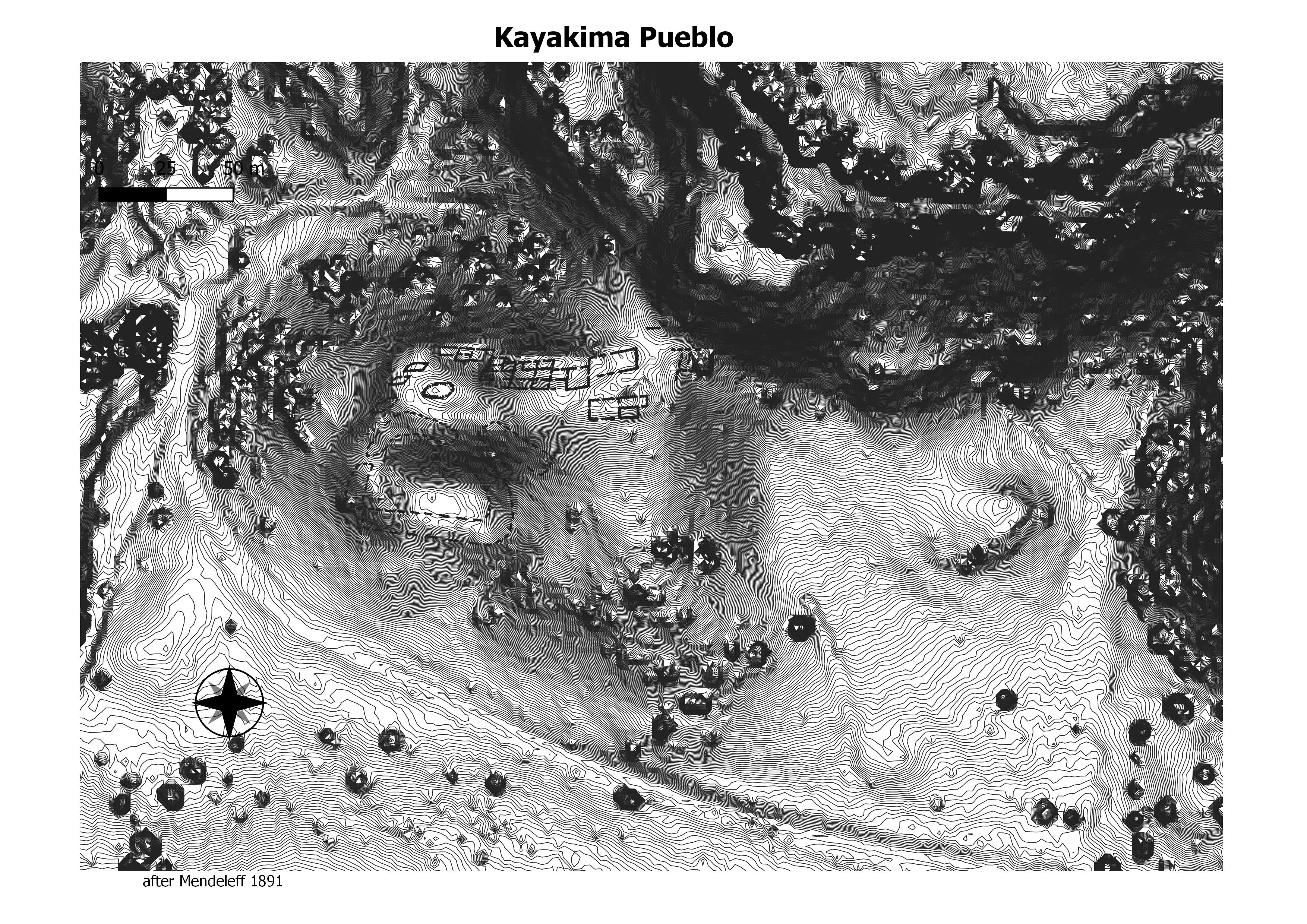
This famous pueblo was occupied at the time
of the Spanish arrival in 1539. In his 1885 report Cushing
(Green 1979: 172-175) indicates that according to Zuni
tradition, Estevan was killed at Kyaki:ma (not Hawikku).
Eggan and Pandey (1979) gave Cushing’s translation for the
name of the village as “house of eagles.”
(Settlement, Subsistence, and Society in Late Zuni Prehistory)
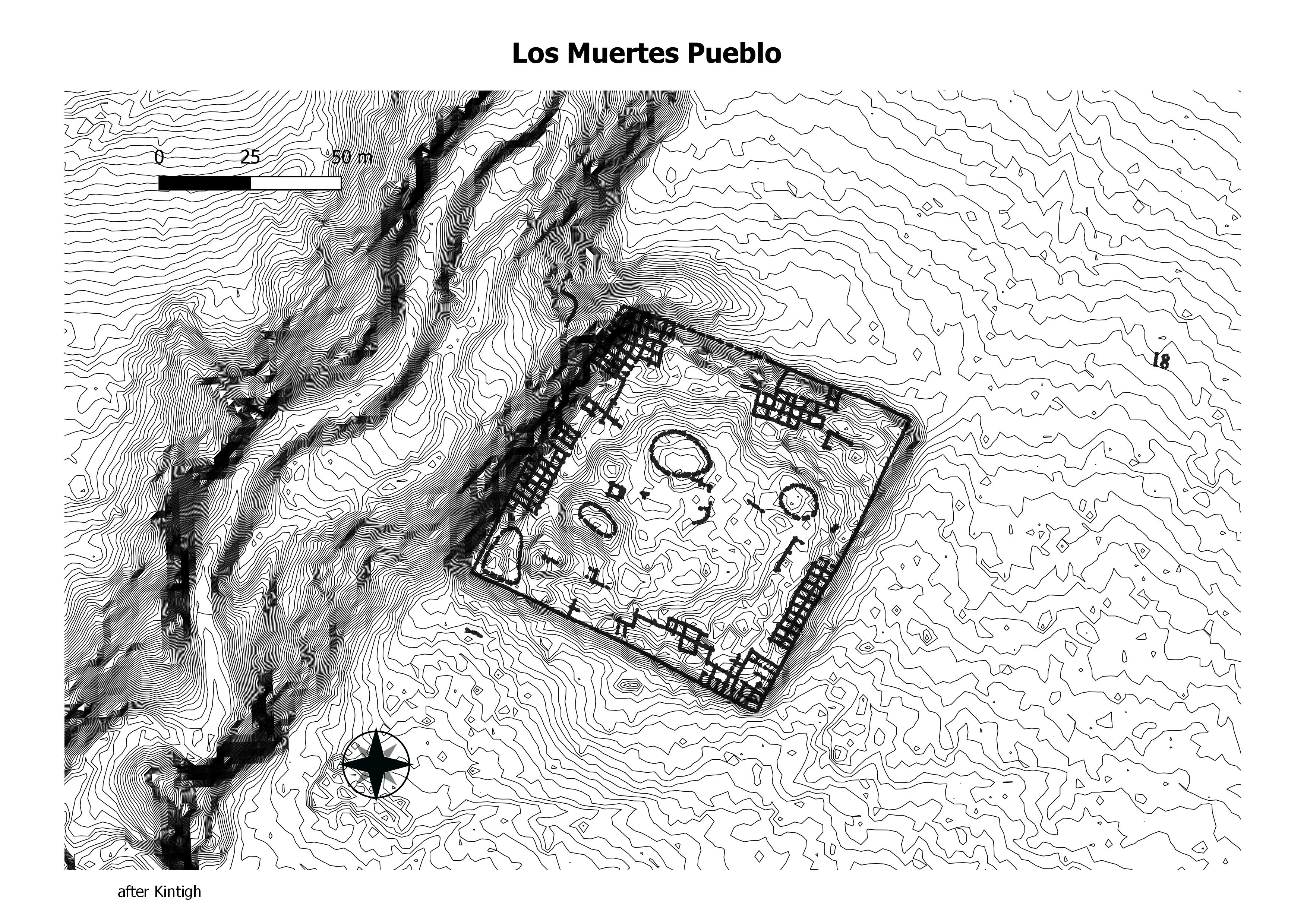
Pueblo de los Muertos ( LA1585; CS 139) is one of several large, nucleated pueblos located in the El Morro Valley . The available archaeological evidence suggests that the pueblo was constructed according to a preconceived plan with later additions (Watson and others 1980). Pueblo de los Muertos is rectangular in shape and consists of three to four rows of rooms on each side of an open plaza . The inner rows of rooms are built over plaza trash and thus appear to have been added some time after the pueblo’s initial construction. The pueblo contained nearly 900 rooms by its final occupation. (Deborah L. Huntley)
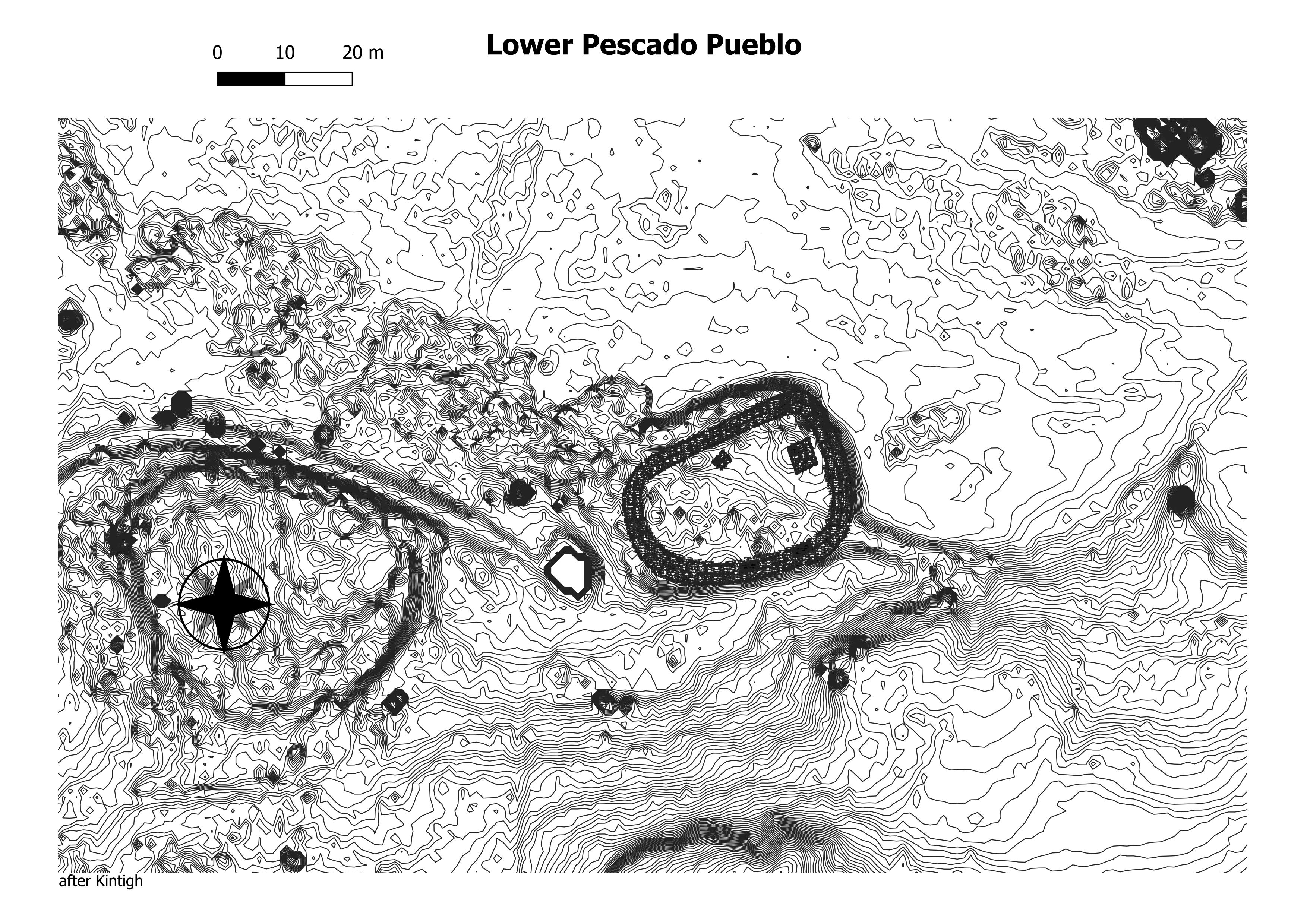
Lower Pescado Village is located along the Pescado River just east of Heshotauthla Pueblo and 25 km (15.5 miles) east of modern Zuni Pueblo . The number of prehistoric rooms is estimated at around 420 (Kintigh 1985a: 53), and the Columbia excavations indicate that the prehistoric component of the pueblo may date as early as the twelfth century and certainly to the fourteenth century (Rothschild and Dublin 1995: 19). (Deborah L. Huntley)
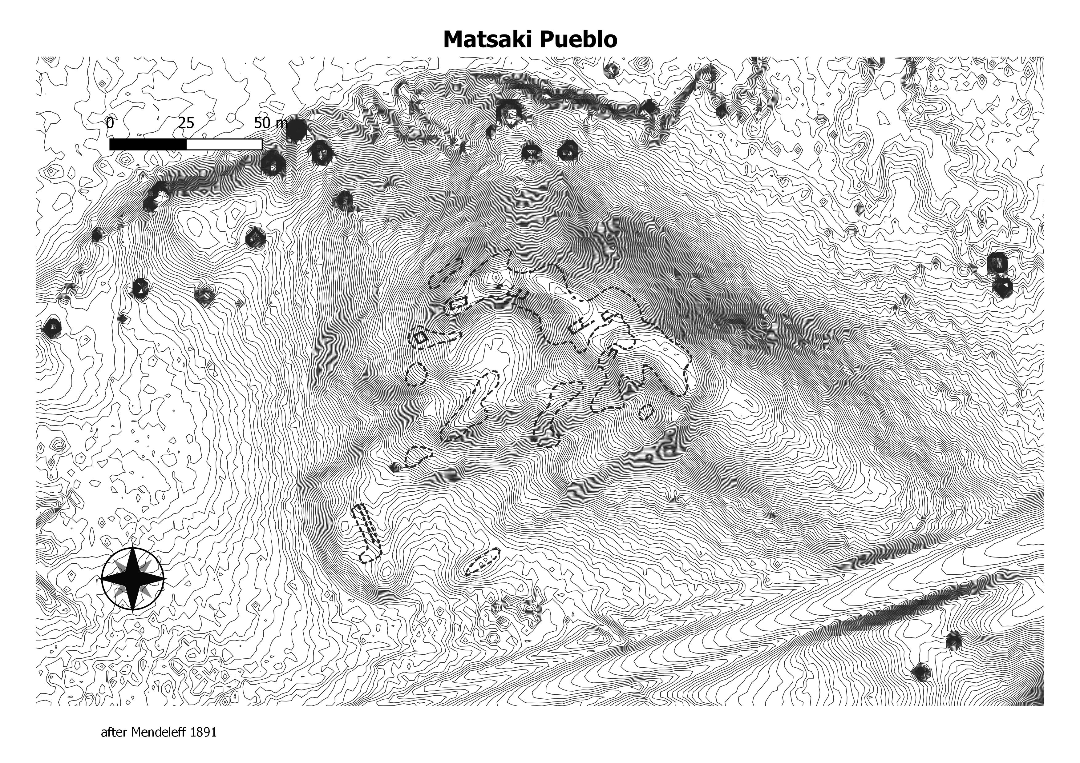
The importance of Matsaki was set forth by Castaneda, who described it, in the form Mac;aque, as “the best, largest, and finest village of that [Cibola] province” and “the
only one that has houses with seven stories.'”
It was situated about three miles east-southeast of present Zuni, a short distance from
the northwestern talus slope of the great mesa of Tawayi’ilane, or Corn mountain, popularly but improperly called “Thunder mountain” from Cushing’s misinterpretation. (
(The Six Cities of Cíbola, 1581–1680 by F. W. Hodge)
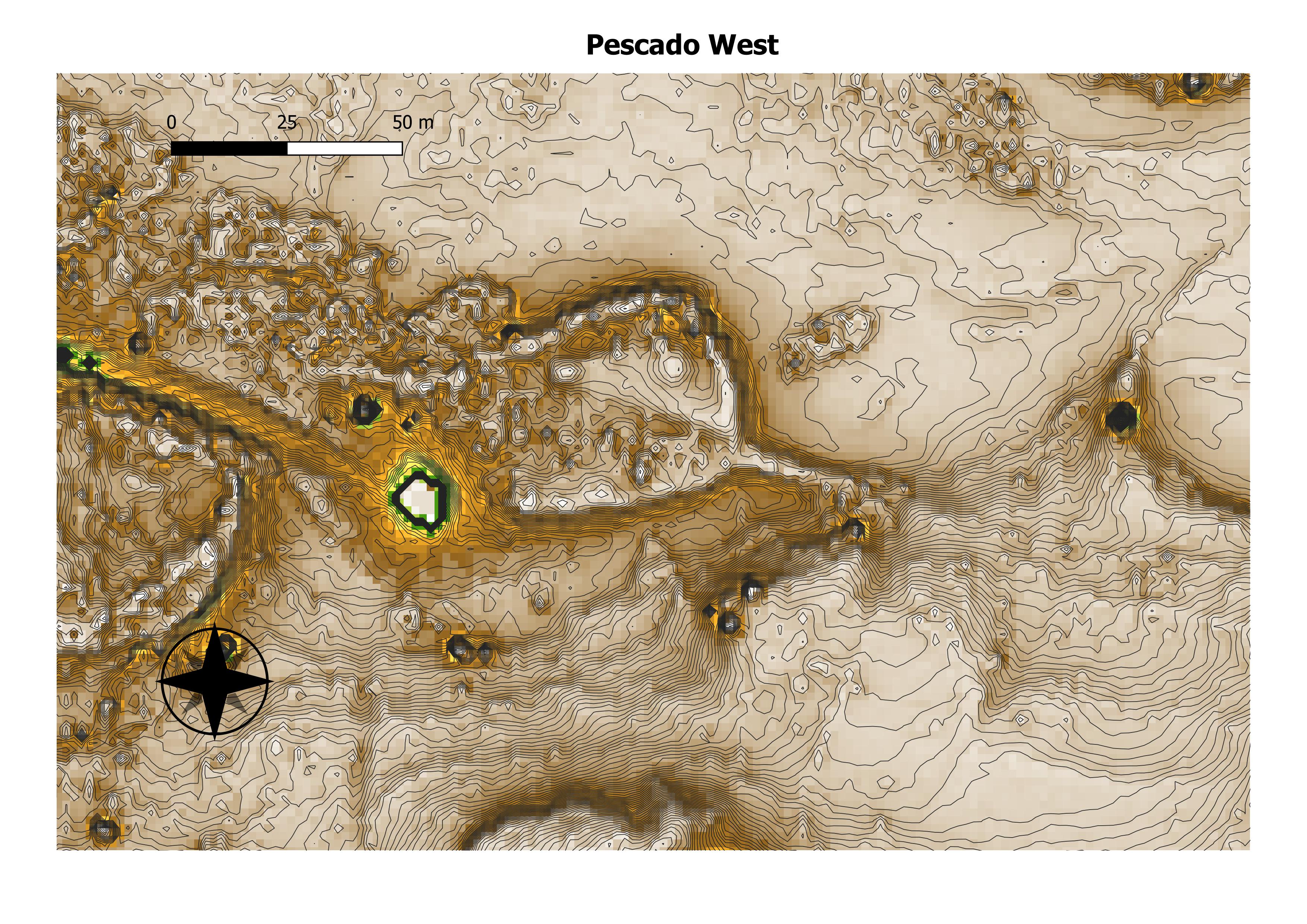
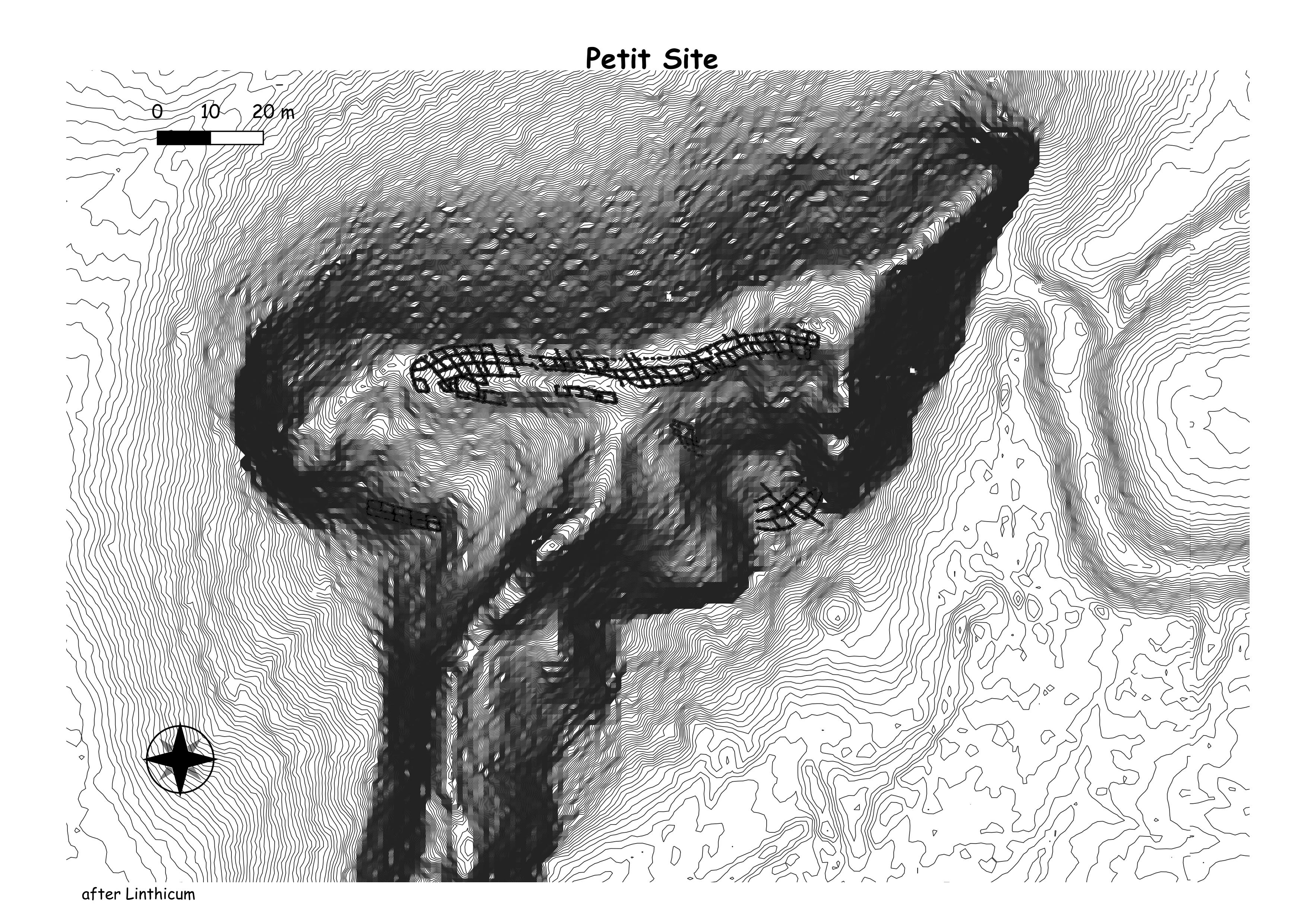
Pescado West is one of three sites in the
vicinity of two major springs located along the Rio Pescado.
Lower Pescado Ruin is about 50 m east and Upper Pescado
Ruin is about 600 m east. All three ruins were identified to
Simpson as ancestral Zuni village. (Kintigh)

The site lies on a basalt flow. from the base of
which (directly below the north wall of the site) flows Upper
Pescado Spring. Sandstone outcrops are on the mesa slopes
about 250 m north of the site. (Kintigh)
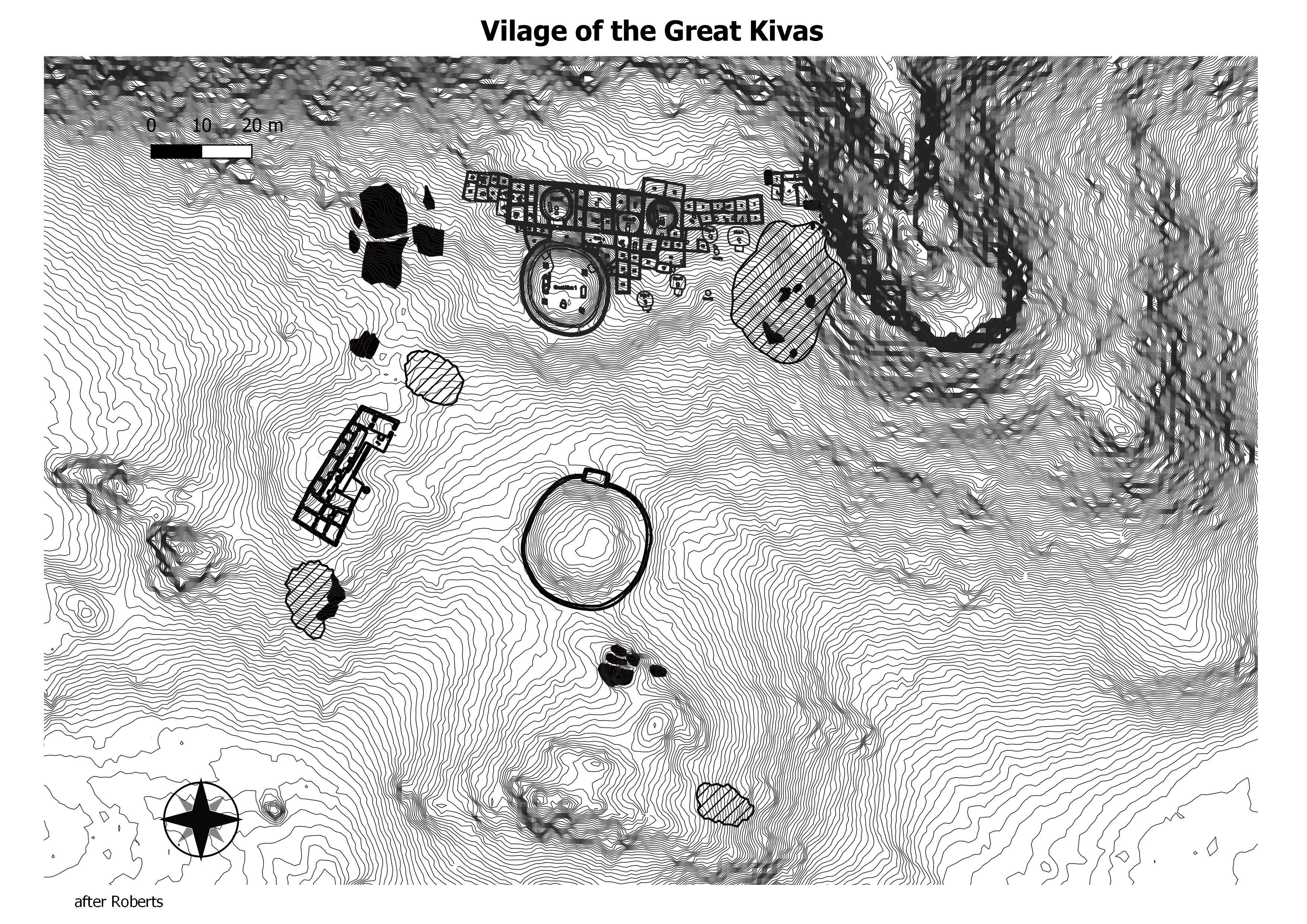
The site consists of a large masonry building, two great kivas, and two smaller masonry buildings. There are several small pit structures to the south and southeast of the main building and three kivas housed in the building. A full description of this site has been published by Roberts (1932) and summaries have appeared elsewhere (Stuart and Gauthier 1981; Marshall et al. 1979; Powers et al. 1983). Stereo aerial imagery of the site was obtained by the Anasazi Monuments Project in 1986. (Chaco Research Aechive)
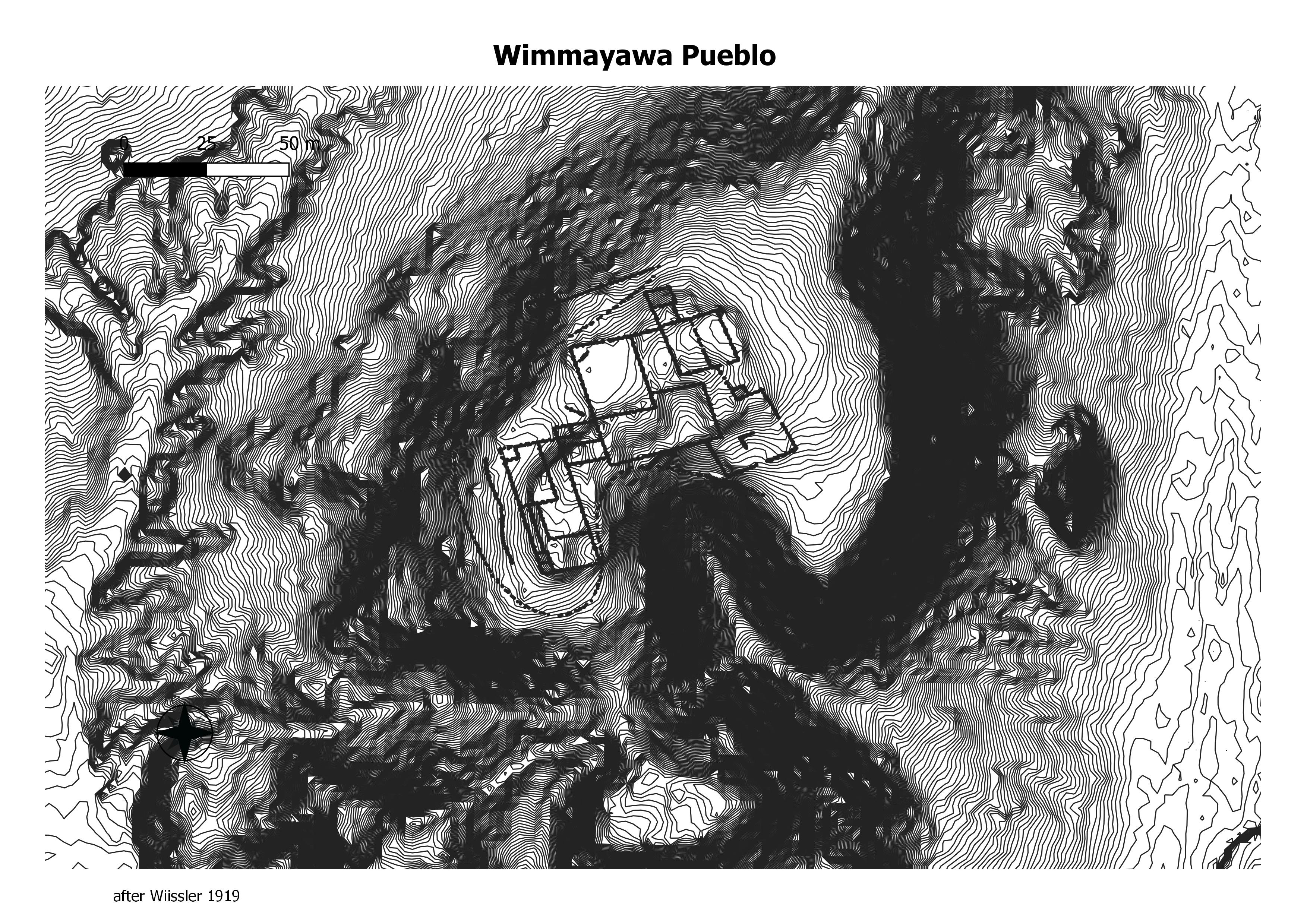
Wimmayawa could have housed two or three hundred people. Its
east and west, and north and south walls conform to the lines of the hill
on which it is situated, though less closely than at cramped little Kolliwa.
Defensibility and water led to the selection of the spot for habitation. (Kroeber, 1916)
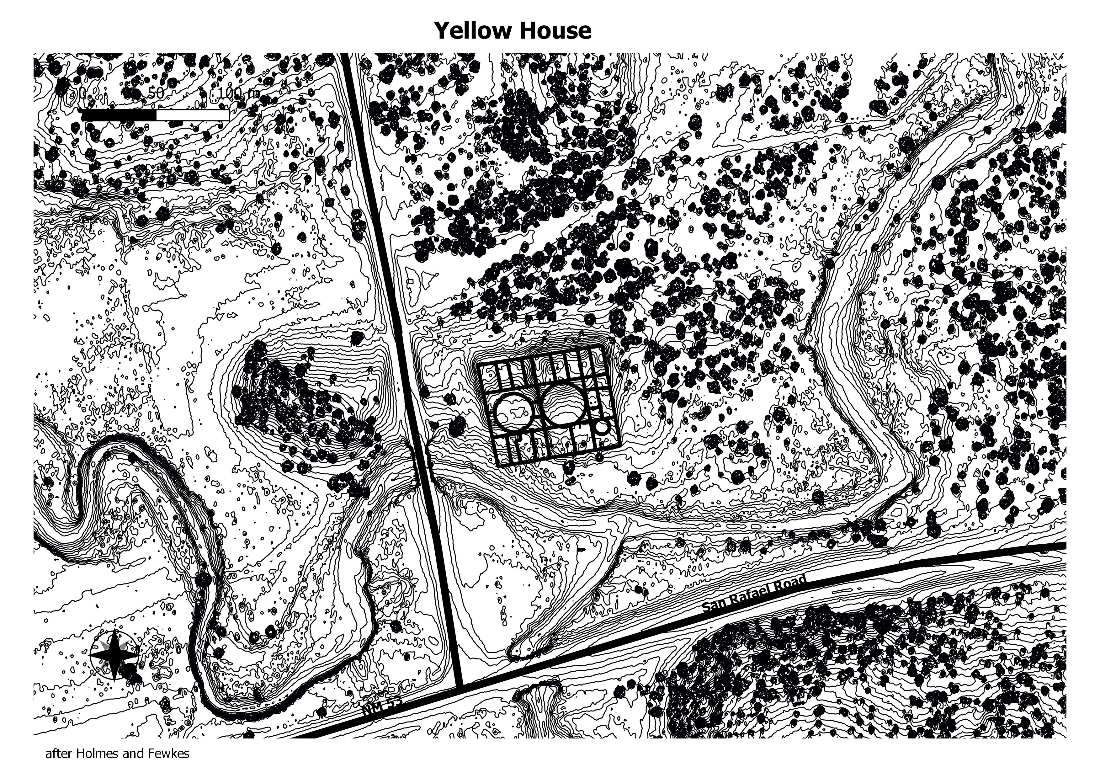
Spier’s map of Yellowhouse does not
appear to show accurately the number of rooms at the site.
His map indicates about 145 ground floor rooms. Yellowhouse
was mapped by the OffIce of Contract Archaeology of
the University of New Mexico. Presumably based on this
map, Hunter-Anderson (1978) suggests that the site had
about 400 rooms. (Kintigh)
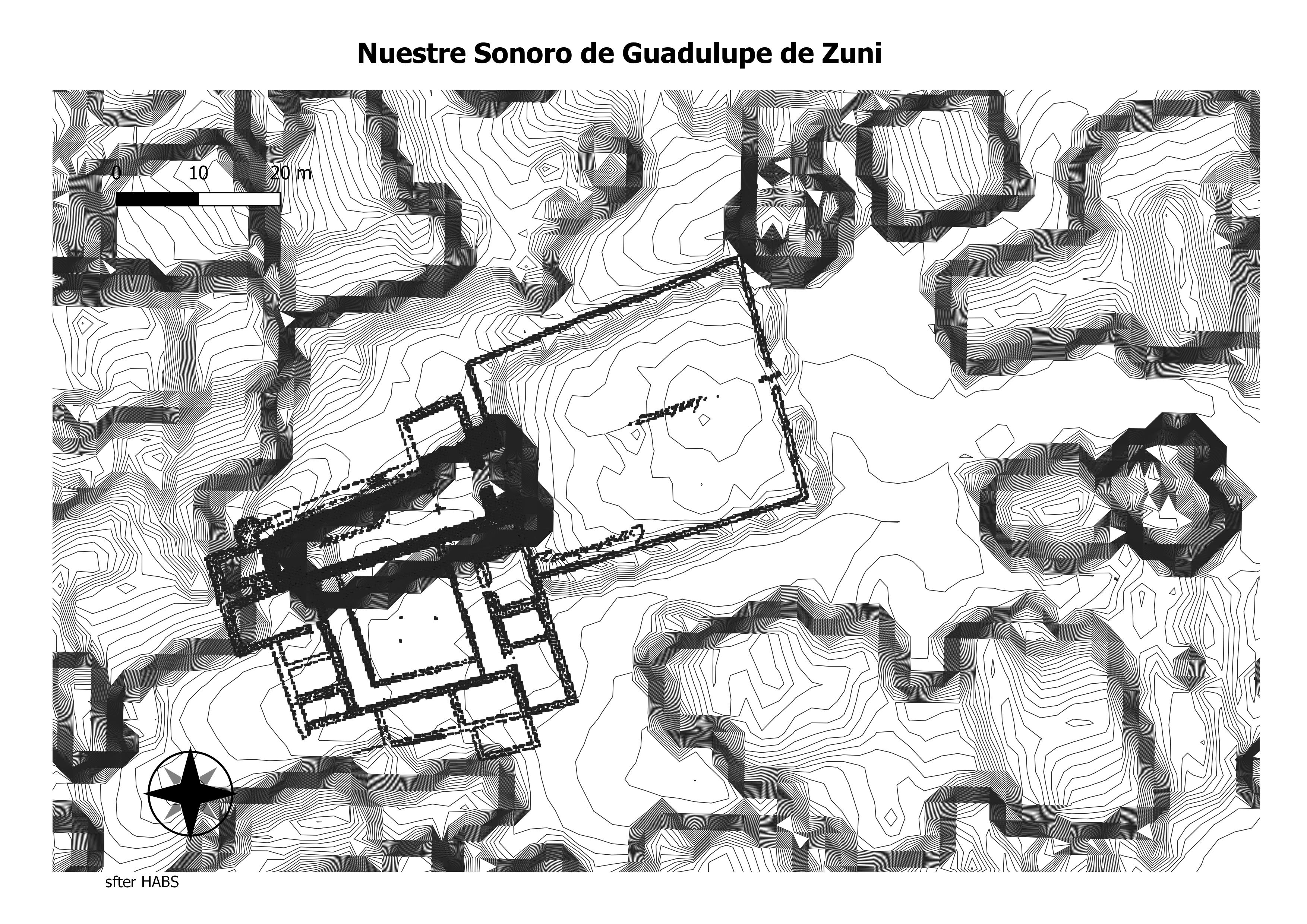
Franciscan missionary efforts began in the region in 1629, and by the 1660s, a mission was built at Halona. Today, visitors can tour the historic Mission Nuestra Señora de Guadalupe church, a fascinating result of the complex history of different cultures coexisting together for centuries. (The NPS)
(
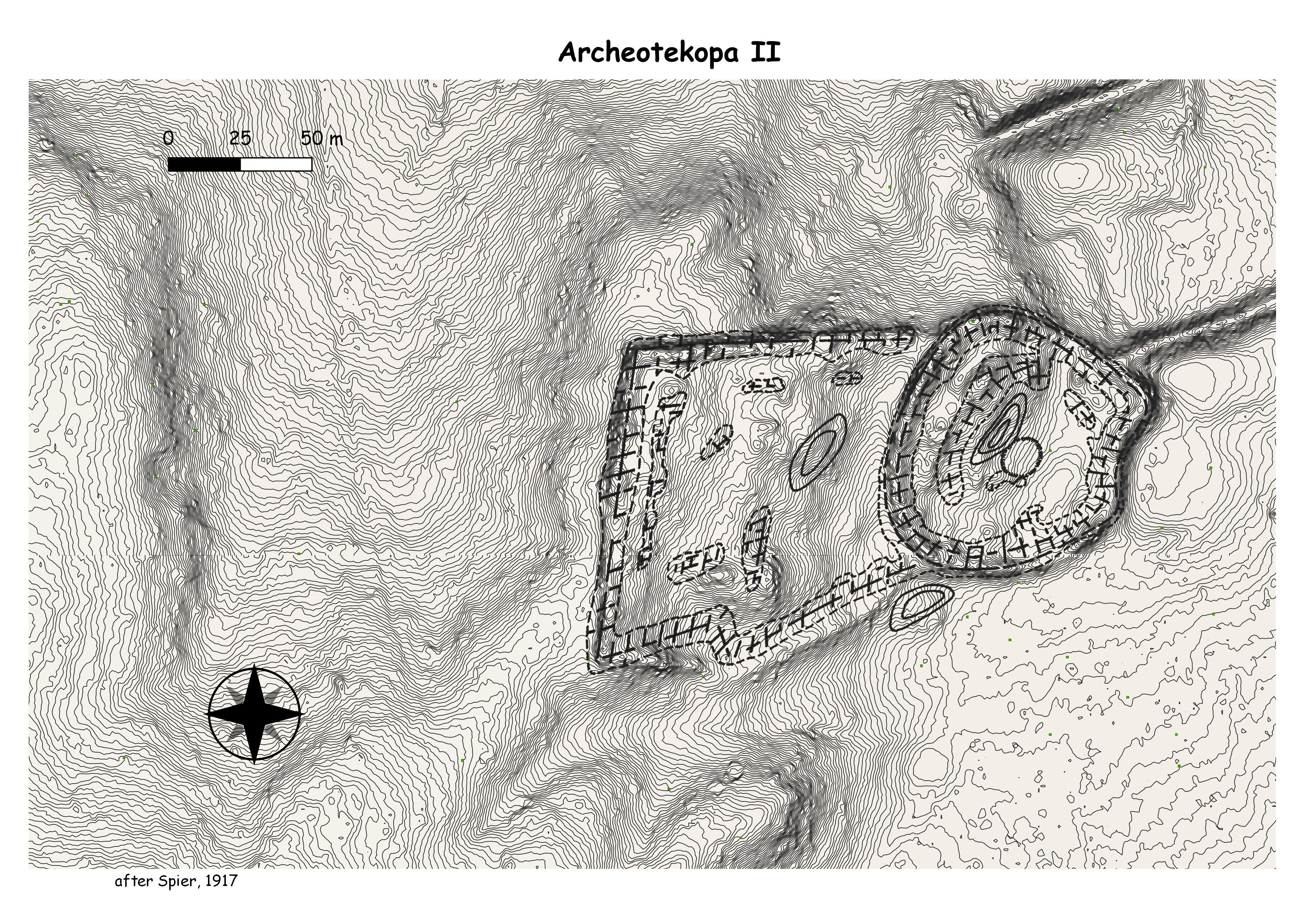
The site bears some similarity to the Kluckhahn
Ruin in its architectural configuration. It consists of an
irregular circular part that merges with a larger rectangular
section to the west. It is difficult to determine the underlying
terrain, but the rubble mound seems to range from 1 m to 2 m
in height. When Spier and Fewkes visited the ruin it was in
better condition than it is today; three-story sections of wall
were visible to Fewkes, and both he and Spier noted a
dramatic narrowing of the walls between the first and second
stories. (Kintigh)
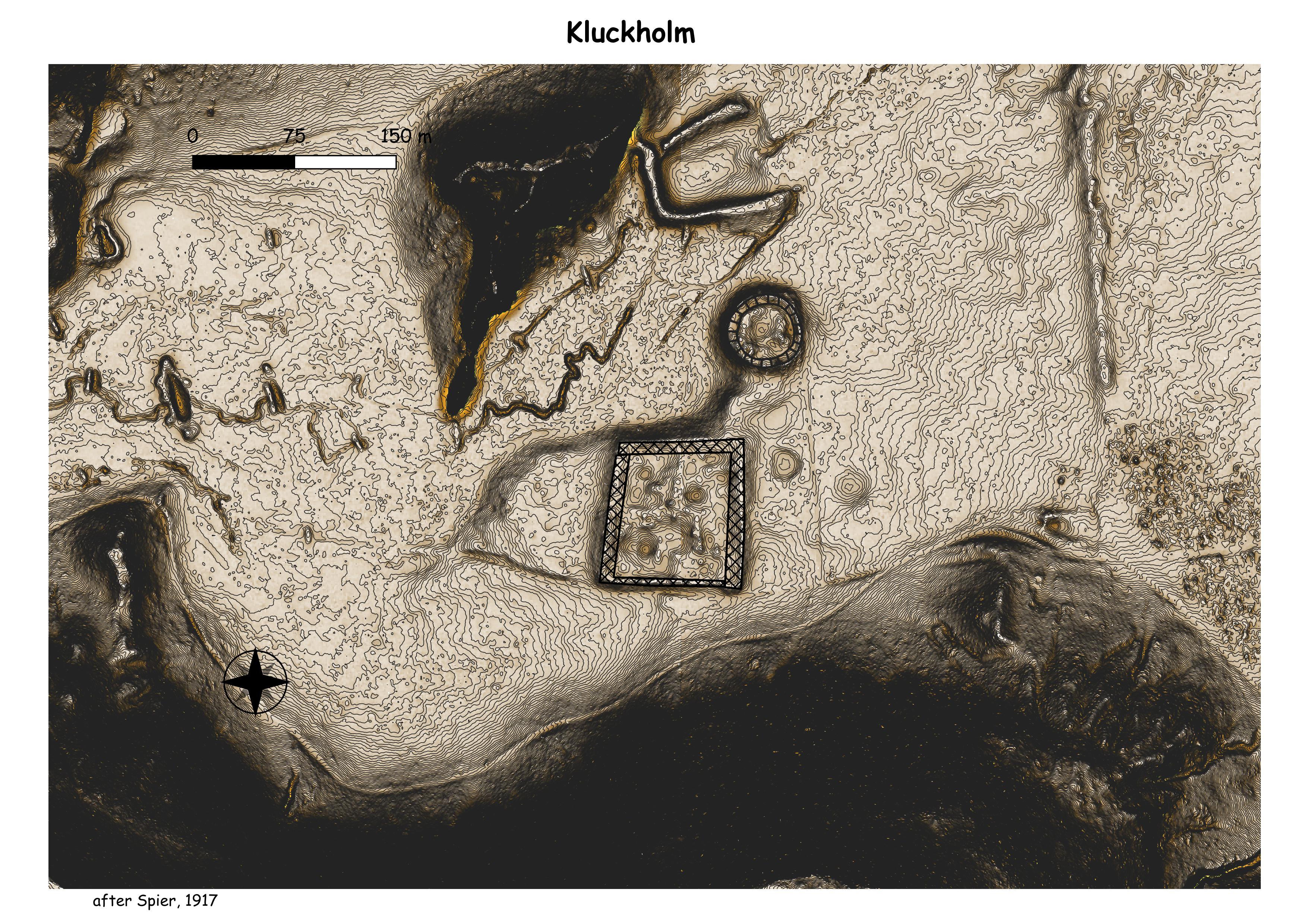
The pueblo forms a large oval nearly filled
with rooms. Construction is of tan, shaped sandstone. The
rubble mound now stands about 2 m high. Fewkes notes the
presence of a large circular depression in the plain near the
ruin, suggestive of a kiva or reservoir. This depression may
be in or under the stock tank. He also says that there is
evidence (unspecified) that building stones were taken from
the ruin for the construction of the modem town of Ramah. (Kintigh)
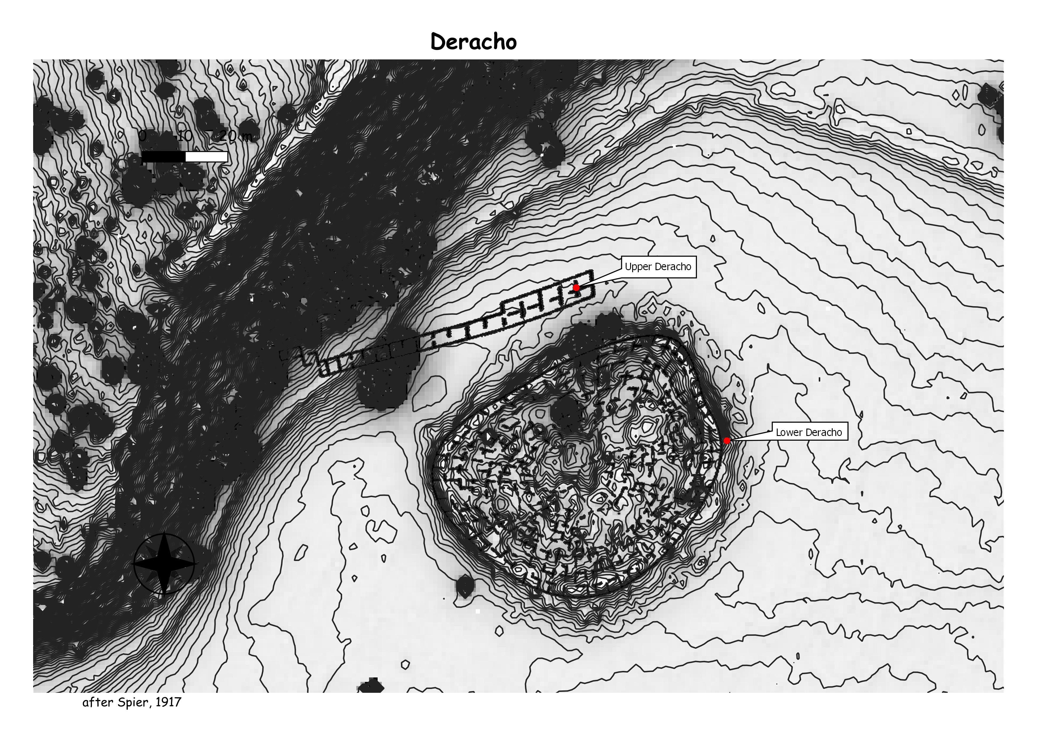
The ruin has a large rectangular section
joined to a smaller circular part by a rubble mound. The site is
on a natural slope so that it is difficult to judge the true height
of the rubble mound, although it is certainly 2 m high in
occur in smaller quantities. The occupation appears
to be slightly later than those of the sites discussed above,
from complex C or D to early in transitional complex DE
(probably from some time after A.D. 1250 to after 1300).
The site was owned by Clyde Kluckhohn and
is named after him. (Kintigh)
The site is composed of a number of small
room clusters constructed of sandstone.
With the information available, an occupation
starting in complex B and lasting into complex C is
indicated (from about A.D. 1225 to after A.D. 1250). (Kintigh)
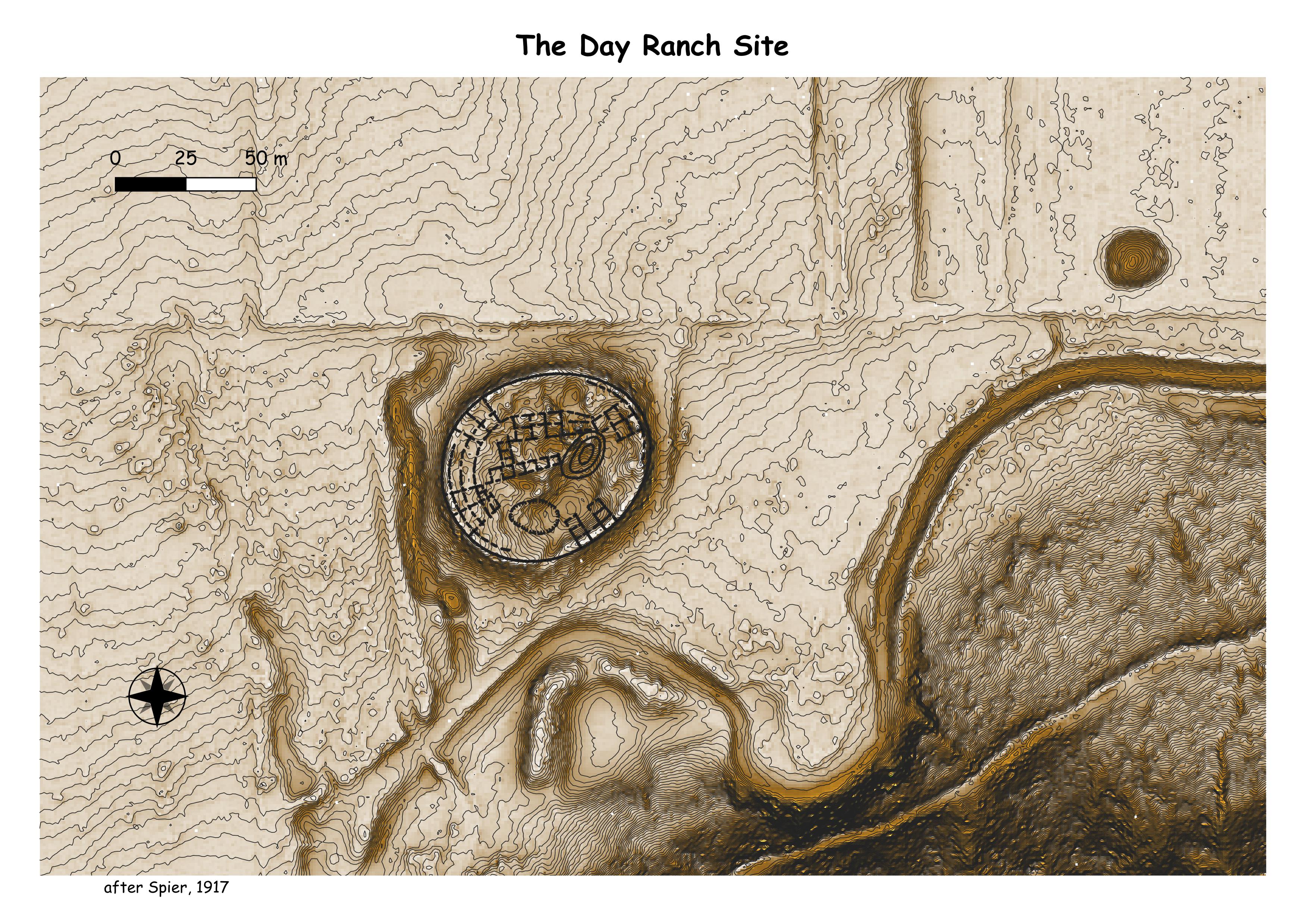
The Day Ranch Ruin forms a large oval
similar to Lower Deracho Ruin. It has a couple of substantial
dt:pr.essions. The areas shown by Spier to have visible room
outlines are the highest parts of the interior of the pueblo. The
rubble mound formed by the site is 2 m to 3 m high around the
outside wall. The visible walls are constructed of roughly
shaped sandstone. (Kintigh)
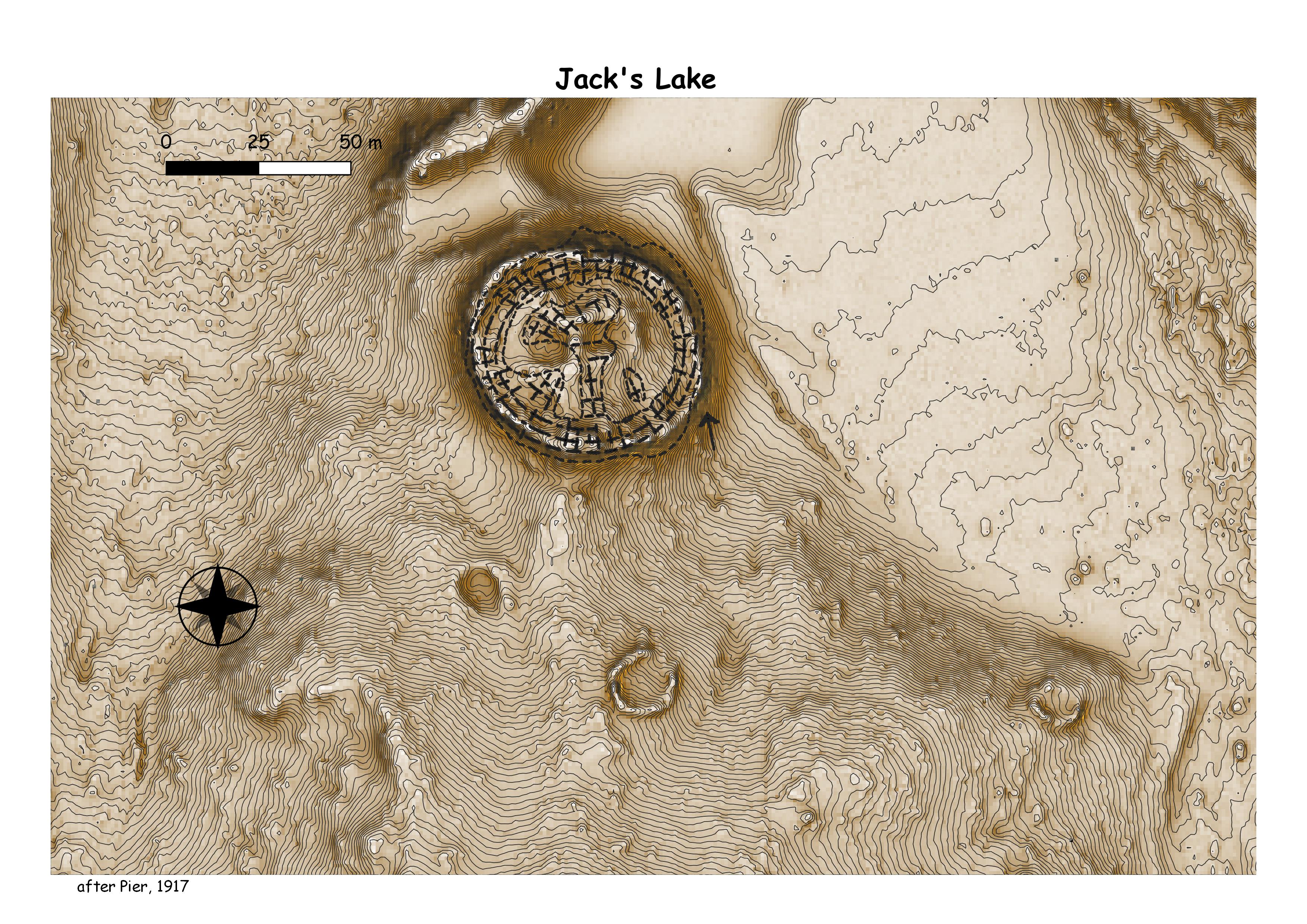
The site is oval and forms a rubble mound
about 2 m high. Substantial relief in the interior of the ruin
suggests interior room blocks, kivas, and plaza areas. At the
time of Fewkes’ observation the entire outside wall was
intact and he could find no openings in it. He indicates that it
attained the height of 15 feet (4.5 m), suggesting at least three
stories. (Kintigh)
Salina
Salinas
tabira
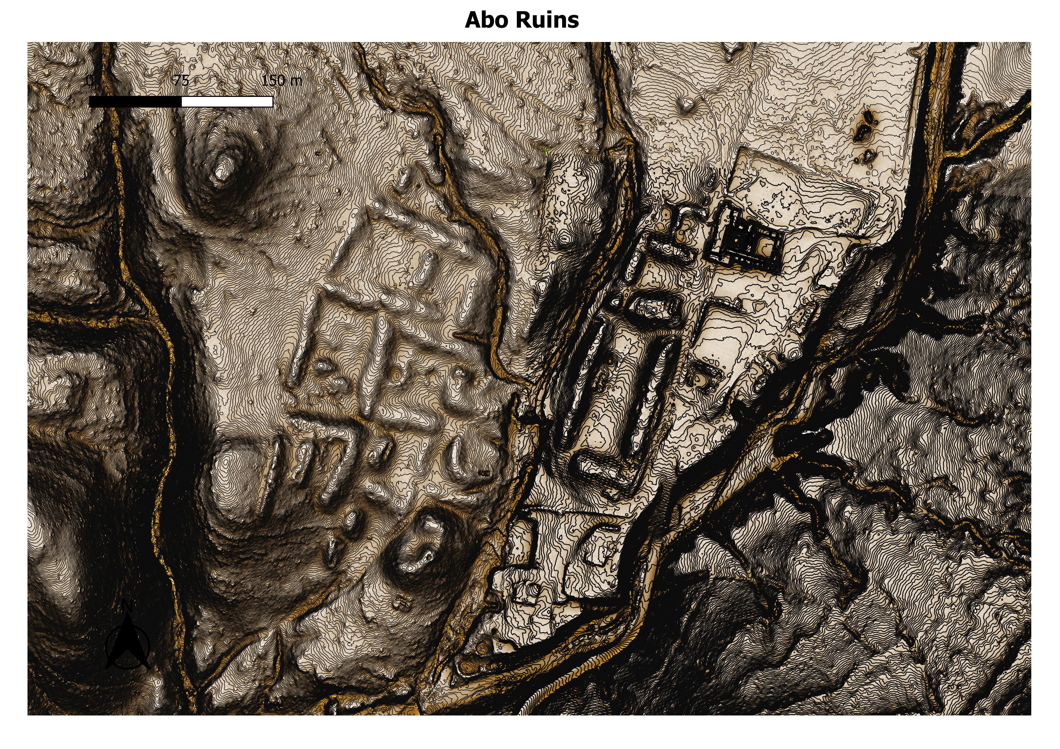
abo
frank’s ruin
gran quivara
pardo
pueblo colorado south
quarai
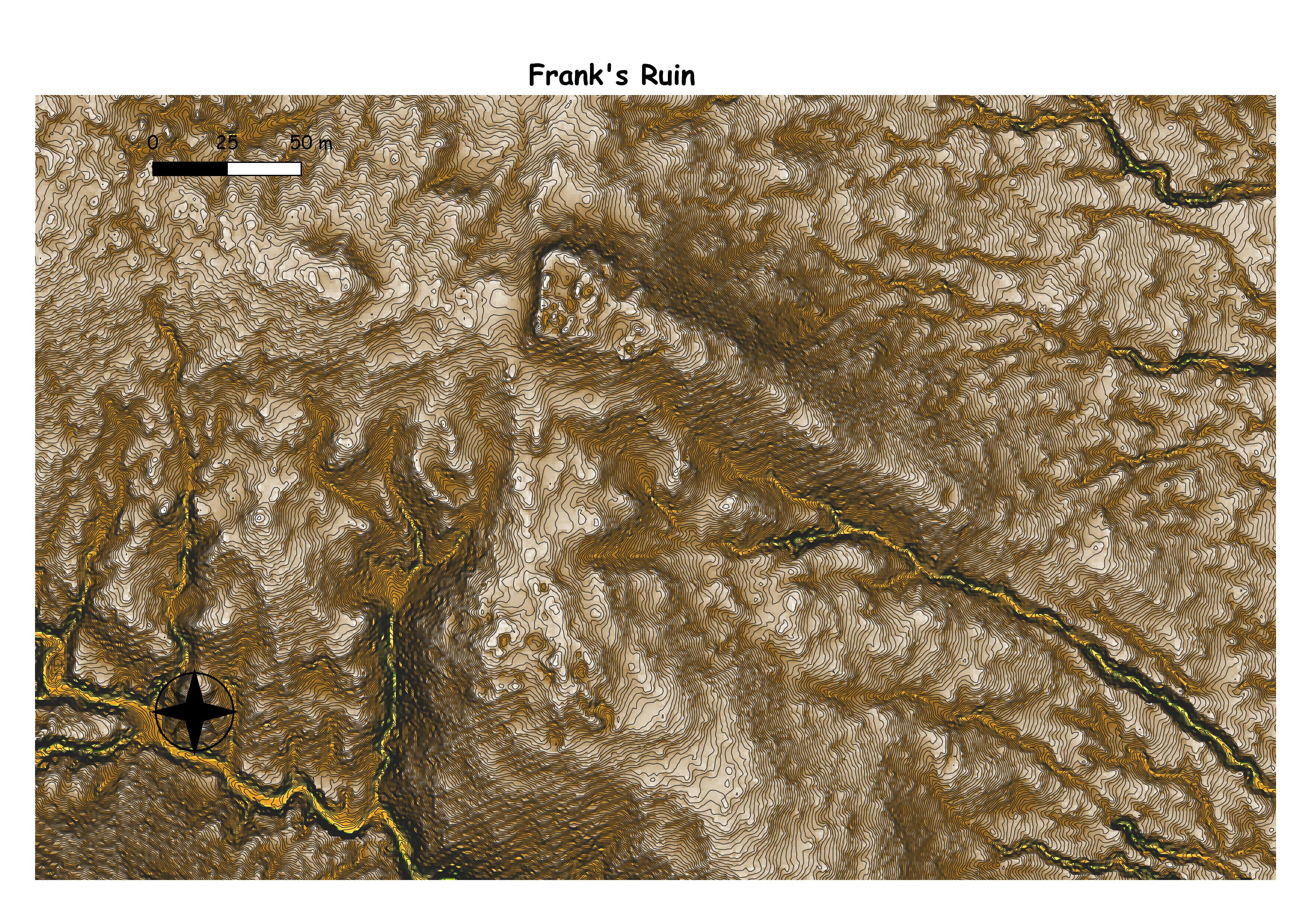
Frank’s Ruin (LA 9032). Contemporaneous with Kite Pueblo, Frank’s Ruin is also located at the edge of Chupadera Mesa, and consists of 121 jacal rooms and 150 more substantially built rooms (Chamberlin 2008; Rautman 2008). The site was occupied in two phases, an earlier adobe phase and a later masonry phase in which the site was “remodeled” with exterior walls being built two courses thick, and a possible enclosing defensive wall being added (Rautman 2008). To ensure defensibility of the site, a cistern was located in one of the plazas (Rautman 2008).
(All Along the Watchtower: Signaling Behavior in the Jumanos Pueblo Cluster, Torrance County, New Mexico, by Ward Beers)
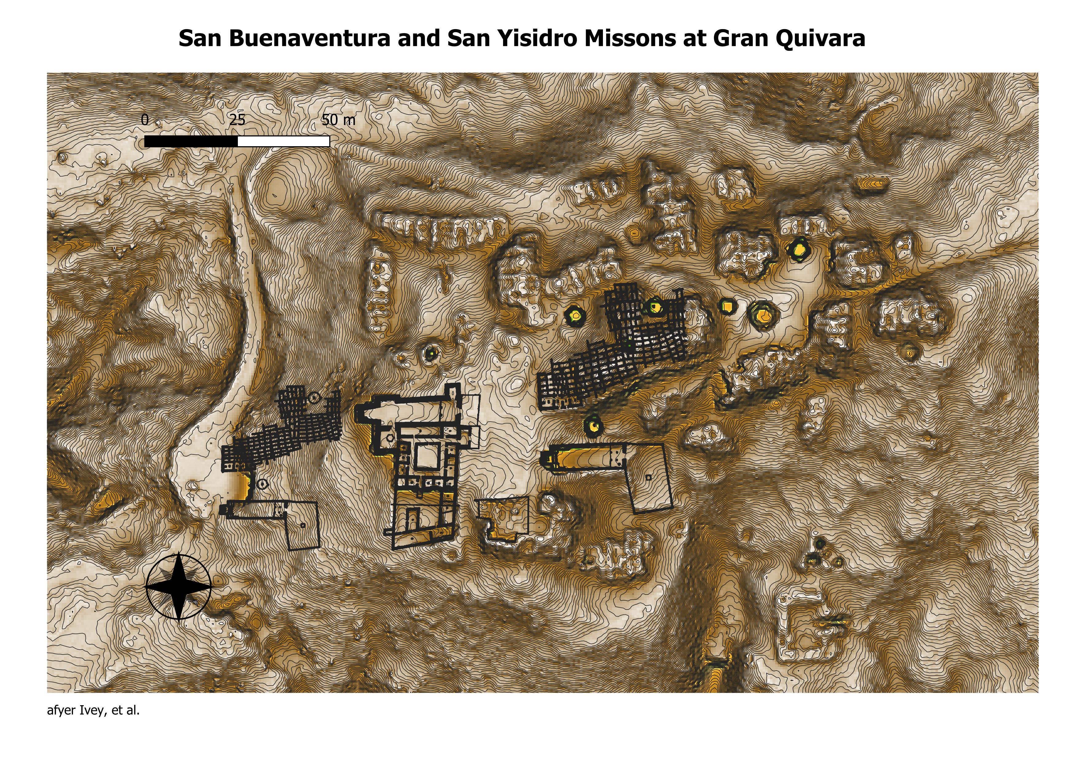
Gran Quivira (LA 120). Gran Quivira was occupied by Tompiro speakers for approximately the same time period as Pueblo Pardo, and was one of the largest sites in the entire region (Graves 2004). The site was designated as a National Monument in 1909, and only a few of the site’s 20-22 roomblocks have been excavated (Hayes 1981; Spielmann and Eshbaugh 1988). That the site was a major trade center between the Plains and Rio Grande Valley is not only historically documented, but is also evident prehistorically from bison remains, mussel shells from the Plains, and pottery from Tonque and San Marcos pueblos to the north and northwest, which were in turn trading partners with the Rio Grande pueblos (Chamberlin 2008; Graves 2004; Hayes 1981). (All Along the Watchtower: Signaling Behavior in the Jumanos Pueblo Cluster, Torrance County, New Mexico, by Ward Beers)
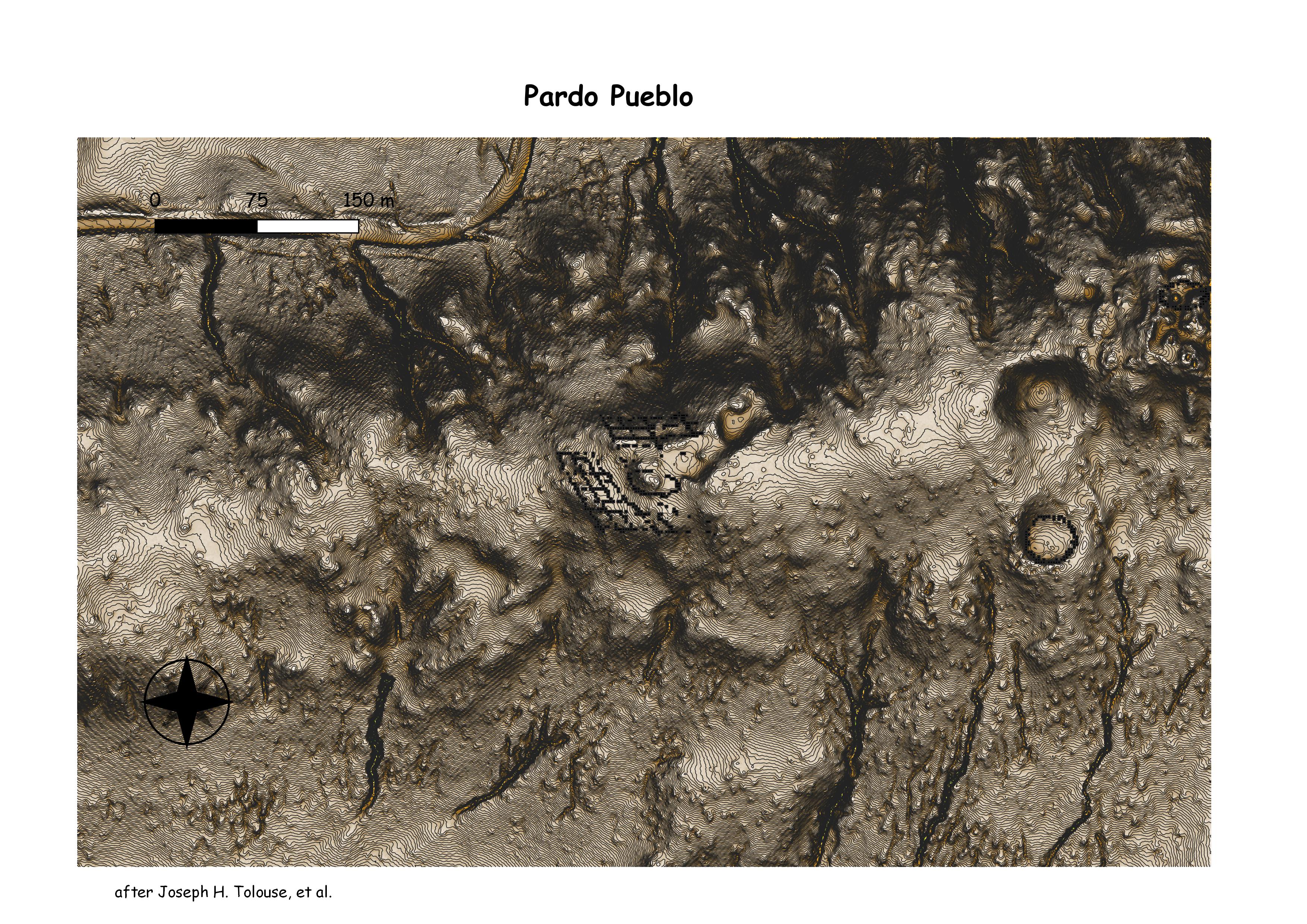
Pueblo Pardo (LA 83). Pueblo Pardo’s earliest occupation was around A.D. 1300, and the site continued to be occupied into the early 1670s, when the entire region was abandoned. It was made up of 500 ground level rooms, with approximately 200 second story rooms, totaling around 700 rooms (Graves 2002). While there are no signs of violence at the site, one burned kiva has been excavated (Toulouse and Stevenson 1960). The site is located on a ridge about 60 meters above the surrounding valley floor, and was occupied by Tompiro speakers at the time of the Spanish entrada (Toulouse and Stevenson 1960). (All Along the Watchtower: Signaling Behavior in the Jumanos Pueblo Cluster, Torrance County, New Mexico, by Ward Beers)
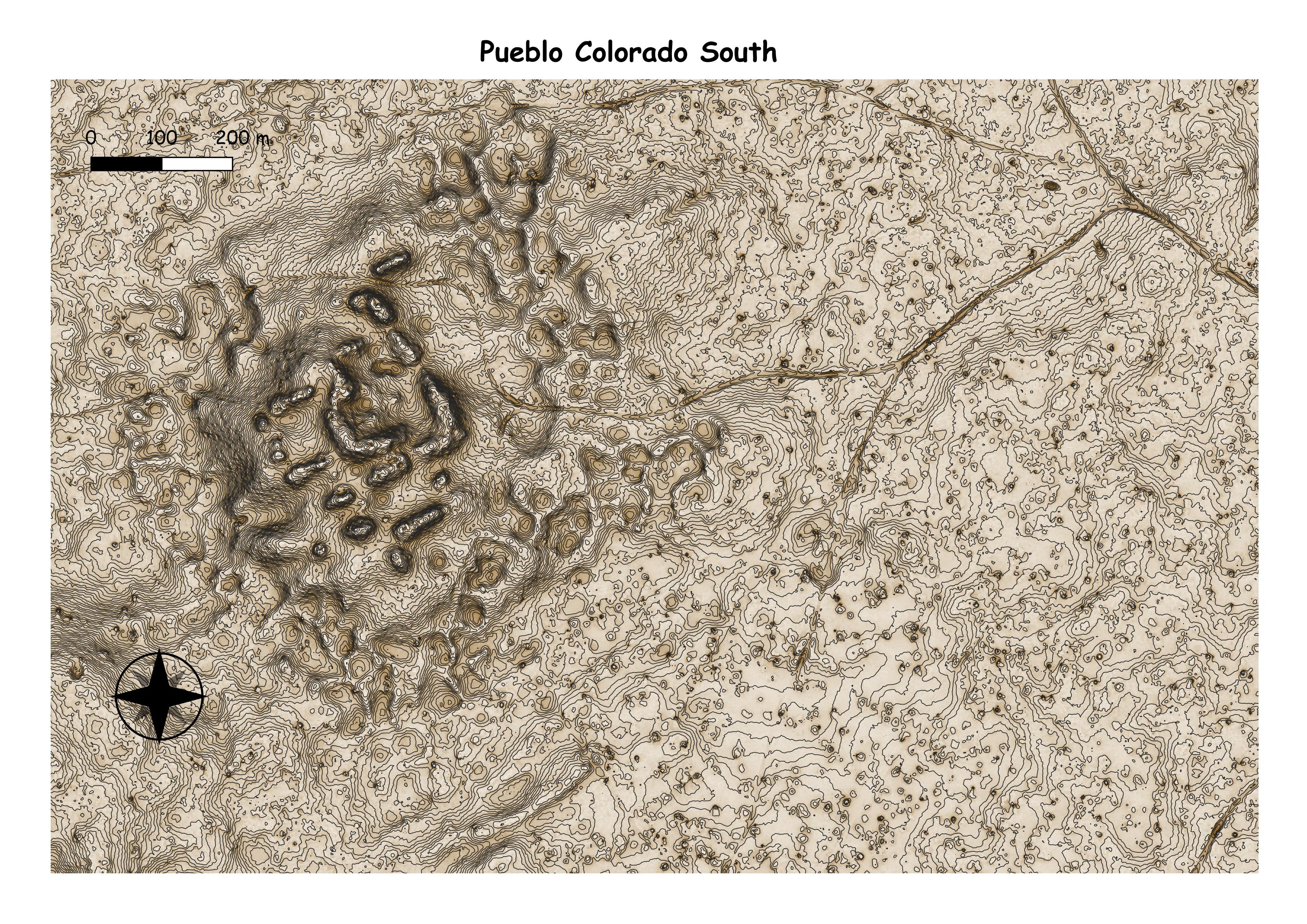
Pueblo Colorado (LA 476). Pueblo Colorado was of comparable size to Gran Quivira, with 3-5 plazas, 18 roomblocks, and up to 1000 rooms (Caperton 1981; Chamberlin 2008; Graves 1996; Spielmann and Eshbaugh 1988). Of the Jumanos pueblos, the location of the site is an anomaly, being located in a large depression between ridges and mesas. Any concern for defense was presumably offset by the size of the pueblo.(All Along the Watchtower: Signaling Behavior in the Jumanos Pueblo Cluster, Torrance County, New Mexico, by Ward Beers)
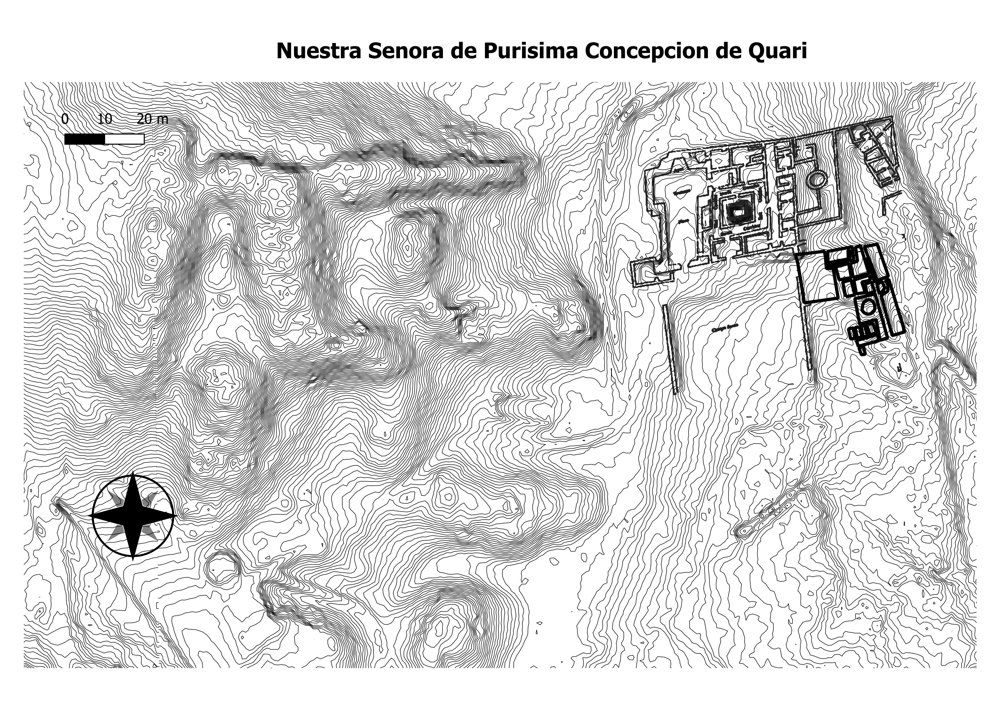
The Quarai ruins are located in central New Mexico, in a rural desert setting about 8 miles (13 km) north of Mountainair, where the main visitors center for the Salinas Pueblos National Monument is located. The largest features of the ruins are the main pueblo and the walls of the mission church, which was probably one of the largest wall and beam structures in North America.[3] The walls range in thickness from three to six feet, and probably reached a height of 40 feet (12 m).[4] Also present are mounds representing the archaeological sites of earlier buildings, and two extremely rare examples of fortified plazuela sites, Spanish colonial-style ranch sites developed in the 1820s and 1830s.[3] (Wikepedia)
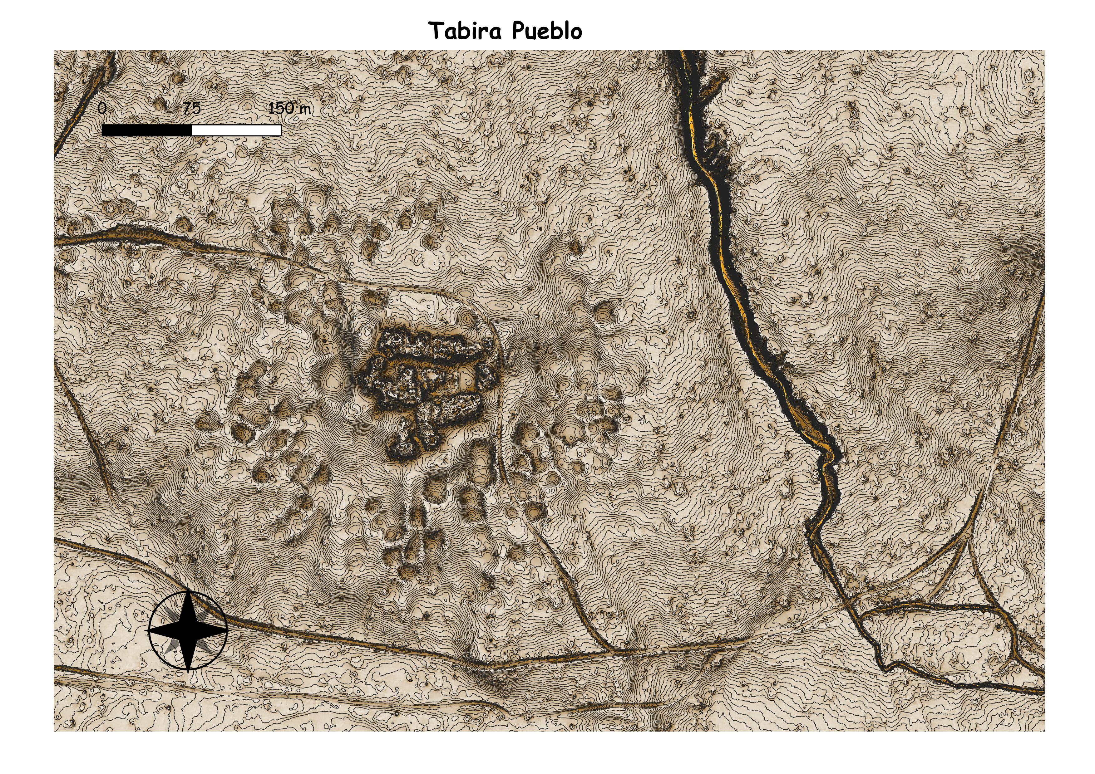
Tabirá (LA 51). Also known as Pueblo Blanco, Tabirá is a large, compact pueblo of approximately 1000 rooms that was occupied between A.D. 1100 and the early 1670s, then briefly reoccupied by Spanish soldiers and Christianized Indians in 1677-1678 (Chamberlin 2008; Graves 2004; Heberling 2010). The pueblo is located near the base of Jumanos Mesa in a position elevated over much of the surrounding terrain, but not to the point of making it obviously defensive. Of the sites in the eastern part of the Jumanos cluster, Tabirá was the last occupied. (All Along the Watchtower: Signaling Behavior in the Jumanos Pueblo Cluster, Torrance County, New Mexico, by Ward Beers)
Chama
Chama Basin
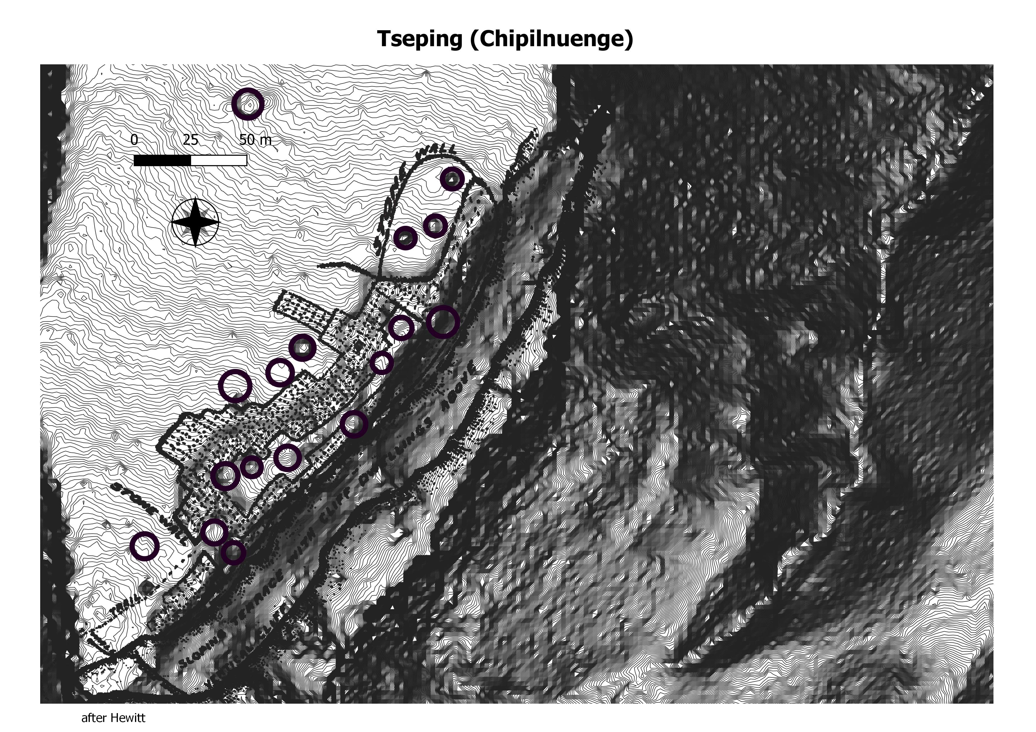
tseping
howidi’oingreh
hupovi
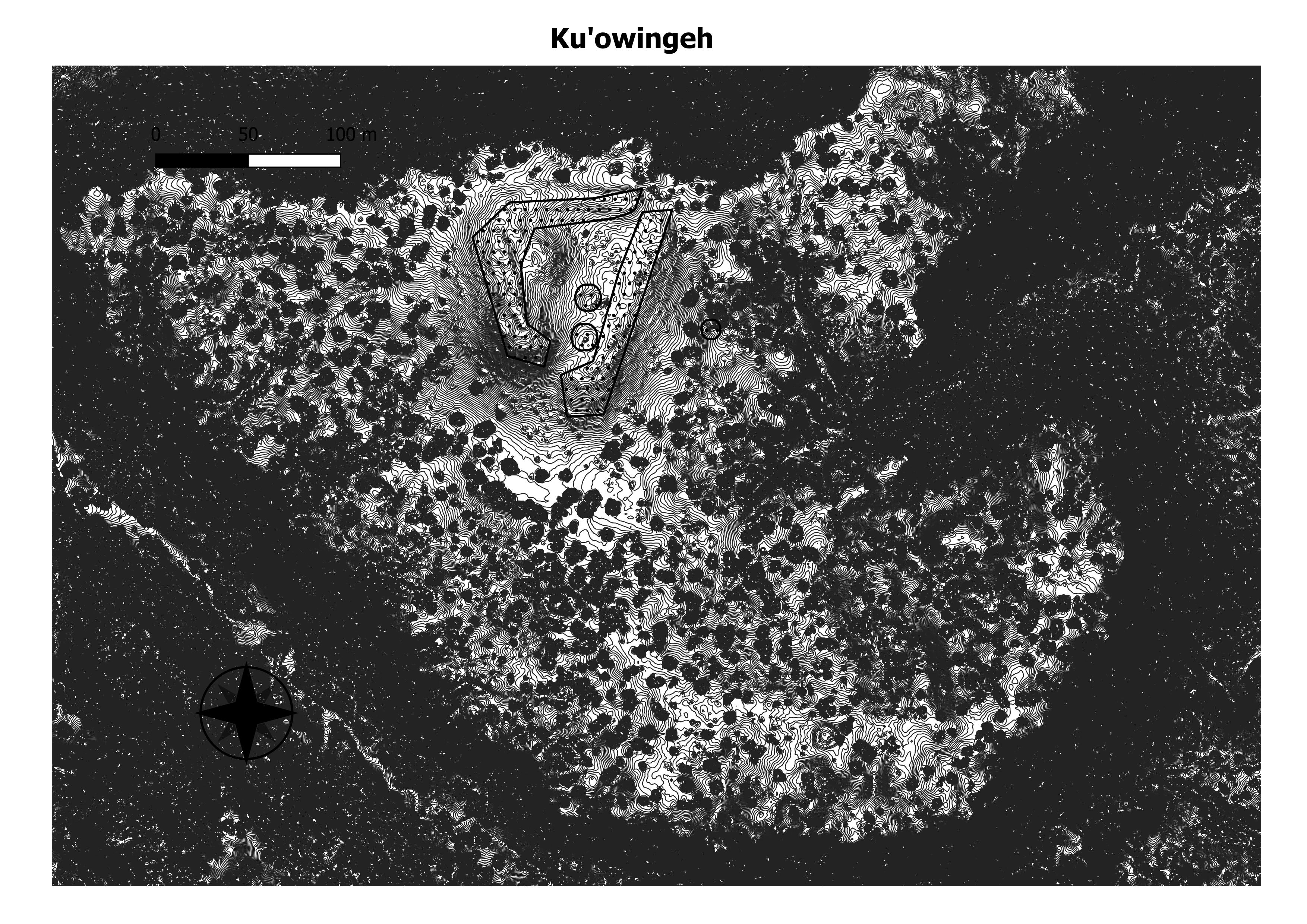
ku’owingeh
leafwater
ponsipa’akeri
poshu-owigeh
posi owingeh
sapawe
te’ewi’owingeh
tsama
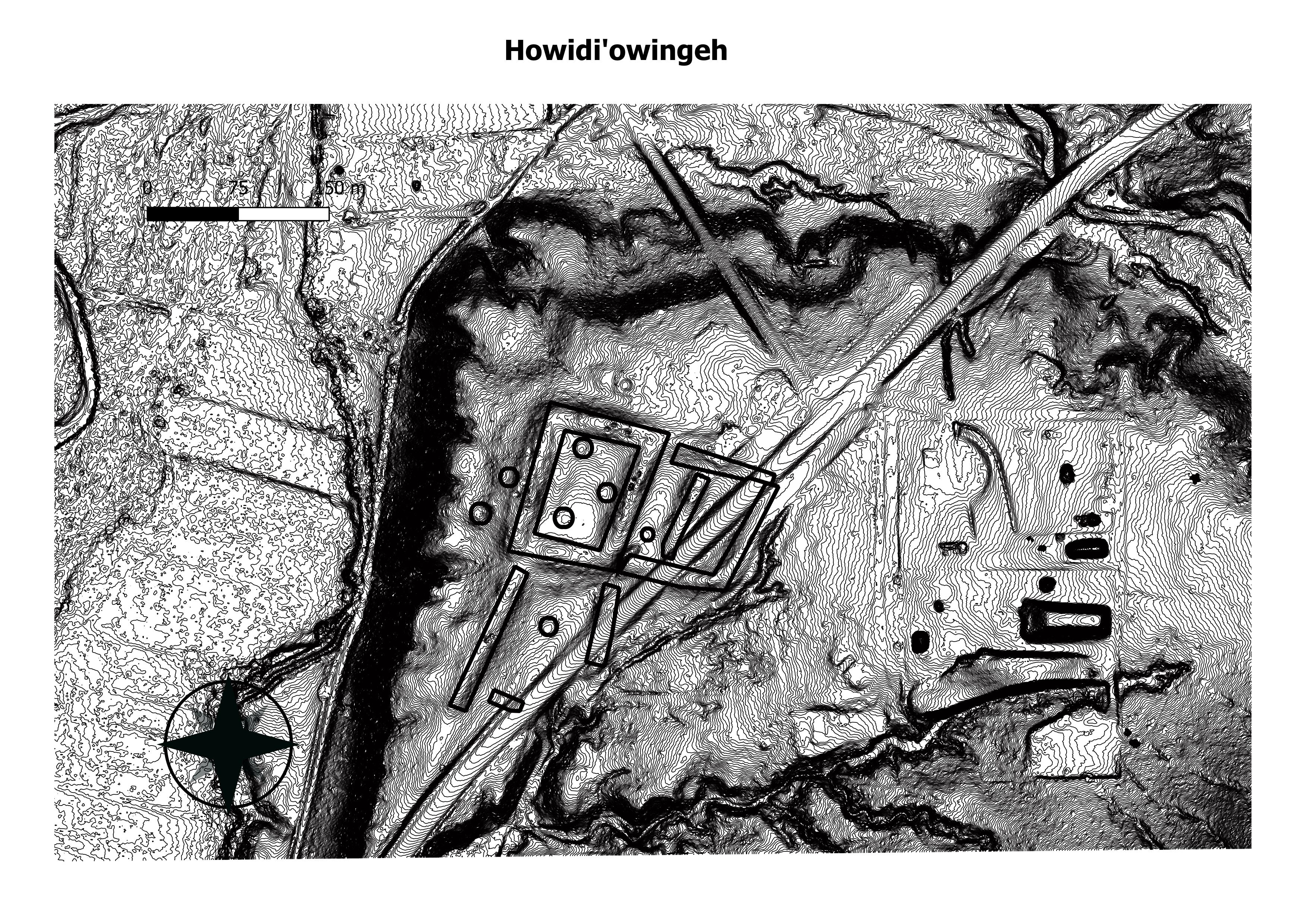
This site dates to A.D. 1377-1537, and contains 1428 rooms. (Samuel Duwe)
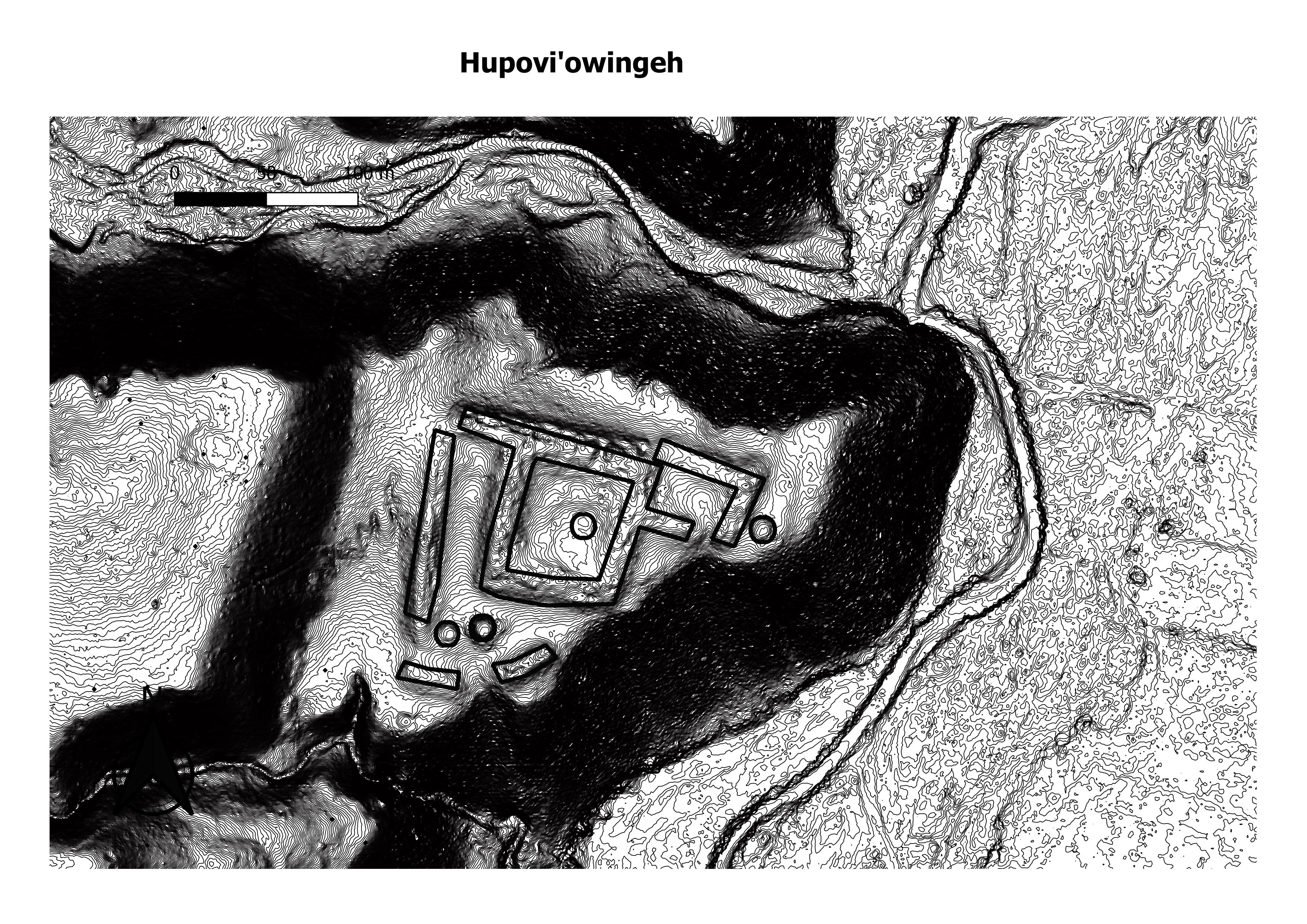
This site dates to A.D. 1363-1550 and contains 948 rooms. (Samuel Duwe)
This site dates to post A.D. 1600 and is considered historic. (Samuel Duwe)

Kapo’uinge, or the Leaf Water Pueblo, appears to have been one of the oldest proto-Tewa/Tewa villages built in the Chaco River Valley. Leaf Water was a relatively small pueblo built on a mesa in a roughly U shape with the open side facing a steep embankment going down to the Chama River. At its maximum the pueblo appears to have had 130 rooms. (Jeff Jones)
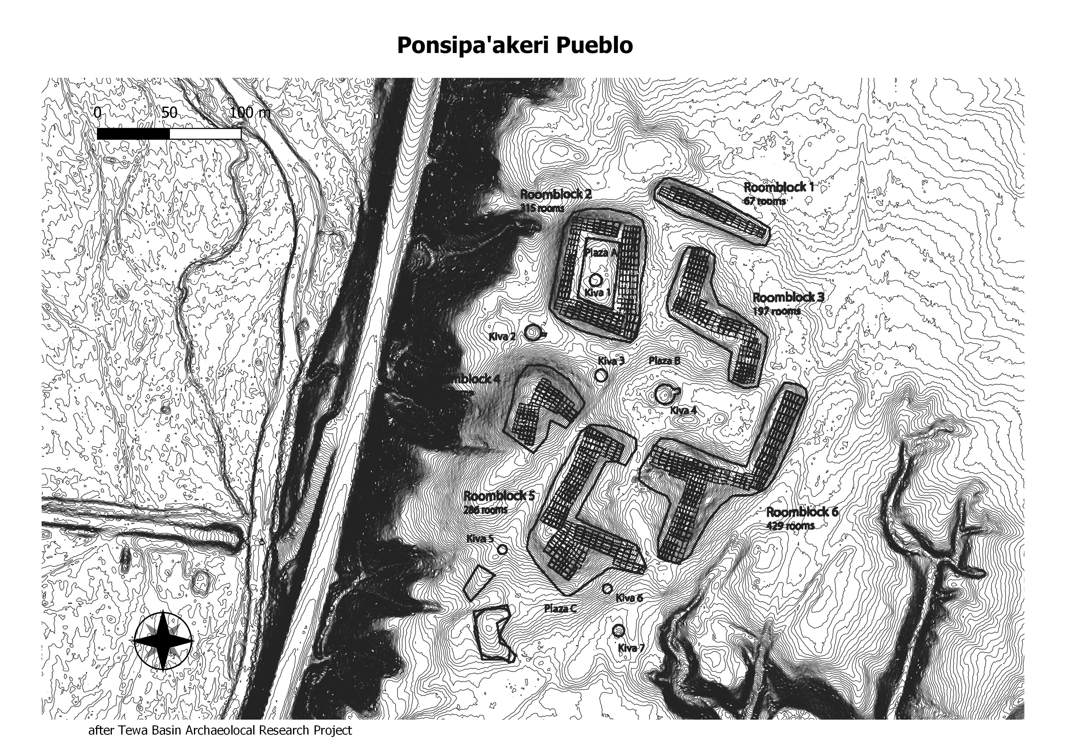
This site dates to A.D. 13122-1550 and contains 1535 rooms. (Samuel Duwe)
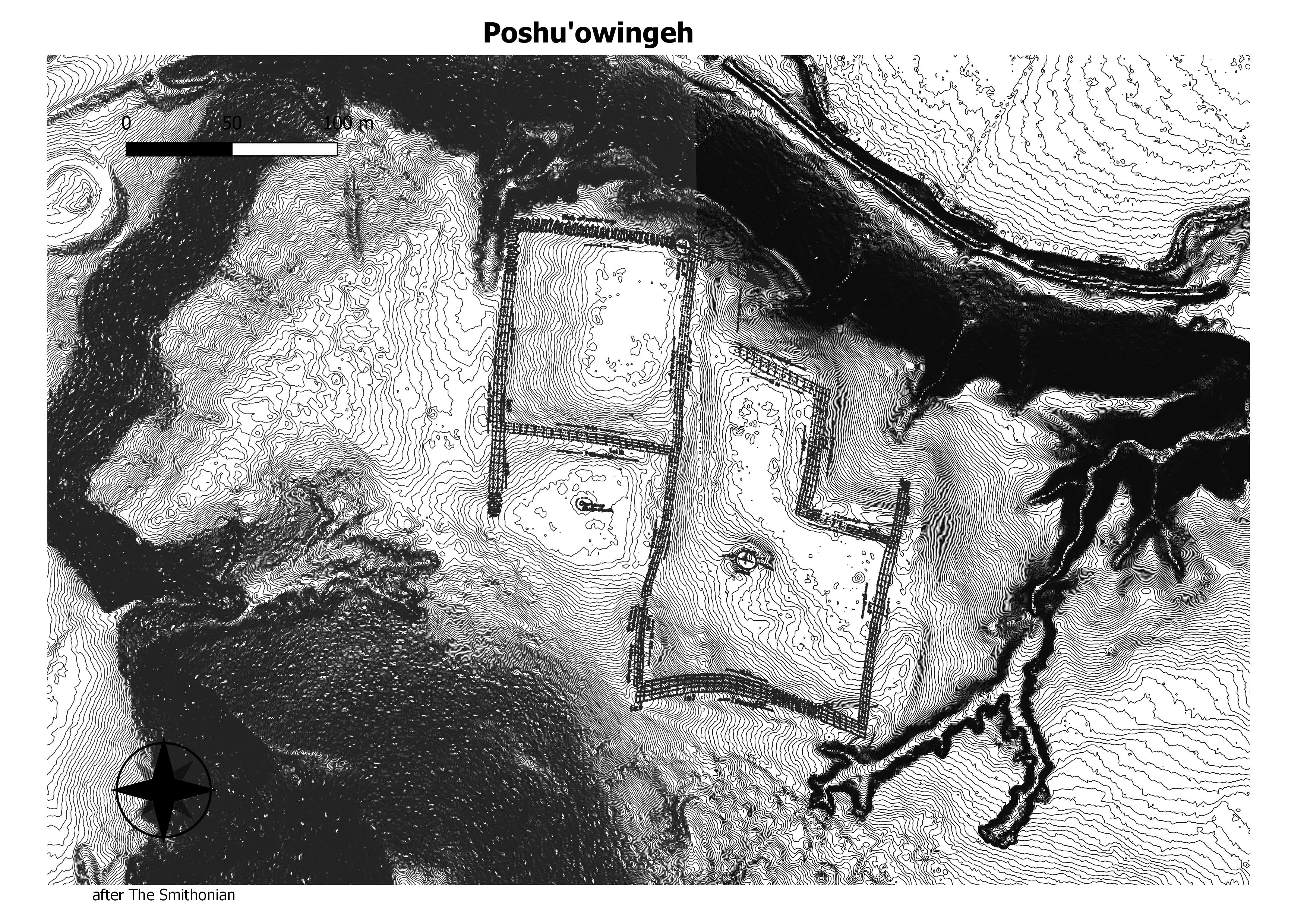
This city, at its largest, consisted of about 700 ground floor rooms, most being two or even three stories tall.[3] The city was laid out with two main plazas, and a large kiva near the center of the eastern courtyard. The city is believed to have been occupied between 1375 and 1475.[5] The site was abandoned around 1500, well before Coronado and the first Europeans arrived. It is believed that its inhabitants left the banks of the Chama River and relocated nearby around the Rio Grande, where their descendants live today.[6] (Wikepedia)
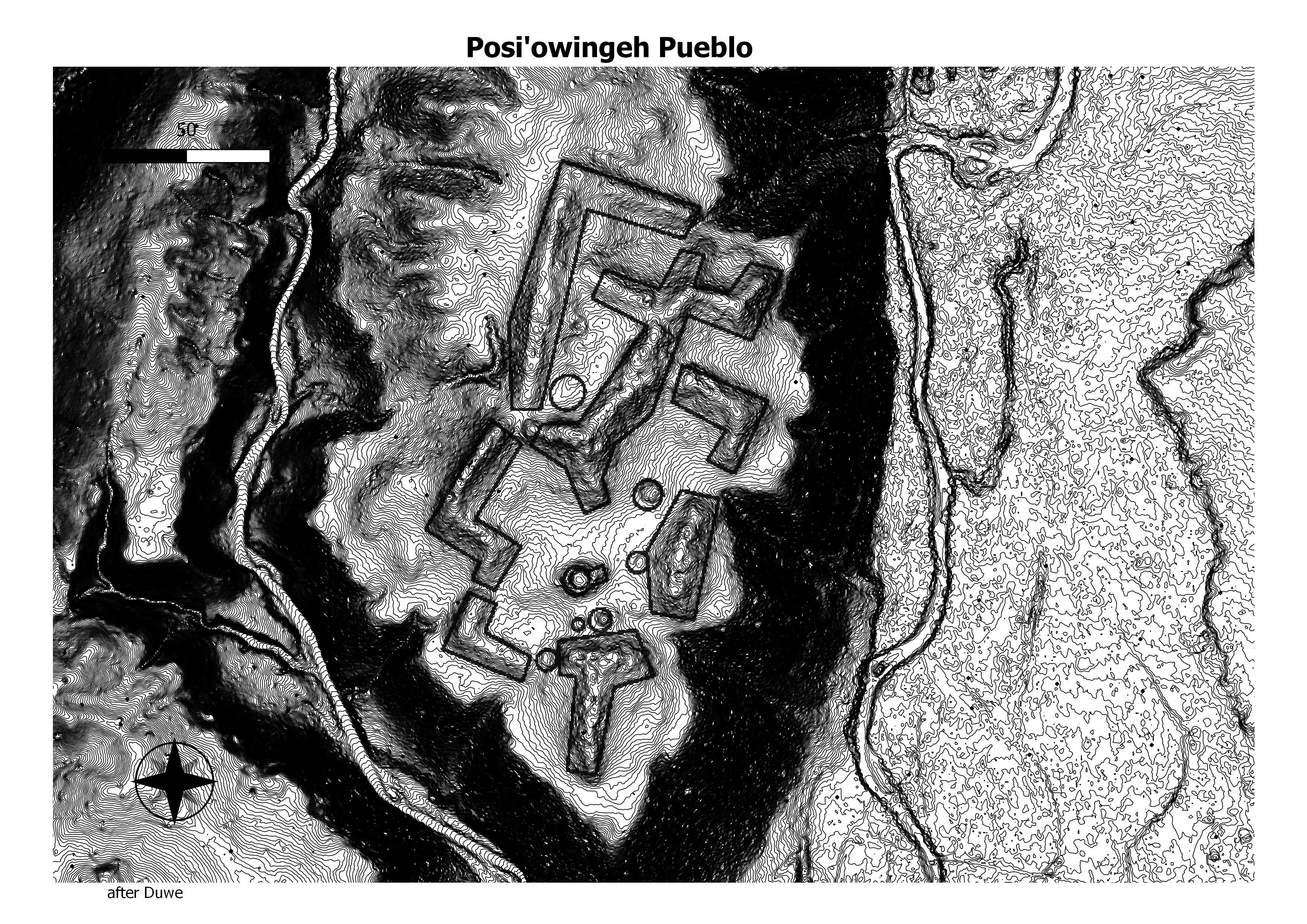
Posi-Ouinge, the ‘Greenness Pueblo,’ is a large prehistoric village dated to the 13th through the 16th centuries AD. The pueblo may have had well over 2,000 rooms, making it one of the largest in the southwest. The village was inhabited by Tewa Indians whose descendants now live near the Rio Grande in the Espanola area. (Wikepedia)
It was built around 1275 AD and abandoned by 1450 AD. At its peak, an estimated 1,000 people lived there.
Jemez
Jemez
west ruin
amoxiumqua
astialakwa
bolo
guisewa
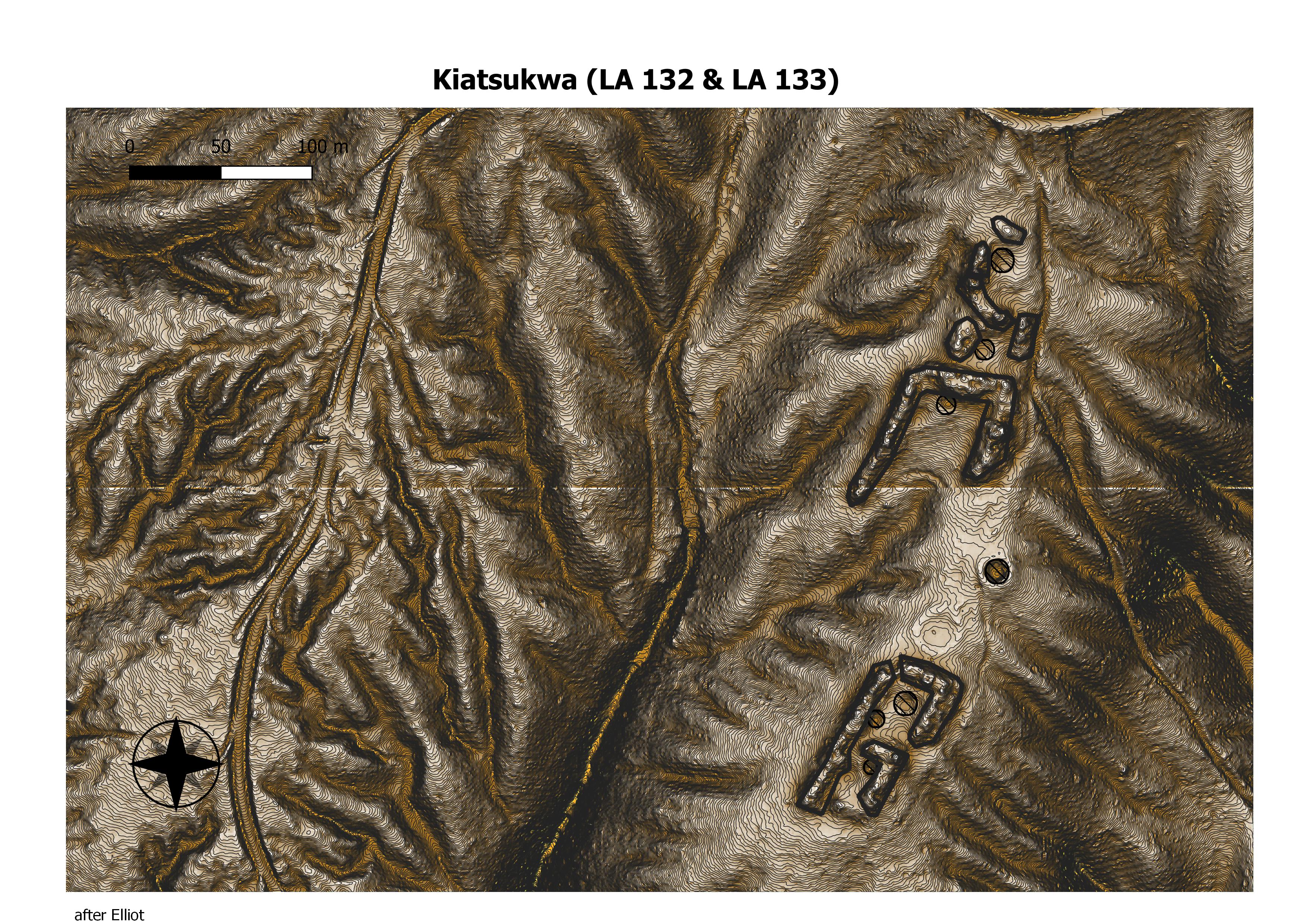
kiatsukwa
patokwa
unshagi
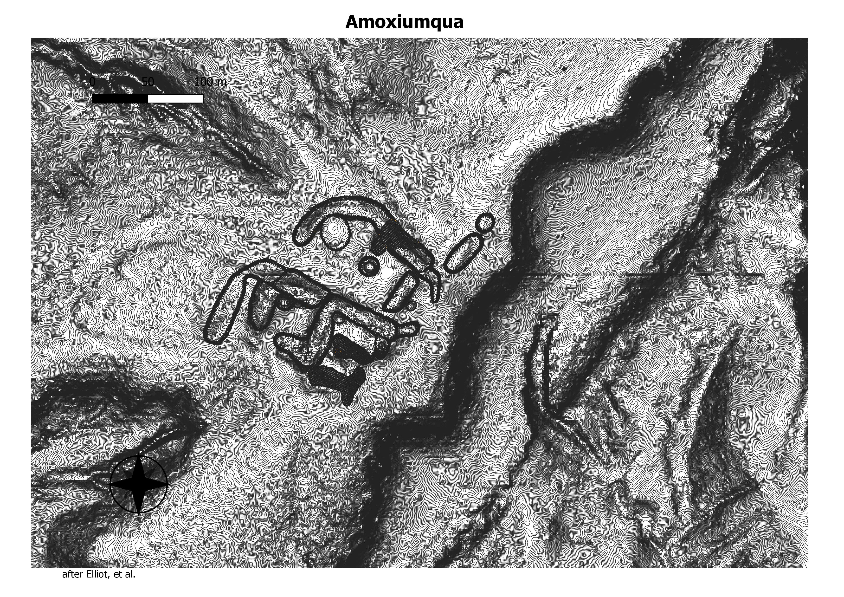
One story is that the people of Amoxiumqua burned the Spanish mission church at Guisewa and started the a Jemez revolt of 1623.(Matthew Barbour)
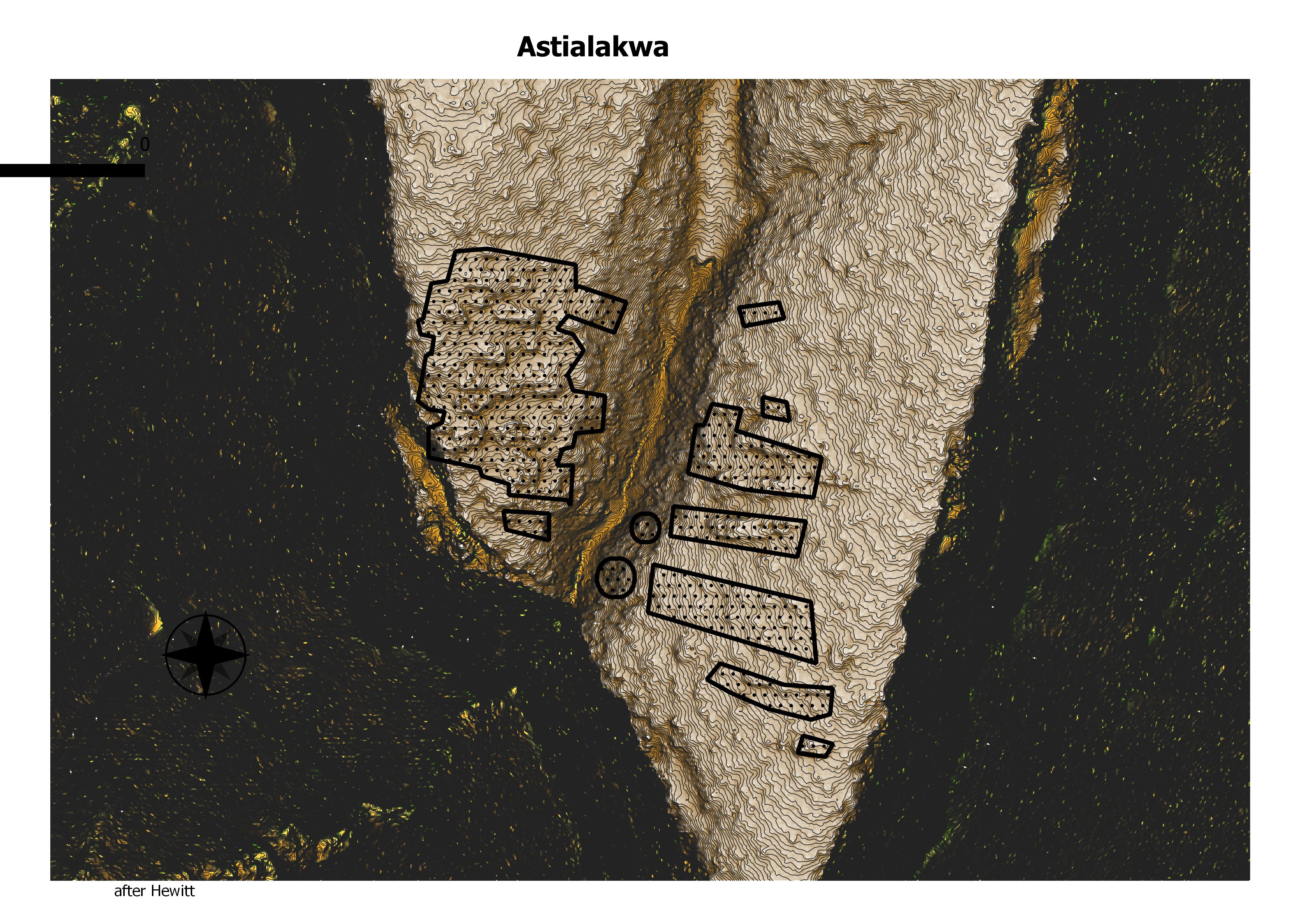
The Battle of Astialakwa (also known as the Siege of Astialakwa) took place on July 24, 1694, when a group of 120 soldiers led by the Spanish governor don Diego de Vargas and their Keresan-speaking allied militia from the Zia, Santa Ana and San Felipe pueblos, waged war against the Jemez Pueblo indigenous peoples. Eighty-four Jemez people died in the battle, while 81 people escaped. Over three hundred and sixty Native women and children were taken prisoner by the Spanish soldiers. Seven people leapt to their death instead of being captured.[7] After the battle, Vargas ordered the village to be “burned and reduced to ashes”[8] after giving the sheep, goats, cattle and maize to his Keres allies.[ (Wikepedia)
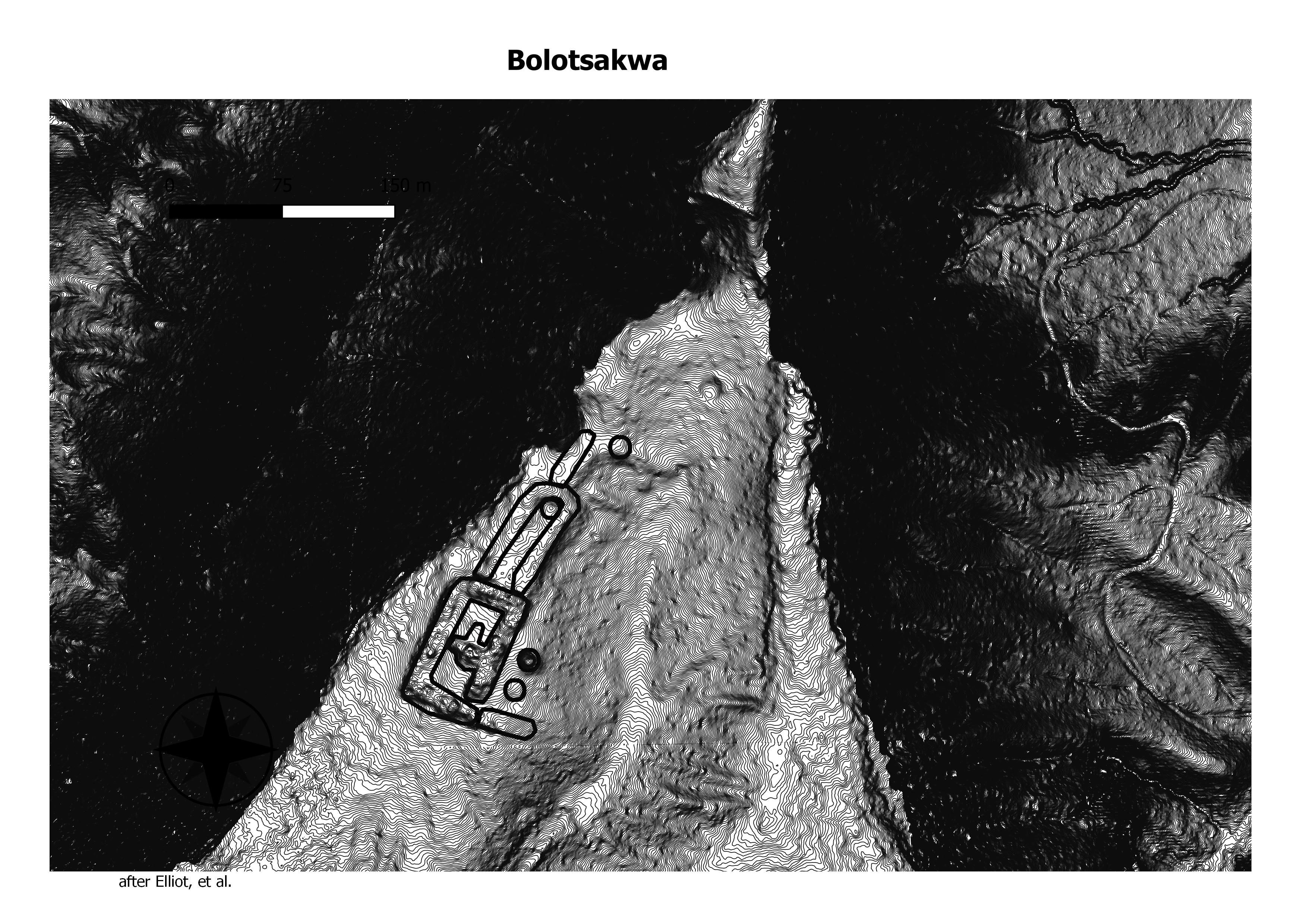
Boletsakwa translates as “Place of the Abalone shell”.
Estimates are that it contained about 650 rooms.
The site seems to have been occupied between 1350 through 1650.
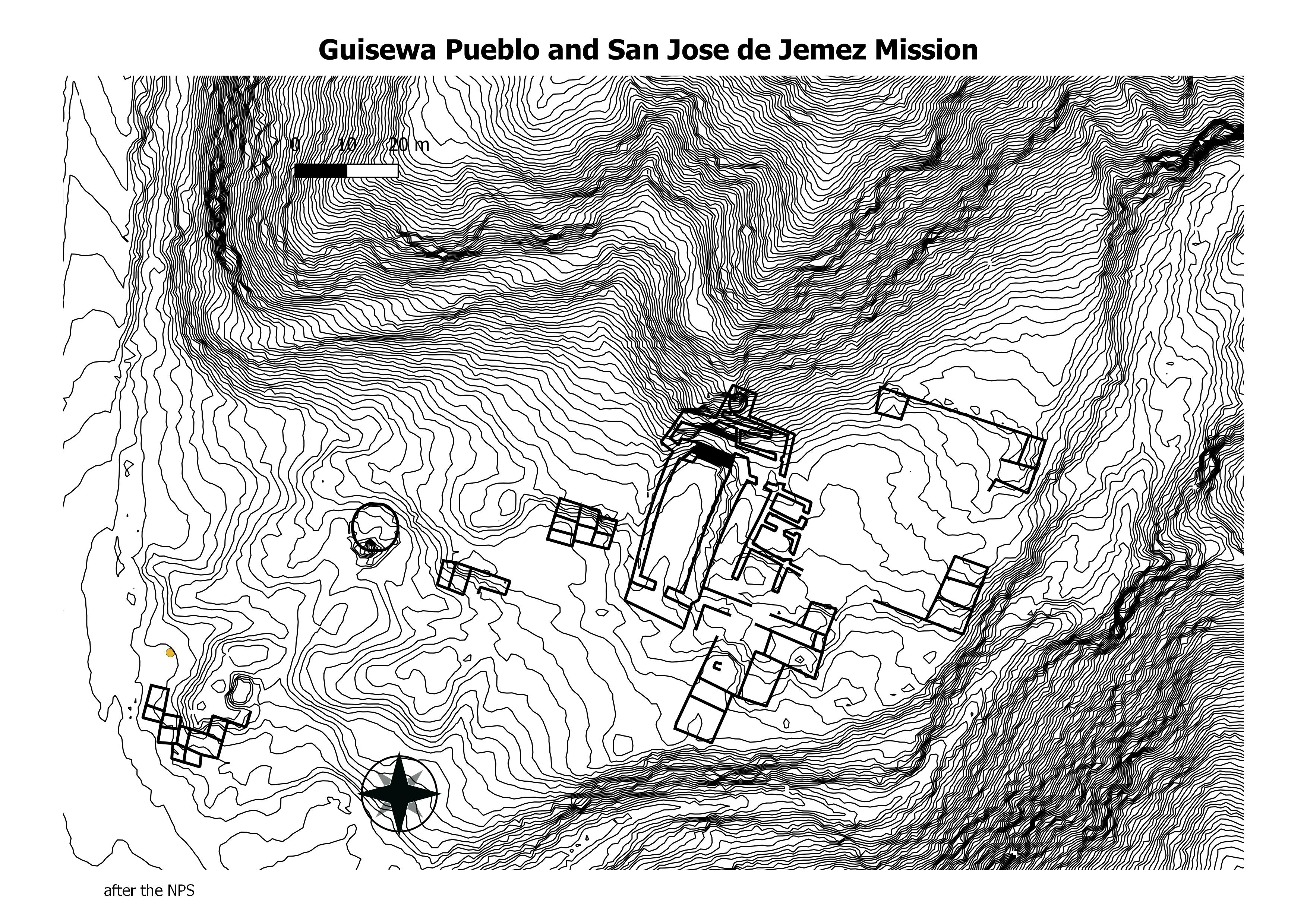
About 50 minutes northwest of Albuquerque is a pueblo settlement along the Jémez River just south of the Jémez Mountains and Santa Fe National Forest. Mission San José de los Jémez and Gíusewa Pueblo Site in Sandoval County, New Mexico, includes the remains of an early 17th-century mission complex and a Jémez Indian pueblo associated with both Native American and Spanish colonial history and an integral part of the heritage of the United States. The ancestors of the present-day people of Jémez (Walatowa) Pueblo built the village of Gíusewa in the narrow San Diego Canyon. The site includes the stone ruins of the pueblo and Mission San José de los Jémez, constructed around 1621. The Franciscans abandoned San José de los Jémez about 1639 although the Jémez continued to live there until about 1680, when they joined other pueblo peoples in successfully driving the Spaniards out of New Mexico. (The NPS)
About 50 minutes northwest of Albuquerque is a pueblo settlement along the Jémez River just south of the Jémez Mountains and Santa Fe National Forest. Mission San José de los Jémez and Gíusewa Pueblo Site in Sandoval County, New Mexico, includes the remains of an early 17th-century mission complex and a Jémez Indian pueblo associated with both Native American and Spanish colonial history and an integral part of the heritage of the United States. The ancestors of the present-day people of Jémez (Walatowa) Pueblo built the village of Gíusewa in the narrow San Diego Canyon. The site includes the stone ruins of the pueblo and Mission San José de los Jémez, constructed around 1621. The Franciscans abandoned San José de los Jémez about 1639 although the Jémez continued to live there until about 1680, when they joined other pueblo peoples in successfully driving the Spaniards out of New Mexico. (Hewitt)
Ancestral Village of Jemez Pueblo, occupied from 1275 C.E. to 1680 C.E. The Pueblo ruinsis llocated on a promontory of the Jemez Mountains 600 feet above the river valley. .Although this village was occupied well into Spanish colonial period, it remained unknown to the Spanish and its location a secret. It has been called the largest pueblo ruin in the Southwest. The village was from 5 to 7 storeys in height, with perhaps 3000 rooms–almost 1/3 of a mile long. (Dennis Holloway)

No. 43. Patokwa.—Two ruined pueblos, extremely interesting on
account of their connection with the events of the Spanish conquest, are found at the confluence of the two main branches of Jemez creek, six miles above the present Jemez pueblo.
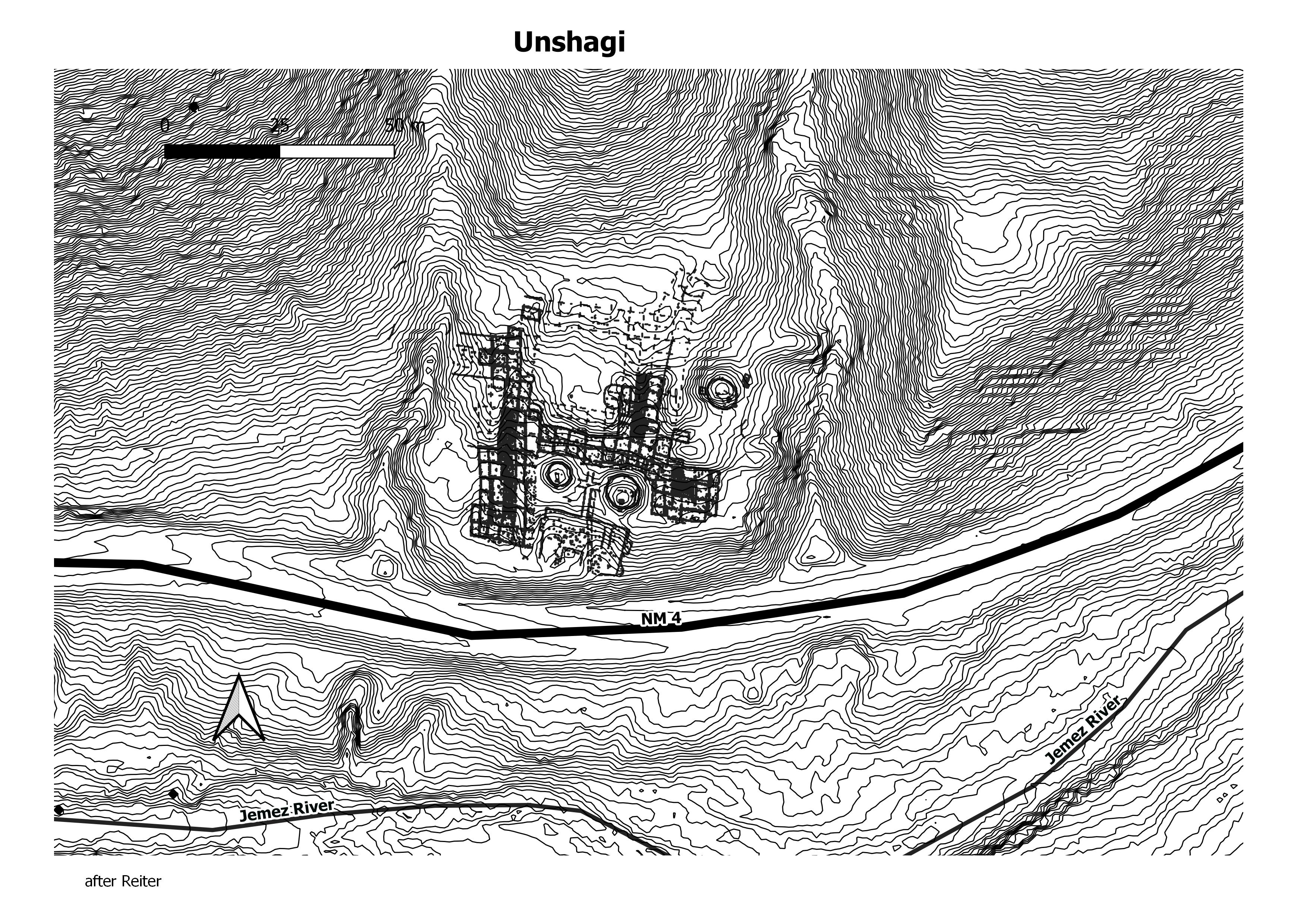
Unshagi consists of several room blocks enclosing a roughly quadrangular plaza area.
Rio Grande
Rio Grande
pottery mound
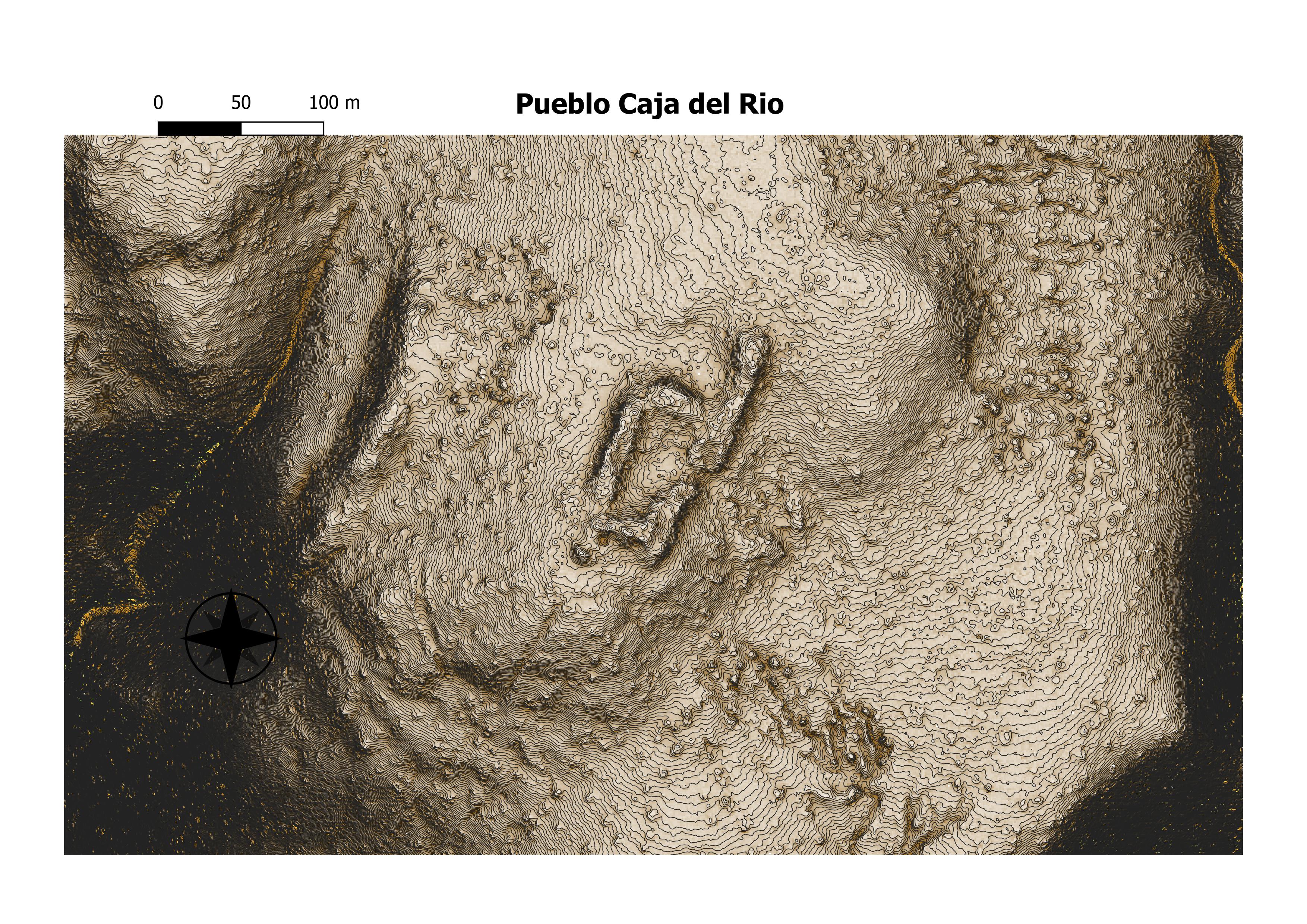
caja del rio
cuyamunge
kuaua
nambe
No data found.
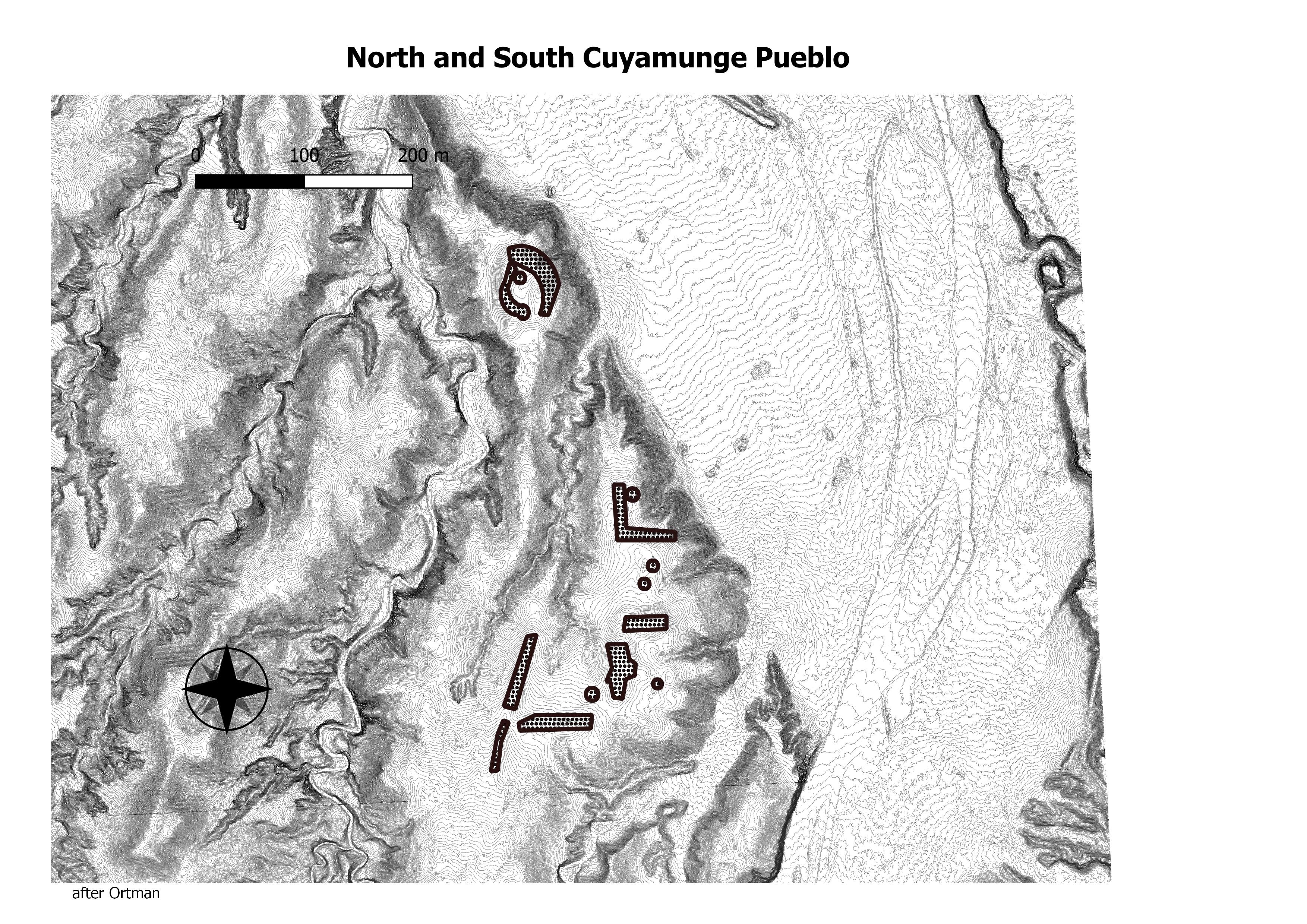
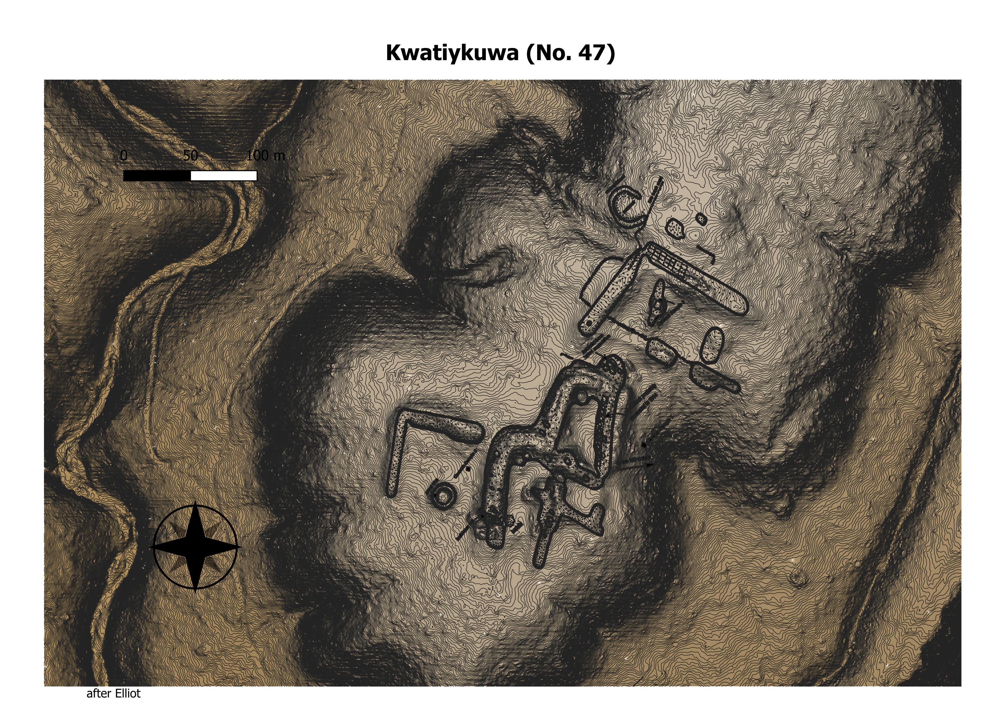
The Cuyamungué Indians were of the Tewa language group. Cuyamungué is located approximately fifteen miles north of Santa Fe – northeast of Tesuque Pueblo. The Pueblo was situated higher up the Sangre de Cristo foothills, with an outcropping that allows a clear view south through the Rio Grande Valley.
Very little is written about this tribe. There is reference to de Vargas killing eleven Tewa people at Cuyamungué in 1694. Cuyamungue was also described as highly involved in the Pueblo Revolt, working alongside Tesuque. (N,M, Council of Health Councils)
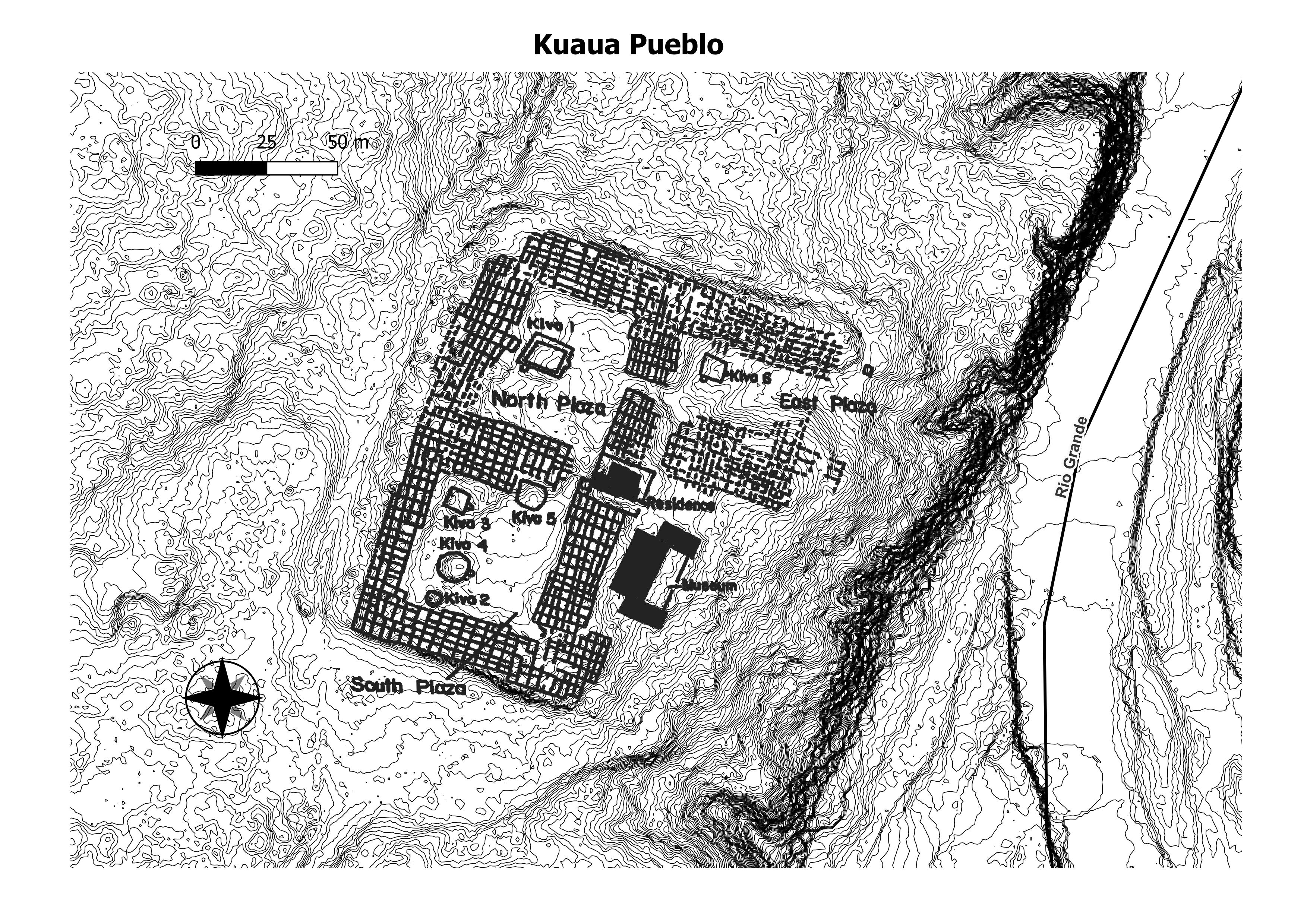
Kuaua was the northernmost of the twelve villages. Its name means “evergreen” in Tiwa. It was first settled around AD 1325 and was occupied by approximately 1,200 people when Coronado arrived. Conflict with Coronado and later Spanish explorers led to the abandonment of this site within a century of first contact. Today, the descendants of the people of Kuaua live in the surviving Tiwa-speaking villages of Taos, Picuris, Sandia, and Isleta. (New Mexico Museum Foundation)
An Ancestreal pueblo of Nanbe. (Rory Gauthier)
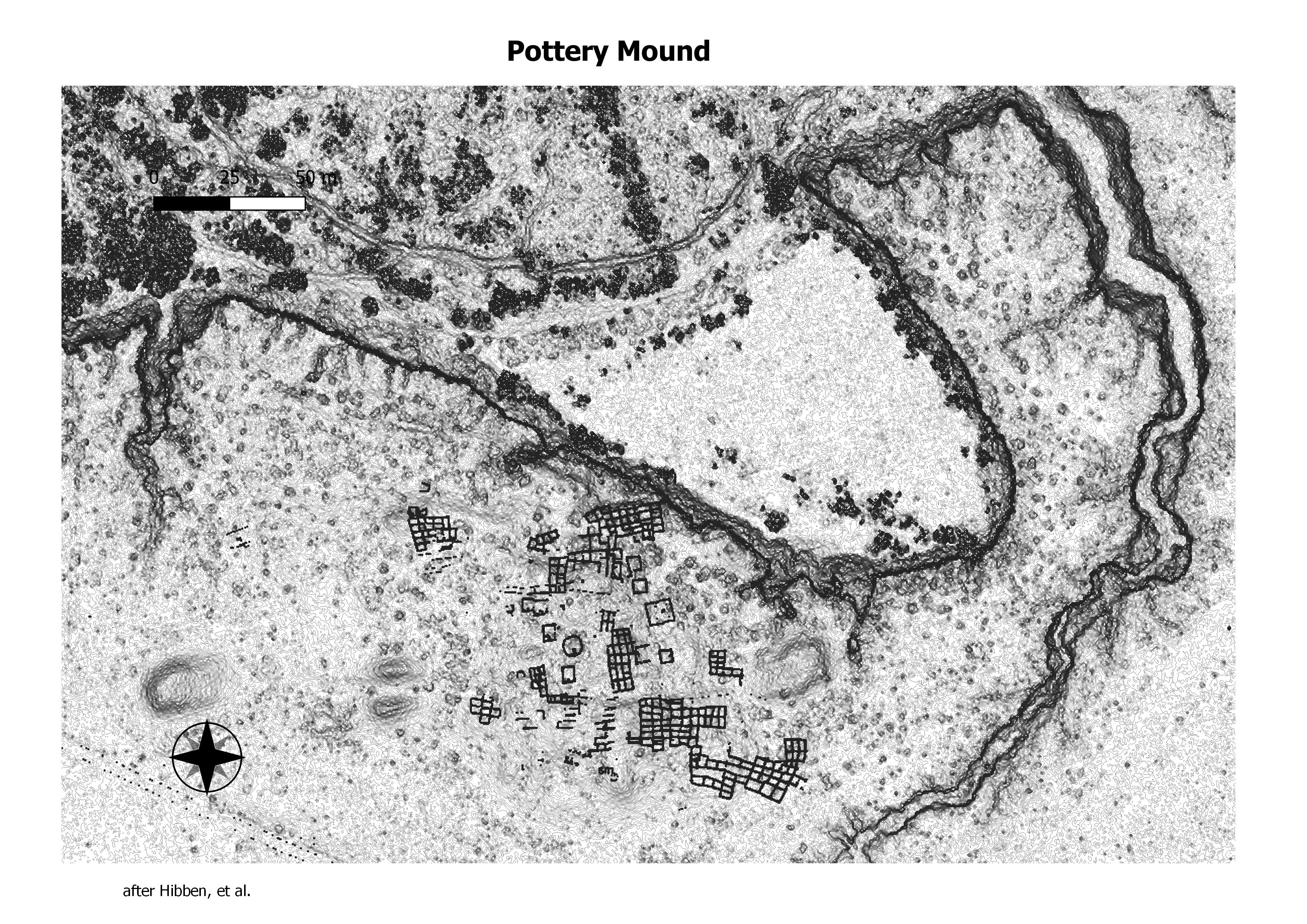
Pottery Mound (LA 416) was a late prehistoric village on the bank of the Rio Puerco, west of Los Lunas, New Mexico. It was an adobe pueblo most likely occupied between 1350 and 1500. The site is best known for its 17 kivas, which yielded a large number of murals. A 2007 book, New Perspectives on Pottery Mound Pueblo (Polly Schaafsma 2007) provides a general introduction to the site. (Wikepedia)
Missions of New Mexico
Missions of New Mexico
san miguel chapel
sandia
santa ana
santa clara
st francis 3d
st. francis
st. thomas mission, abiqui
taos
tesque
ysleta
zia
abo 2
abo
acoma
buenaventira and san yisidro at gran quivara
east morada abiqui
el rosario
gran quivara vat
gran quivara
isleta
mission and pueblo at pecos
mission
morada south, abiqui
nambe
nuestra senora de socoro
pecos
polvadero
quarai
san agustin de la isleta
san buenaventura de cochiti
san filipe
san ildefonso
san jose de garcia church, trampas
san jose de jemez
san juan
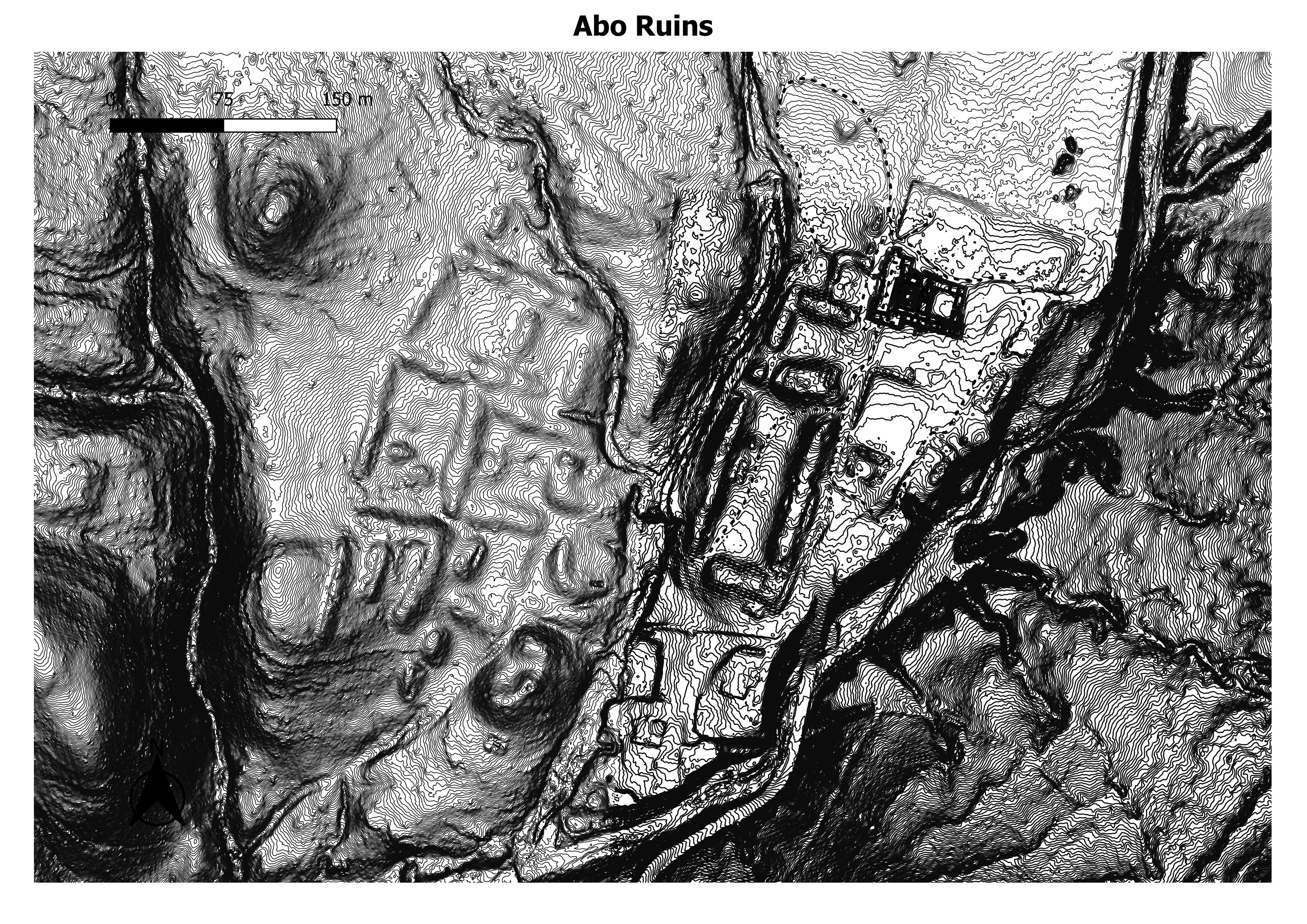
As village-dwelling and sedentary Pueblo Indians, the Abó Tompiros’ livelihood depended on agriculture. The region where they lived is more than 6,000 feet (1,800 meters) in elevation, near the upper climatic limit for corn cultivation. They had little surface water for irrigation, rainfall was sparse and sporadic, and winters were cold. Tompiro settlements were made viable by their proximity to salt deposits in the Salinas and to the bison herds of the Great Plains. The Tompiros were important traders and middlemen between the Plains Indians and the Pueblos of the Rio Grande Valley for salt and bison skins and meat. They s also hunted small and large game in the region, especially deer, pronghorn, and rabbits and gathered wild foods, including pinyon (piñón) pine nuts. (Wikipedia)

The Mission San Gregorio de Abo was founded about 1621 by Fray Francisco Fonte as one of the twenty-one Spanish missions founded in New Mexico. The large San Gregorio de Abo Church and Convento were completed by 1629. The Mission Abo was largely abandoned by 1673, due to a series of droughts, disease and Apache raids that made life in the area precarious. The surviving inhabitants of Abo are believed to have joined their Piro-speaking relatives along the Rio Grande. By 1678, the pueblo was entirely abandoned. (Fortwiki.com)
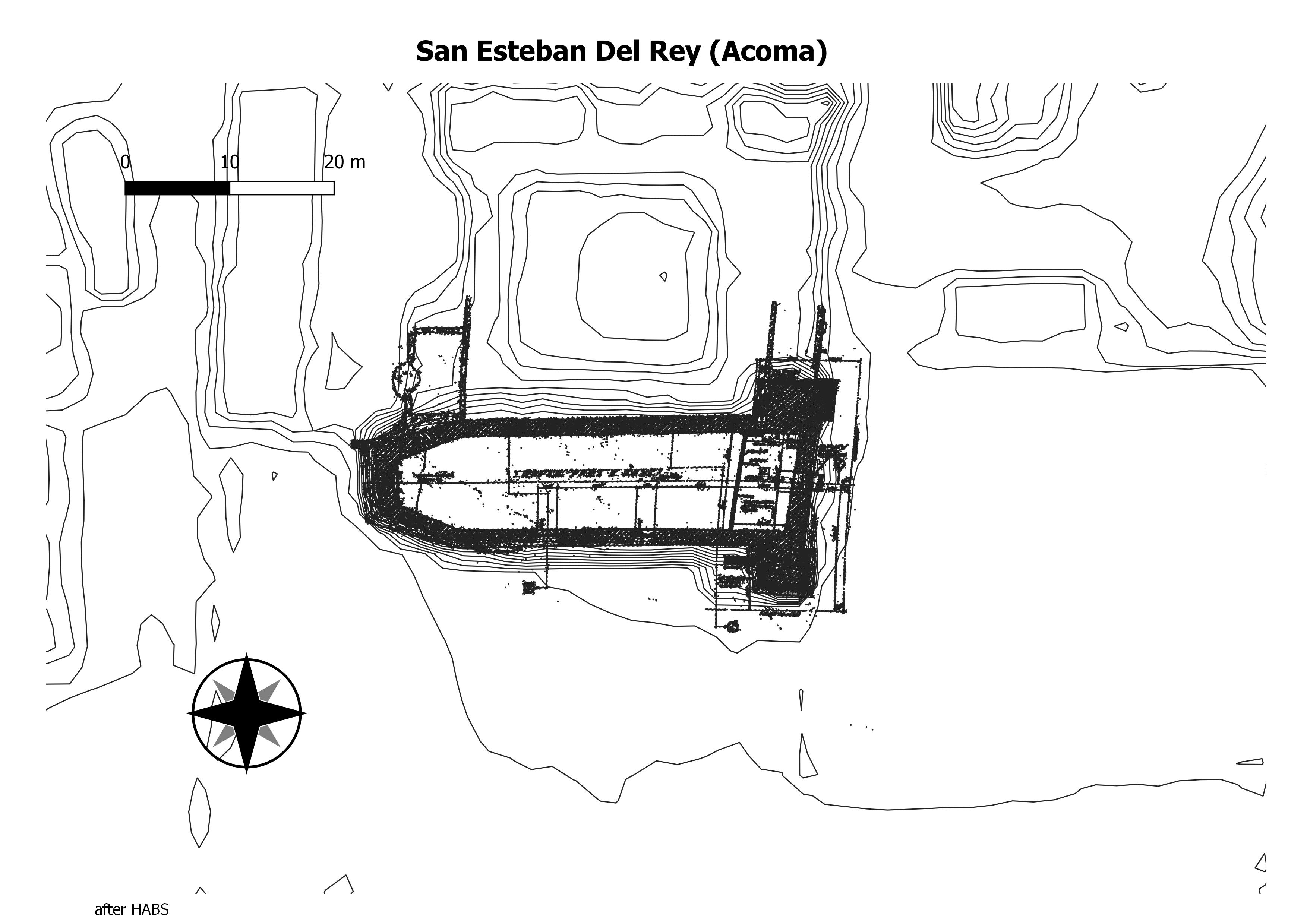
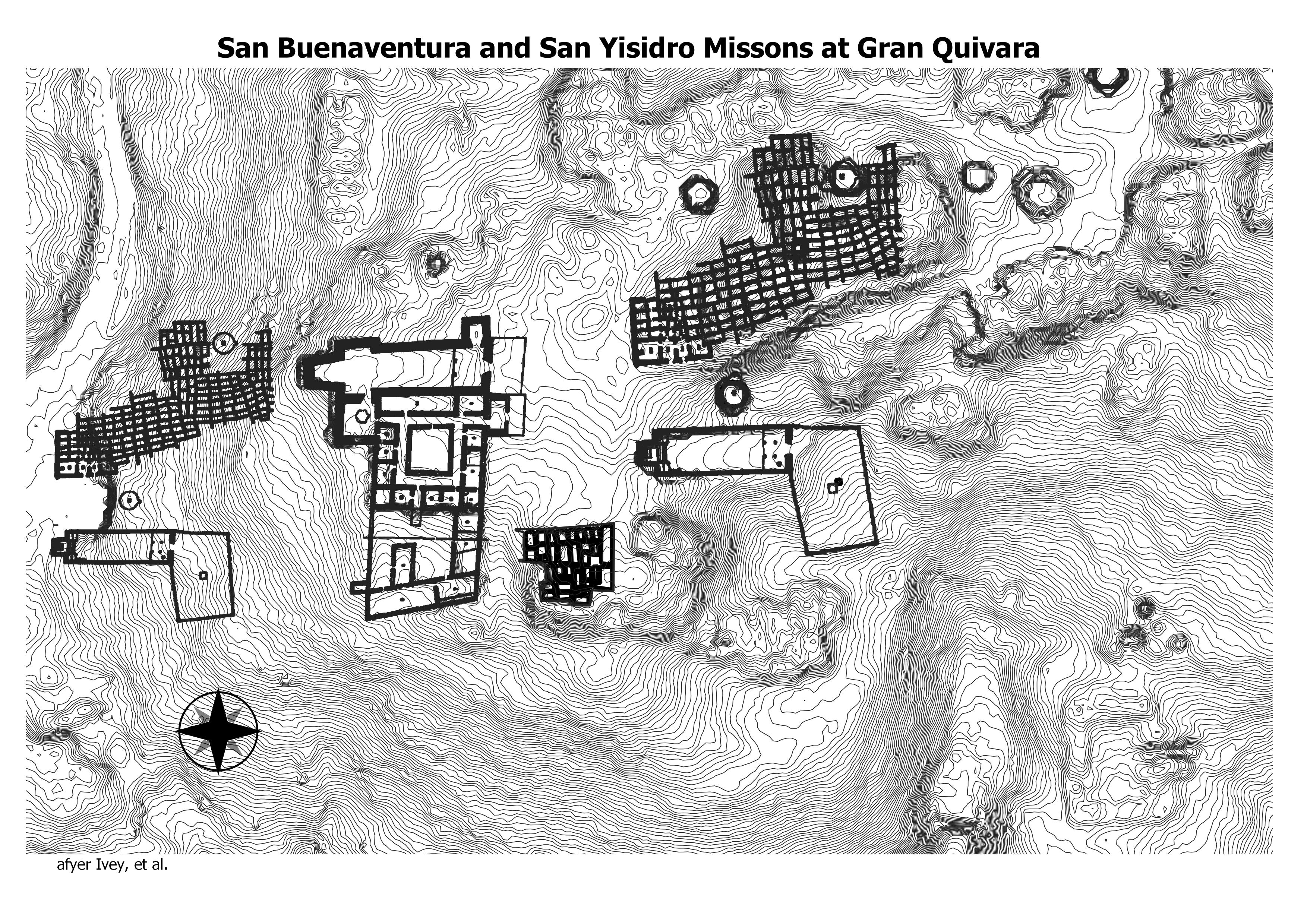
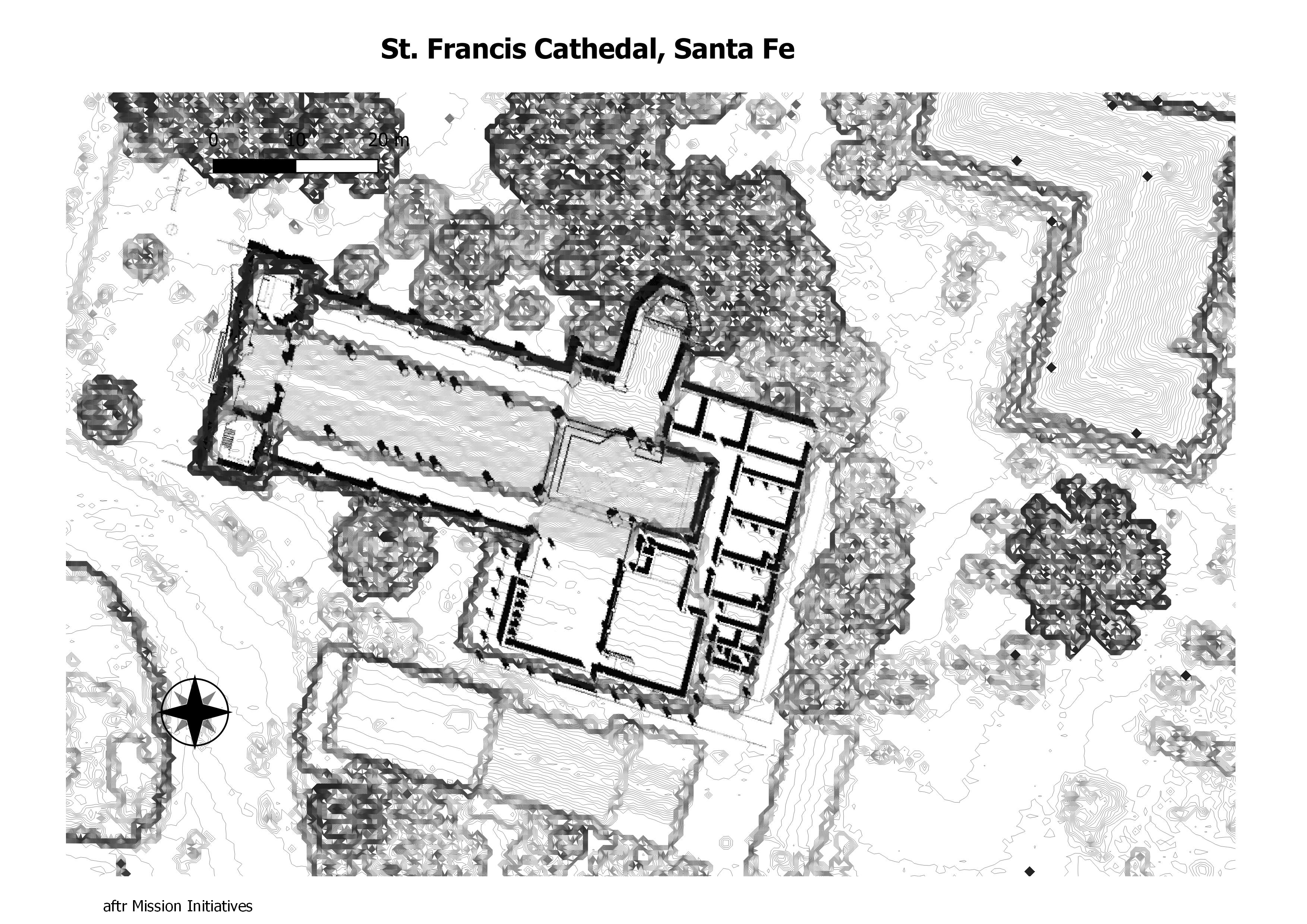
The cathedral was built by Archbishop Jean Baptiste Lamy between 1869 and 1886 on the site of an older adobe church, La Parroquia (built in 1714–1717). An older church on the same site, built in 1626, was destroyed in the 1680 Pueblo Revolt. The new cathedral was built around La Parroquia, which was dismantled once the new construction was complete. A small chapel on the north side of the cathedral was kept from the old church. (Wikepedia)
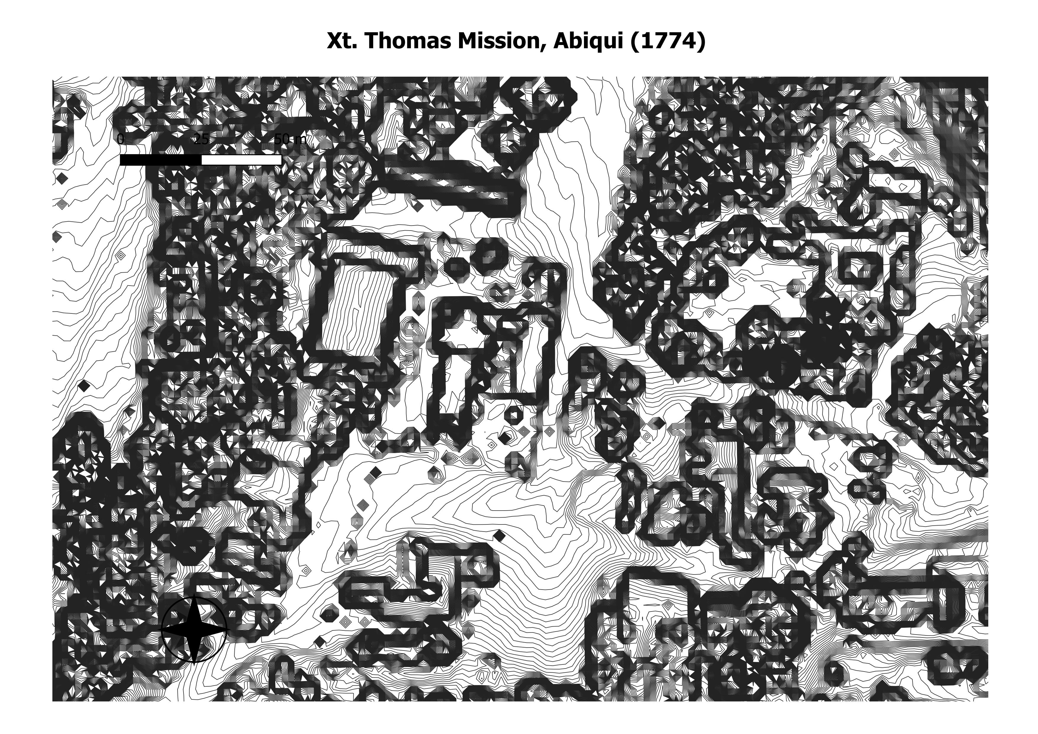
After the fire of 1867 the people of Abiquiú rebuilt their church of Santo Tomás and kept on celebrating the feast of Santa Rosa. Adolph Bandelier, who thought Abiquiú “quite a romantic spot” and the view superb, was there on the Día de Santa Rosa in 1885. Such a crowd had assembled that Bandelier found himself standing outside for Mass. At least he had his facts straight. “The old Pueblo of ‘Genízaros,'” he wrote in his journal, “stood where the store and church are now, but the old church of Santa Rosa de Abiquiú is still two miles farther down, or east, of here.” The rebuilt church in Abiquiú proper, first with traditional flat roof and, by the early twentieth century, with pitched roof and cupola, had a unique feature. Placed high, perhaps 10 feet off the ground, in the plain end-wall facade and reaching to the ceiling were two vertical, elongated niches or windows, each about 2-1/2 by 8 feet. Set wide apart, they looked like the stylized eyes of some giant jack-o’-lantern. (The NPS)
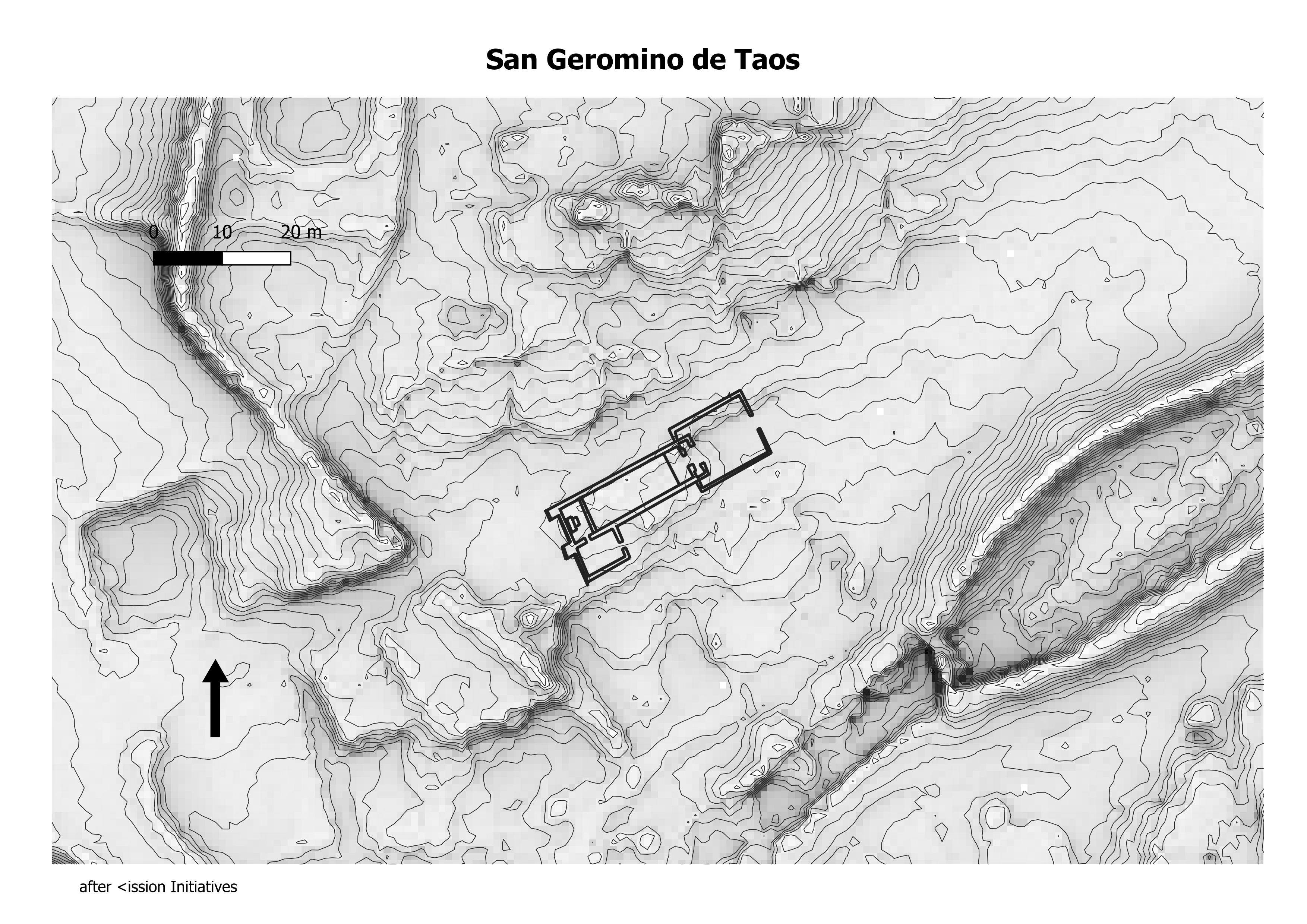
Taos pueblo built a new church on the main plaza sometime after 1847. Early photos taken around 1885 depict a church that looks different from the structure seen today. The original chapel was a plain, simple building. There have been many modifications and renovations over the last century. The windows that line both walls have Gothic flourishes that imply renovation during Archbishop Lamy’s tenure. Lamy favored gothic flourish and implemented his vision throughout the diocese. Taos added a turret in the 1920s, twin towers, reminiscent of the churches in Las Trampas and Santo Domingo. (The NPS)
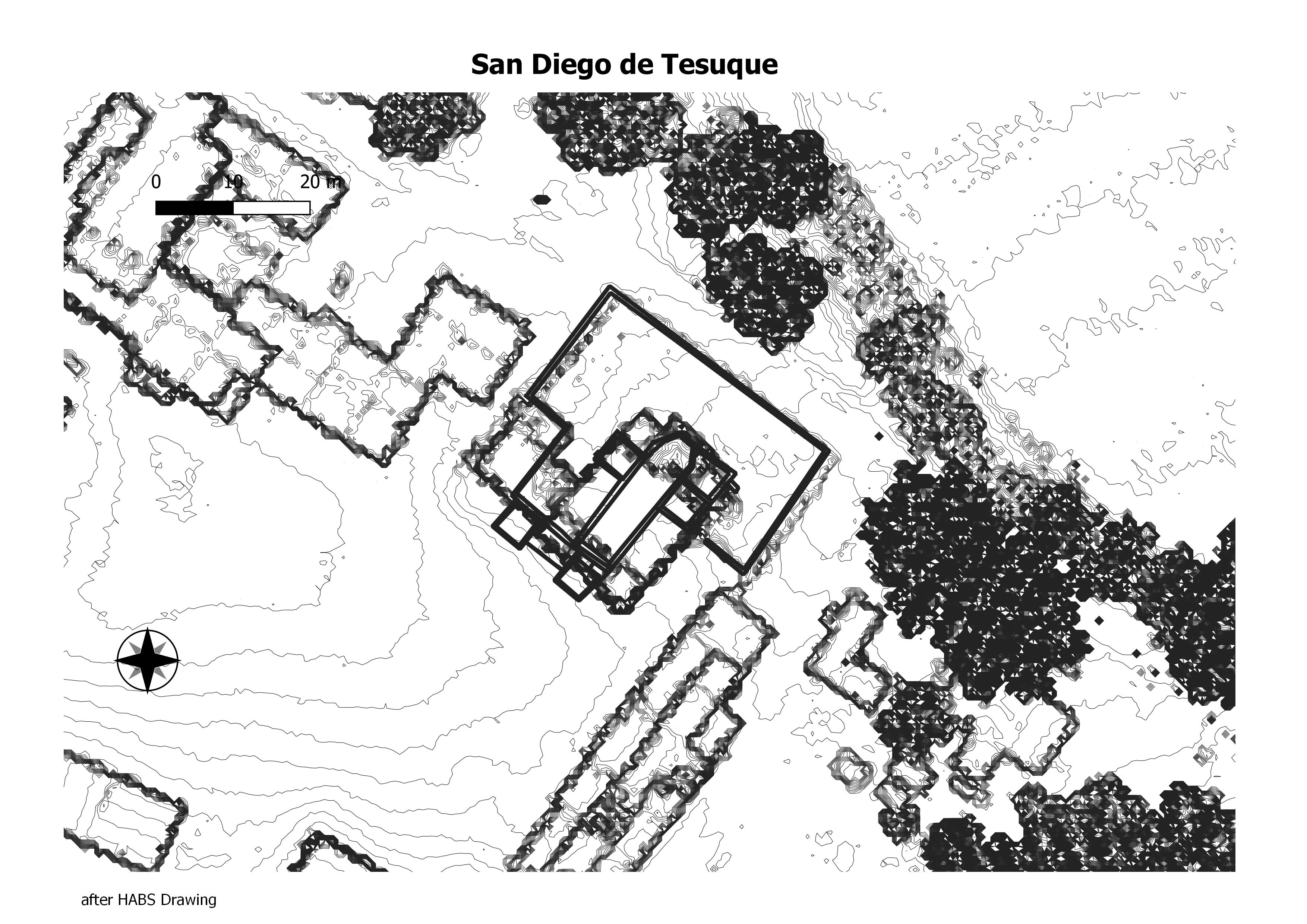
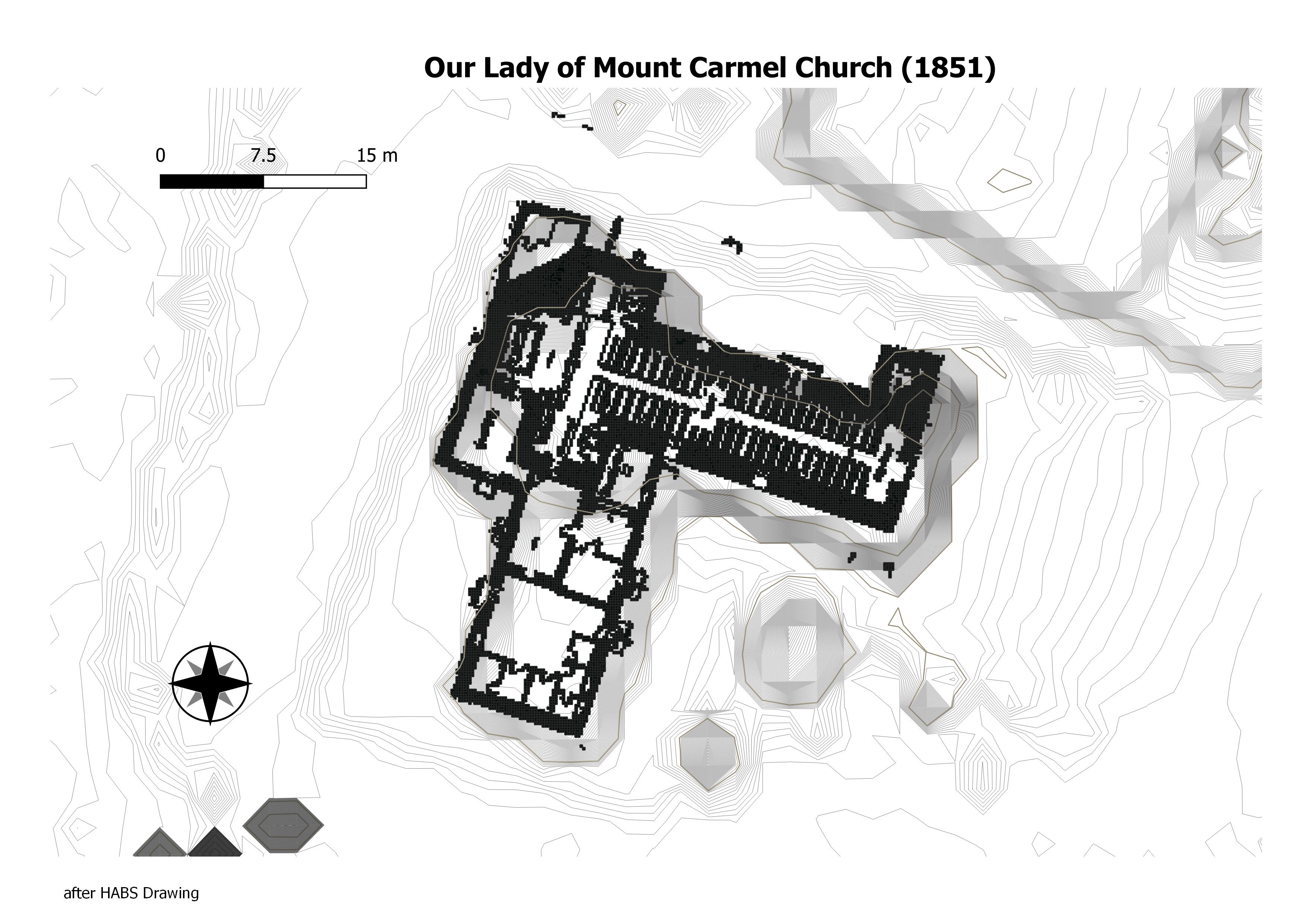
Our Lady of Mt. Carmel Church is a historic church building in Albuquerque, New Mexico. It was built in 1870 in a Vernacular Pueblo Revival style. The building was added to the National Register of Historic Places in 1984. (Wikepedia)
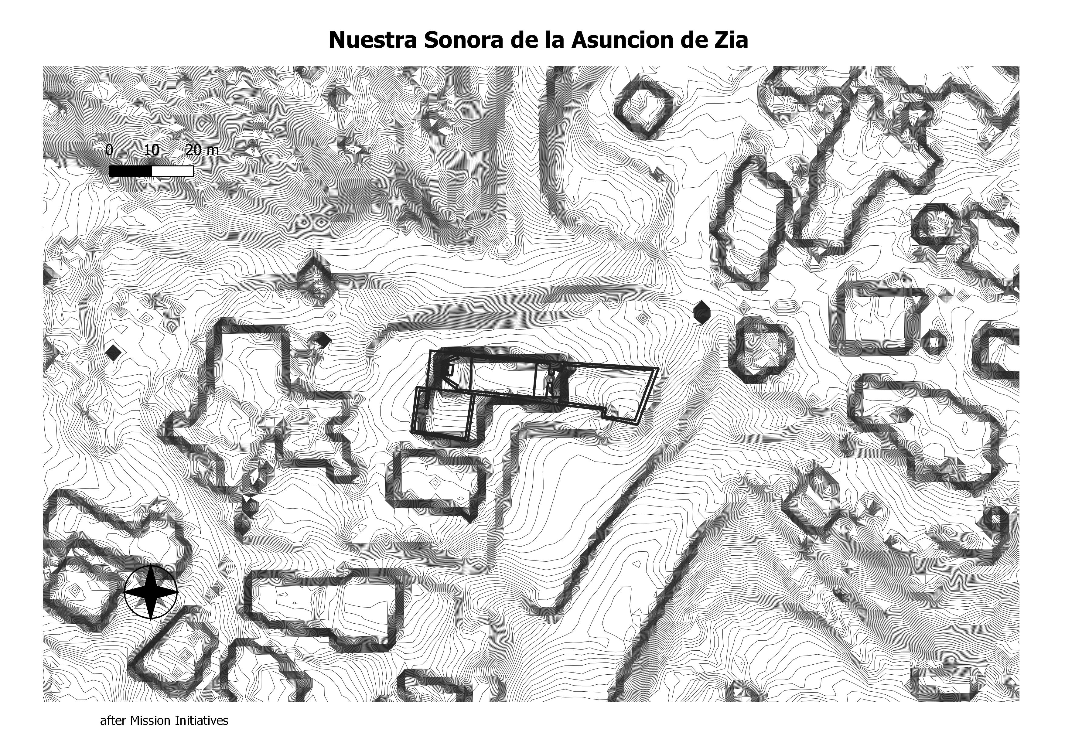
Mission Nuestra Señora de la Asunción de Zía was a Spanish Mission to the Zia Indians, established around 1610 by Franciscan missionaries accompanying Juan de Oñate. The church sustained severe damage in the Pueblo Revolt of 1680; after the reconquest of the territory by Diego de Vargas in 1692, the Franciscans returned and performed a mass baptism of the Zia.[1] Reconstruction of the church began in 1706 under the supervision of Fray Juan Alvarez, and was completed in 1750 under Fray Manuel Bermejo. (Wikepedia)
Chaco-Arizona
Arizona Chaco
Arizona Chaco
wide reed
chambers
emigrant springs
ganado greathouses
houck
isham
kin tiel
klagetoh
sanders accropolis
sanders
taylor springs
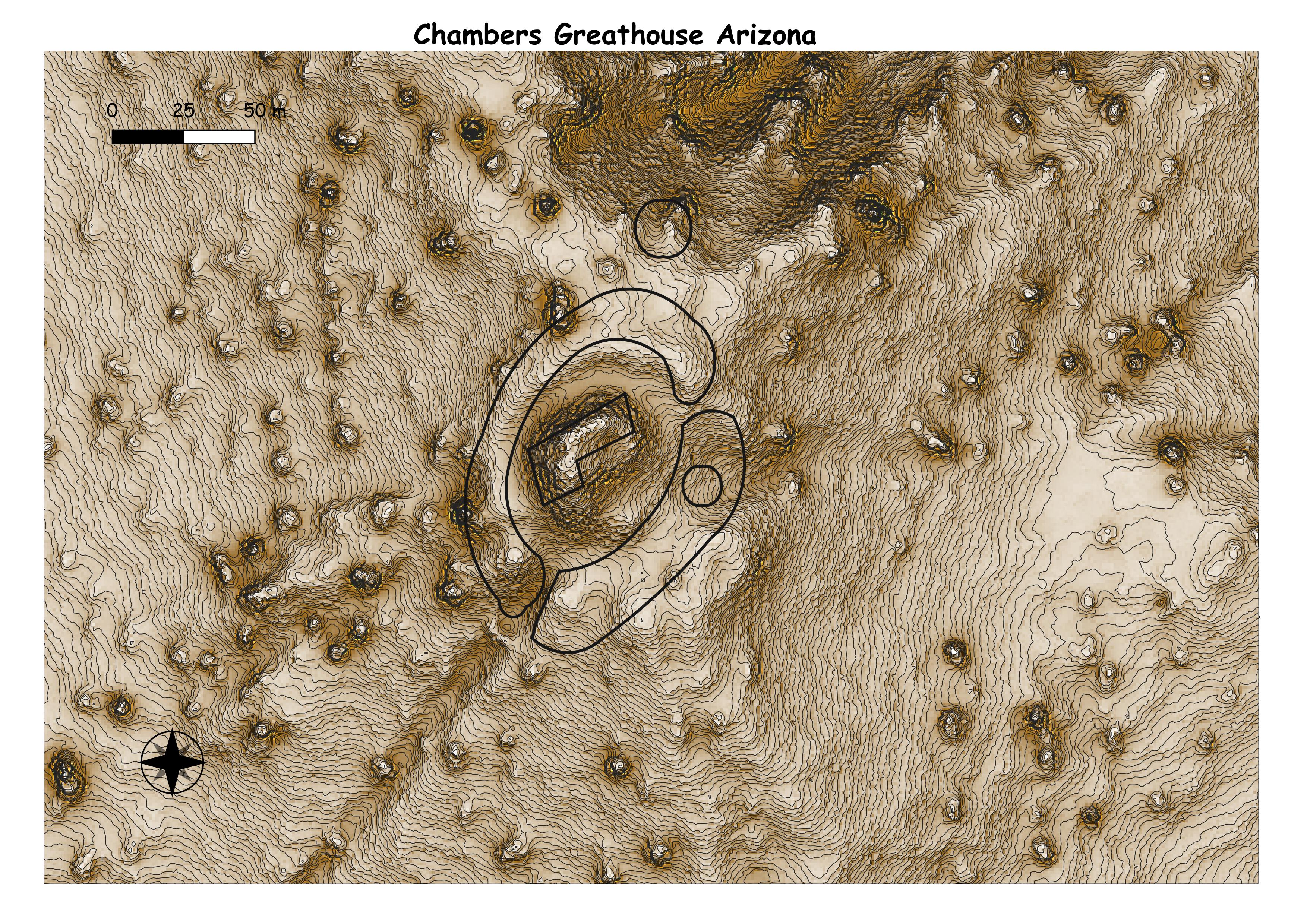
The Chambers great house contains an estimated 40 ground-floor rooms and 2 interior kivas. This site is surrounded by a berm with openings for perhaps ten roads. A large depression, likely a great kiva, is located outside the berm to the northeast of the great house. Ceramics on the surface of the Chambers great house suggest that it was occupied from about A.D. 1125 to 1275, making it one of the last great houses to be constructed in the valley . (Tne Chaco Archives)

No written data found.
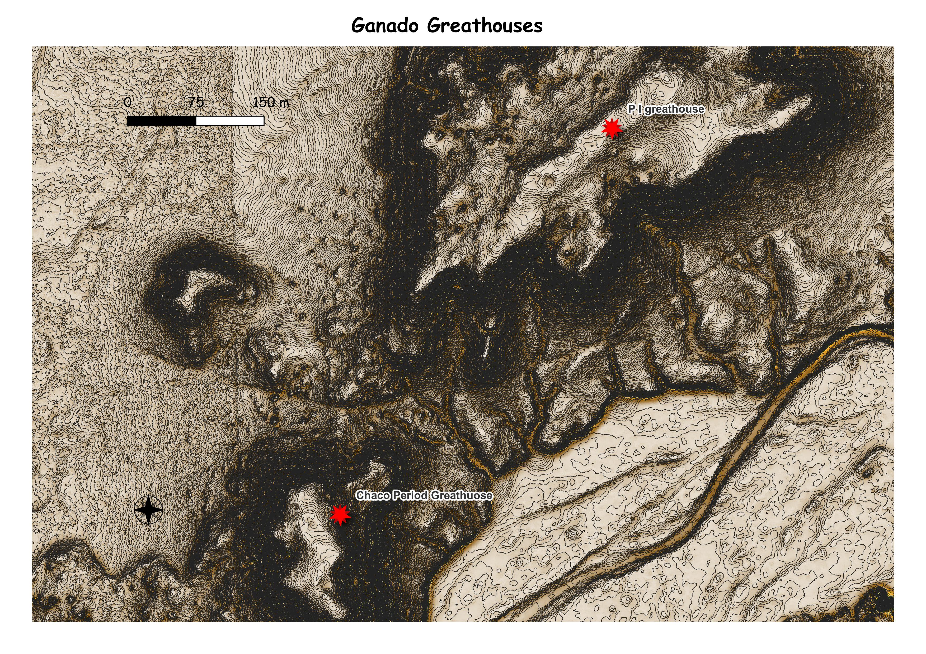
No written data found.
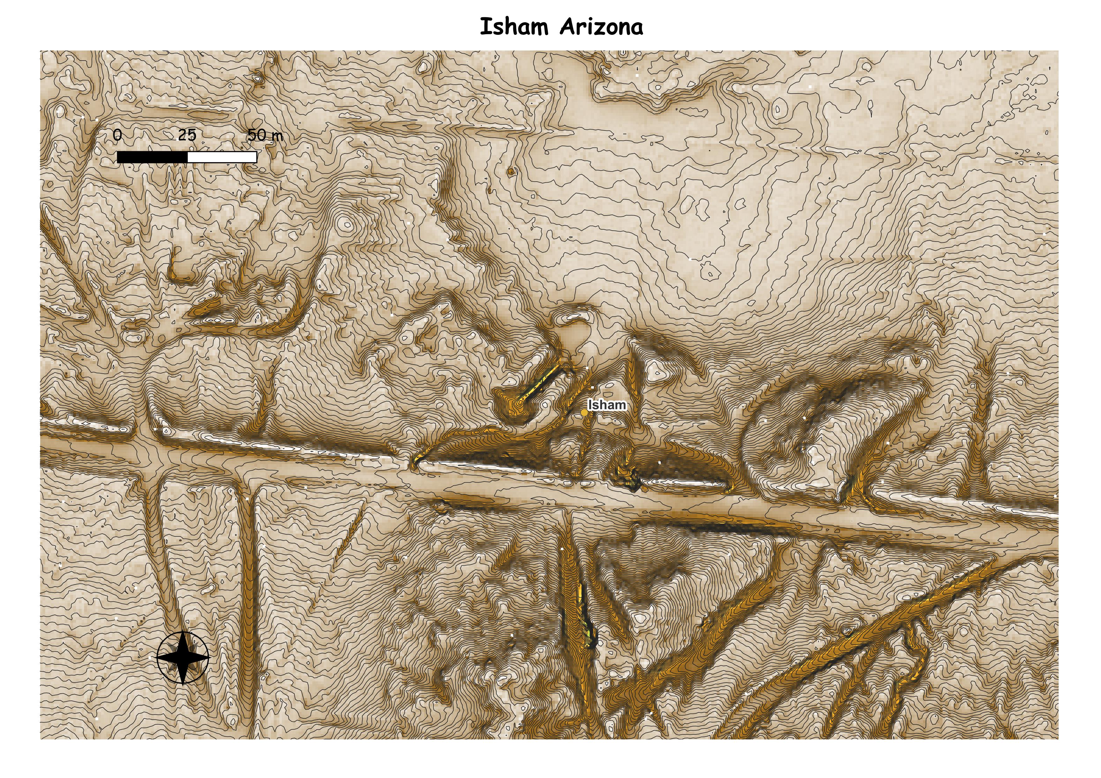
No written data found.
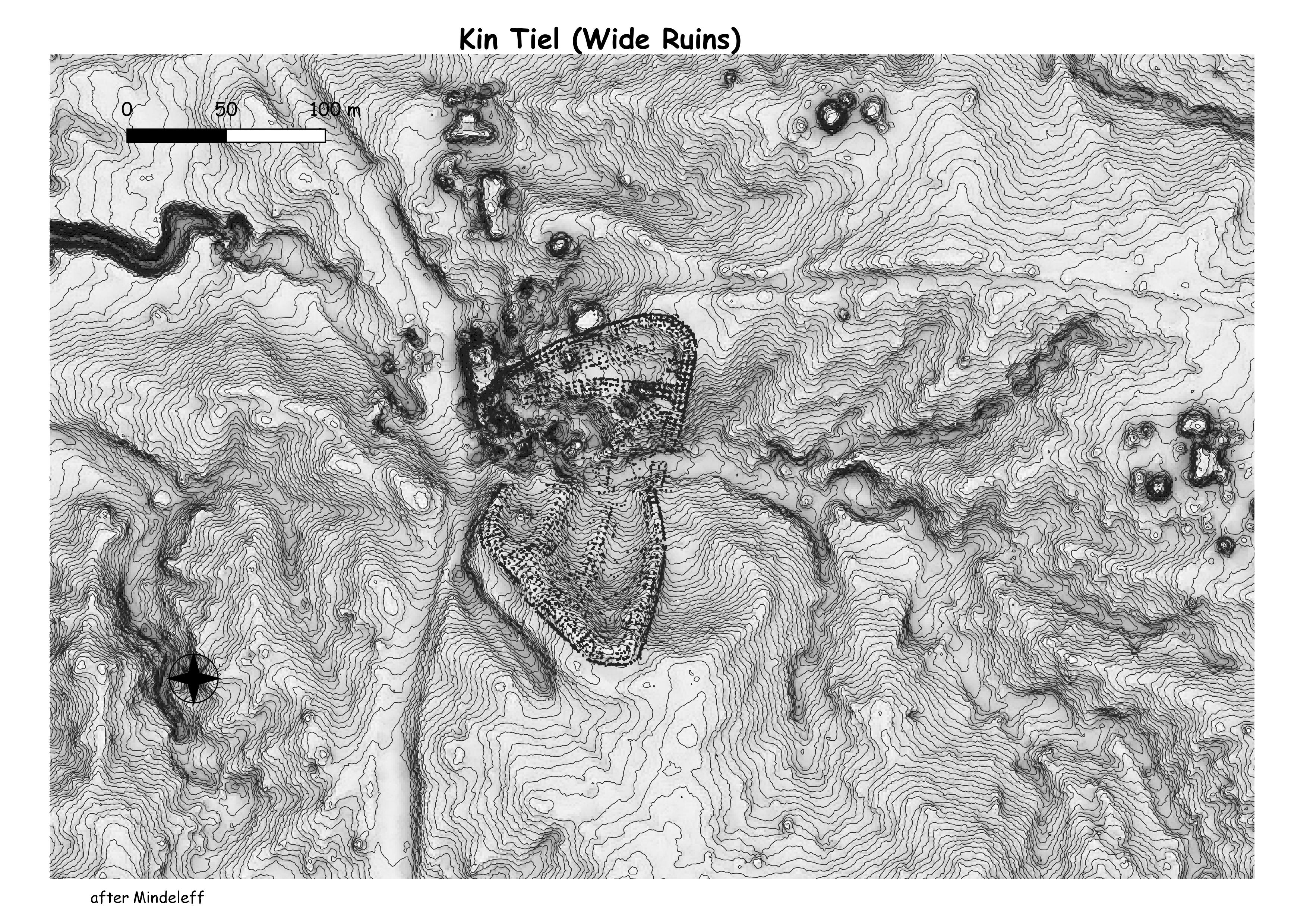
The pueblo was constructed in 1276 AD, and was constructed all at once, consisting of over 1300 rooms in 3 stories. Victor Mindeleff visited the ruins in the 1880s, at which point much of the outer wall was still extant, to a height of two stories. Pottery found at the site as become known as the “Kin Tiel focus” of the “Rio Puerco” pattern. The National Geographic Society excavated the site in 1929. Most of the stones which were still standing in walls were pulled down to construct a trading post nearby in about 1895. That trading post was subsequently torn down in the 1980s. (Wikepedia)
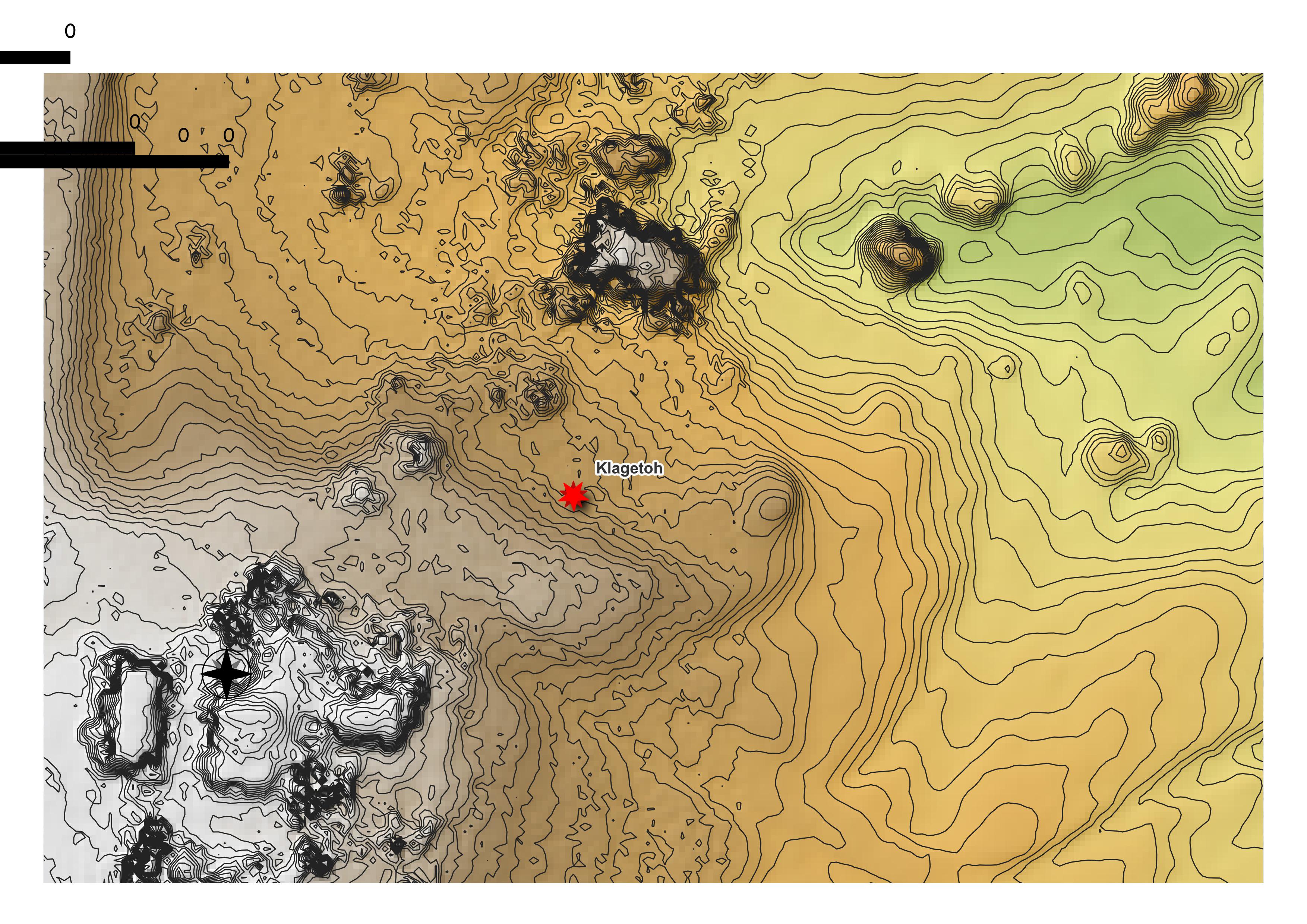
No Written data found.

The Sanders great house contains an estimated 30 ground-floor rooms and one interior kiva. Wilcox estimates a total interior floor area of 360 m2. The site is surrounded by a berm, which is broken by a swale (possibly a prehistoric road) running to the northeast. Based on ceramics from the excavations, Fletcher suggests that this great house was in use from about A.D. 1000 to 1050. The central portion of the room block was probably 2 stories tall, based on 7 m of wall fall to the northwest of the room block, but the rooms on the west side (excavated by the Zuni Cultural Resource Enterprise) were never completed, and represent an unfinished addition to the site. Fletcher (1994) identified formal burial areas at the site, which he interpreted as possible evidence of status differentiation. (The Chaco Archives)

No written data found.
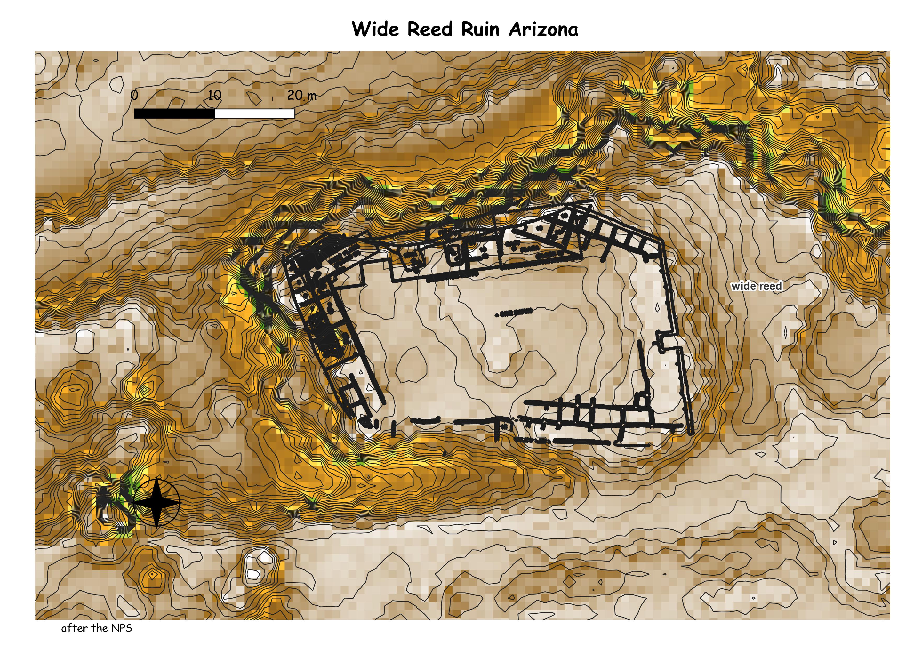
Wide Reed Ruin forms an irregular pentagon with a missing north corner. It measures roughly 50 m east-west and 30 m north-south. By tracing the direction of the outside walls on the east and west to a point where they would meet on the north, it is estimated that the wash has moved a good 10 m into the pueblo. The original north-south dimension, then, was at least 40 m. The continuous outer and inner walls, the wall abutment pattern of the partitions and the tight cluster of tree-ring dates (at A.D. 1276) indicate the pueblo was planned and built as a unit. (The NPS)
Colorado Chaco
Southwest Colorado Chaco
chimneyrock
coyote village
escalante
farview and pipeshrine
farview community
farview towers
haynie
ida jean
jor ben wheat complex
lowery pueblo
mitcheli spaings
mummy lake
wallace
yrllowjacket pueblo
yucca house
ansel hall ruins

Jim Kendrick recorded this site as a part of his Lowry survey – it is approximately 1 km west of Lowry. It may not be a great house, but it is a big bump that may have 50 rooms. (Chaco Archives)
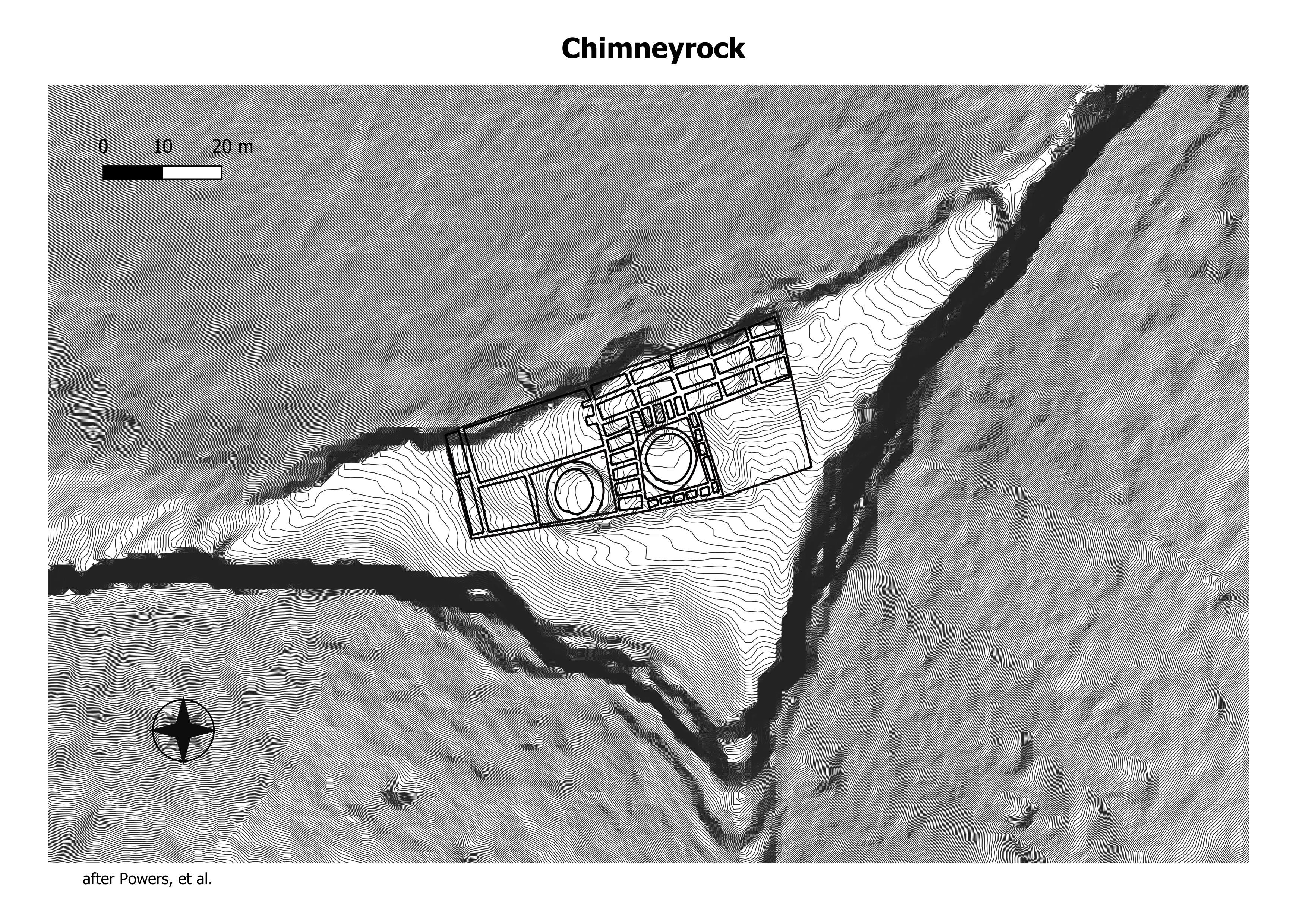
Housing approximately 2,000 ancient Pueblo Indians between AD 925 and 1125, the settlement included a Great House Pueblo with round ceremonial rooms, known as kivas, and 36 ground-floor rooms. A grizzly bear jaw found in one of the rooms when excavated suggested a reverence for the animal, and modern Chaco oral history suggests that the Bear clan originated in the Chimney Rock area. Evidence suggests that Great House Pueblo was first built in AD 1076 during a lunar standstill and expanded and finished in AD 1093 during another. It consists of 36 rooms and two kivas. (Wikepedia)
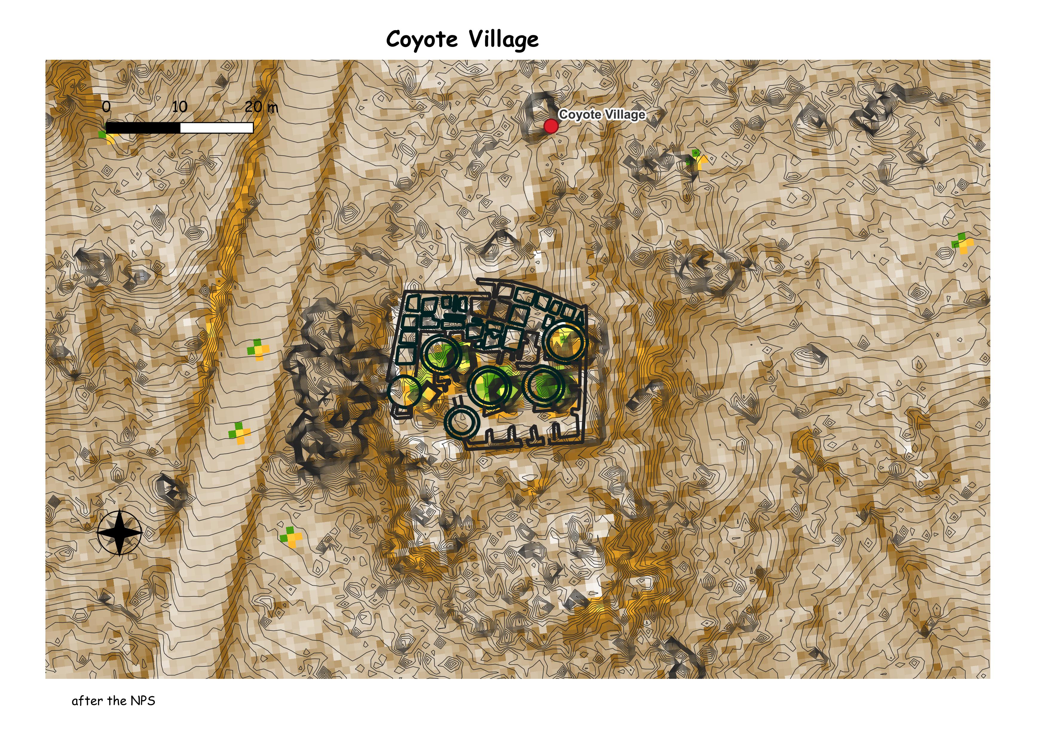
Coyote Village is the most recently excavated village open for public display in Mesa Verde National Park. The University of Colorado excavated this village during the 1968 and 1969 seasons.
Coyote Village consists of some 30 ground floor rooms, five kivas, and a circular tower. 40 to 50 people probably occupied the village you see here in the A.D. 1000’s. Much of the stone work is single course masonry.
During excavation, archeologists uncovered evidence of an earlier occupation of this site during the A.D. 800’s or 900’s. Some walls are also double course masonry suggesting some construction or remodeling during the Classic Pueblo Period. Double course walls may have supported second story rooms, but there is no evidence of this in Coyote Village. (Mesa Verde Museum Association)

This Chacoan structure is located on a ridge forming the west side of the valley drained by Simon Draw, northeast of Cortez, Colorado. Wallace and Haynie are other great houses in this community, often referred to as the Lake View Group community. (The Chaco Archives)
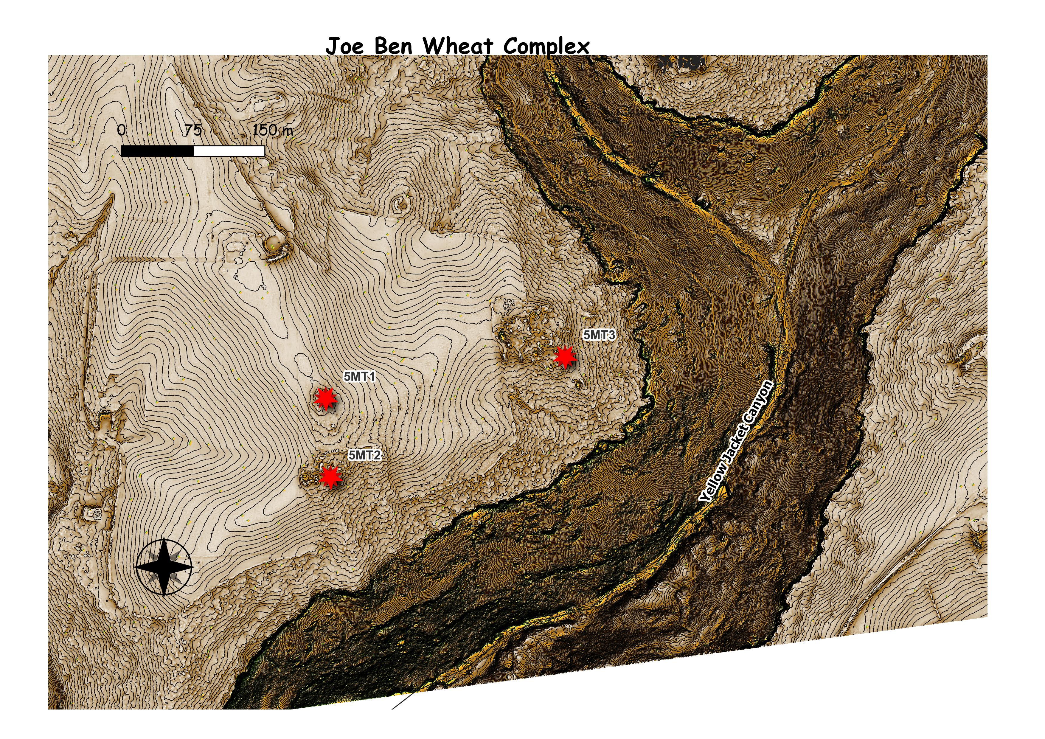
Consisting of three multi-component sites, the complex has the potential to provide important information about the design and development of Ancestral Puebloan communities. While there is evidence of earlier habitation, the most extensive, visible and impressive architectural elements are from the Great Pueblo Period (AD 1075-1300). Its over 90 rooms, 14 kivas, and a dance plaza constitutes one of the largest satellite settlements of the 13th century community known today as Yellow Jacket. (History Colorado)
Mounds
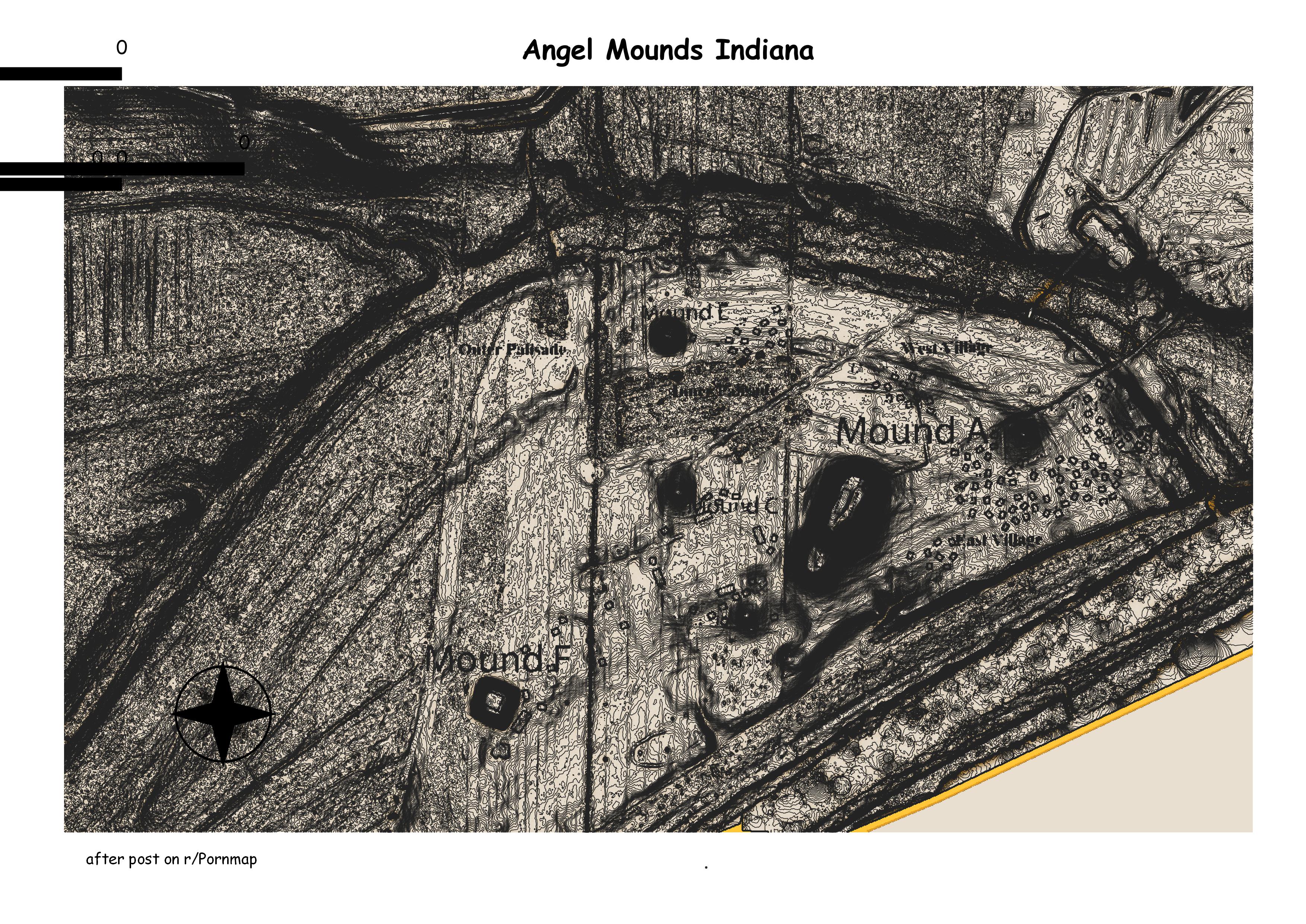
Located on the banks of the Ohio River near Evansville, IN, the Angel Mounds State Historic Site boasts a unique combination of nature, history, and archeological wonders sure to entertain all visitors. From 1000-1450 A.D., the area was the site of a Middle Mississippian culture town where the cultivation and storage of corn allowed a permanent community to persist. The town’s inhabitants left by 1450 A.D. for reasons unknown, although it was possibly due to nutrient-depleted soils or lack of wild game. (the NPS)
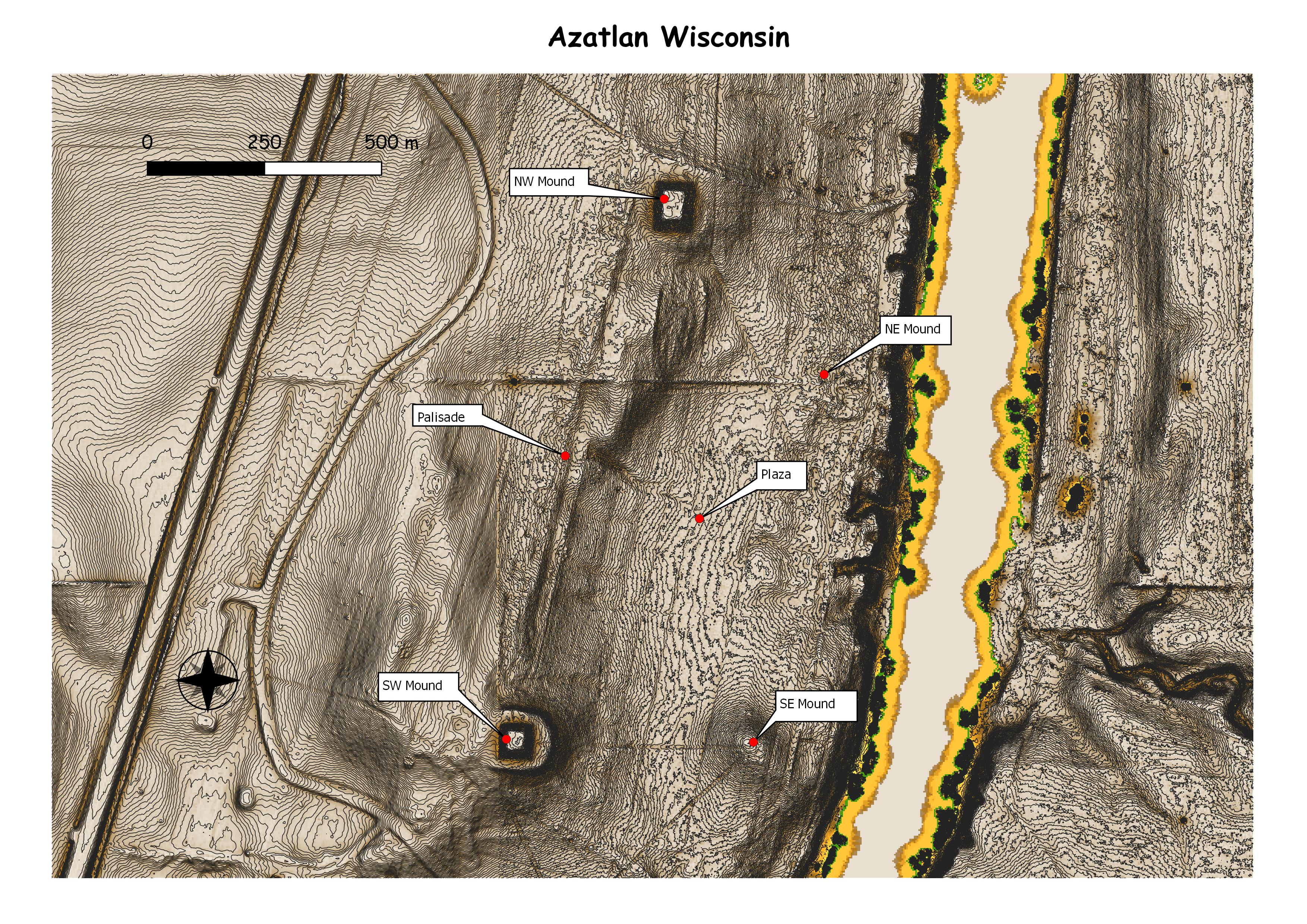
Aztalan was first settled around 900 CE by a Native American culture known as the Middle Mississippian tradition. The chief center of a Middle Mississippian settlement is at Cahokia, in present-day Illinois, a city that at its peak had 20,000–30,000 people. This was not surpassed by Europeans in North America until after 1800. These settlements are characterized by the construction of earthwork mounds, stockades, and houses, by decorated Mississippian culture pottery, and agricultural practices. There are also elements of the Woodland culture found there. (Wikepedia)

Cahokia was the largest and most influential urban settlement of the Mississippian culture, which developed advanced societies across much of what is now the Central and the Southeastern United States, beginning more than 1,000 years before European contact.[7] Today, the Cahokia Mounds are considered to be the largest and most complex archaeological site north of the great pre-Columbian cities in Mexico. (Wikepedia)
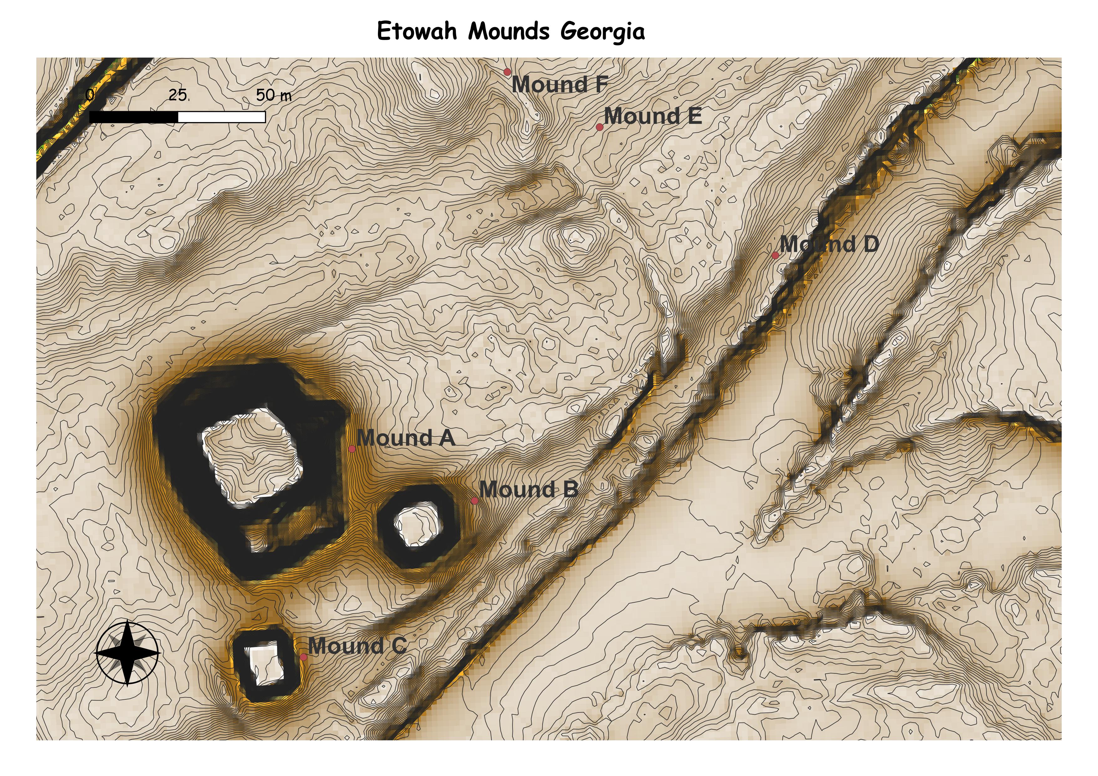
Etowah Indian Mounds (9BR1) are a 54-acre (220,000 m2) archaeological site in Bartow County, Georgia, south of Cartersville. Built and occupied in three phases, from 1000–1550 CE, the prehistoric site is located on the north shore of the Etowah River. (Wikepedia)
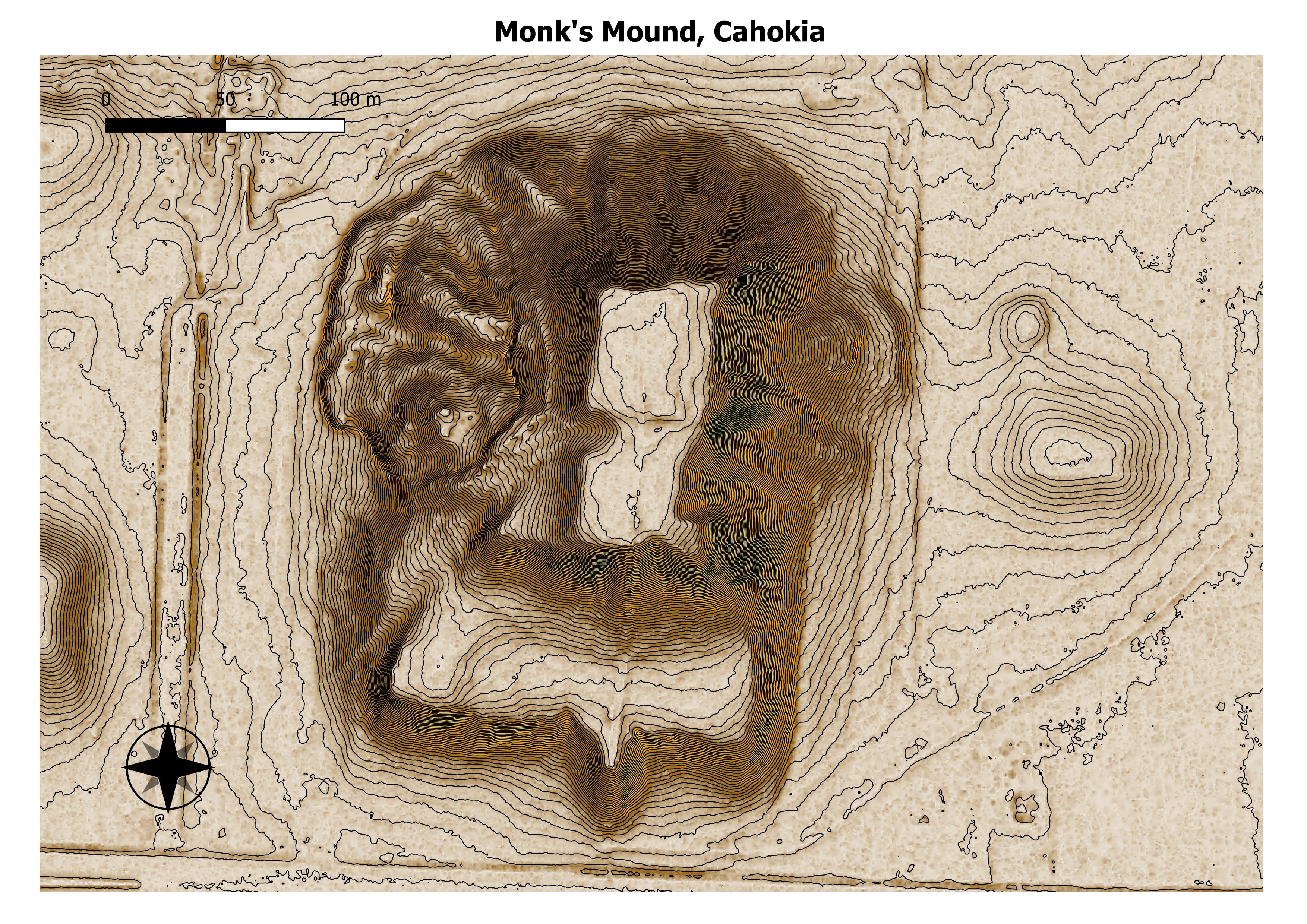
Monks Mound is the largest Pre-Columbian earthwork in the Americas and the largest pyramid north of Mesoamerica. The beginning of its construction dates from 900 to 955 CE. Located at the Cahokia Mounds UNESCO World Heritage Site near Collinsville, Illinois, the mound size was calculated in 1988 as about 100 feet (30 m) high, 955 feet (291 m) long including the access ramp at the southern end, and 775 feet (236 m) wide.[1] This makes Monks Mound roughly the same size at its base as the Great Pyramid of Giza (13.1 acres / 5.3 hectares). The perimeter of its base is larger than the Pyramid of the Sun at Teotihuacan. As a platform mound, the earthwork supported a wooden structure on the summit. (Wikepedia)
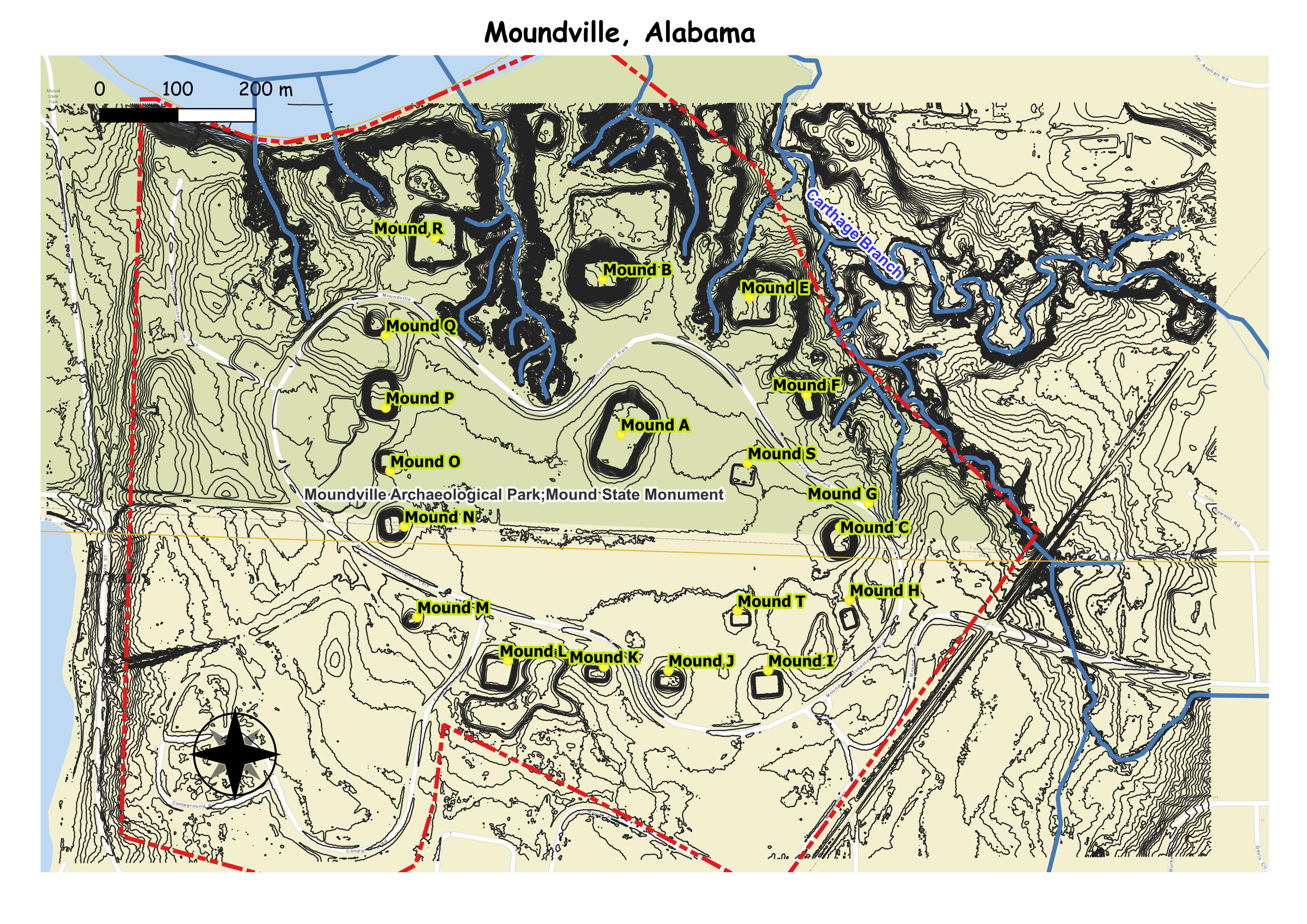
Moundville Archaeological Site, also known as the Moundville Archaeological Park, is a Mississippian culture archaeological site on the Black Warrior River in Hale County, near the modern city of Tuscaloosa, Alabama.[3] Extensive archaeological investigation has shown that the site was the political and ceremonial center of a regionally organized Mississippian culture chiefdom polity between the 11th and 16th centuries. The archaeological park portion of the site is administered by the University of Alabama Museums and encompasses 185 acres (75 ha), consisting of 29 platform mounds around a rectangular plaza.[3]
Moundville is the second-largest site in the United States of the classic Middle Mississippian era, after Cahokia in Illinois. The culture was expressed in villages and chiefdoms throughout the central Mississippi River Valley, the lower Ohio River Valley, and most of the Mid-South area, including Kentucky, Tennessee, Alabama, and Mississippi as the core of the classic Mississippian culture area.[4] The park contains a museum and an archaeological laboratory. (wikrpedia)
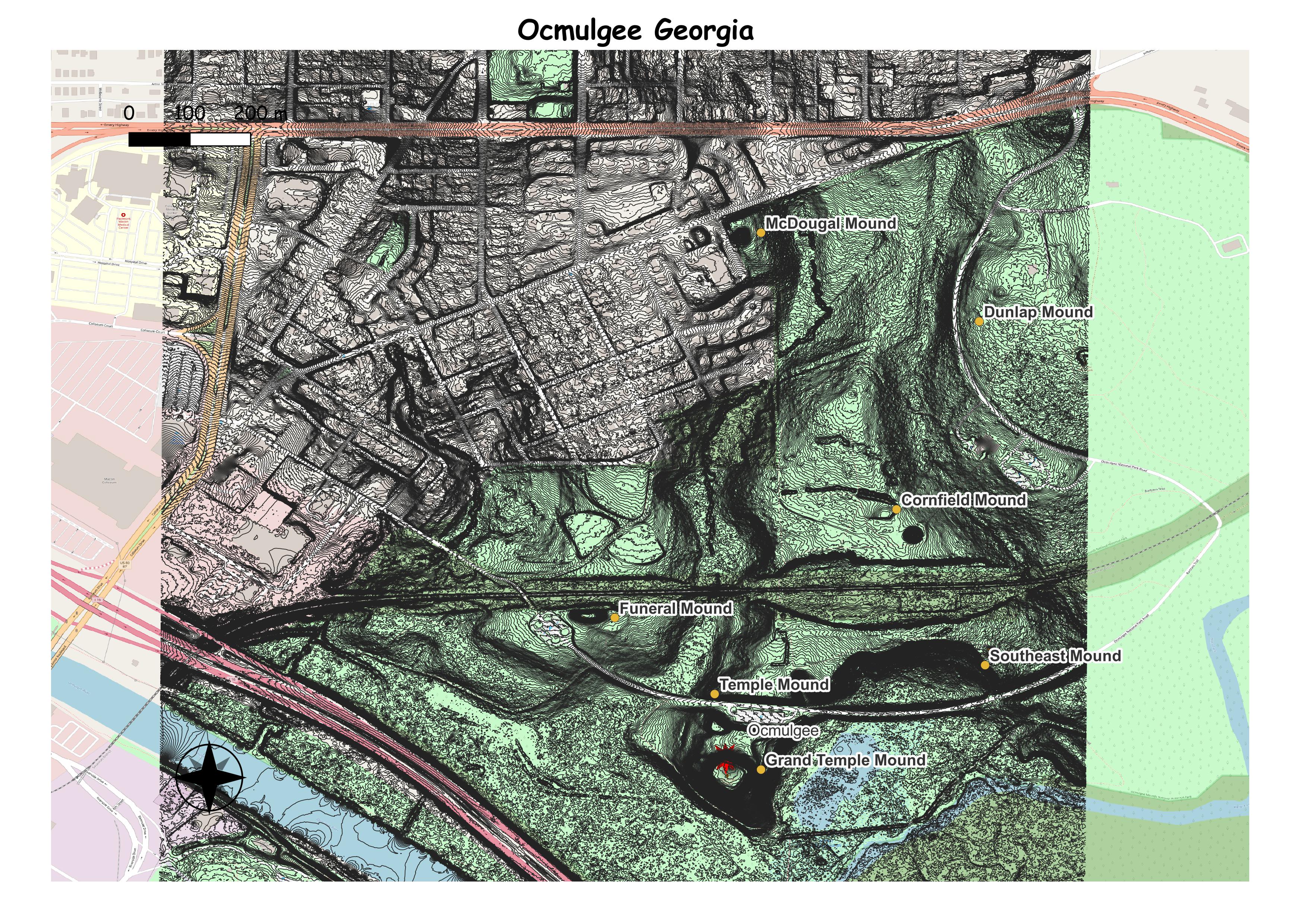
Ocmulgee Mounds National Historical Park (formerly Ocmulgee National Monument) in Macon, Georgia, United States preserves traces of over ten millennia of culture from the Native Americans of the Southeastern Woodlands. Its chief remains are major earthworks built before 1000 CE by the South Appalachian Mississippian culture (a regional variation of the Mississippian culture.)[4] These include the Great Temple and other ceremonial mounds, a burial mound, and defensive trenches. They represented highly skilled engineering techniques and soil knowledge, and the organization of many laborers. The site has evidence of “12,000 years of continuous human habitation.”[5] The 3,336-acre (13.50 km2) park is located on the east bank of the Ocmulgee River. Macon, Georgia developed around the site after the United States built Fort Benjamin Hawkins nearby in 1806 to support trading with Native Americans. W (Wikepedia)
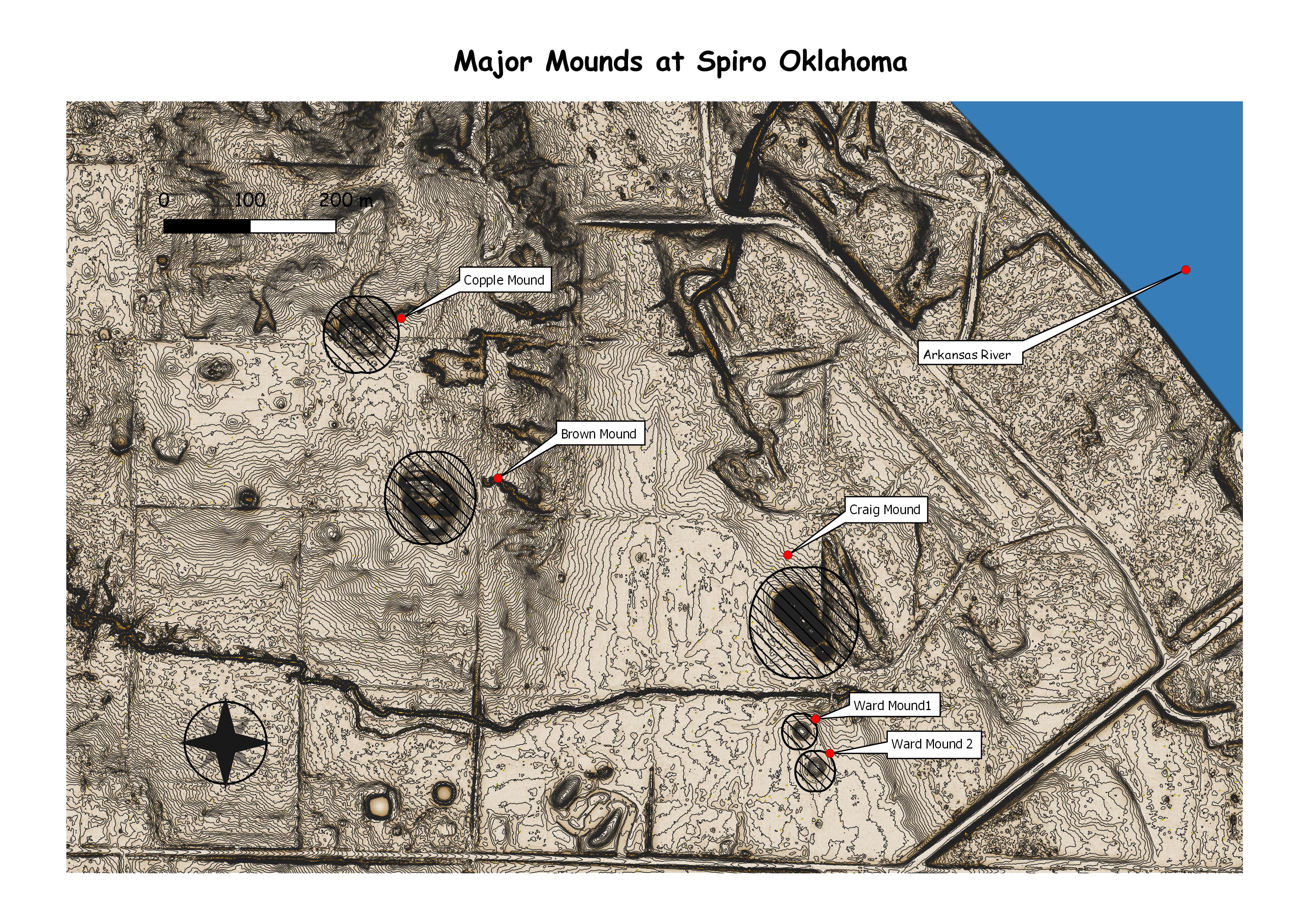
Spiro Mounds (34 LF 40)[3] is an Indigenous archaeological site located in present-day eastern Oklahoma. The site was built by people from the Arkansas Valley Caddoan culture.[4] that remains from an American Indian culture that was part of the major northern Caddoan Mississippian culture. The 80-acre site is located within a floodplain on the southern side of the Arkansas River. The modern town of Spiro developed approximately seven miles to the south. (Wikepedia)
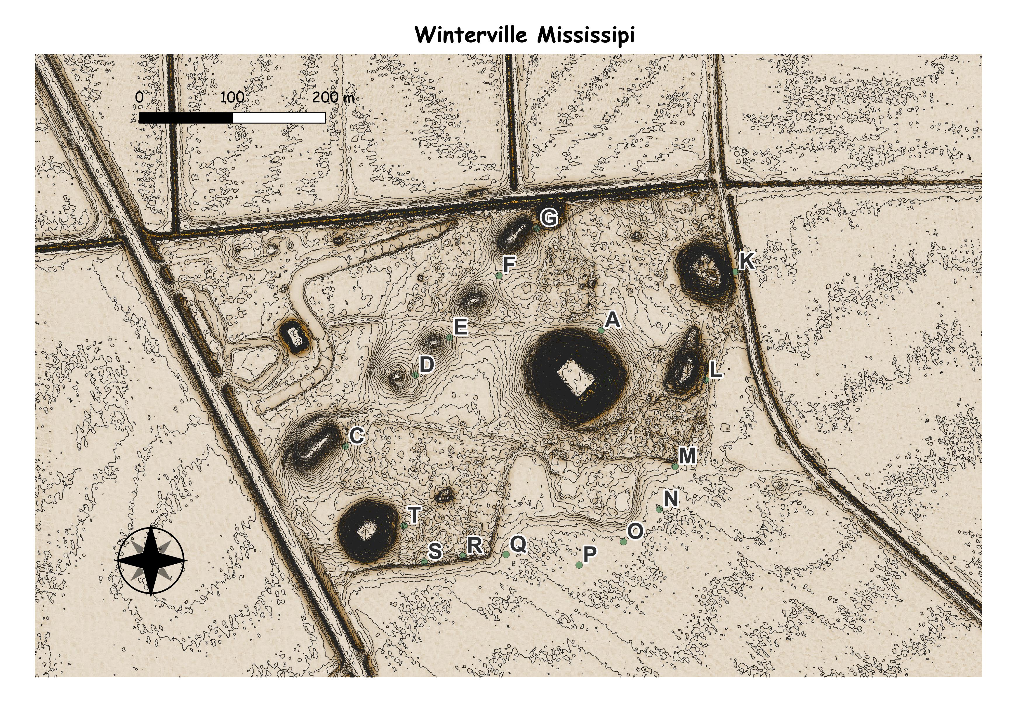
The Winterville site (22 WS 500) is a major archaeological site in unincorporated Washington County, Mississippi, north of Greenville and along the river. It consists of major earthwork monuments, including more than twelve large platform mounds and cleared and filled plazas. It is the type site for the Winterville Phase (1200 to 1400) of the Lower Yazoo Basin region of the Plaquemine Mississippian culture. Protected as a state park, it has been designated as a National Historic Landmark. (Wikepedia)
